Under sunny, dry skies, temperatures reached the 90s in Littleton and Denver on June 16, 2016.
On June 16, 1965, South Platte River crested after three straight days of rain, which pushed flood water into local neighborhoods.
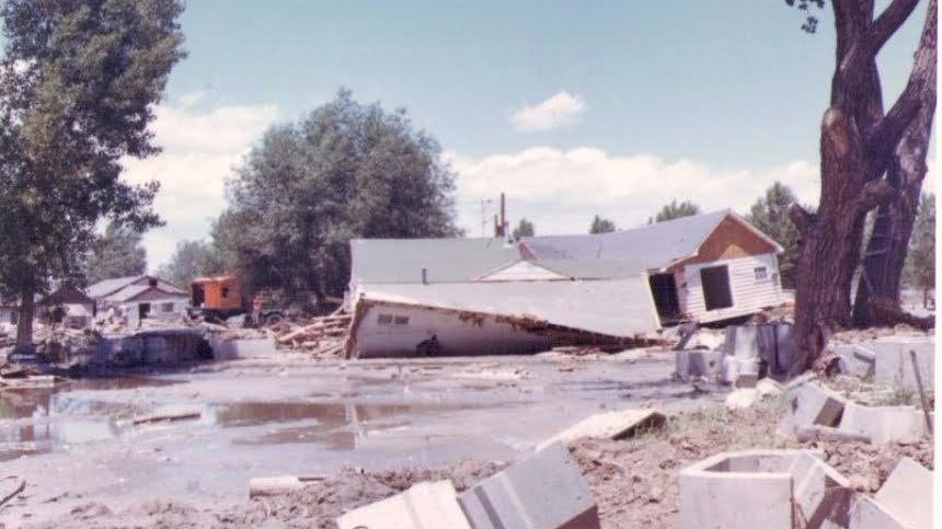
Thursday, the city of Littleton shared a photo taken of the destruction.
Some described the wall of water as 15 feet high, and it reached 25 feet by midnight. The torrent carried 40 times the normal flow, the city says.
“In its wake, the course of the South Platte River from Littleton to the Colorado-Nebraska border was a wreckage-strewn landscape of desolation. The great South Platte River flood of 1965 was not Littleton’s first flood, nor the city's only disaster – it was simply the biggest and costliest, to date.”
The photographer, a Littleton city employee, was looking north from the west side of where the City Shops were located, at 2121 West Chenango Avenue.
The flooding happened in four primary areas: north of Greeley and north and west of Sterling, the Plum Creek and Cherry Creek Basins, the Kiowa and Bijou Creek Basins and along the South Platte River from Plum Creek to North Platte, Nebraska.
According to the Littleton Museum, there had been little interest in building a dam, and the city did not anticipate a flood. The forecast showed scattered thunderstorms. In fact, storms in other places like Castle Rock and Larkspur pushed the water level over the edge.
More than 20 people were killed and 100 horses died at the Centennial Race Track. Twenty-six bridges and thousands of homes and businesses across Denver, Englewood and Littleton were ruined.
The damage totaled more than $500 million.
The Chatfield Damn was built in response to the flood, and completed in 1972.
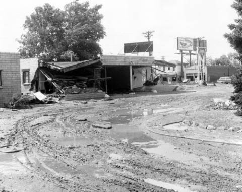
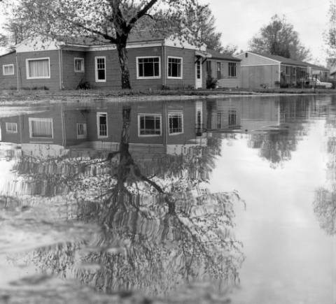
Pictures from the Denver Library archives show significant damage to the metro-area:
View of South Platte River flood damage in the Baker neighborhood of Denver, Colorado; shows buildings with collapsed walls and signs: "Conoco" "Groceries & Creamery" and "Sigman's Top Dog."
View of South Platte River flood damage in Denver, Colorado; shows houses reflected in water.
View of South Platte River flood damage in Denver, Colorado; shows warehouses, smokestacks, power poles, water, railroad tracks, and the Colfax Avenue viaduct. Billboards read: "Chevrolet" and "Jim Beam."

View of South Platte River flood damage in Denver, Colorado; shows water and mud on Denver and Rio Grande Western Railroad tracks, trailers, and warehouses. Signs read: "Morgan" and "Rio Grande Rock Island."

Credit: Western History/Genealogy Dept., Denver Public Library