ATLANTA — The National Oceanic and Atmospheric Administration released its winter outlook on Thursday, forecasting a weak La Niña in the coming months.
Right now we are in an ENSO neutral phase, but NOAA reports there is a 60% chance that La Niña will develop by November. That chance goes up to 75% in December. According to Jon Gottschalk, operational prediction branch chief of NOAA's Climate Prediction Center, this La Niña event will likely be short-lived and weak, allowing for "less confidence than with a strong La Niña".
What is La Niña?
La Niña is part of the natural climate cycle and the cool phase of El Niño-Southern Oscillation. ENSO is one of the most important climate factors and can impact temperatures and precipitation across the globe. It has three phases - La Niña, El Niño, and ENSO neutral. The phase of ENSO is based on the water temperatures in the equatorial Pacific Ocean.

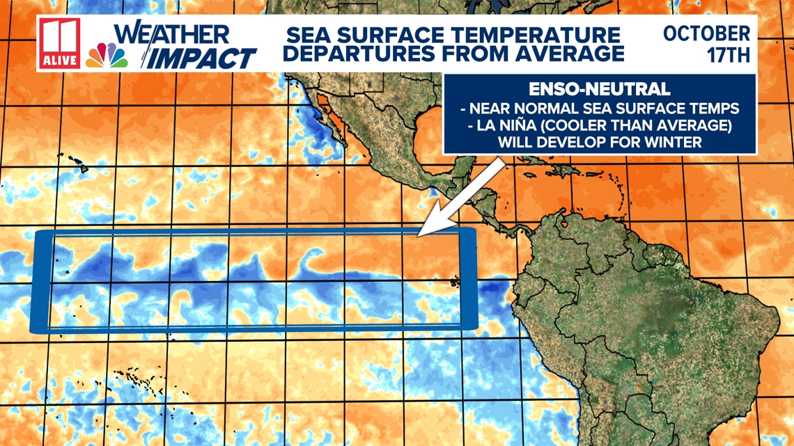
When sea surface temperatures are colder than average, it is called La Niña. In this case, the low-level surface winds (also known as trade winds) that blow from east to west along the equator become stronger.
On the opposite side of the spectrum, El Niño is when sea surface temperatures are warmer than average. Easterly winds near the equator weaken or, in some cases, even change direction to blow from west to east. ENSO neutral occurs when sea surface temperatures are near normal.
What does that mean for Georgia?
The influence of La Niña varies based on location and the season, and no two La Niña winters are the same.
Ocean temperatures affect the position and strength of the jet stream, which drives storm tracks over the United States. Colder water during La Niña pushes the jet stream north.

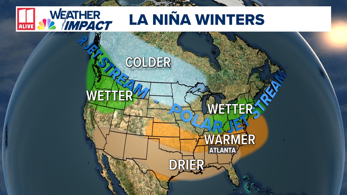
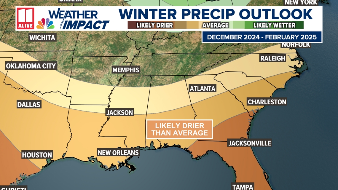
A northerly jet stream leads to a more active winter in the north, but more precipitation doesn't necessarily mean more snow. NOAA is forecasting wetter than average conditions for the entire northern tier of the continental U.S., particularly in the Pacific Northwest and the Great Lakes region. Meanwhile, drier than average conditions are expected from the Four Corners to the Southeast, Gulf Coast and lower mid-Atlantic states.
This year, widespread moderate to extreme drought may develop through the southwest and southern plains. Drought could also worsen in the southeast.

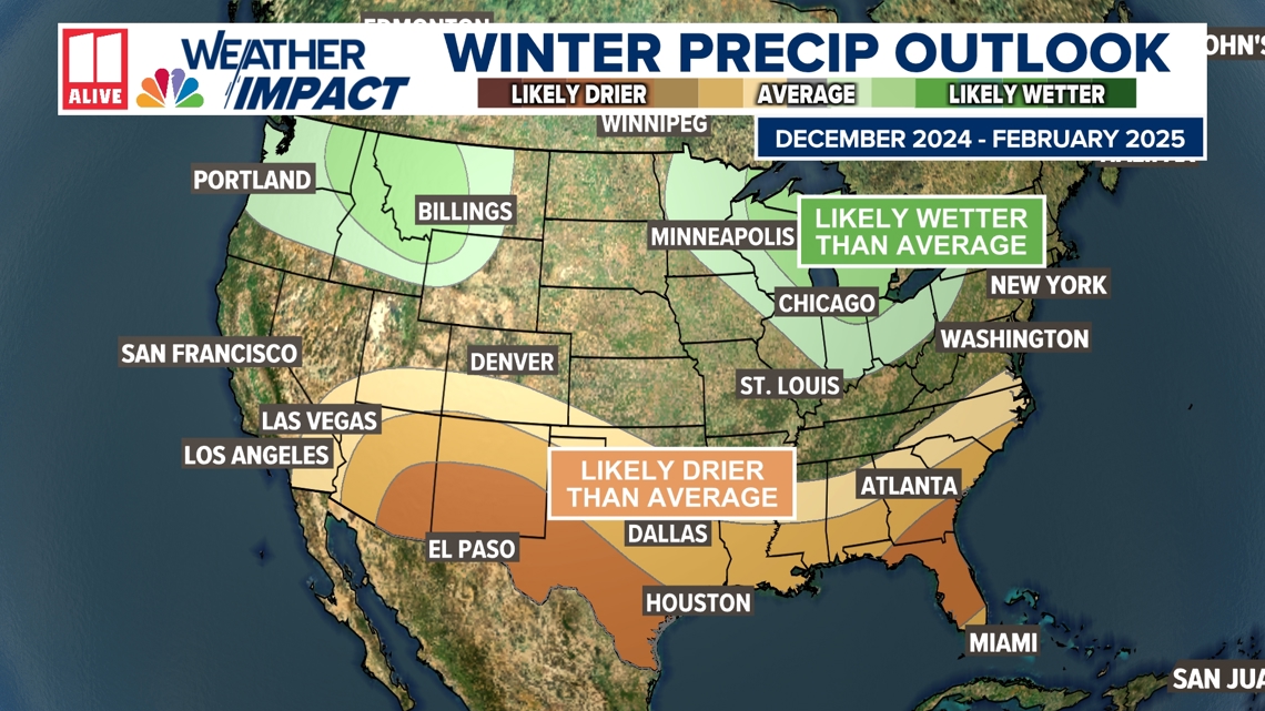
Across Georgia, La Niña winters are typically drier than average.
The map shows areas most likely to be wetter or drier than normal. It is a probabilistic outlook, so other outcomes are possible.

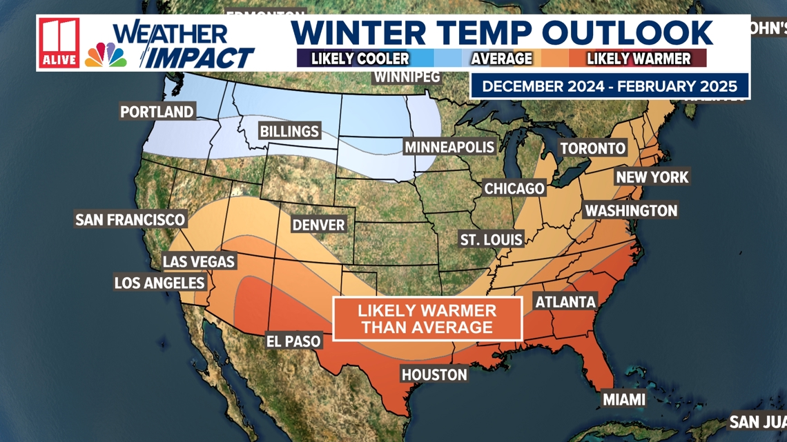
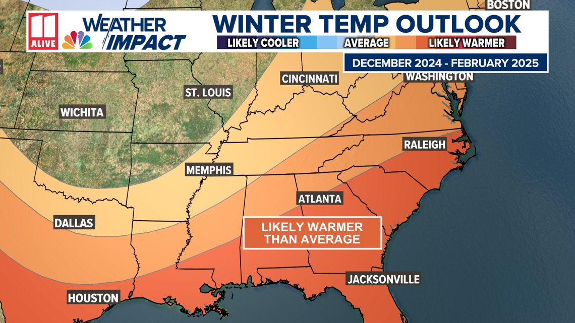
Temperatures are expected to be likely warmer than average across much of the U.S. as cold air stays bottled north of the jet stream. Cooler than average temperatures are most likely from the Pacific Northwest to the northern High Plains.
La Niña years amplify the jet stream, leading to more frequent cold air outbreaks. Just because temperatures, on average, may run warm does not mean the winter won't still bring cold air.