
ATLANTA —
Quick Forecast:
Thursday: Lots of sunshine, breezy. High: 55°.
Friday: Chilly and breezy. High: 51°.
Saturday: Slightly warmer. High: 57°.
Discussion:
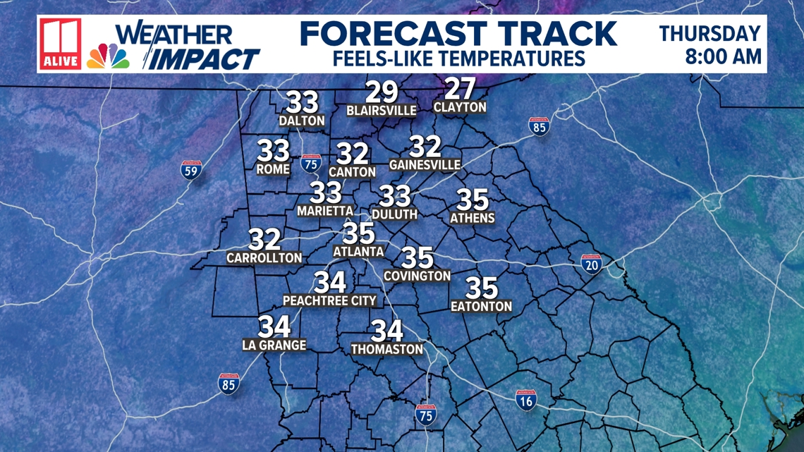
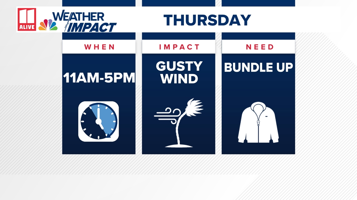
Colder air is moving in behind a cold front. We will have a cold start to the day Thursday with temperatures around 40 degrees in the city and upper 30s in the outlying areas. It will be breezy early Thursday making it feel even colder. The wind will help to make it feel like it's in the low to mid 30s when you are headed out.

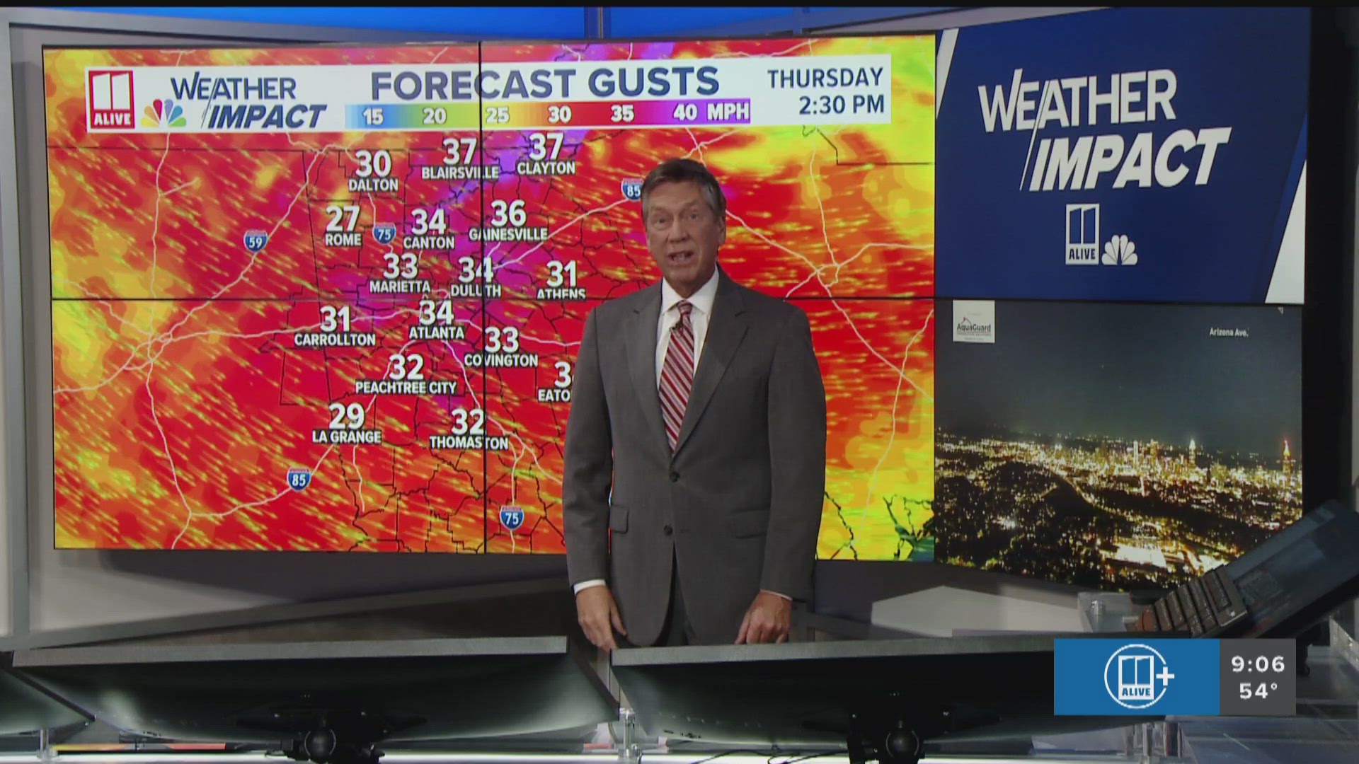
The wind will whip up again Thursday afternoon. We will have wind gusts in metro Atlanta and north Georgia between 25-35mph.

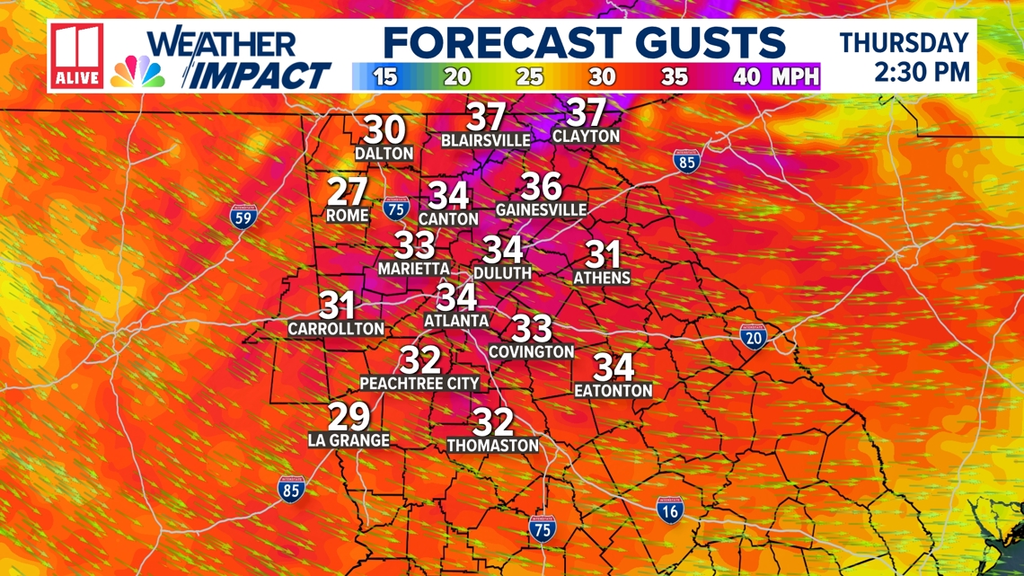
The wind will make the afternoon temperatures in the 50s feel even colder.

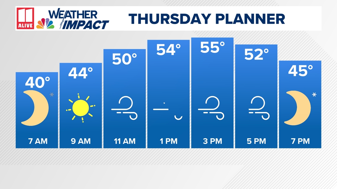
The windiest part of the day will be between 11am and 5pm. During the evening, it will still be breezy, but not as gusty as it will be in the afternoon. Definitely bundle up for protection from not only the temperatures but also the wind.

This cold blast will stick with us for a few days. We will have lows in the 30s on Friday, Saturday and Sunday mornings.

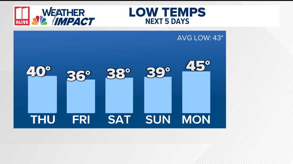
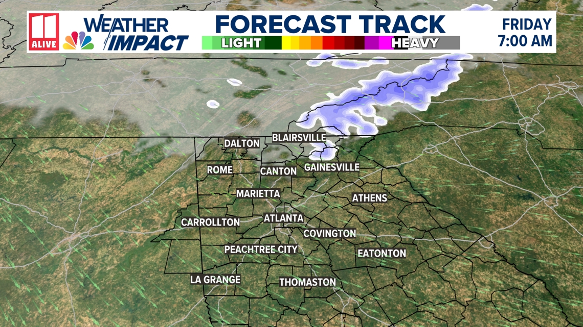
Friday will be the coldest morning of the week. We will be watching any moisture in the atmosphere in north Georgia and the mountains of North Carolina. We could have a few flurries early Friday in far northeast Georgia. The highest elevations of North Carolina could even have some accumulating snow.

Afternoon temperatures the next few days will be below average. The average high for this time of year is 63 degrees. We will be in the 50s through Saturday. We return to the 60s in the afternoon beginning Sunday with continued warming into next week.


It's still too early to be specific about Thanksgiving Day. However, we've been watching the trends in the models indicating a chance for some showers on Thanksgiving. We will keep monitoring the long-term outlook and narrow down the rain chances as we get closer.
MORE FROM 11ALIVE WEATHER IMPACT TEAM
DOWNLOAD THE 11ALIVE APP:
Set up weather notifications by clicking the Gear icon in the upper right corner of the app. Select Notification -> Notification Settings -> Severe Weather Alerts -> Toggle the Severe Weather Alerts button to the right to turn alerts on.
Send photos and videos through the app by selecting the Near Me feature on the bottom right task bar of the app and entering your information.
TEXT YOUR WEATHER PHOTOS TO US: 404-885-7600
JOIN THE 11ALIVE WEATHER IMPACT FACEBOOK GROUP: Nearly 10,000 metro Atlanta and north Georgia weather enthusiasts share their weather photos every day. Click here to join the group!