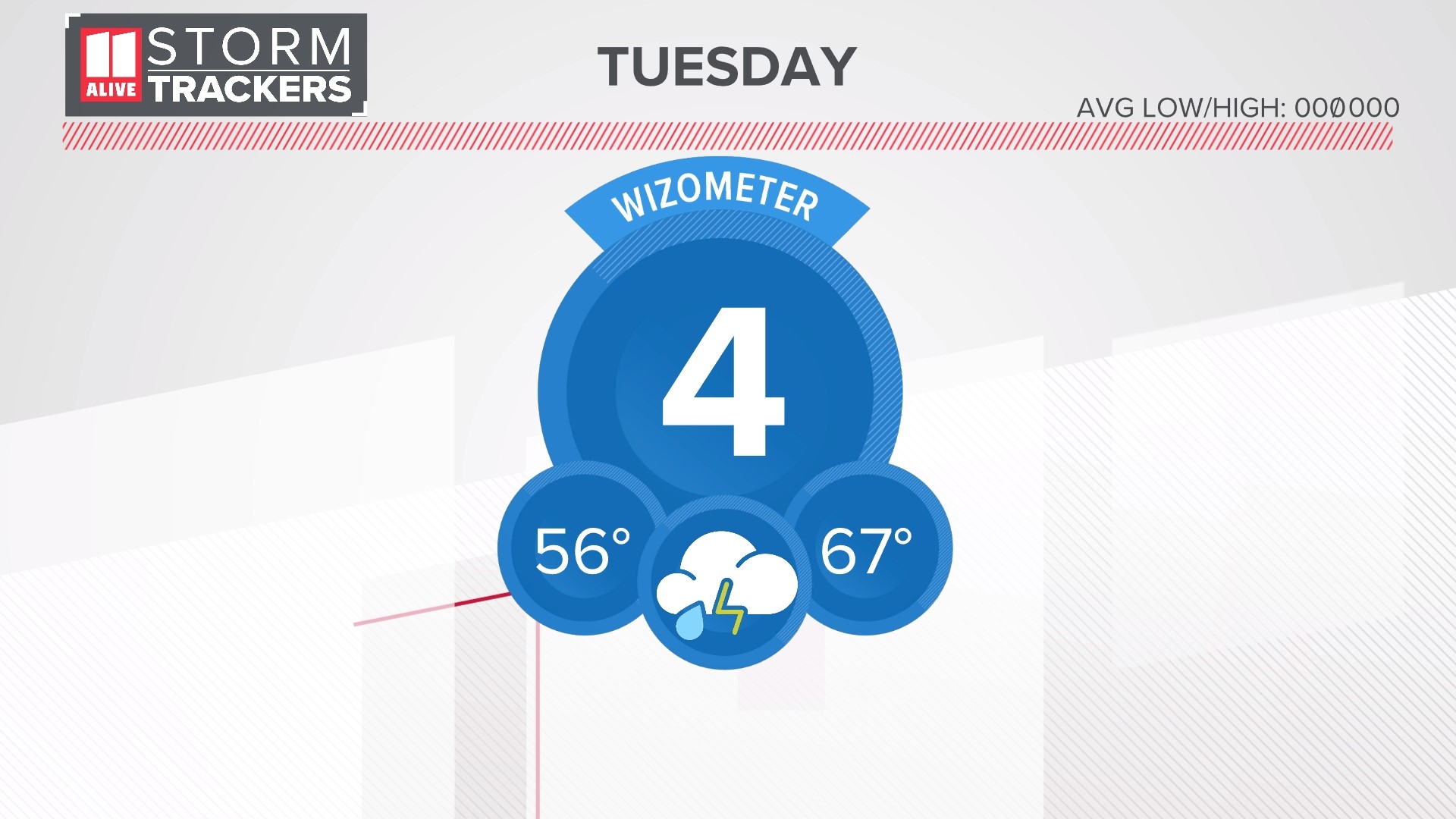
ATLANTA — Atlanta could pick up more rain in a single day this Tuesday than the area has seen in the previous five weeks combined. For other parts of north Georgia, the one-day rain total could exceed the rainfall for the entire rest of the fall season.
A strong incoming cold front and low pressure system will pull in ample moisture from the Gulf of Mexico, and bring widespread and sometimes heavy rain across the Peach State. The heaviest rain timing will be between 4 a.m. and 2 p.m. on Tuesday.
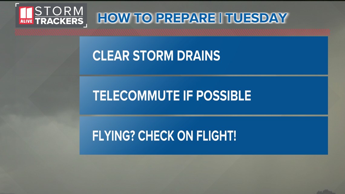
In advance of the rain, here's how you should prepare:
- Clear leaves and other debris from storm drains so the water has somewhere to flow
- Plan on a slow, wet commute Tuesday morning with water-logged roads. Drivers should give themselves extra time. If your work situation allows it, consider teleworking that morning.
- There could be weather-related airline delays between Monday and Wednesday from this system as it advances across the country and up into the northeast. Check with airlines and pay attention to delays/cancellations that may occur for people who have a flight out or in of Atlanta's Hartsfield-Jackson International Airport ahead of the Thanksgiving holiday.

Rainfall Amounts
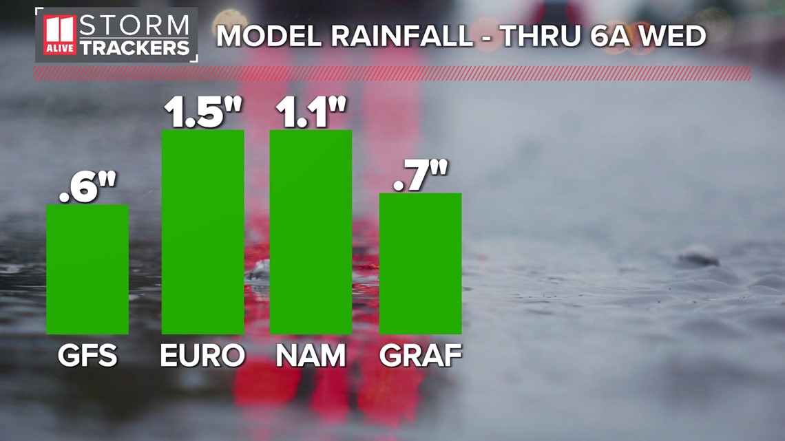
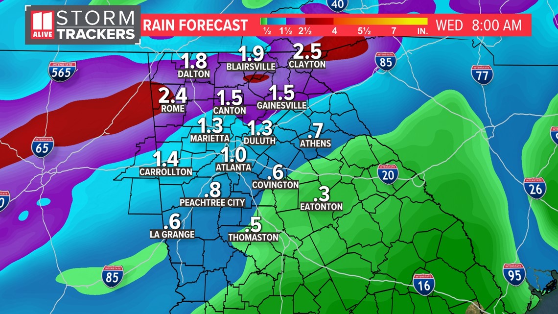
Models still vary on rainfall totals, but the consensus points to around 1" of rain in Atlanta. Here's a model comparison for the city of Atlanta, which shows anywhere from 1/2 an inch to 1.5 inches.
If Atlanta gets 1" of rain, it'll be our first 1"+ rain day since 1.07" on Aug. 6 -- more than three months ago. If Atlanta exceeds these models and gets more than 1.5" on Tuesday, it'll be our wettest day since the spring on March 26.

Not everyone will see this amount. It looks like areas south of 1-20 will get 0.5" to 1.0" on average.
The bulk of the Atlanta metro will end up around 1" and up to 1.5" of rain.
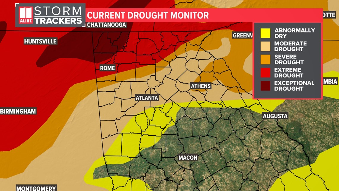
Areas in far north Georgia where the drought is worse, those rain totals could near 2 inches.

Timing
Although a few showers will be possible Monday, the bulk of the rain comes in on Tuesday. The critical timing for the most widespread rain and embedded storms will happen between 4 a.m. and 2 p.m. that day.
Monday overnight - Rain enters the northwest and western parts of the state, mostly after midnight. Gusts start to increase as well. A wind advisory is in effect from 7pm Monday until Tuesday at 1pm.

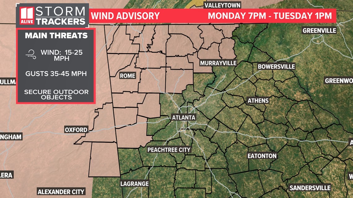
The first rounds of heavier rain move in from the northwest overnight Monday until Tuesday morning.

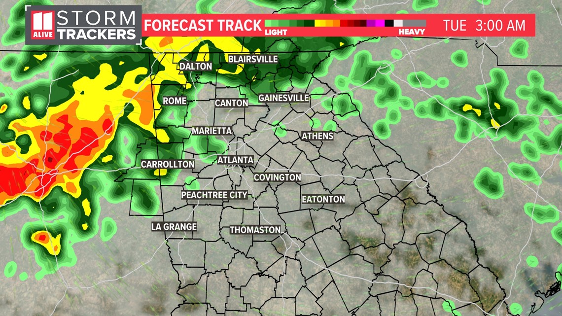
Tuesday Morning - The commute will be slow and wet with heavy rain and embedded storms across the area. Roads could become water-logged with ponding or standing water, especially where storm drains are blocked by recently fallen leaves. Wind gusts could be 25 to 30 mph.

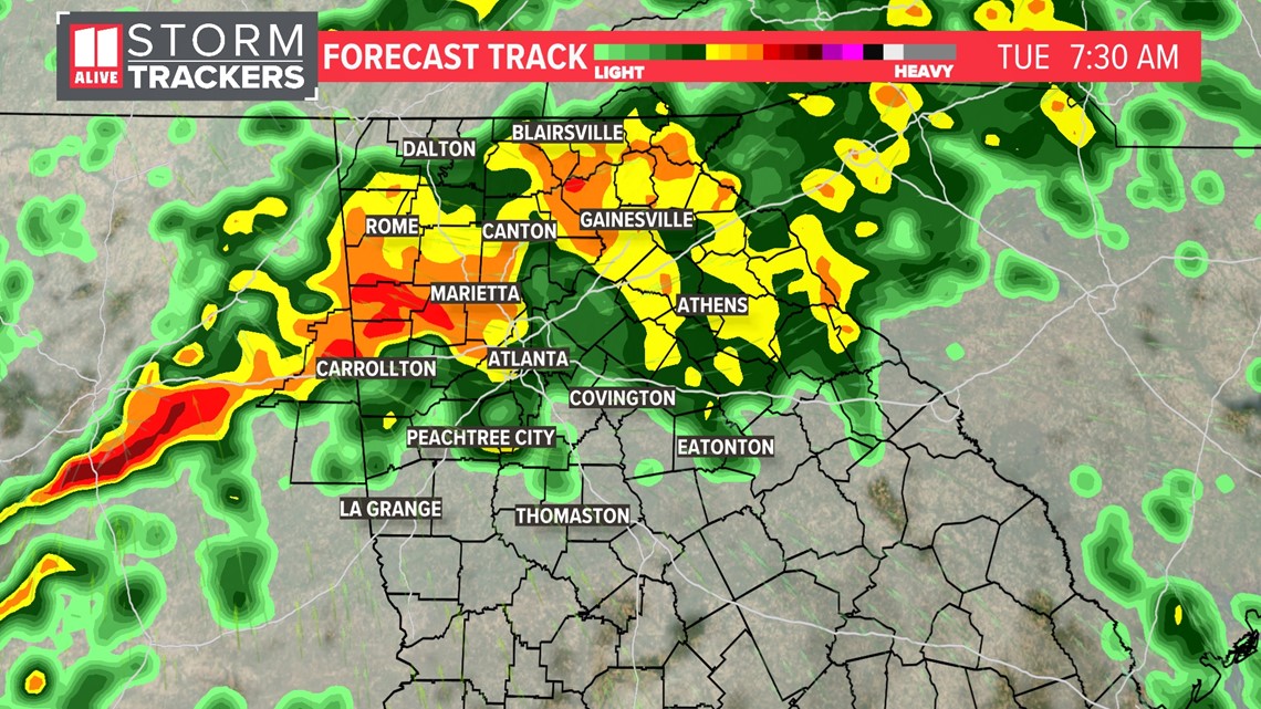
Tuesday Afternoon - The most widespread period of rain comes to an end, but scattered to numerous showers and an embedded storm could continue. Isolated storms will be possible, and a strong or severe storm can't be ruled out. Roads will stay damp to wet for the commute home.

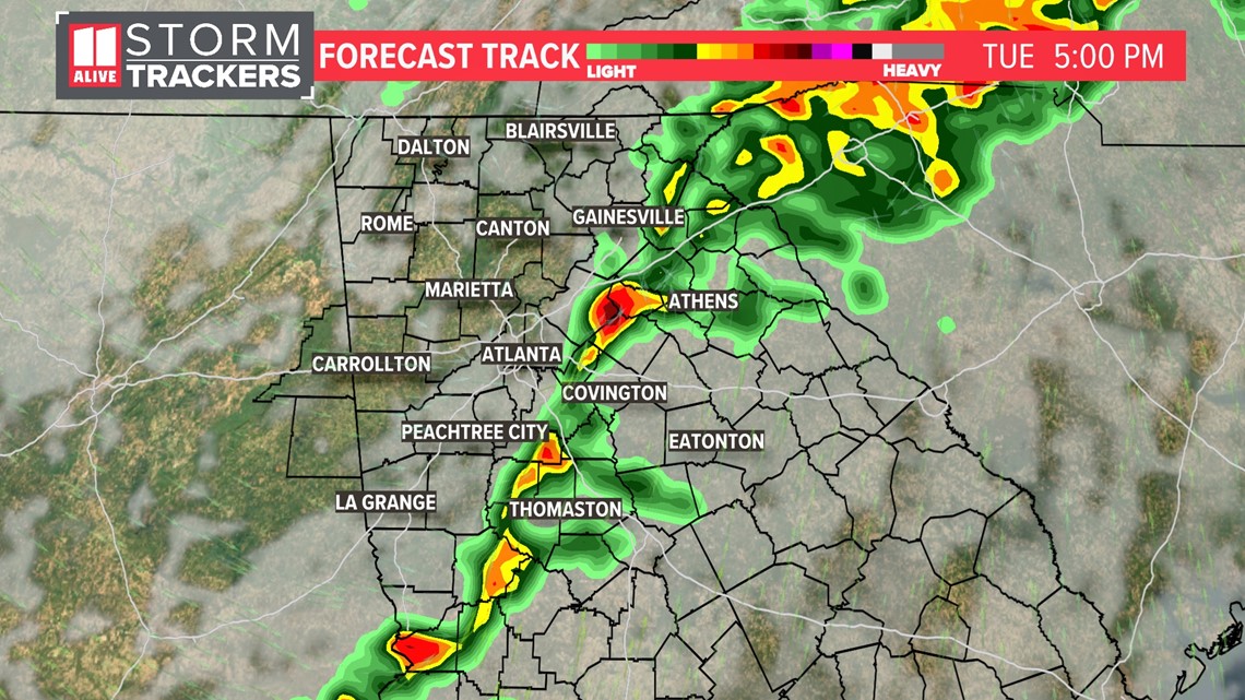
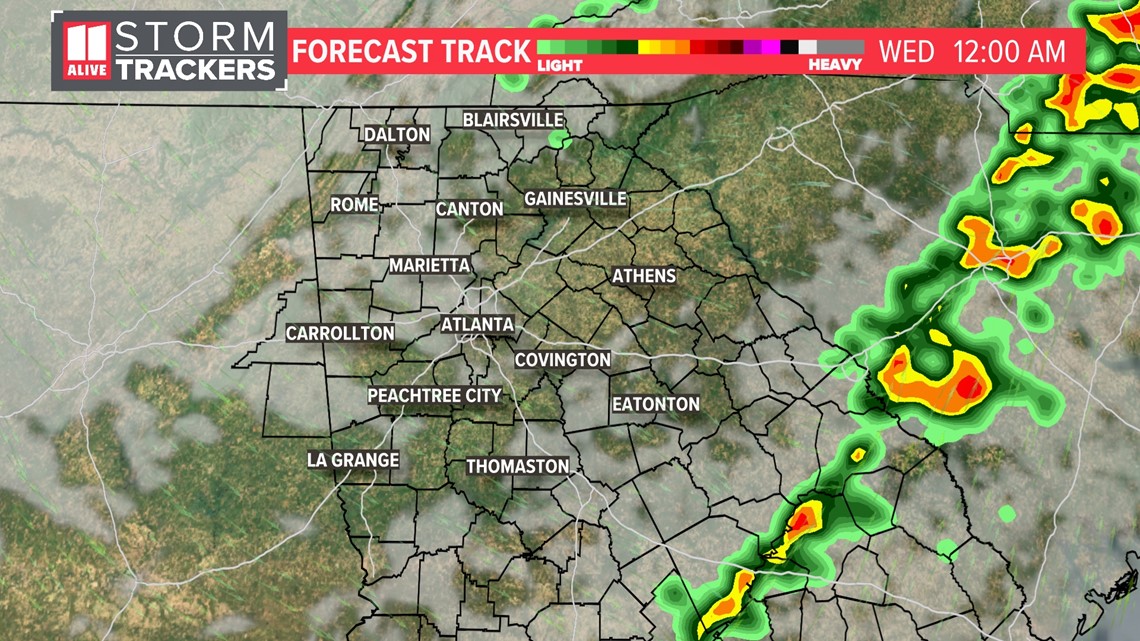
Tuesday Night - We dry out and colder air moves in for the middle of the week.

Severe Chances
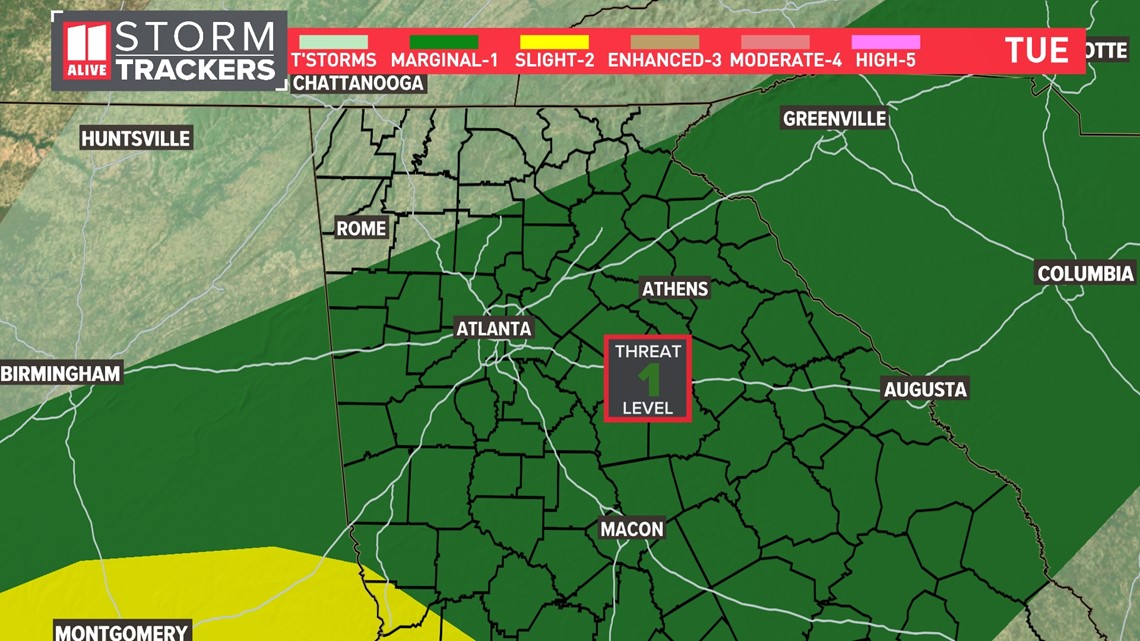
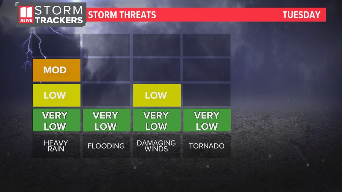
By Tuesday, the conditions become less favorable as a whole. The Strom Prediction Center still have a Level 1 out of 5 threat of severe weather across parts of north and central Georgia. The Atlanta metro area is included. This is where isolated storms could have damaging winds and a brief spin-up tornado can't be ruled out.

The main threats would be from pockets of heavy rain and wind. The tornado threat is very low, but not zero.

Direly-Needed Rain
This comes in the middle of a level 4 'exceptional' drought across northwest Georgia. 16 counties in the state are under emergency drought declarations, designated by the U.S. Department of Agriculture.
Although this system alone won't wipe out our drought, it will put a small dent in it. We also have a second chance for rain this week coming on Friday. Rain totals from that are yet to be determined.

