ATLANTA — It was a stormy weekend across north Georgia with heavy rain falling in most spots, leading to problems with isolated flooding at times.
The heaviest of the rainfall occurred on Saturday, when we had two waves pass through, with some spots picking up more than five inches of rainfall.
Additional rainfall occurred on Sunday morning and then again for the afternoon, adding to the already saturated ground.
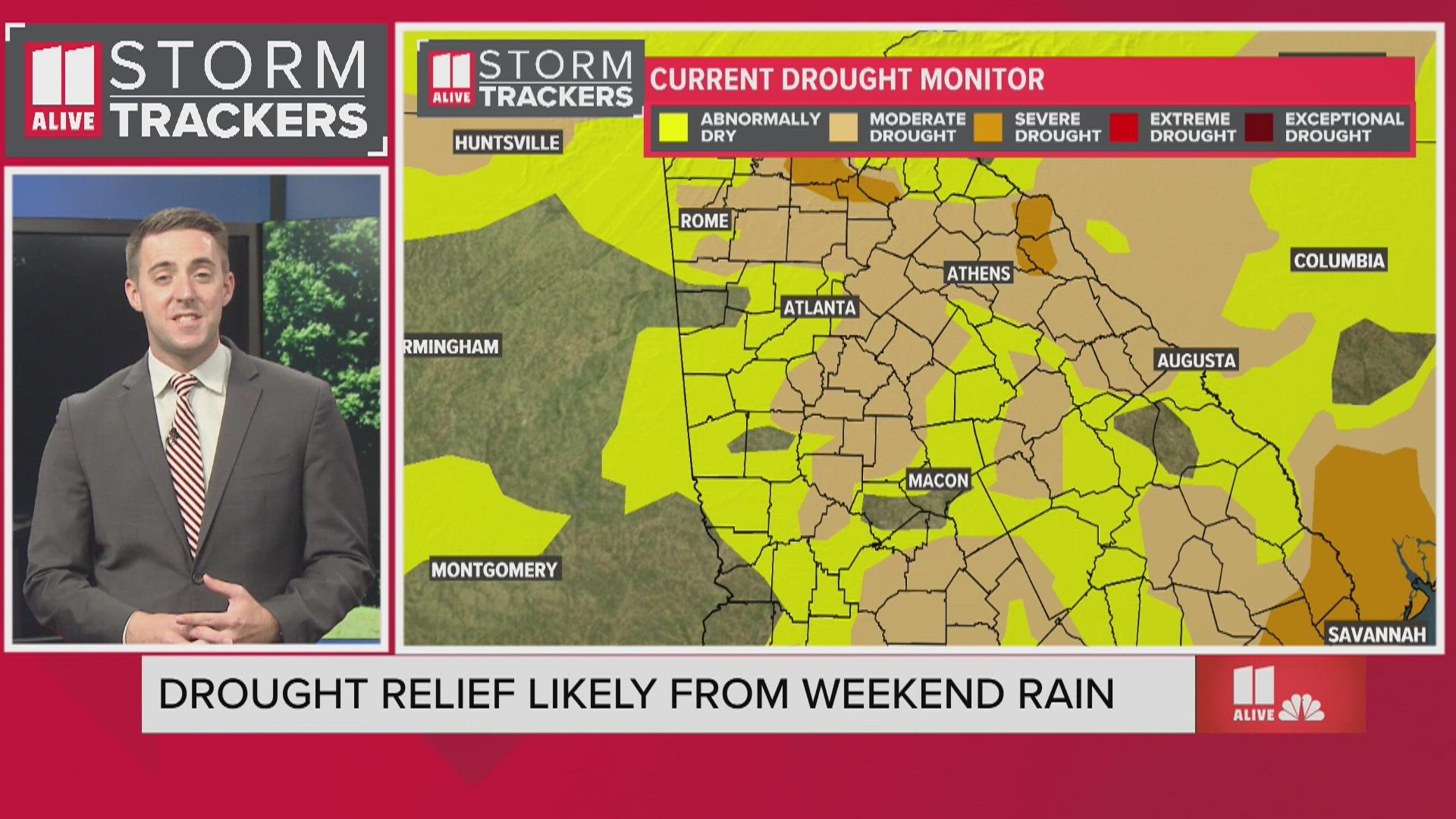
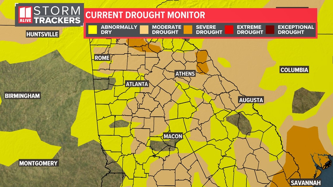
That rain came after the Drought Monitor updated our region to show fairly widespread moderate to severe drought on Thursday.
The worst of the drought showed up closer to Athens and into far north Georgia, an area that saw some spots receive significant rainfall over the weekend.

From 12 a.m. Saturday through 12 a.m. Monday some of these spots showed radar estimates above eight inches.

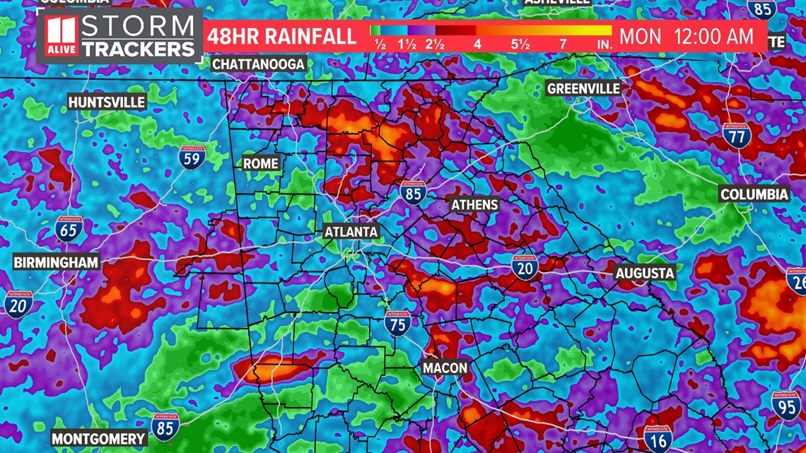
The highest totals occurred in the north Georgia mountains. Southwest of Cartecay, in Gilmer County, one spot had a radar estimate of more than eight inches of rain. Meanwhile, Woodstock had an estimate of near six inches and Helen came in with more than four inches.

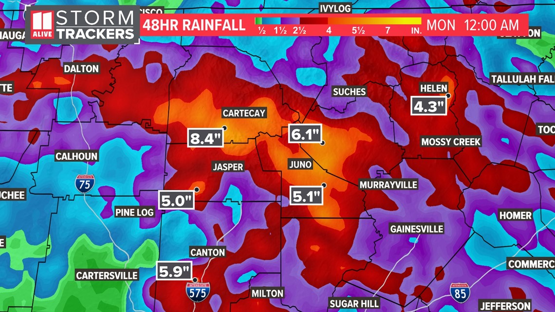
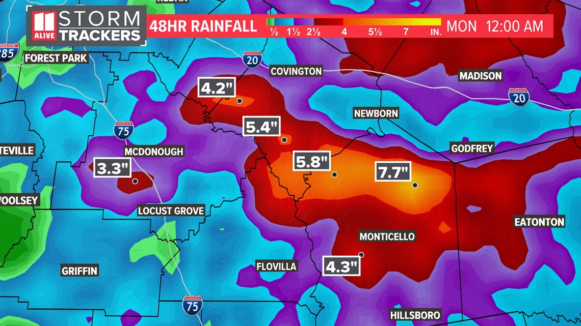
Two other hot spots for heavy rainfall were in Newton and Jasper counties. Northern Jasper County had radar estimates more than seven inches and southern Newton County had five and a half inches, which caused a sinkhole to form and flooding.

RELATED:
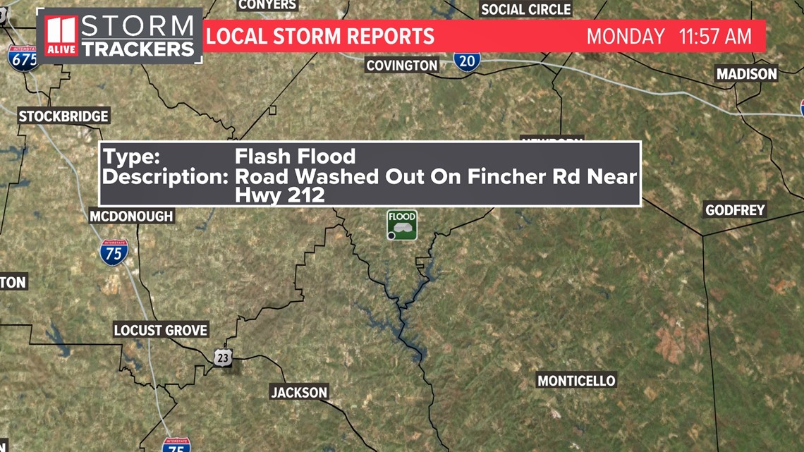
The flooding that caused the sinkhole to form and create the flooding occurred on Saturday in southern Newton County, washing out part of Fincher Road near Highway 212.

However, this wasn't the only instance where the heavy rain led to issues. Heavy rainfall caused the Yellow River to rise quickly in Gwinnett County and four people ended up being stuck on a rock, needing rescue.
Yet, while some parts of the Atlanta metro received a good amount of rainfall, others were lacking with only around half an inch estimated in the College Park area. Closer to Buckhead and up to Norcross, some spots had estimates of more than three inches throughout the weekend.

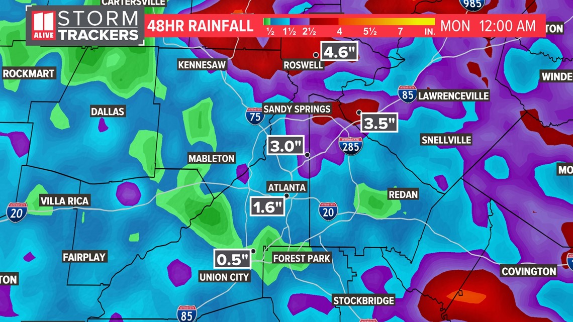
Despite some spots not picking up much more rain, Atlanta is still ahead for the year on rainfall and we are now more than two inches ahead for our normal year-to-date rain accumulation.

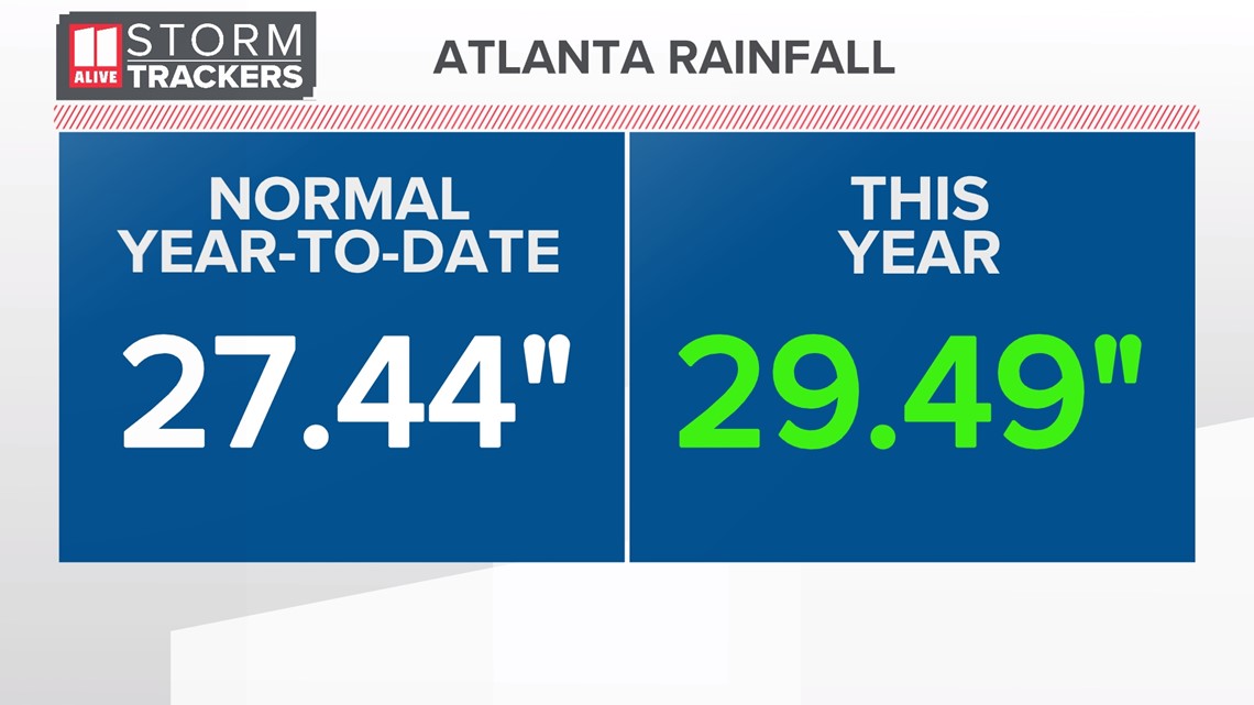
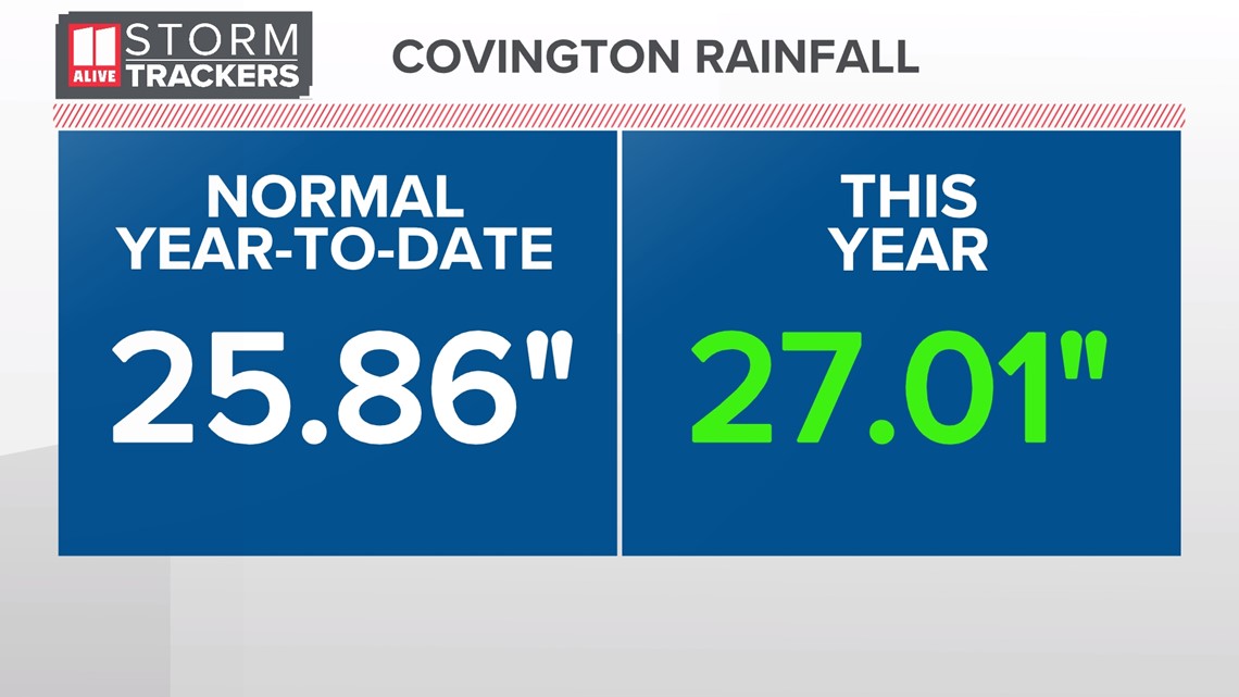
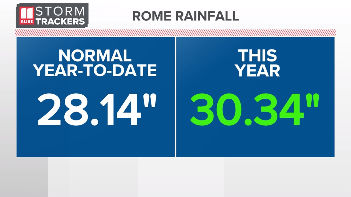
Other spots now ahead on rainfall for the year, which will likely lead to major improvements in the Drought Monitor update on Thursday, include Covington and Rome.
Covington in particular is now more than an inch ahead on its normal year-to-date rainfall.

Meanwhile, Rome is more than two inches ahead on their normal year-to-date rainfall.

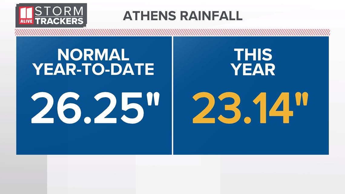
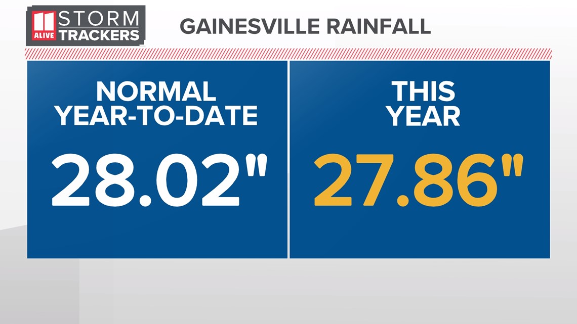
Not everyone had the rain they needed to see drought conditions go away over the weekend though, as Athens and Gainesville are still behind.
Athens in particular still needs more than three inches of rain to get to their normal year-to-date rainfall.

Gainesville on the other hand is close and only needs less than a quarter of an inch to get above their normal year-to-date rainfall.

However, the good news for spots still behind on rain is we have more chances for rain later this week, after our drier start on Monday.

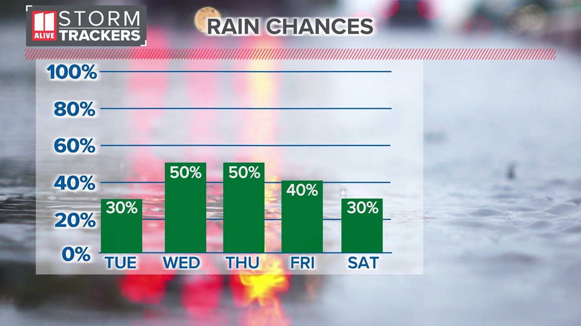
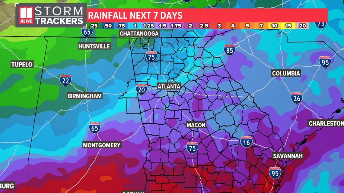
Rainfall totals expected this week should help to continue to push back drought conditions with an inch to two inches of rain possible in spots throughout the next seven days.

