ATLANTA — The 11Alive StormTrackers are tracking showers and thunderstorms moving through Georgia with some severe weather.
Here's what you need to know:
- Storms are early Sunday morning, some of which could be strong
- Many areas could pick up around 1 inch of rainfall
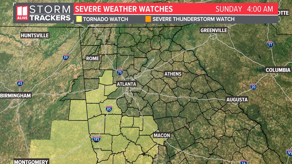
Some counties in NW Georgia are no longer in the tornado watch that was supposed to expire at 3am. The NWS extended the watch until 5am for Douglas and Paulding counties.
Another tornado watch is in effect south of I-20 for areas south and west of Atlanta until 9am. This includes Carroll, Coweta, Heard, Lamar, Meriwether, Pike, Troup and Upson counties.

The main threat will be pockets of heavy rain, some strong wind and even the low risk for a tornado. We don't have a lot of fuel or instability for these storms, but we do have some shear. That's why we need to watch for the potential for some rotation in this line as it moves through.
Here's a look at the timing:
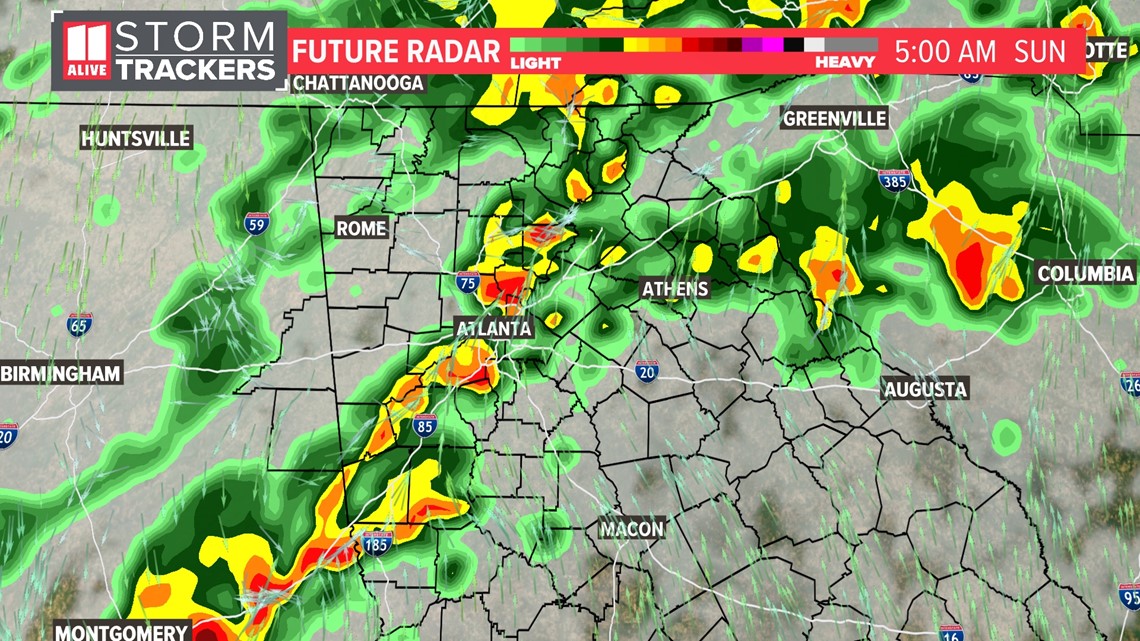
Pre-dawn Sunday
Storms keep working east across the area in the overnight. They'll contain heavy rain. Some gusty winds are possible. And again, we feel the risk of a brief, weak spin-up is very, very low.
The storms will continue moving east and will move through Atlanta between 3-6am.

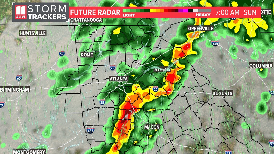
Sunday morning
By 7am, the line is east of Atlanta and will continue pushing to the east.

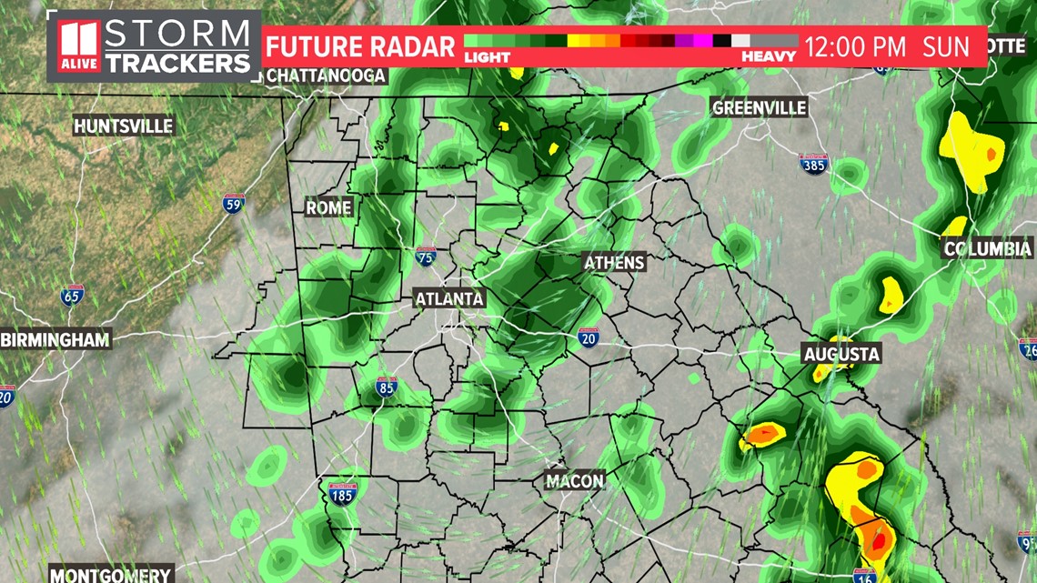
Sunday midday
By noon, the stronger storms are well out of our area, however we will still have some lingering lighter showers for a while.

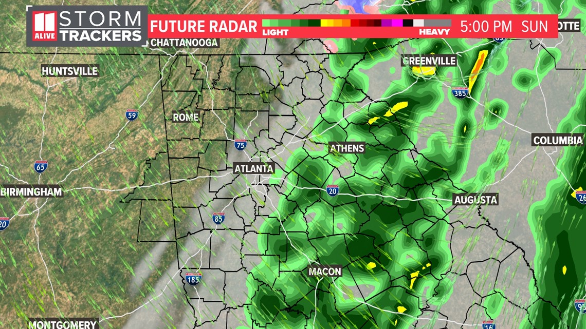
Sunday afternoon
Showers will gradually taper off, but gusty northwest winds will pick up. By 5pm, the back edge of the rain has moved east of Atlanta. This will help to drop our temperatures. Remember, we start the day in the 60s but fall into the 50s and then 40s as the day wears on. Notice how that may result in a little brief changeover in the north Georgia mountains into some bursts of snow. We don't expect accumulations.

Sunday evening
We dry out altogether but turn windy and cold. Wind gusts in the metro area will be around 35 mph but could be up to 45 mph in the higher elevations in the mountains. Temps tumble into the 30s, with wind chills falling into the 20s.