ATLANTA — We're enjoying low humidity and comfortable mornings now, but we're cranking up the heat this week! A summer-like heat wave will bring north Georgia its hottest temperatures of the year so far.
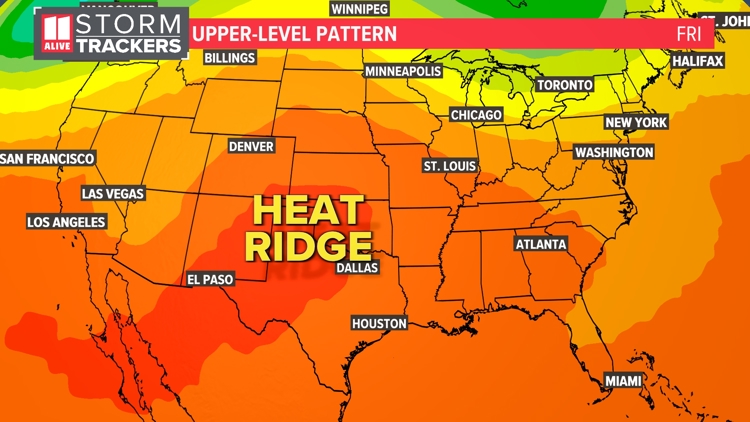
A ridge of high pressure is strengthening over the western U.S., and this heat ridge will gradually shift eastward over the coming days.
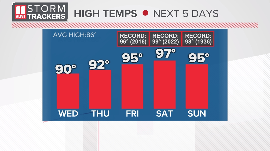
High temperatures climb back to near 90° by Wednesday and then soar into the mid-90s for the end of the week and the weekend. Average temperatures for this time of year in Atlanta are in the mid to upper 80s.
We'll be flirting with record highs:
- Friday: forecast - 95°, record - 96°
- Saturday: forecast - 97°, record - 99°
- Sunday: forecast - 95°, record - 98°

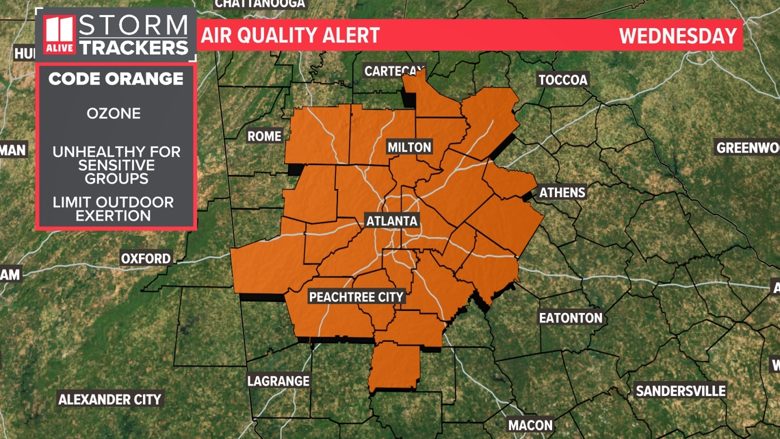
Hot, sunny, dry days are optimal for ozone production. Ozone levels on Wednesday are expected to reach unhealthy levels for sensitive groups. Anyone with heart or lung disease, older adults, and children should consider limiting strenuous activity outside in the heat of the day when ozone levels are the highest.
A Code Orange Alert has been issued Wednesday, and ozone levels will likely be elevated through the week.

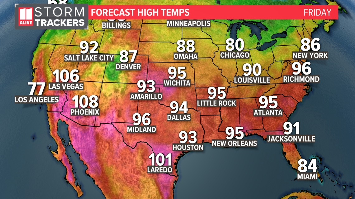
Much of the country will be sizzling. High temperatures will be running above average across the U.S.

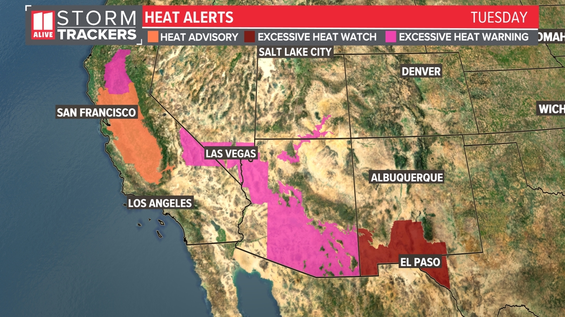
Various heat alerts have been issued in the western U.S. for Tuesday through Thursday, and more may be added as the heat wave intensifies.
No heat alerts here as temperatures + humidity are expected to stay below heat advisory criteria.

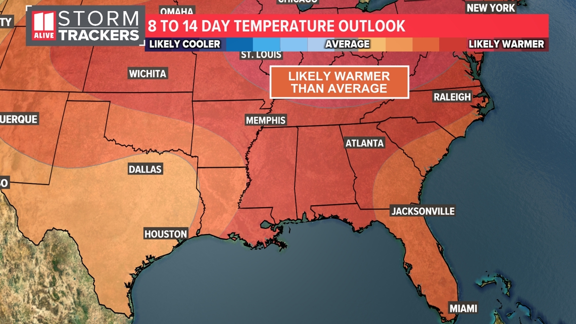
Thanks to rain, some minor heat relief is possible in the Atlanta area early next week, but our long-term forecast brings much of the same. The 8 to 14 day temperature outlook likely shows warmer-than-average temperatures.

