ATLANTA — 11Alive has issued a Weather Impact Alert through Saturday, September 14.
Francine made landfall as a category 2 hurricane around 6pm Wednesday. The remnants of Francine will move inland along the Mississippi River, supplying plentiful moisture for rain across the Southeast.
We remain on the right-hand side of the dying center of circulation, which is the most active side of the storm track. Impacts are expected here in north Georgia. We have been watching the potential for heavy rain and flooding.
Luckily, with a cooler wedge of air in place, this has helped to suppress our severe and flood potential thus far.
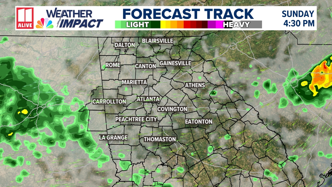
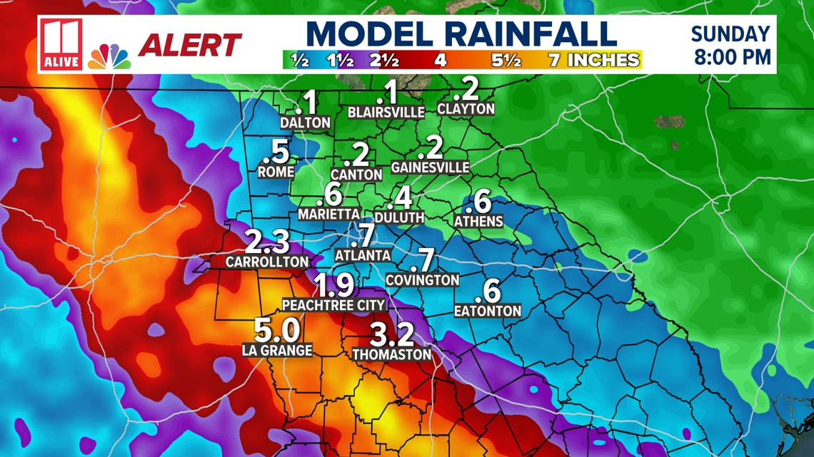
Through the first half of the weekend, areas of rain keep working through west Georgia. At times, the rain could be heavy, mainly southwest of Atlanta.

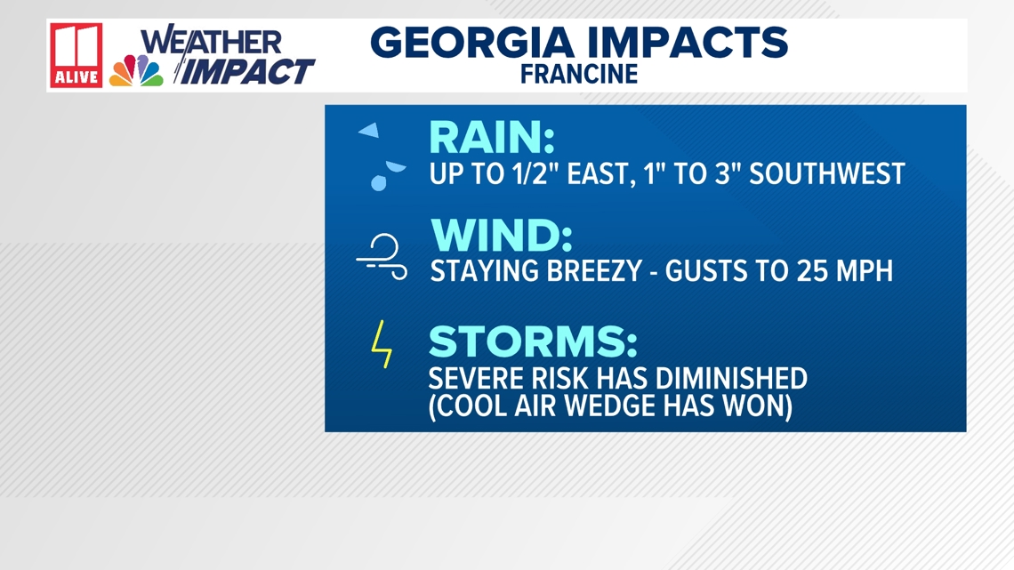
Rain:
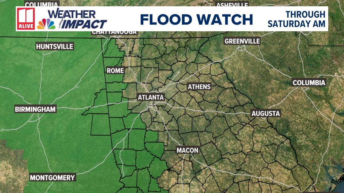
The axis or area of heaviest rain has trended westward today. This is good news, as it limits the severity of the flooding potential in north Georgia. Nonetheless, some areas of heavy rain could work in through early Saturday.
Rain amounts southwest of the metro will be 1 to 3 inches. Northeast of Atlanta, less than 1/2" is expected on average.

This could lead to isolated flooding, so a Flood Watch will be in effect through Saturday morning. If you see standing water, do not try to drive through it!

Wind:
The Wind Advisory that was in effect expired at 5 a.m. Friday. Winds remain breezy, but gusts will only be up to 25 mph.
Storms:
Whenever a tropical system makes landfall, there is a potential for severe storms on the right-front quadrant of the storm. Many times, some of the outer rain bands can develop strong storms with rotation.
Although some storms have rotated across the southeast, the cooler wedge of air has suppressed severe potential in north Georgia. We do not expect tornadoes into the weekend.
Timing:
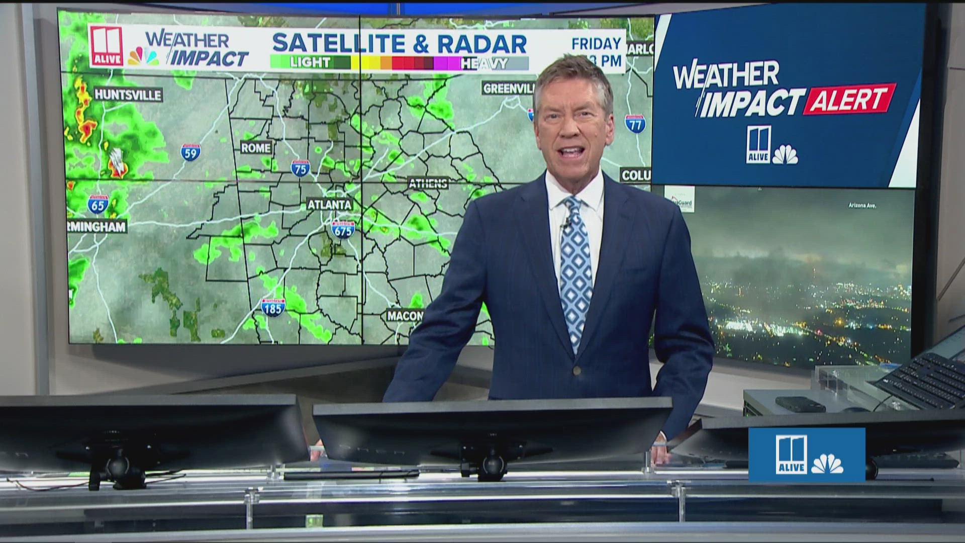
Scattered showers and storms linger Friday evening. Some of the rain could be heavy at times.

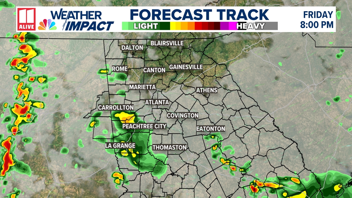
Some tropical moisture will stick around through the weekend. Training thunderstorms may develop through Alabama and into NW Georgia Friday night. These storms drop heavy rain over the same locations, elevating flood risk.

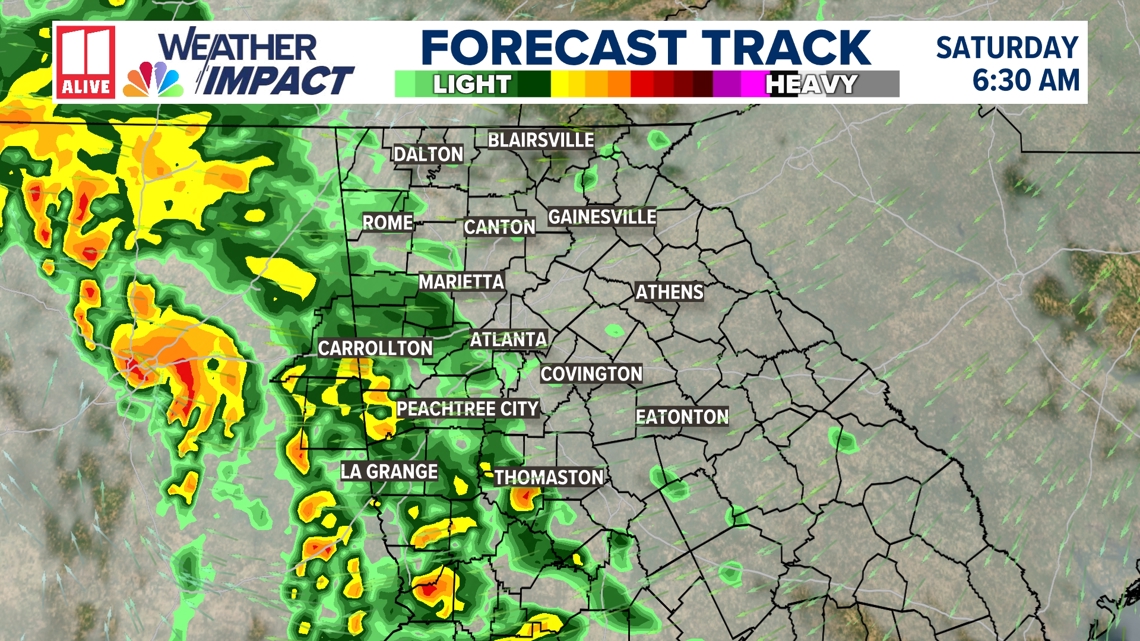
Saturday is looking wetter -- so expect rain showers and a few pockets of heavy rain to impact outdoor plans.

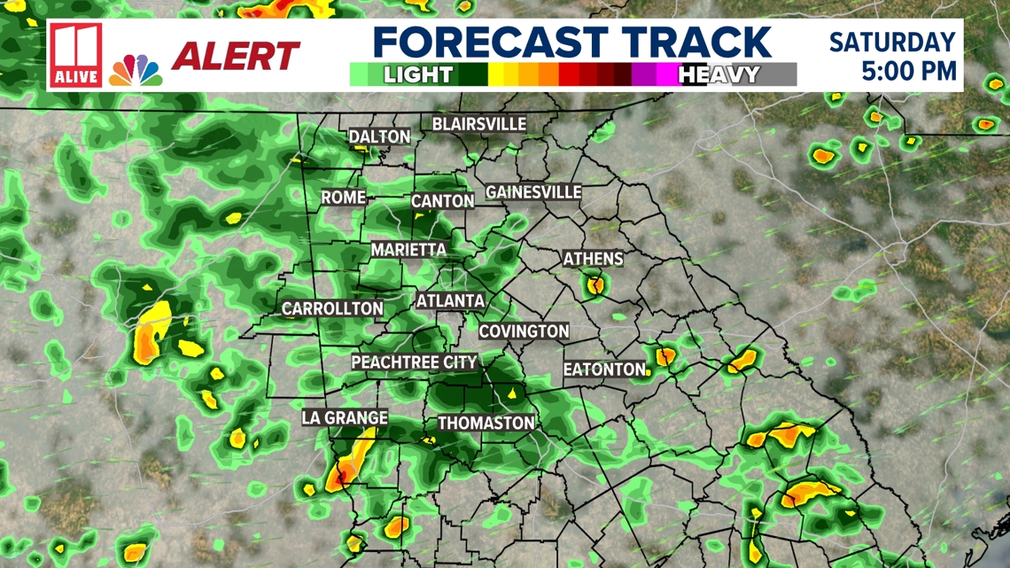
By Sunday, the rain chance drops to 40 percent. A few showers may linger, but we largely dry out.