
ATLANTA — We are less than two weeks removed from Hurricane Helene's landfall, and some of the earliest findings of what happened in that storm are now coming out.
Earlier this week, the Insurance Institute for Business and Home Safety, or IBHS, released its preliminary findings report on the storm. 11Alive spoke to IBHS Lead Research Meteorologist Dr. Ian Giammanco about their findings.
Can you first talk to us about why it is important to publish early findings of storm impacts?
These first reports are to give a diagnosis of what transpired with any landfall hurricane, and Helene obviously was no different. It produced catastrophic impacts really far inland, which makes it a very unique event. One -- to just understand what came together to produce such catastrophic output, but also just to understand what could be the scope of damage. What was the response? How did we look at how we communicated those impacts?
So we're always looking at these things, trying to learn: One, what can we do better? Two, can we diagnose the potential for these kinds of impacts? Should a storm like Helene present itself down the road? But those are all the things we want to gather as we get into this post-event timeline. It's just to understand what transpired.
There are a lot of areas that are not accessible by driving up in the mountains. So, how do you come to those early findings? Are you using satellite imagery going in a helicopter? How do you come to those conclusions?
We at IBHS rely very heavily on aerial imagery. So that's how we do a lot of our roof cover damage assessments. We say we have a storm like Milton that could produce a lot of roof damage. We're going to use those early-on aerial imagery to help assess the current state of what's going on, and that can come from a variety of different sources.
NOAA will fly their aerial mission. So, that imagery is extremely helpful for these early-on insights, as well as some of the private sector vendors that will go back and use fixed-wing or helicopters or drones to get even higher resolution imagery. So, all that technology has come a long way, and for us at IBHS, that helps us determine if and then where we may want to use field teams to go investigate something very specific about how our built environment performed and how our homes and businesses fare during these events.
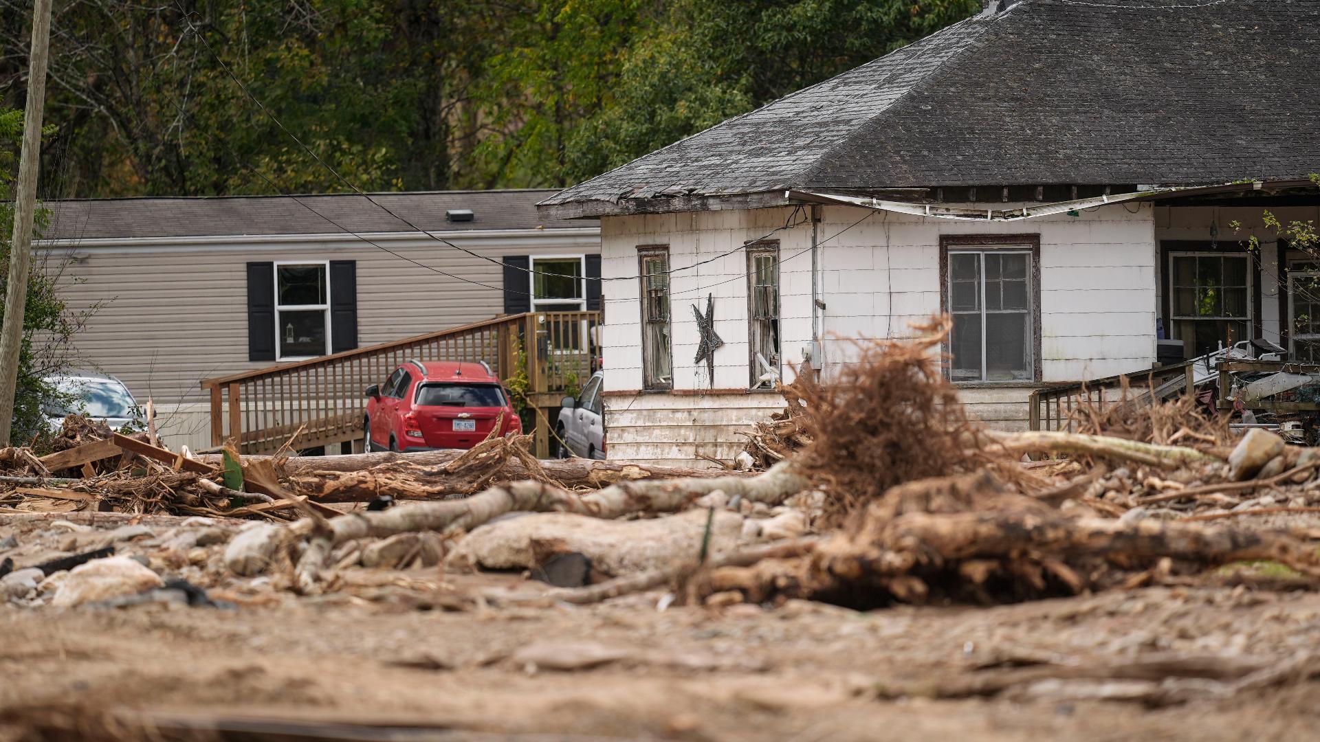
Let's talk specifically about Georgia. We know that landfill didn't happen here but there was significant wind damage, Valdosta up through Augusta and then here in Atlanta and up to the North Georgia Mountains, there was flooding a lot of flooding. Can you talk more about what you found in your research from that?
The tree damage in South Georgia was tremendous all the way from Valdosta through Augusta, even into the Midlands of South Carolina. And trees are a thing we have to balance. Trees can do a very good job of, even being an old school windbreak, helping slow those winds down until they're not until we see catastrophic tree damage. We have trees falling on homes that are going to be a huge source of that. Inland wind damage from Pale is just simply tree damage. We're looking at winds in the 80 to 100-mile-hour gust range that produces tremendous tree damage.
I want to point out from a wind mitigation standpoint that we've had two hurricanes impact southern Georgia that weren't landfalls that came from the south, and one of those was a major hurricane, which was Michael, and this is something I'm not sure we really thought very hard about. We often focus on the coastal areas, but now we've had two events that really exposed we can get impacts in Southern Georgia very easily from storms that make landfall to the south, not just the homes themselves and the trees but also agriculture.
Let's shift now and talk about storm surge flooding. Tampa specifically and the coast near Tampa had really bad storm surge flooding, and we're now awaiting another storm surge event for them coming in from Milton. Talk to me about the vulnerability of that part of the coast from Helene.
Tampa Bay is perhaps the second most vulnerable storm surge area in the United States, just behind the New Orleans and Mississippi River Delta areas, which include parts of Mississippi. Tampa Bay actually looks like a baseball glove. So it's simply going to catch all that water that gets funneled through the mouth of the bay. The one thing that sort of makes these events a little lower probability than, say, other areas of the northern Gulf coast. It takes a very specific track to generate that maximum storm surge.
To maximize those impacts, you have to get a landfall that comes in just north of the mouth of the bay. But with Helene, we saw Helene move about 100 miles or so offshore. It produced enough onshore winds to move all that water, and we saw 7 to 8 ft of surge along Tampa Bay.
If you look at a worst-case scenario, take Milton. For example, if Milton Jogs further left today comes in further north, we're going to see water amounts of 3, 4, or 5 feet above that, maybe even higher across Tampa Bay. Right now, we might see the peak surge if you follow the official track further south toward the Venice area.
But that part of the country is the second most vulnerable area, and there's so much development there over the entire metro area down the length of the west coast of Florida.
What do you hope comes out of putting out these early insight reports and later findings?
Helene was one of those events where we saw the most catastrophic impacts occur well inland, away from the coast. We, as weather forecasters and enterprise members, have to work to help folks understand the potential for these kinds of events. I'm guessing no one would have thought of how catastrophic this could be, but hurricanes aren't just a coastal problem. They are an inland problem, both from a wind and rain issue.
At IBHS, we're really focused on education and outreach about what can happen and understanding what the impacts could be. But down the road, there is absolutely a building code impact for, say, an event like Hurricane Ian. We are actually able to look at how well the Florida building code performed in a wind mitigation sense and show that it was worth the extra money and effort to create that great building code system, and it proved itself out in that particular event.
We hope things like this can show really jurisdictions, local jurisdictions, state governments, and even all the way up the federal ladder what are the mitigation elements work...What are the vulnerabilities we have, and how can we work to start fixing our built environment to really make these events, hopefully in maybe the next 30, 40, 50 years, more like a bump in the road rather than the truly disruptive catastrophic impacts that we, unfortunately, see time and time again today.
A copy of the report can be read below.