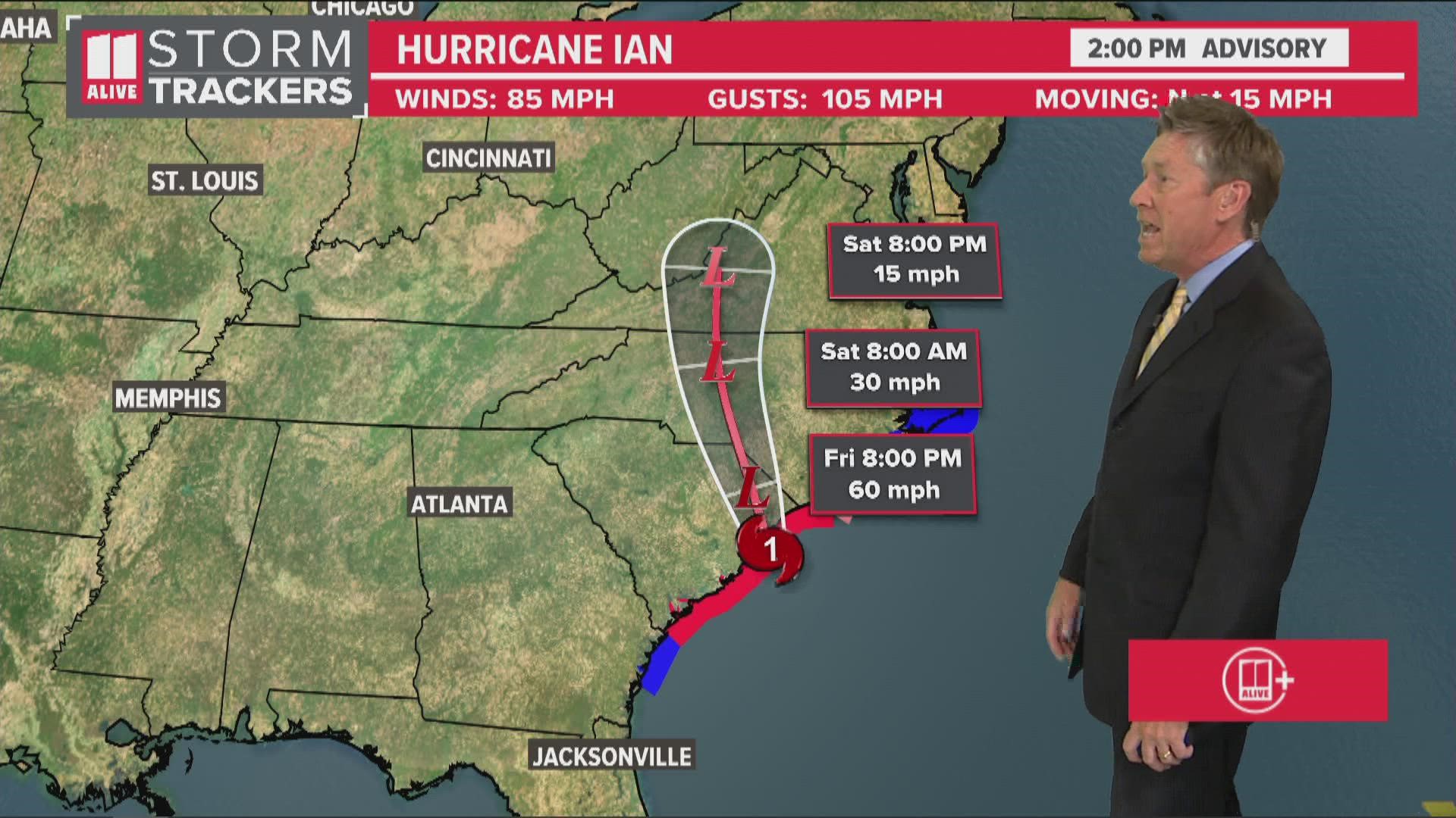
ATLANTA — Ian made its final landfall Friday afternoon at 2:05 p.m. near Georgetown, SC. It is a category one hurricane with maximum sustained winds of 85 mph and gusts to 105 mph.
With the track having shifted progressively further east each day this week, our impacts for north Georgia have become less and less.
The latest update from Ian, shows the storm has lost tropical characteristics and is now a post-tropical cyclone with 70 mph sustained winds.

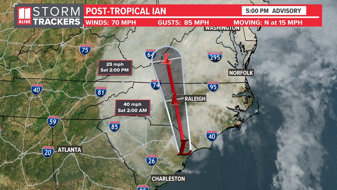
RELATED: Forecast cone and models
What To Expect: North Georgia impacts from Ian
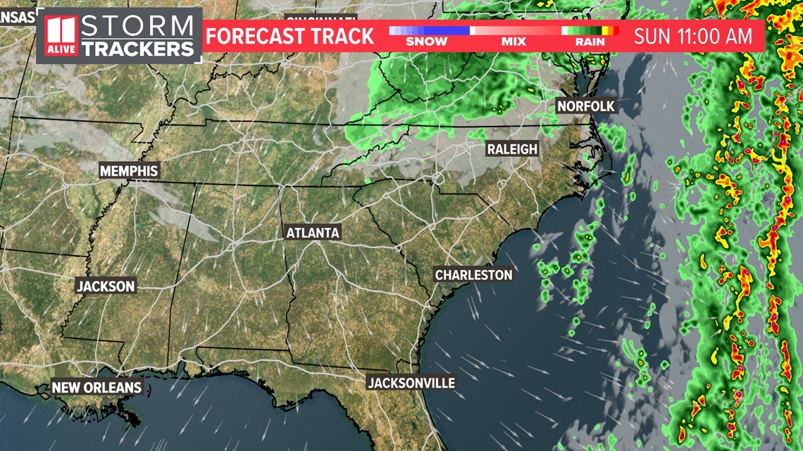
Because the storm continues to shift further and further east, we will see little impact from Ian. On the left side of the storm, we're on the cleaner side. The extent westward of rain impacts are smaller than on the storm's eastern side.
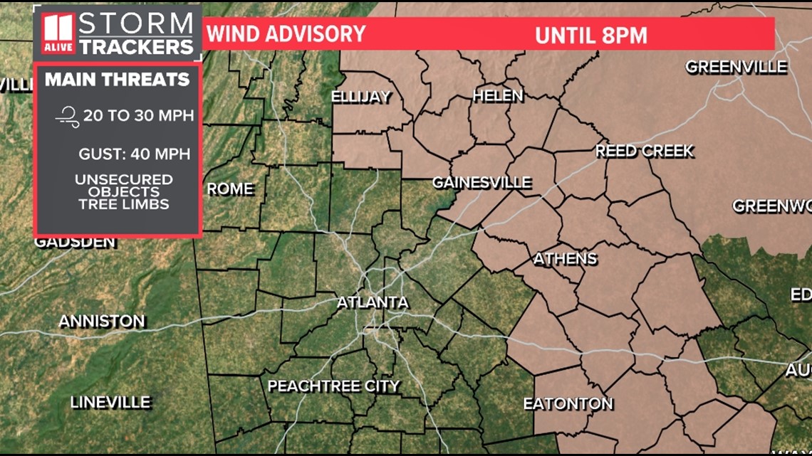
The biggest difference the next couple of days will be gusty winds at times, especially out in eastern Georgia closer to the storm. There is a Wind Advisory for our eastern counties, where gusts 30 to 40 mph will be possible.

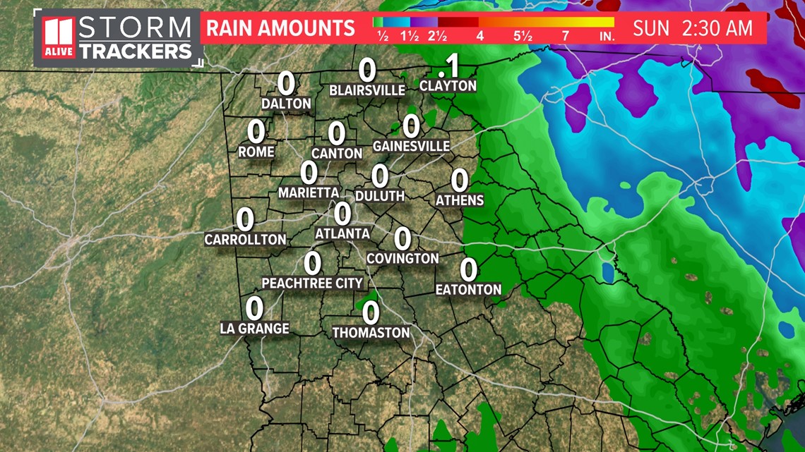
Rain chances look minimal. There is a slight chance Friday PM through Saturday AM of a few showers, mainly well east and northeast of the Atlanta metro.
We do not expect accumulating rain in the Atlanta metro. Far eastern Georgia could pick very minor, light accumulations.

Timeline
Friday Night: Most showers stay east of the metro. A few showers in far east and northeast Georgia. Breezy with gusts around 20 - 25 mph. Higher east.

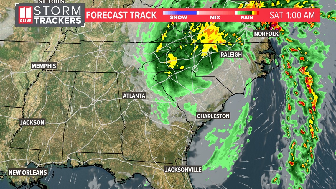
Saturday Morning: Low risk for a shower early north and east of Atlanta. Ian's remnants race northward taking the moisture with it.

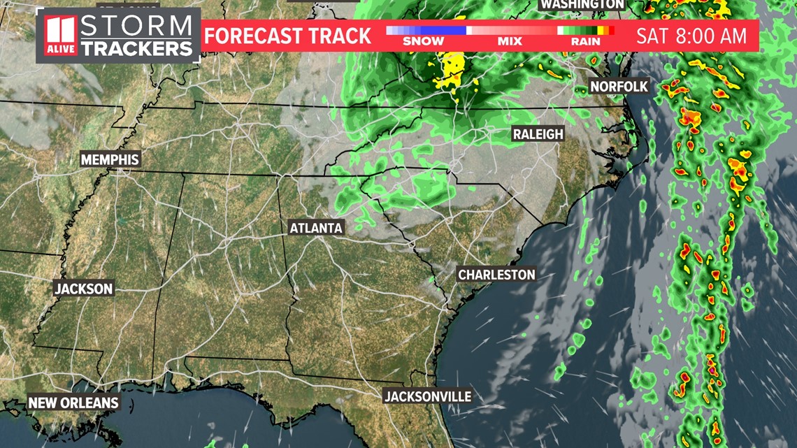
Saturday Afternoon: Clearing skies. Still breezy at times. Ian tracks further away up through the Mid-Atlantic.

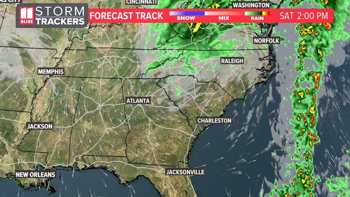
Saturday Night: Clearing and cooler.

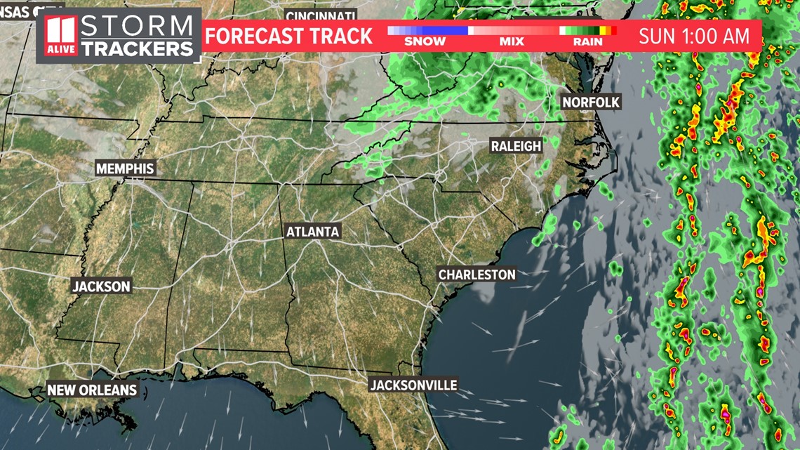
Sunday: Mostly sunny to partly cloudy. Overall a pleasant fall day.

Why we won't see high impacts
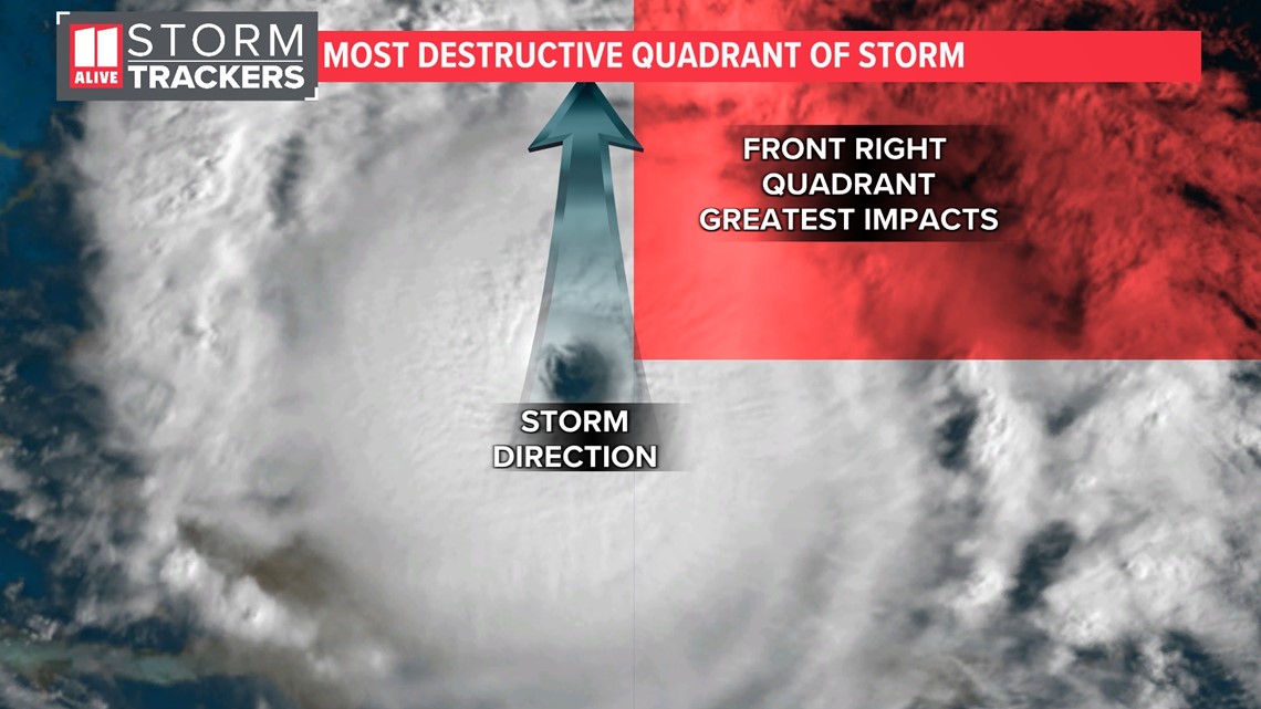
When it comes to impact from landfalling tropical systems, location relative to the center of circulation matters. While every part of a hurricane is dangerous, the "dirty side" refers to the side of a hurricane or tropical system where you find the highest winds, highest storm surge, and the greatest tornado threat.
In a tropical system moving north like Hurricane Ian, the "dirty side" is the northeastern quadrant.

Why does this happen?
Tropical systems in the northern hemisphere rotate counterclockwise. As Hurricane Ian moves forward to the north, the winds on the right side are moving in the same direction as the storm. This accelerates wind speeds.
On the left side, winds are moving in the opposite direction of the storm. This slows down wind speeds.
MORE FROM THE 11ALIVE STORMTRACKERS
DOWNLOAD THE 11ALIVE APP:
- Download the app on your Apple or Android device.
- Set up weather notifications by clicking the Gear icon in the upper right corner of the app. Select Notification -> Notification Settings -> Severe Weather Alerts -> Toggle the Severe Weather Alerts button to the right to turn alerts on.
- Send photos and videos through the app by selecting the Near Me feature on the bottom right task bar of the app and entering your information.
TEXT YOUR WEATHER PHOTOS TO US: 404-885-7600
JOIN THE 11ALIVE STORMTRACKERS FACEBOOK GROUP: Nearly 10,000 metro Atlanta and north Georgia weather enthusiasts share their weather photos every day. Click here to join the group!
Tuesday video update:

