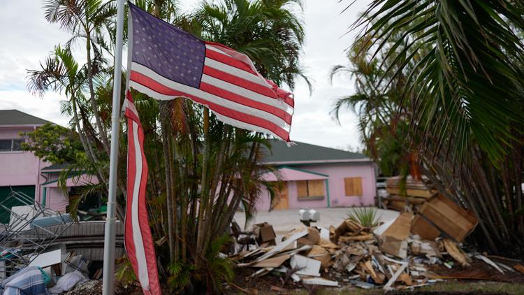
TAMPA, Fla. — Hurricane Milton is rapidly approaching Florida's west coast in a powerful and historic fashion.
The state's peninsula is already feeling its devastation. Tornadoes spawned from Milton continue to tear through areas in and around the storm's path Wednesday.
VERSIÓN EN ESPAÑOL: ¿Cuándo tocará tierra el Huracán Milton?
The National Weather Service said a total of 53 tornado warnings had been issued as of 3 p.m. That includes warnings issued by NWS Tampa Bay, NWS Miami and NWS Melbourne. Forty-one of those were issued by NWS Miami.
Residents are warned to remain sheltered in place, even in the outer bands of Milton, because of flooding rains, tropical-storm-force winds and the threat of tornadoes.
But this is only the beginning. Here's what we know about when Milton will make landfall.
Hurricane Milton is working its way toward the Tampa Bay area right now, just slightly weakening to a Category 3 storm.
The eye of the storm is expected to first touch Florida's west coast Wednesday night, then likely won't finish its path through the state until early Thursday morning.
As of the latest advisory, the storm is about 60 miles west-southwest of Sarasota with maximum sustained winds at 120 mph. It is moving northeast at 17 mph.
"While fluctuations in intensity are expected, Milton is forecast to remain an extremely dangerous hurricane through landfall in Florida," the NHC previously said.
The Tampa Bay area has the potential to see 10 to 15 feet of storm surge, but this is highly dependent on the track. A slight shift in the landfall south of Tampa Bay would result in lower surge totals.
Rainfall from Milton is expected to range between 5-12 inches with localized totals up to 18 inches across portions of the Florida Peninsula and the Keys through Wednesday night. That rainfall will bring risks of flash, urban and areal flooding along with minor to moderate river flooding, according to NHC.
With a front sinking in from the north, the areas prone to seeing most of the rain will exist along and south of I-4. Coastal areas should pay close attention to the forecast and have a way to receive alerts in case a flash flood warning is to be issued.
If you haven't already, now is the time to find shelter. Find a list of safe places to wait out the storm here.
Keep up-to-date on all the latest weather information on 10 Tampa Bay here.