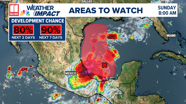
Invest 91-L, a broad area of low pressure sitting in the southwestern Gulf of Mexico, is becoming more organized. Shower and thunderstorm activity associated with it is increasing.
91-L has a high 90% chance of formation from the National Hurricane Center and is expected to become a tropical depression in the next couple of days.


It is forecast to drift slowly northwest, moving into environmental conditions that are conducive to additional development.
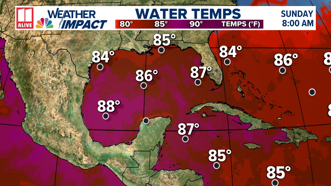
Sea surface temperatures in the Gulf of Mexico are warm, and wind shear is low.

Invest 91-L is expected to move through the Gulf of Mexico and approach the Gulf coast. Watches may be issued for portions of the coast this evening.
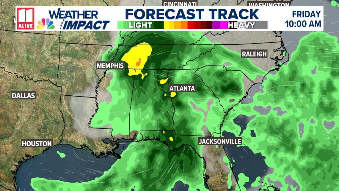
Regardless of any further development, 91-L could bring heavy rain across the Gulf Coast this week.

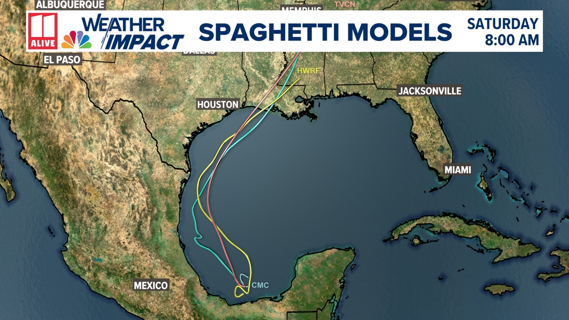
An Air Force Reserve Hurricane Hunter aircraft is scheduled to investigate the system later today, which will give us better insight. Forecast models generally have a hard time with tropical systems before they develop a closed center of circulation, so the forecast for Invest 91-L is fluid.
Right now, some of the tropical moisture may spread rain across north Georgia for the end of the week. Our forecast here in north Georgia is very dependent on where this tropical wave ends up. Further west = less rain. Further east = more rain and cooler temps.
We'll be monitoring closely this week. Stay tuned!

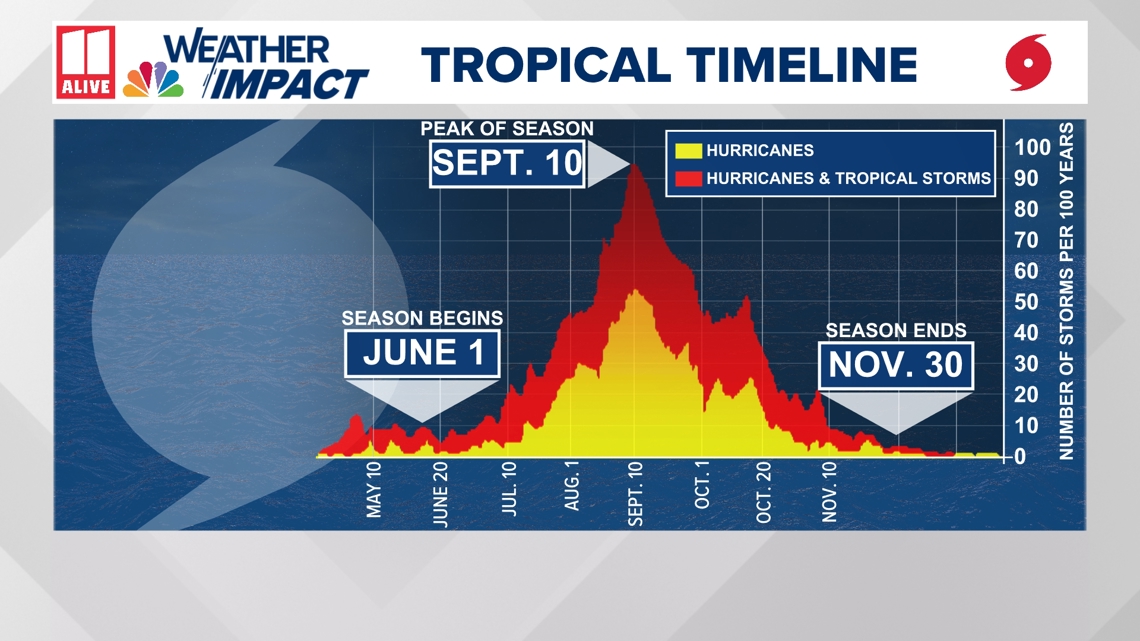
September is considered the most active month of the Atlantic hurricane season, with a statistical peak on September 10. However, hurricane season is far from over. The end of the season is November 30.
NOAA's most recent hurricane outlook released at the beginning of August still calls for an active season.

Although the 2024 Atlantic hurricane season kicked off with Hurricane Beryl, the earliest category 5 on record, the last few weeks in the Atlantic have been quiet. This is in part because of the presence of Saharan dust, which limits tropical activity.
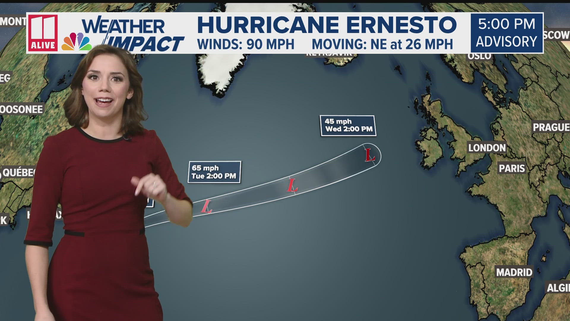
Hurricane Ernesto was the last named system which became post-tropical on August 20.
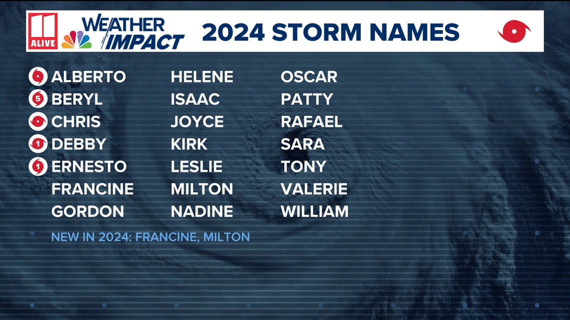
If Invest 91-L strengthens into a tropical storm, the next name on the list is Francine.

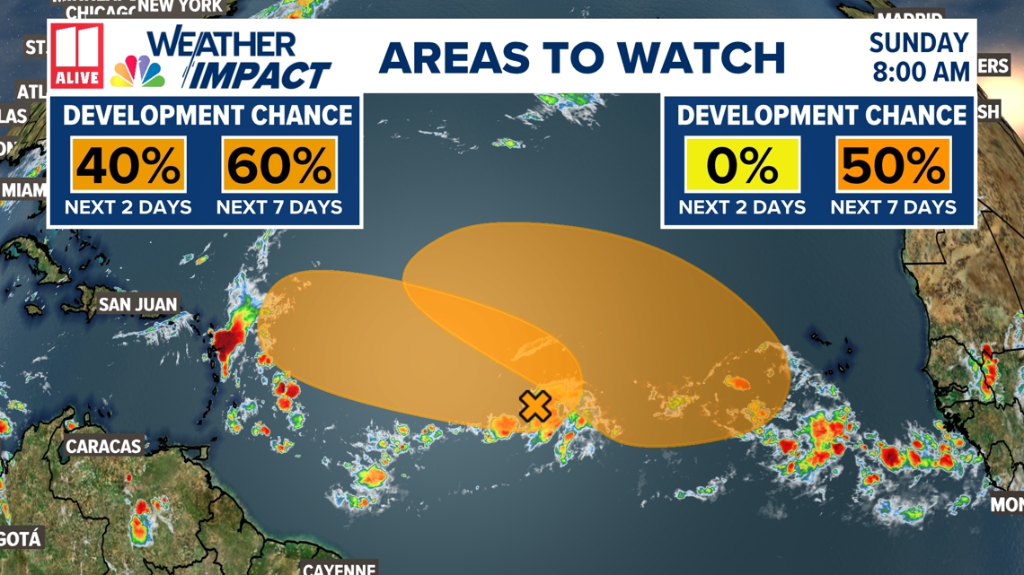
Invest 91-L is not the only tropical wave worth watching right now. Two areas in the Atlantic have a medium chance of development.