ATLANTA — Laura has been downgraded to a tropical depression. As of the 11pm Thursday advisory from NHC, winds are down to 35mph which is below tropical storm strength. We can't ignore this storm, though. As it moves to the east, the remnants will still generate rain and storms.

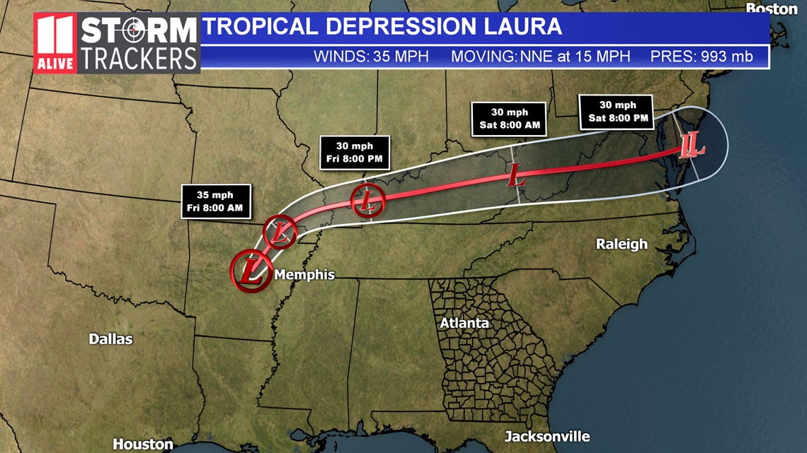
We still have to track the remnants of Laura as it turns toward the east. The tropical depression moves through western Kentucky Friday night then a remnant low in eastern Kentucky into West Virginia Saturday. That location to our north will be close enough to enhance our rain chance and storm risk late Friday into Saturday.

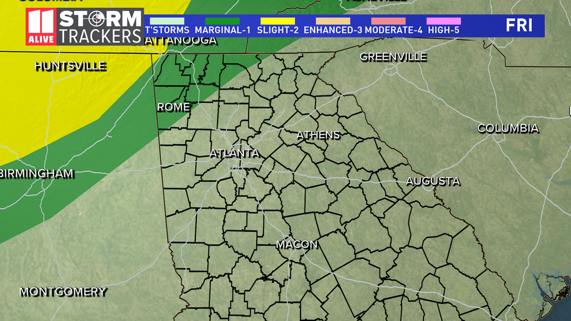
The Storm Prediction Center brings the "marginal" or level 1 of 5 risk for severe storms into NW Georgia late Friday. The "marginal" risk covers all of north Georgia and metro Atlanta Saturday.

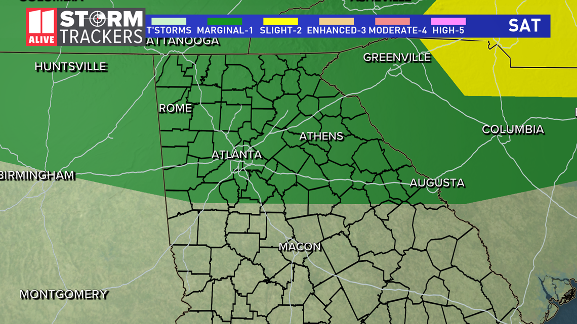
The main risks will be pockets of heavy rain, lightning, wind and a low risk for isolated tornadoes.
The remnants of Laura will exit the country, but we will still have plenty of moisture left behind to keep us with some scattered showers Sunday into Monday.

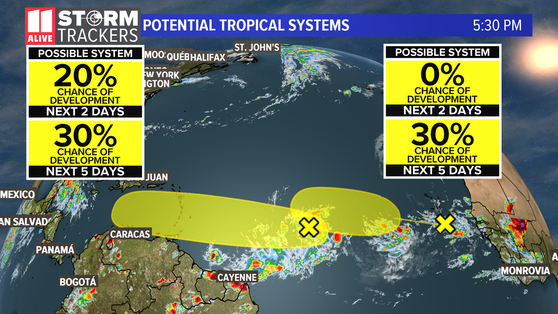
We have to watch 2 additional potential tropical systems in the Atlantic basin. The National Hurricane Center gives them a low risk of development for the next 5 days.

