
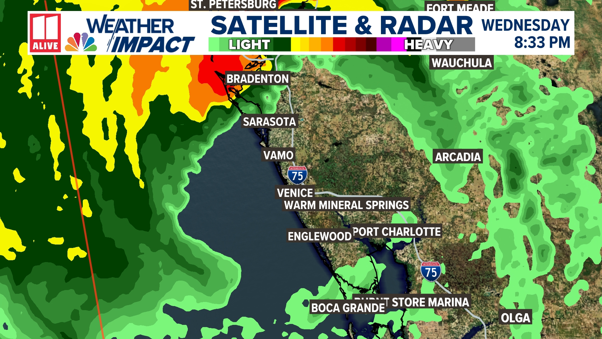
ATLANTA — Hurricane Milton makes landfall Wednesday evening at 8:30pm at Siesta Key, Florida. This is just south of Sarasota. Max winds at 120mph as a category 3 hurricane.
At its peak, Milton reached max winds of 180 mph. Milton's max winds Monday increased 95 mph in a 24-hour period, one of the highest increases ever on record in a 24-hour period, only to be topped by Wilma in 2005 and Felix in 2007.
The storm is encountering more wind shear as it approaches landfall. Wind speed is expected to decrease, but Milton will become a larger storm. Life-threatening storm surge is expected across the coast of western Florida, and strong winds could lead to long-lasting power outages and devastating damage.
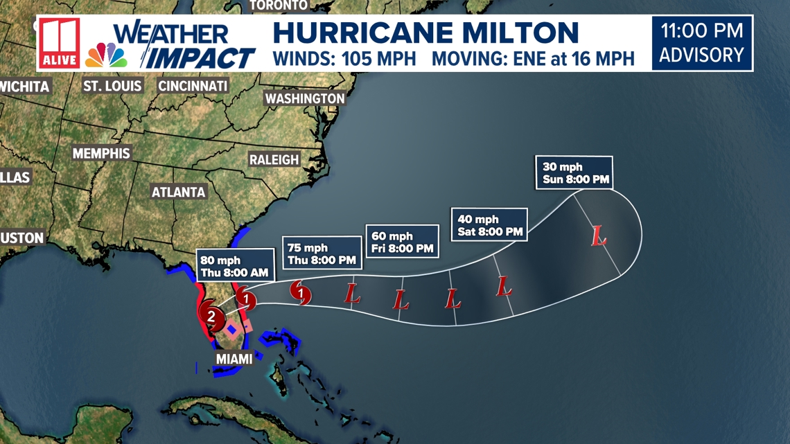
Where is Milton now? Latest track
Milton will weaken slowly as it interacts with land and cuts across Florida. It will re-emerge in the Atlantic Thursday afternoon. Then become extratropical by the end of the week in the Atlantic.

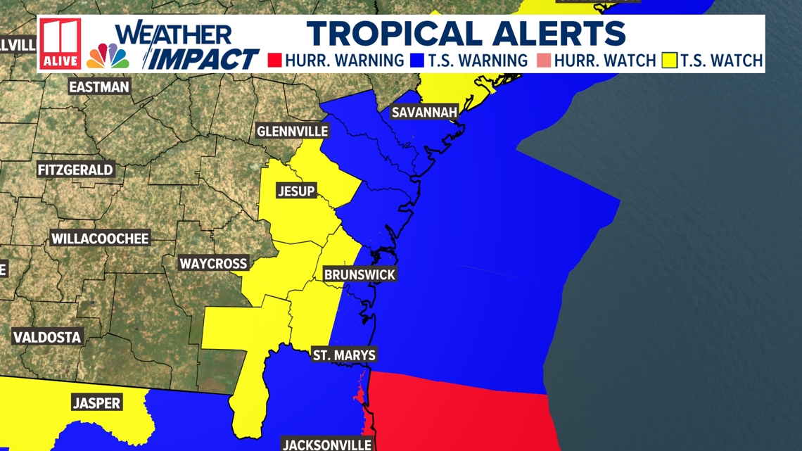
Milton latest watches and warnings
Tropical Storm Warnings and Tropical Storm Watches have been issued for Florida as well as portions of the Georgia and Carolina coast.

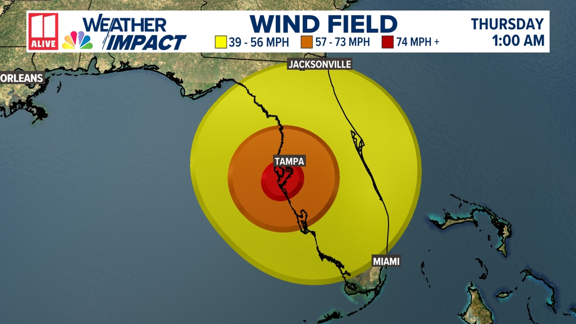
The wind field of Milton will be very large at landfall, with tropical storm-force winds extending nearly 350 miles across!

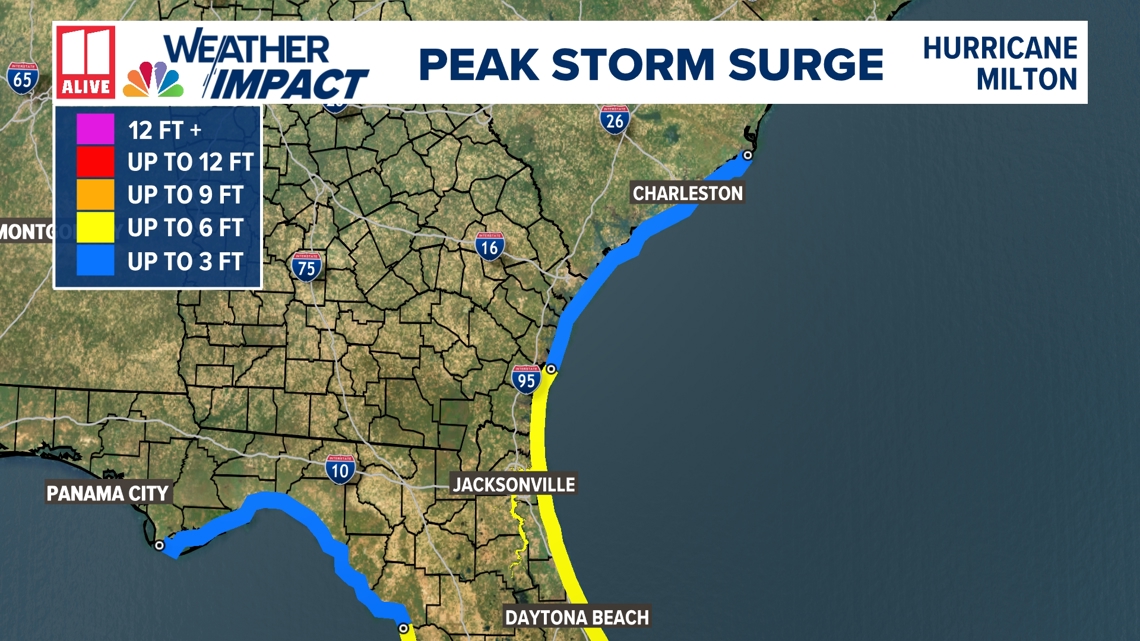
Milton storm surge
Significant Storm Surge is likely along the west coast of Florida, especially just south of landfall. Up to 12 feet of storm surge is expected in Tampa and Fort Meyers, and more than 12 feet is forecast from Holmes Beach to Boca Grande, including Sarasota.

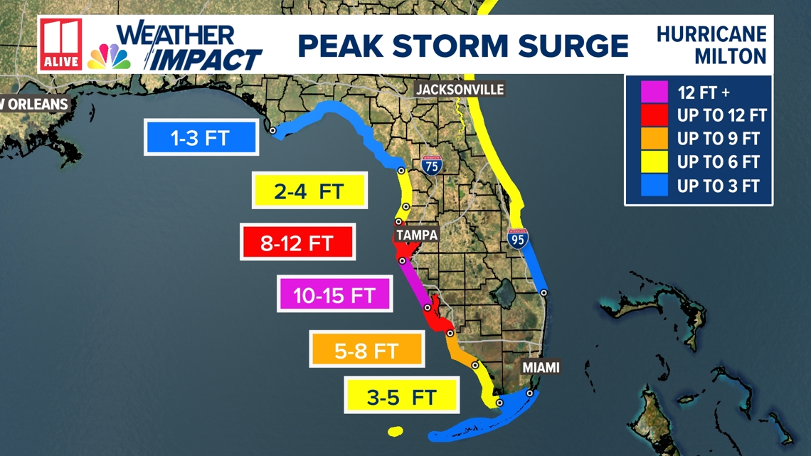
There will even be storm surge on the east side of Florida and the Georgia coast.

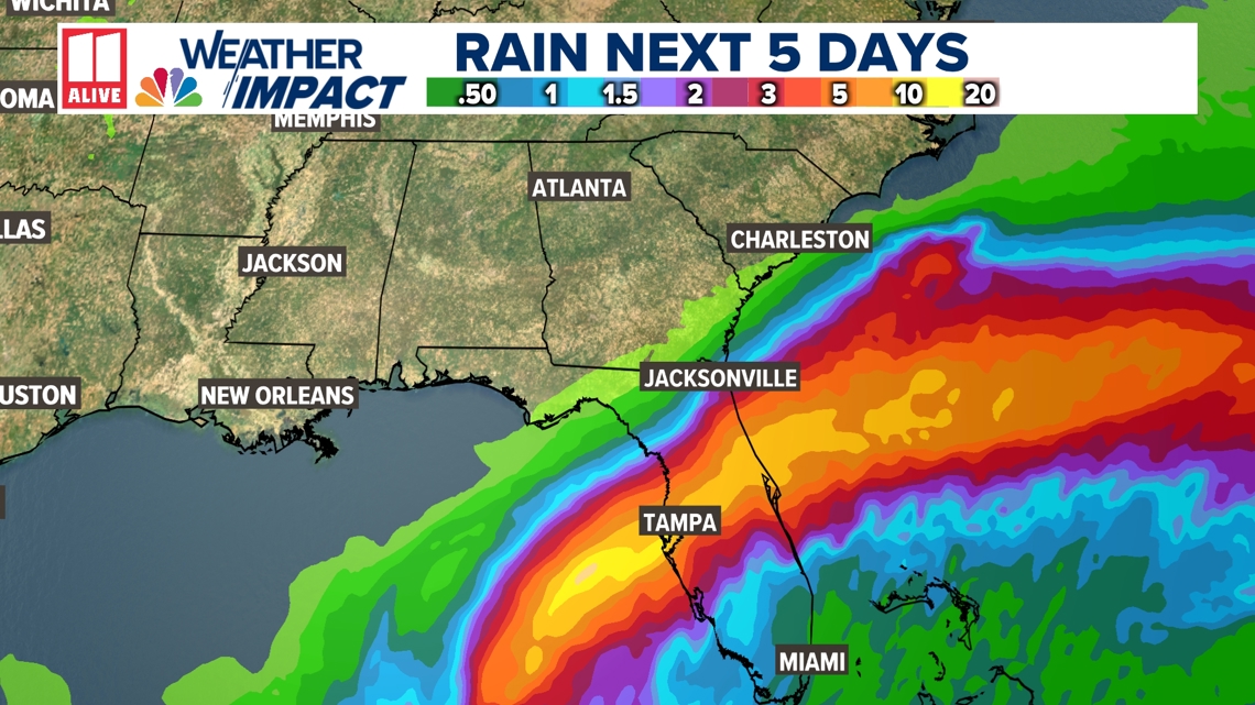
Milton rainfall totals
Regardless of where Milton makes landfall and how strong it becomes, heavy tropical rain is likely across Florida throughout this week.

Will Milton impact Atlanta? North Georgia?
No impact from Hurricane Milton is expected in north Georgia, thanks to our fall front that will be stalled over central/southern Georgia.