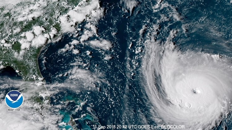
Hurricane Florence made landfall as a category 1 hurricane Friday morning, but as the storm moves inland it will likely impact parts of Georgia with gusty winds and rain.
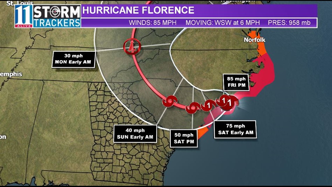
According to the National Hurricane Center, Florence is expected to move inland across extreme southeastern North Carolina and extreme eastern South Carolina Friday and Saturday. Florence will then move generally northward across the western Carolinas and the central Appalachian Mountains early next week.
New forecast track models show the storm's path dipping into South Carolina, bringing some parts of north Georgia into the forecast cone as the storm downgrades into a tropical depression late in the weekend.
However, the track shows those remnants quickly veering north. The risk of rain and chance for winds will move into northeast Georgia Sunday into Monday.
Any additional changes to the forecast track could impact what Florence brings to Georgia.
Download the FREE 11Alive News app to receive breaking alerts and subscribe to our newsletter for email updates.


Friday
Right now, the forecast for Friday for metro Atlanta and north Georgia are for partly sunny skies with highs in the low 90s.
Weekend
The uncertainty of Florence's path puts the overall forecast for the weekend in question right now.
Saturday looks dry. We will begin to feel the wind picking up a little, especially east of Atlanta. We will have breezy conditions with only a 20% chance for a shower late.
The storm with move more west after making landfall, with the track of the remnants of Florence dipping into South Carolina and closer to the South Carolina-Georgia border.
At that point around 8 p.m. Sunday, the storm will be a depression. If that track holds steady, northeast Georgia could possibly see more wind and rain for Sunday and Monday. Areas east of Atlanta will see a better chance of rain and wind. Areas west of Atlanta a lower rain and wind risk.
Florence's landfall
Initially, models showed Georgia remaining on the left and quiet side of the storm. This would provide less of an opportunity for severe weather, but showers and thunderstorms will likely move through northeast Georgia based on the latest forecast track.
If Florence's landfall continues to shift further, the forecast for Georgia could shift dramatically. As a result, viewers are advised to continue to check with the 11Alive StormTrackers and 11Alive.com for the latest information and updated weather advisories or warnings.
► UPLOAD | Send us your weather pictures here
► Download the FREE 11Alive News app now in the iTunes store or on Google Play.
► POWER OUTAGES CHECK | Georgia Power customers, check here. Georgia EMC customers check here.
► Have a news tip? Email news@11alive.com, visit our Facebook page or Twitter feed.


