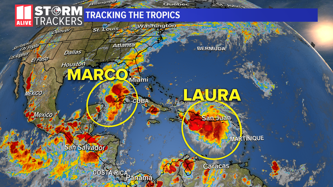
ATLANTA — In true 2020 fashion, Hurricane Season in the Atlantic is cranking up in a way many couldn't have imagined even a few days ago. We are tracking two tropical named systems that will be entering the Gulf of Mexico at the start of the work week.


The paths of these two storms may end up with similar landfall locations with just a day or two difference. 'Marco' and 'Laura' have the Gulf Coast on watch and high alert in preparation for potential impacts early in the week.
Marco is forecast to become a hurricane Saturday, and Laura will follow behind by Monday. That's two hurricanes in the Gulf of Mexico at the same time.
If you've been wondering: they cannot merge into a giant hurricane. That's meteorologically impossible. But in something called the 'Fujiwhara Effect', they can interact with each other if they are close enough. This time, Marco will be about a day ahead of Laura in timeline, which should be enough to limit interaction.
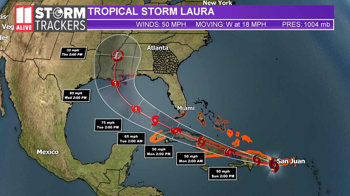
Tropical Storm Laura
Laura's eventual path continues to inch further west in the long term -- those along the Gulf Coast from central Texas through the panhandle of Florida need to be paying attention to forecast changes and prepared to take action ahead of the storm.
As of the 8 PM Saturday advisory, Laura is centered 85 miles east southeast of Santa Domingo, Dominican Republic, where it is bring heavy rains and the potential for flooding. The path from here takes it right over the high mountains of Hispaniola tonight, which will disrupt the storm. A path from there over Cuba will also limit the potential for strengthening through Sunday. But Laura will emerge in the Gulf Of Mexico by Monday night with an atmosphere more ready for intensification. Warm waters of the Gulf of Mexico and low wind shear will allow for Laura to strengthen into a Hurricane before landfall.
The current timeline for a landfall is Wednesday, with the effects of Laura being felt along the Gulf Coast as early as Tuesday.


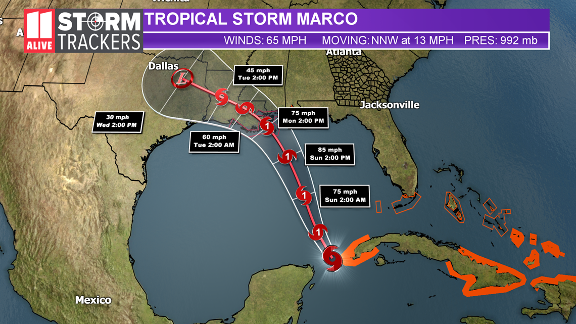
Tropical Storm Marco
Marco formed late Friday night and continues to show remarkable strengthening Saturday with Hurricane Hunters finding it has sustained winds of 65 mph and rising. Marco will become the 3rd hurricane of the 2020 Atlantic season later Saturday as its center slides just east of the Yucatan Peninsula.
As it emerges in the Gulf of Mexico, Marco will continue gaining strength. As Marco closes in on the coast, it will begin to slow, turn westward, and may weaken some before its eventual landfall in Texas or Louisiana. Impacts will be felt as early as Sunday night and increasing for Monday and Tuesday. Storm surge, high winds, and heavy rains are likely as Marco makes its approach and landfall.
Although it's the later name in the alphabet, Marco will precede Laura in U.S. mainland impacts and landfall by 1 to 2 days.
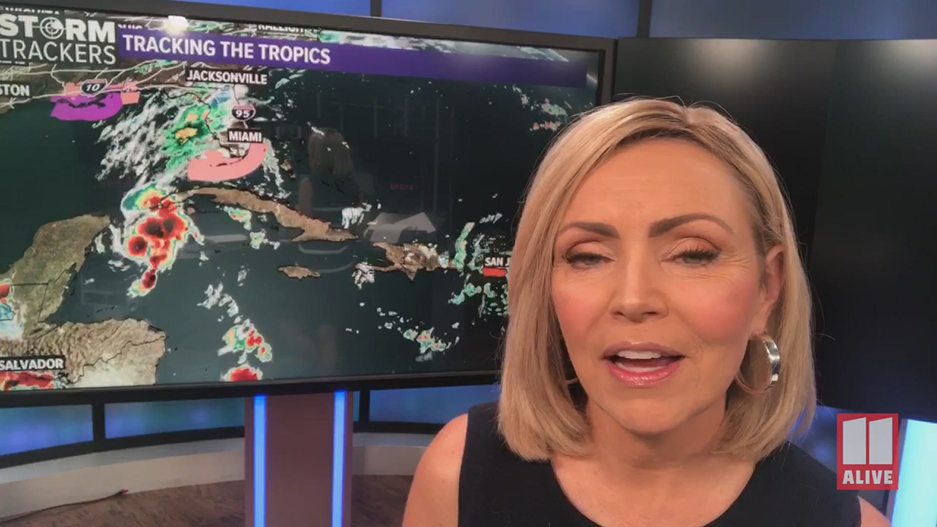
Tropical Storm Marco formed late Friday night. The storm is currently located in the western Caribbean and is nearing the Yucatan Peninsula. It is moving to the northwest and will eventually get into the Gulf.
There is a hurricane watch in effect for Punta Herrero to Cancun Mexico. There is a tropical storm warning in effect for Punta Herrero to Dzilam Mexico. The latest track shows this system staying just below hurricane strength as it nears landfall near the Texas coast Tuesday. We will have 2 named systems at the same time in the Gulf next week.


Another system is coming off the coast of Africa. It has a 10 percent chance of development over the next five days. It is struggling to gain strength at this point.

