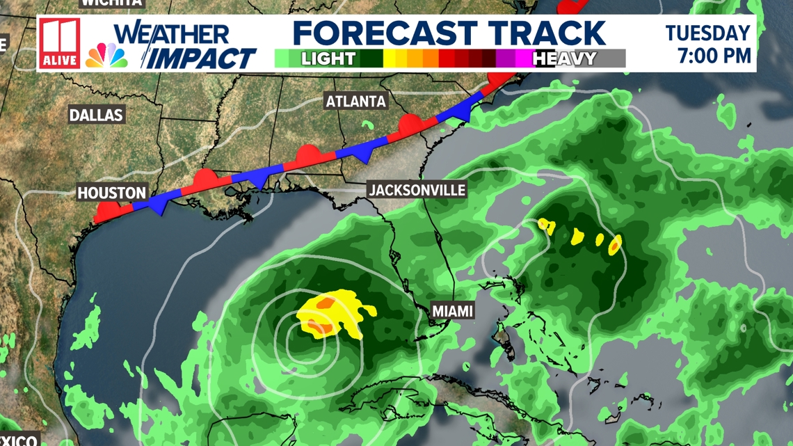
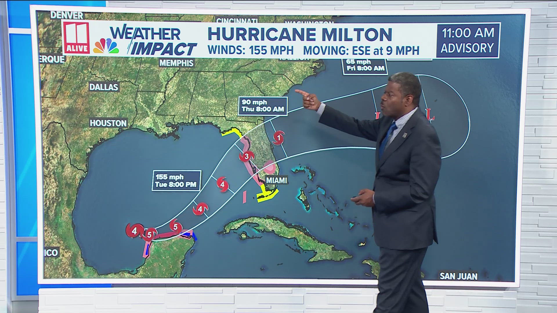
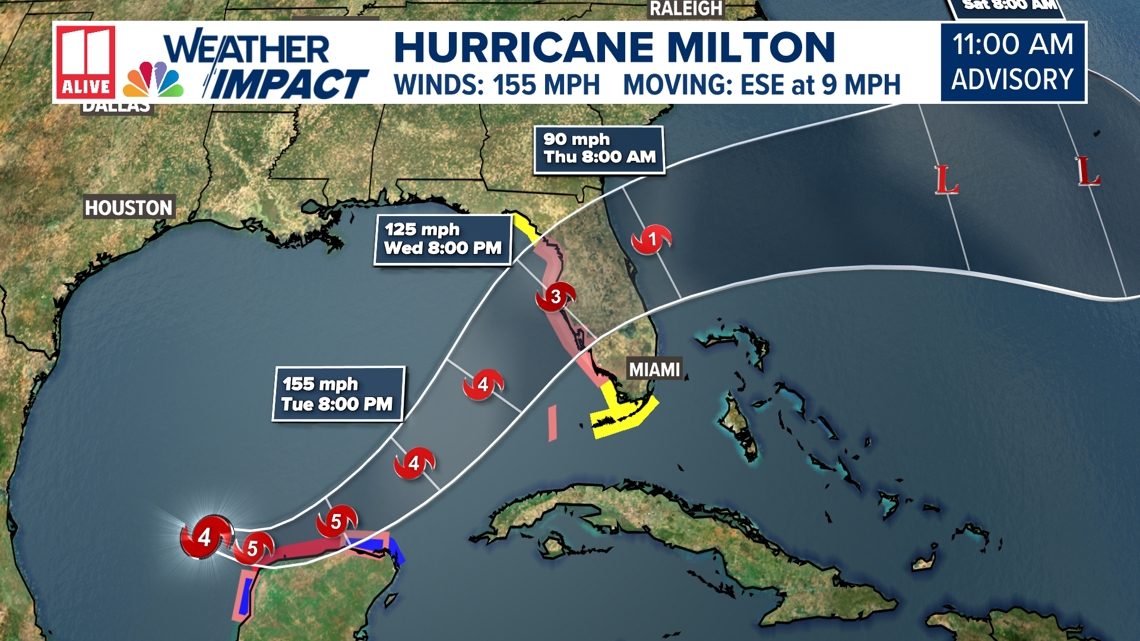
ATLANTA — Milton has undergone incredible rapid intensification today, and is now a very dangerous category 4 hurricane with winds of 155 mph and higher gusts. Category 5 begins at winds of 157+ mph. Milton's max winds have increased of 90 mph in a 24-hour period, one of the highest increases ever on record in a 24-hour period, only to be topped by Wilma in 2005 and Felix in 2007. Milton's central pressure has also dropped, and is now down to 933 mb.
The storm is nearing the northern edge of the Yucatan Peninsula today and will be a Category 5 later this afternoon. As it gets closer to landfall Wednesday, the max winds could decrease a little as it becomes a larger storm. This will bring life-threatening storm surge to the coast of western Florida, and winds that could cause long-lasting power outages and devastating damage.
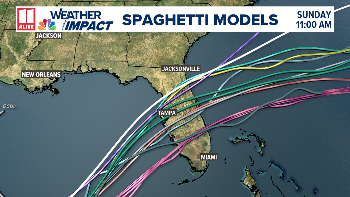
The official forecast from the National Hurricane Center has the storm nearing landfall Wednesday evening. This could happen anywhere between Crystal River and Fort Meyers, but the Tampa-St. Petersburg metro area is at the center of the cone of uncertainty. This 11 a.m. forecast cone is a slight shift north.

Hurricane warnings are in effect along the Yucatan Peninsula, stretching from Celestun to Rio Lagartos and tropical storm warnings to the northern tip of Cancun.

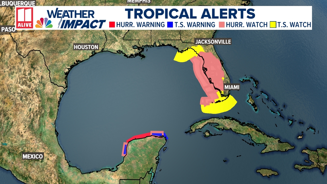
Hurricane Watches are now spread throughout western Florida and well inland to the Orlando metro area. Tropical Storm Watches are in effect for the Big Bend of Florida, and the Florida Keys.

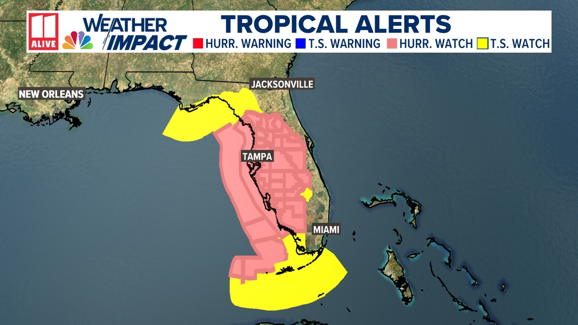
Landfall is expected along the Florida coast Wednesday, but there is still model variation as to where that landfall location will be. All of the Florida peninsula needs to be prepared.

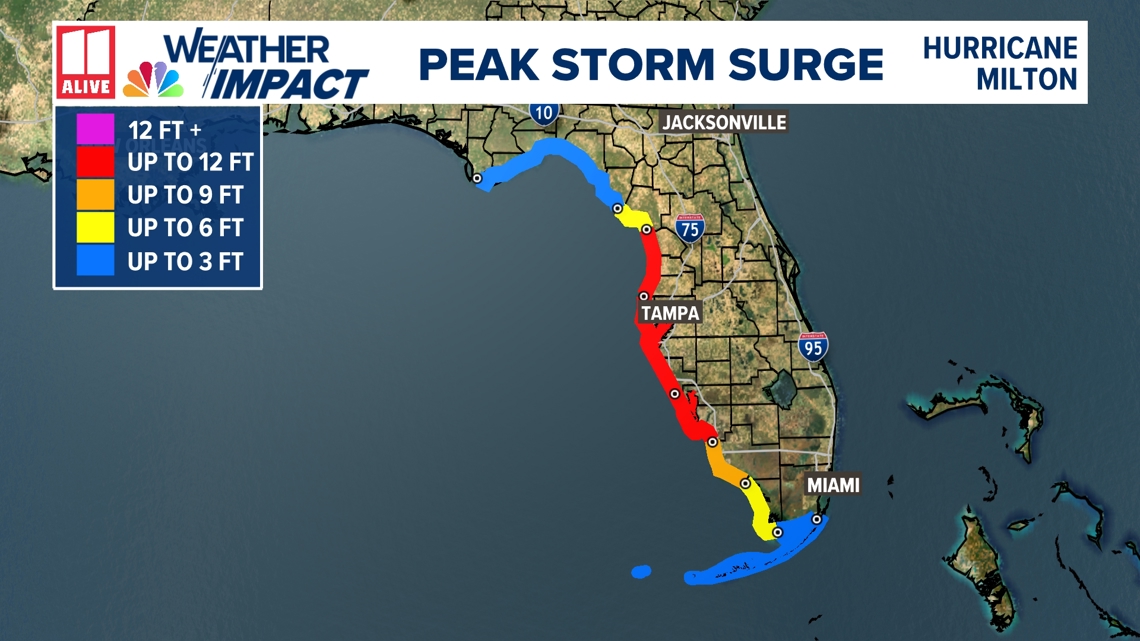
Significant Storm Surge is likely along the west coast of Florida. You'll see below in red a huge area where up to 12 feet of storm surge is possible. This includes the Tampa area, Sarasota, Clearwater, Fort Meyers, and Bonita Springs.

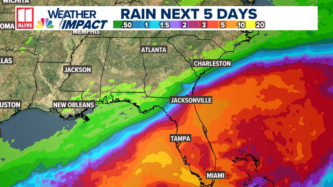
Regardless of where Milton makes landfall and how strong is becomes, heavy tropical rain is likely across Florida through much of this week.

No impact from Hurricane Milton is expected in north Georgia, but the forecast is fluid.
A cold front swinging through the southeast on Monday, along with a building ridge of high pressure, will steer Milton, keeping it south of metro Atlanta. Stay tuned!

