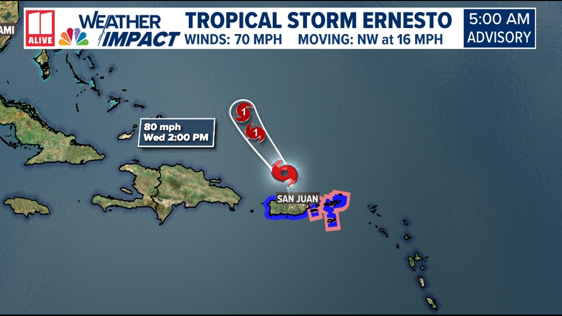
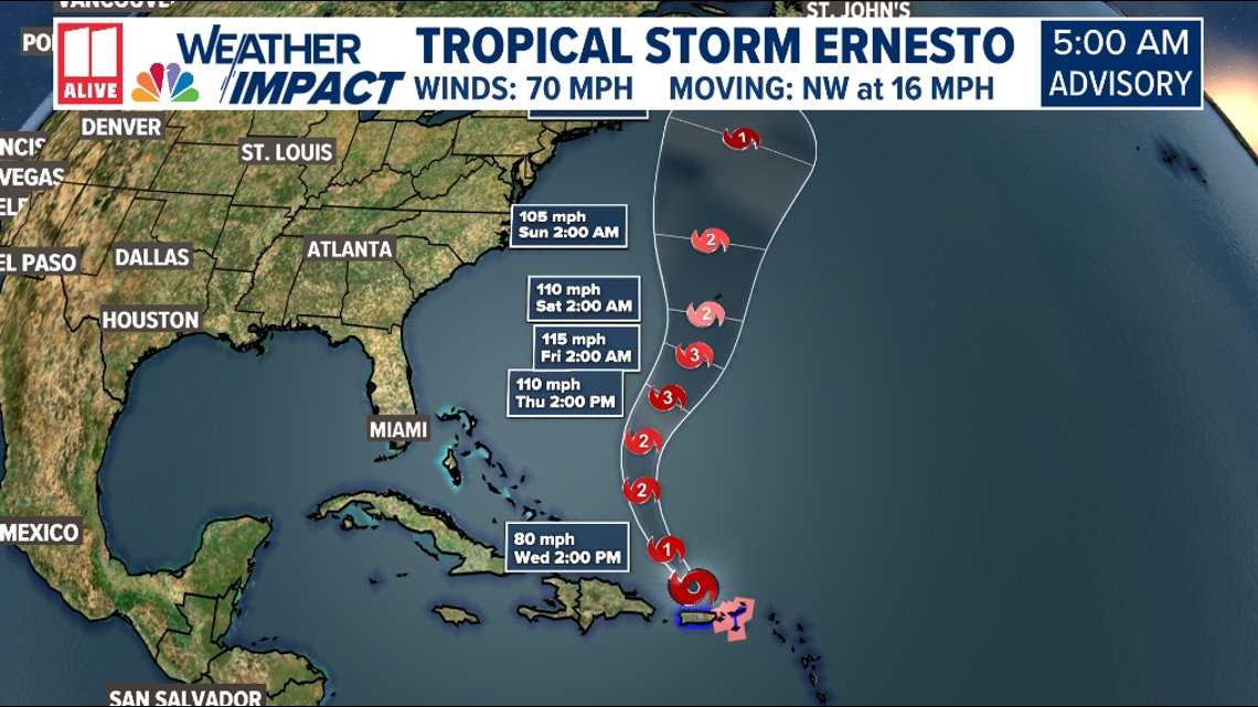
ATLANTA — Tropical Storm Ernesto is getting stronger. It is expected to become a hurricane today as the storm passes just north of Puerto Rico.
As of 5am update, the NHC advisory shows Ernesto with 70 mph winds moving NW at 16mph.

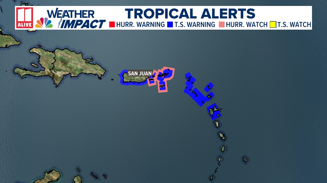
A Hurricane Watch is in effect for the U.S. Virgin Islands, the British Virgin Islands, and Vieques and Culebra. This means that hurricane conditions are possible.
Tropical Storm Warnings are in effect for Puerto Rico, the U.S. Virgin Islands, and the northern and the Leeward Islands in advance of the system. This means Tropical Storm conditions are likely.

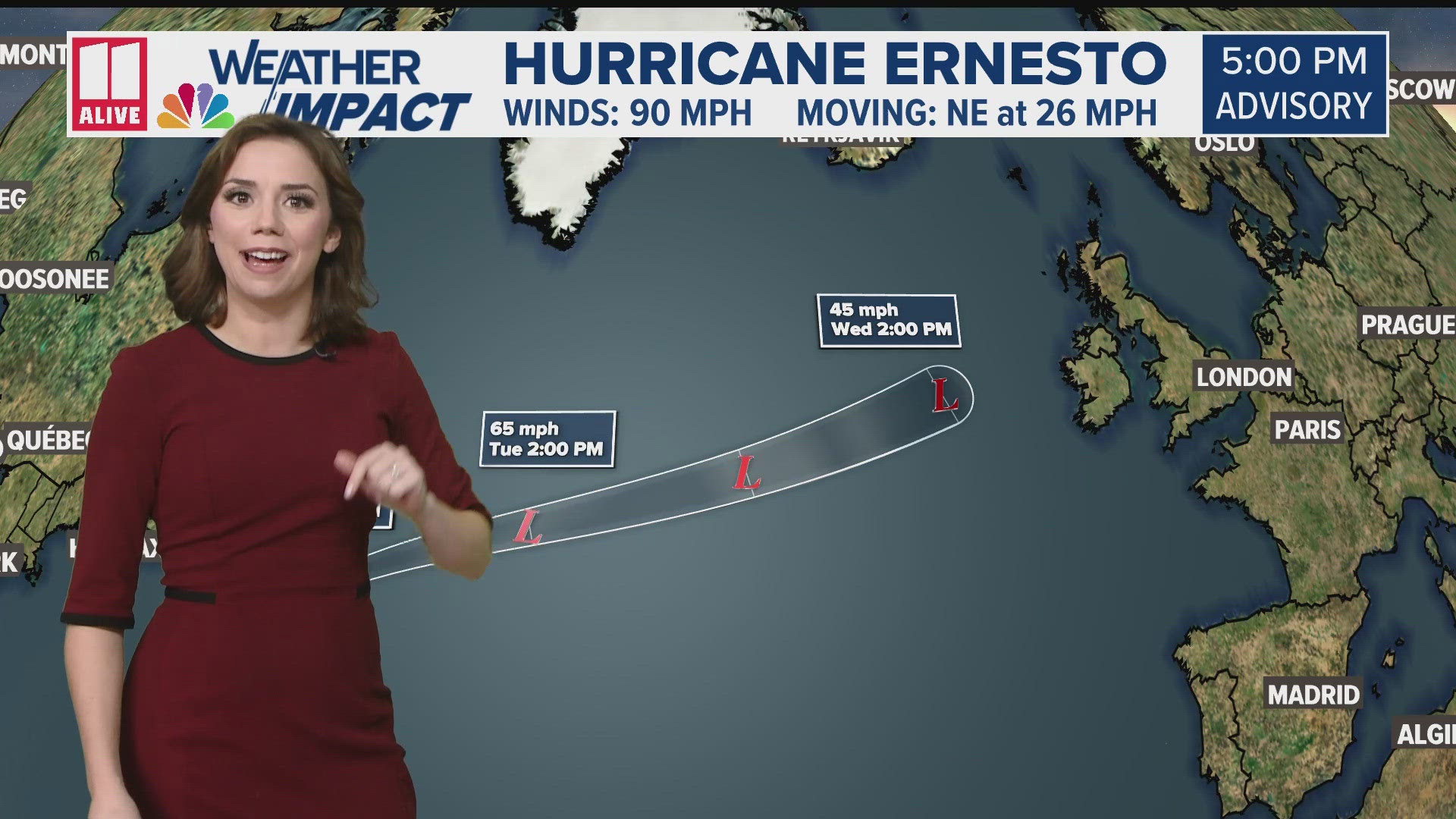
As Ernesto continues to gradually strengthen, it moves into the open Atlantic, the system is forecast to strengthen to a category two hurricane. It may pass very close to Bermuda by early this weekend as category 3, making it a major hurricane.

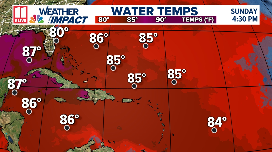
Environmental conditions appear conducive to gradual development as Ernesto moves west. Wind shear, which can limit tropical formation, is low, and sea surface temperatures remain unusually warm.

The system will be worth watching for potential impacts along the Atlantic coast, but right now, it looks likely that Ernesto will avoid landfall on the continental U.S.
The Bermuda High over the central Atlantic is shifting east. This shift in the atmospheric currents may help steer Ernesto northward, but it will depend on the strength of the high and its location.
Spaghetti models are currently in good agreement for a northward turn after Ernesto passes the Leeward Islands.

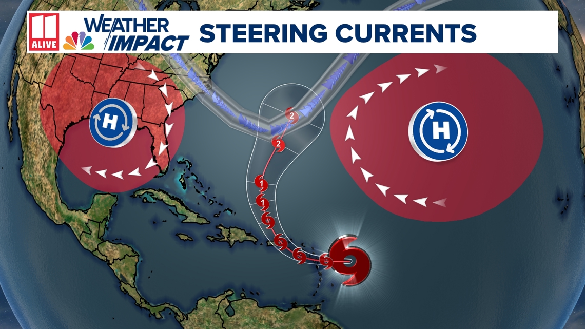
Typically, the Bermuda high around the August time frame is a little further to the west and will send systems closer to the United States, but the fact the Bermuda High is to the east will help keep this system away from the continental United States.
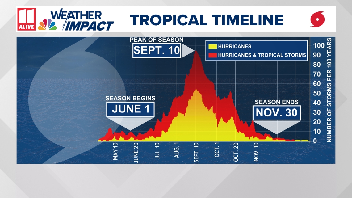
Although hurricane season begins June 1, the tropics typically don't start to heat up until August. The statistical peak of hurricane season is September 10.
The average date that the "E" storm typically develops in the Atlantic is August 22, so this is slightly earlier than average.
Last week, NOAA updated its Atlantic Hurricane Outlook, reinforcing the prediction of a very active season.