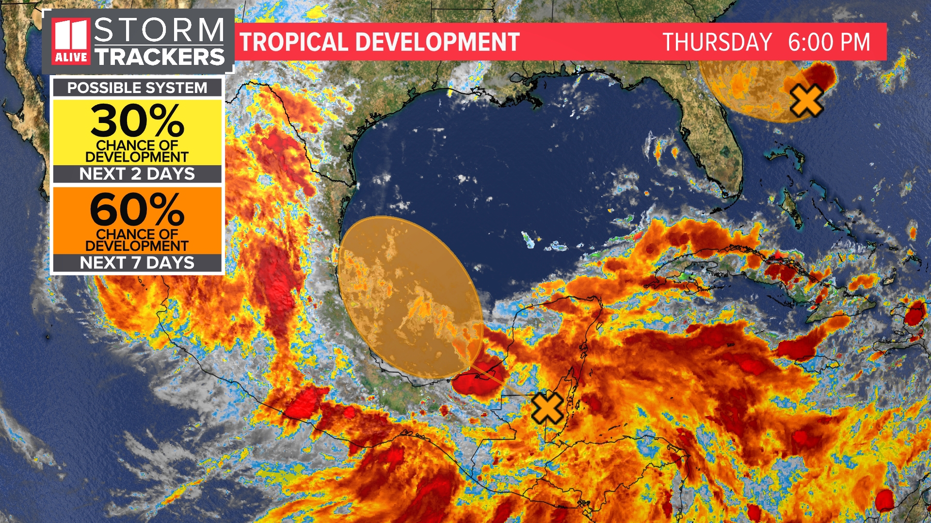
ATLANTA — As our first named storm of the Atlantic season dissipates over Mexico, our attention turns to what has the next chance of becoming a tropical system over the next two days.
Invest 92-L is an area of thunderstorms in the Atlantic that will near the first coast of northeast Florida and the southern Georgia coastline on Friday. This now has a 50% chance of development in the next 2 days.

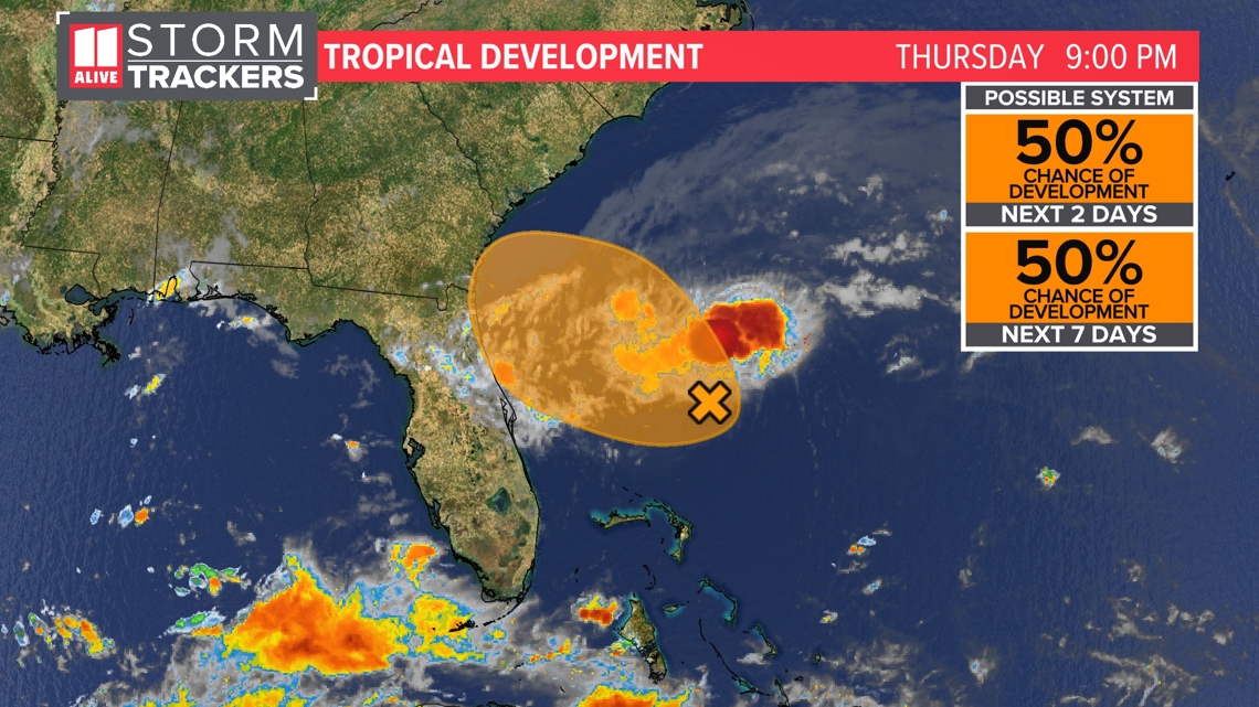
Hurricane hunters were out in the storm today and found wind gusts near tropical storm force, but they noted the system did not have a well-defined center yet. It is battling some dry air.
There is a chance it could get its act together by Friday and become a tropical depression.
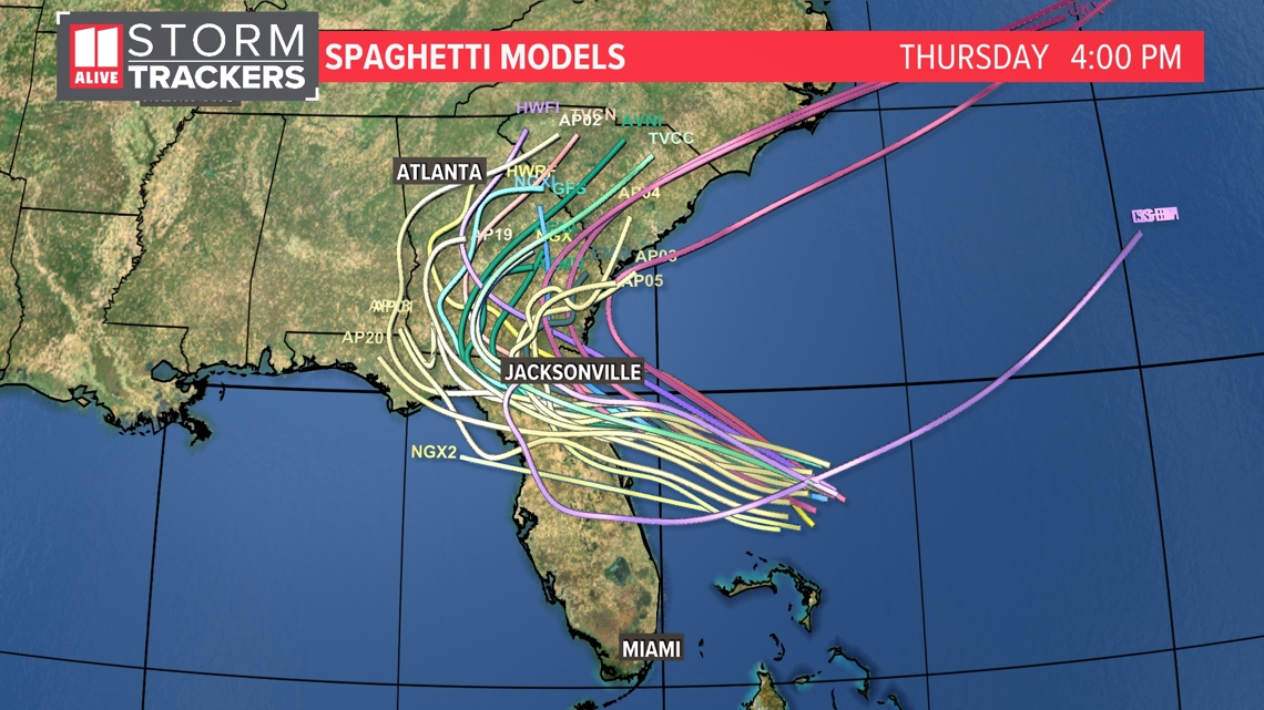
The broad area of low pressure will head west to northwest. These spaghetti model plots show the movement of the tropical low.

Rain showers and isolated thunderstorms will move onshore in Georgia Friday. The low then falls apart, meandering over southeast Georgia early this weekend.
Along the coast, rough surf and a higher risk of rip currents will also be a factor for beachgoers.

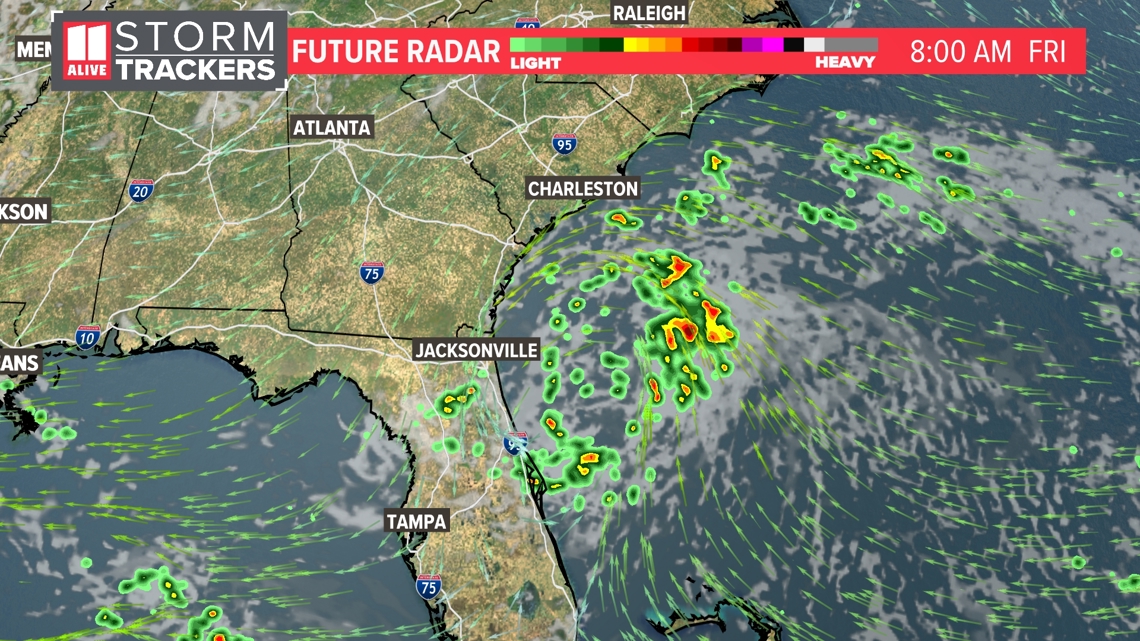
It will effectively increase the atmospheric moisture here in north Georgia. On Saturday, some isolated showers/storms are possible over central Georgia. By Sunday, an isolated shower is possible over northeast Georgia.
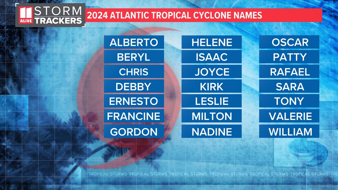
NOAA is forecasting a very active hurricane season with 17 to 25 named storms and eight to 13 of those becoming hurricanes. Alberto formed Thursday and made landfall in Mexico early Thursday. The next name on the list is Beryl.

MORE WAYS TO GET 11ALIVE
- Download our streaming app on Roku and Fire TV
- Download the 11Alive News mobile app
- Follow us on Facebook, Twitter and Instagram
- Watch live streams on YouTube

