
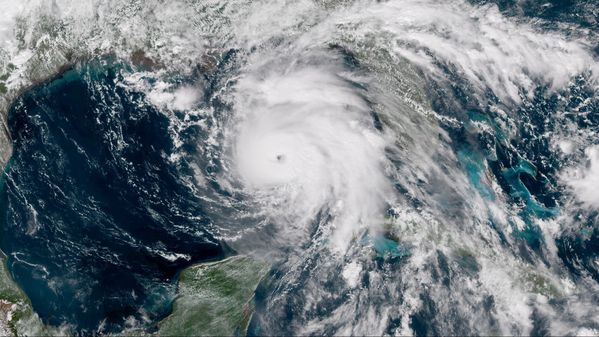
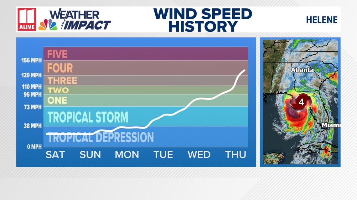
ATLANTA — Hurricane Helene underwent Rapid Intensification Thursday, climbing from a Category 1 storm to a Category 4 leading up to landfall.
A tropical cyclone "rapidly intensifies" when it has an increase of winds of at least 35 miles per hour in a 24 hour period.
Hurricanes that undergo rapid intensification right before landfall are among the most dangerous storms.
In 2018, Michael intensified from a Category 2 to a Category 5 hurricane the day before it made landfall in the Florida Panhandle. Our 11Alive team was there, covered the widespread damage and devastation from both the winds and also the storm surge.
In 2022, Ian also underwent rapid intensification, leading to a catastrophic storm surge and wind devastation in southwest Florida.

What ingredients make a hurricane rapidly intensify?
First, extremely warm ocean waters. Hurricanes are like steam engines. They use warm, unstable air as fuel. Having extremely warm waters over 85 degrees can be a main factor. That warm bath water doesn't just need to be right at the surface, but also further down in the gulf or ocean waters.
Hurricanes also need a lack of wind shear, which can disrupt a storm's circulation.
Lastly, a storm needs to be in a moisture-rich environment so that thunderstorms can easily wrap all the way around the storm's center. Dry air on any side would limit this and prevent symmetry and a storm's ability to strengthen.
Even though we know these three factors are important, forecasting rapid intensification is still challenging for meteorologists.
Researchers continue to look at past rapidly-intensifying storms with hopes of improving forecast skill and ultimately help decision-makers get the best information to prepare communities.
Some research shows that rapid intensification may become more, not less common, in a warmer atmosphere.
MORE FROM THE 11ALIVE STORMTRACKERS
Download the 11Alive+ streaming app on Roku, Amazon Fire or Apple TV for continuous coverage of the storm when we're not on the air. Also download the 11Alive News mobile app on your Apple or Android device to keep streaming if the power goes out. Set up weather notifications by clicking the gear icon in the upper right corner of the app to get the latest safety information, including updates on the Helene's track and watches or warnings.
Select Notifications -> Notification Settings -> Severe Weather Alerts -> Toggle the Severe Weather Alerts button to the right to turn alerts on.
Send photos and videos through the app by selecting the Near Me feature on the bottom right taskbar of the app and entering your information or TEXT your weather photos to us at 404-885-7600.
JOIN THE 11ALIVE WEATHER IMPACT TEAM'S FACEBOOK GROUP
Nearly 10,000 metro Atlanta and north Georgia weather enthusiasts share their weather photos every day. Click here to join the Weather Impact Facebook group.