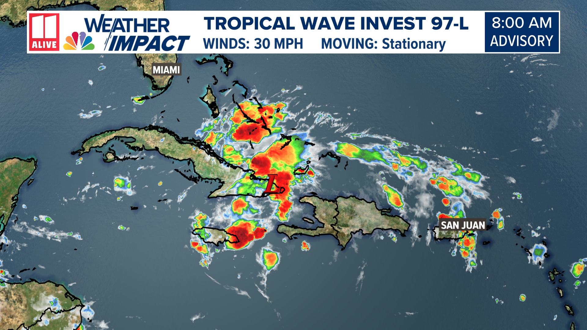
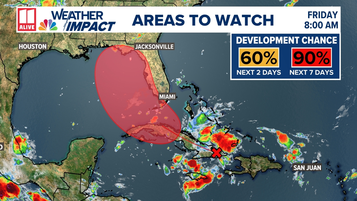
Invest 97-L, a well-defined tropical wave in the Caribbean Sea and southwestern Atlantic, is currently being monitored for further tropical development. It has a 90% chance of formation in the next 7 days from the National Hurricane Center and will likely become a tropical depression this weekend as it approaches the Florida coast.
97-L is producing showers and storms over eastern Cuba, Hispaniola, the Bahamas, and Jamaica. It is expected to move over Cuba today and then emerge over the Straits of Florida tonight or Saturday.

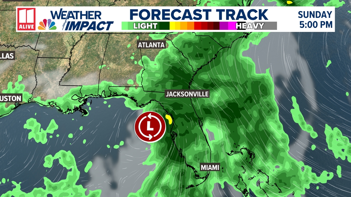
Regardless of development, Invest 97-L will be a big rain-maker. Heavy rain is expected, and rain totals of more than 4" or 5" could lead to flooding across Florida, Cuba, and the Bahamas.

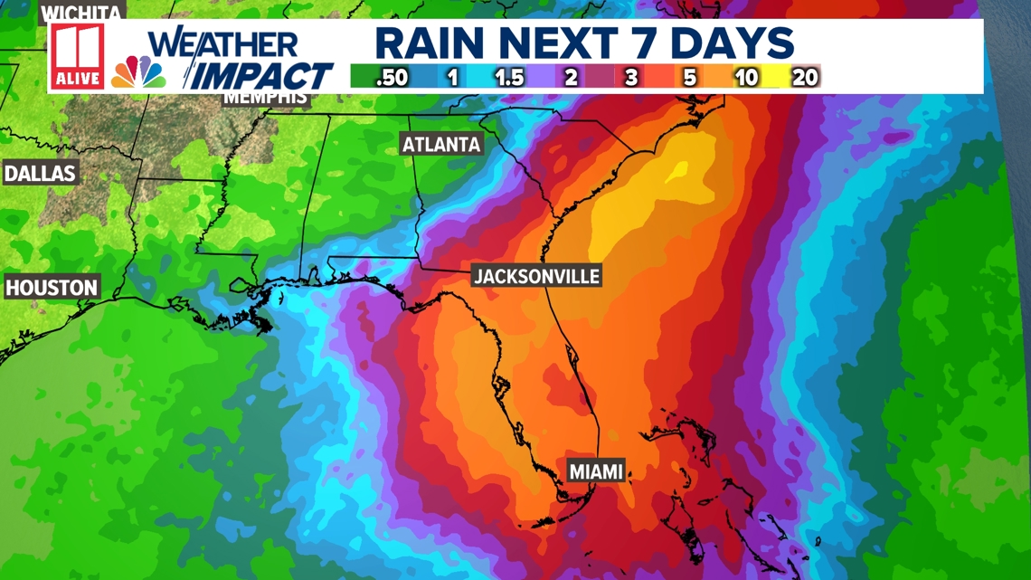
Florida Governor Ron DeSantis declared a state of emergency on Thursday in anticipation of the heavy rain and flood threat. DeSantis signed an executive order preparing resources for "major disaster" in 54 of Florida's 67 counties.
This move allows for the mobilization of resources and the implementation of emergency plans to protect life and property.
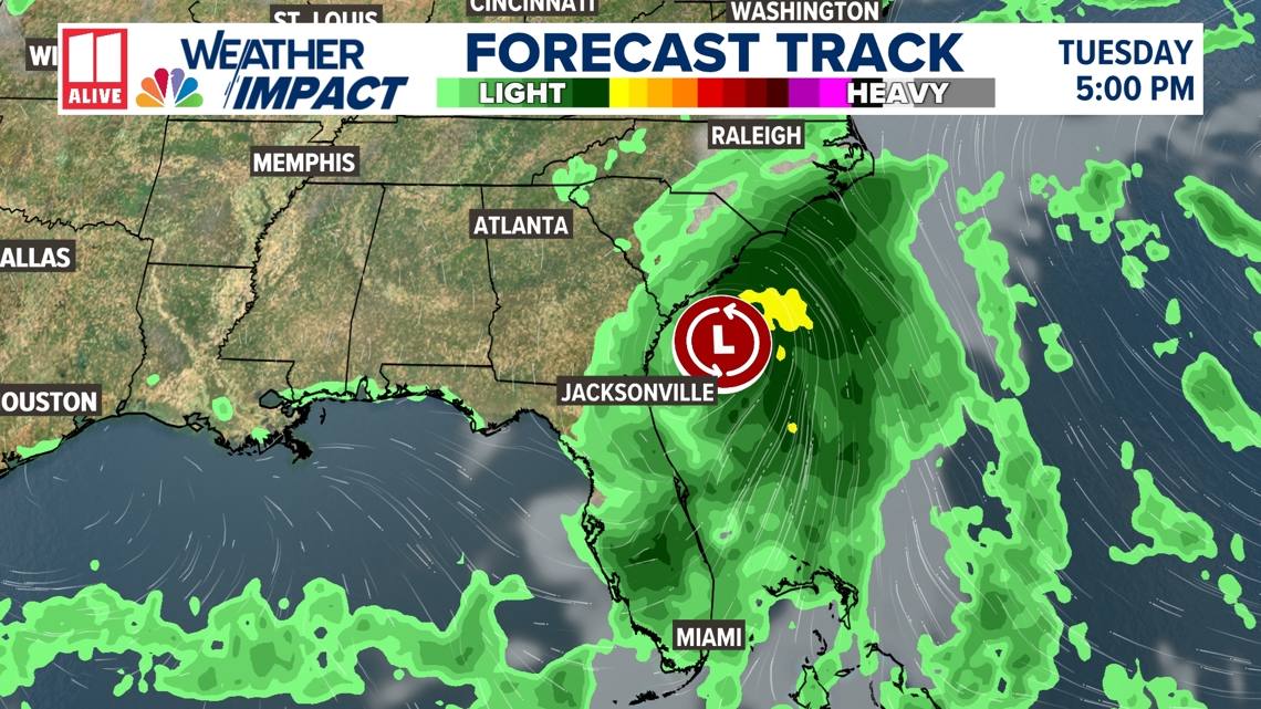
Models for Invest 97-L are in much better agreement this morning, and we'll get an even better picture once a center of circulation forms.
Further intensification is expected as it moves through the Gulf of Mexico. It will veer northeast as it approaches the Florida coast, likely crossing the state and re-emerging in the Atlantic.
Tropical watches and warnings may be issued for portions of Florida today.

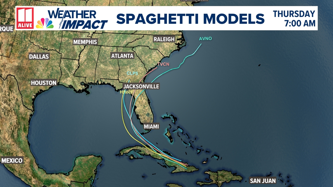
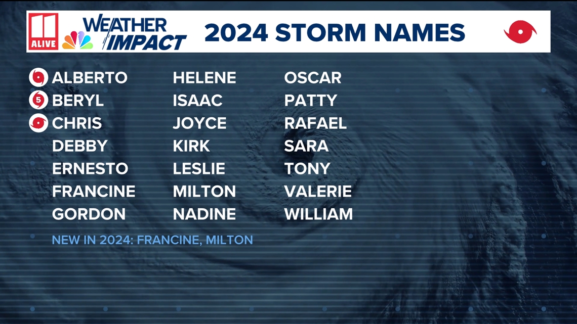
If it strengthens into a tropical storm, the next name on the list is Debby.

Will the Atlanta metro be impacted?
The forecast is fluid, so it will be worth watching. At this point, it looks unlikely we'll see much rain directly associated with Invest 97-L in north Georgia.
While some tropical moisture could add to rain chances this weekend, we would be on the west side of the center of circulation. Historically, the west side of any tropical system is the drier side.
Any westward shift in the track would bring more rain to our area.

Anyone with plans to travel to the Georgia, Florida, or Carolina coast this weekend and next week should closely monitor the forecast. Invest 97-L could strengthen quickly IF it enters back into the open water of the Atlantic.