
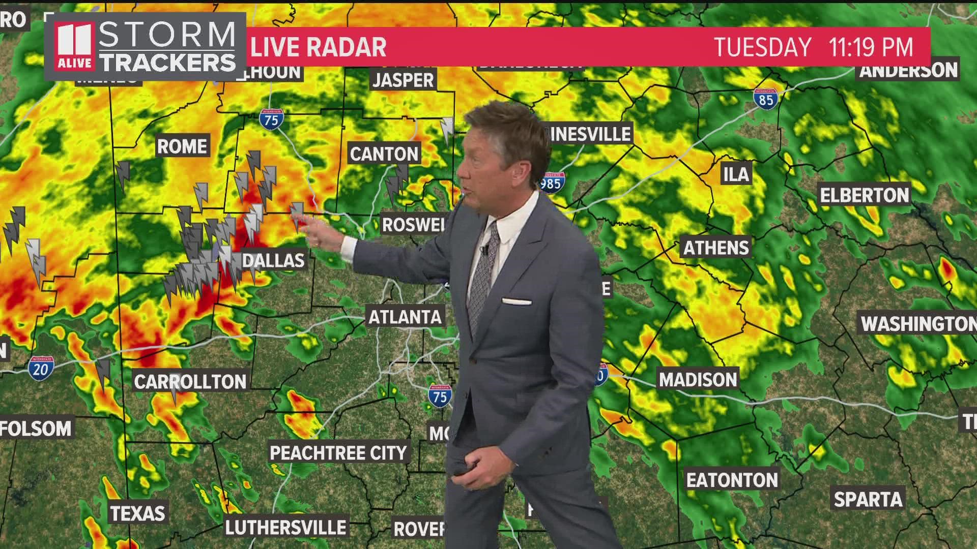
ATLANTA — Storms continue to hold together over the southeast. We've been tracking severe storms in Mississippi and western Alabama. Those storms are moving our way. We expect them to be weaker by the time they get here. While the widespread severe storms stay west, it is possible that we could have some isolated strong storms with heavy rain and damaging wind possible.

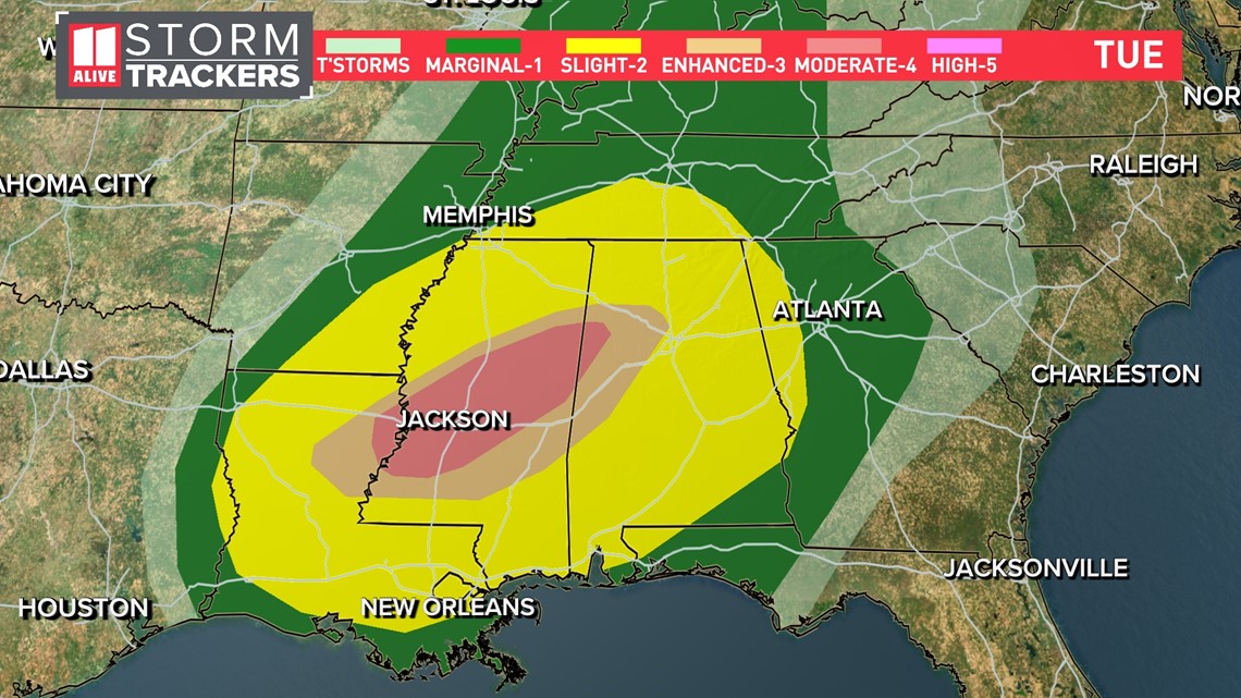
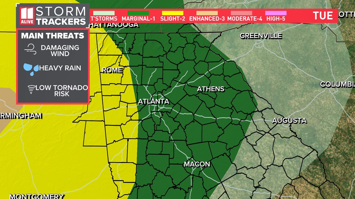
At 8pm Tuesday, the Storm Prediction Center expanded the level 2 of 5 risk from Alabama over into west Georgia. The level 1 risk has also been extended eastward to include areas east of Athens over to the SC line. West Georgia will have slightly higher chance for some stronger storms.

The storms quickly move southeast on Wednesday. That will take the severe weather risk out of our area.

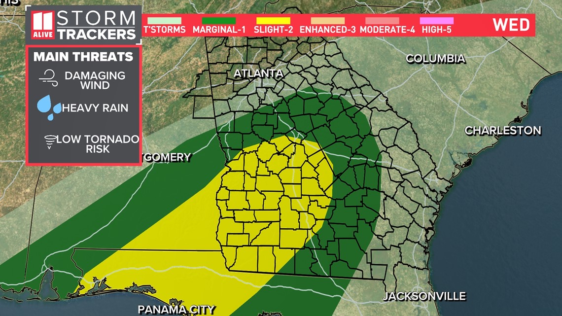
The line of storms could include strong to damaging winds, periods of heavy rain/frequent lightning and a brief tornado possible. The tornado risk is very low, but we can't rule out some brief rotation in some individual storms as the system moves through.
Here's a timeline of when to expect weather to form and where:
Metro Atlanta, north Georgia thunderstorm timeline
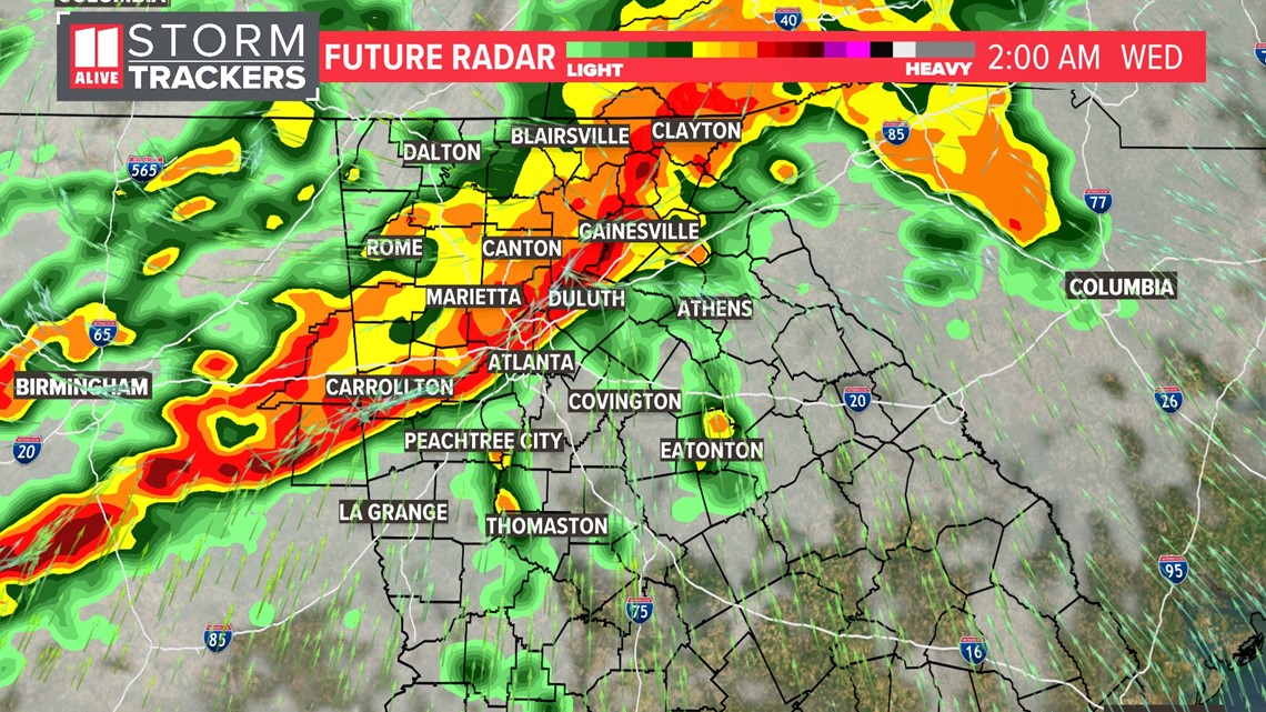
Overnight
It gets more active overnight as the line moves from the NW to the SE. These storms will have moderate to heavy rain and gusty winds with them.

Early Wednesday morning
The storm risk stays with us overnight Tuesday into early Wednesday morning. This band of rain is along the cold front. That will be an additional ingredient to support some isolated severe storms for the early morning hours.


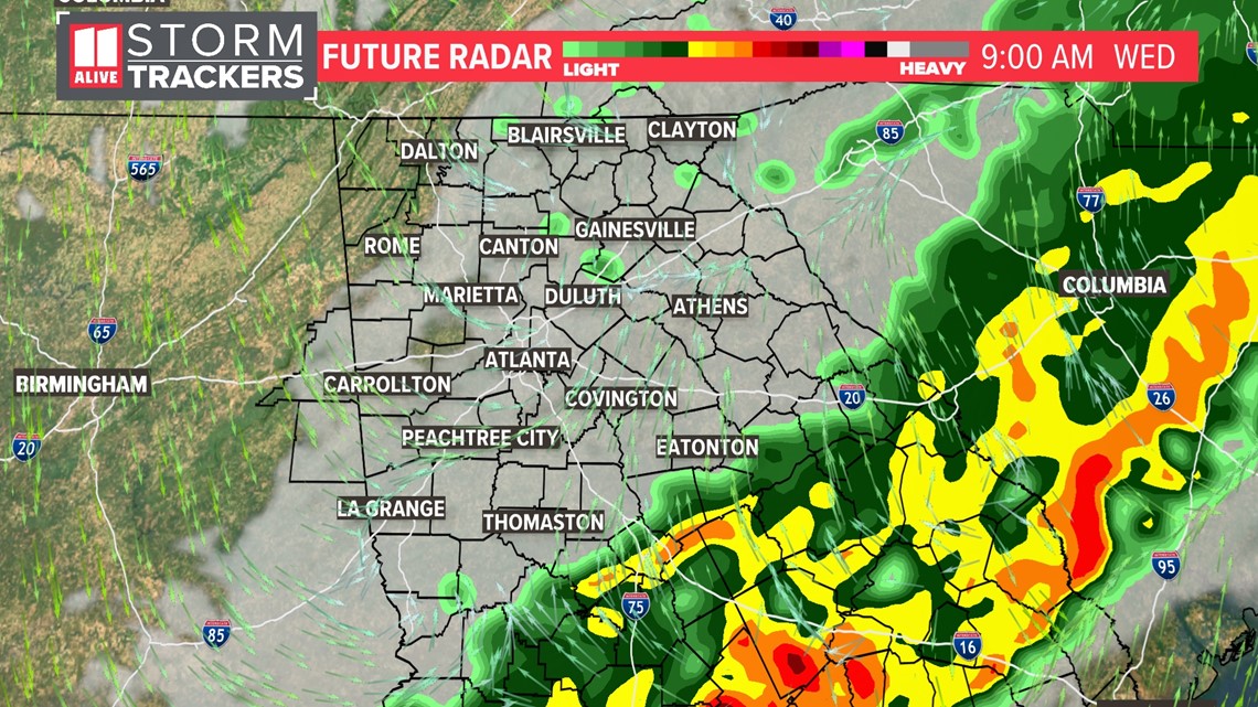
Mid Wednesday morning
The drive into work early Wednesday looks soggy. Plan extra time for your drive in to work or taking the kids to school.

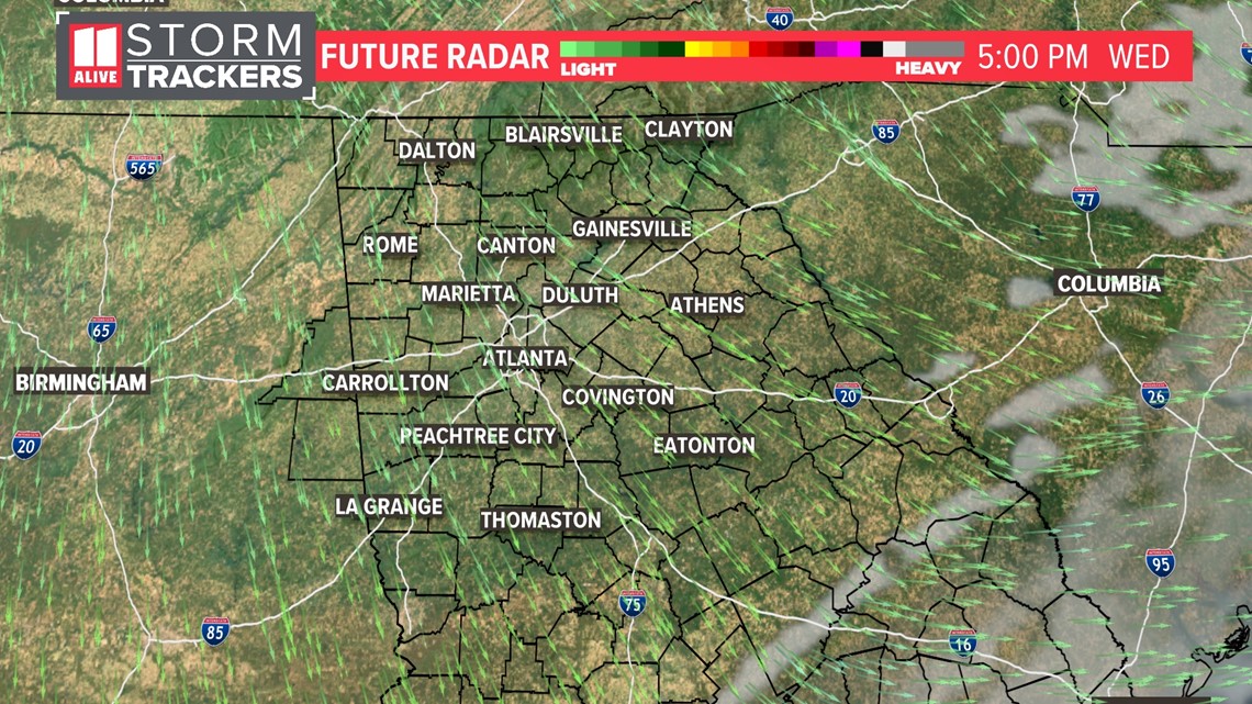
Later Wednesday morning/afternoon
The system pushes east and shifts the severe threat to south Georgia late morning into afternoon Wednesday. We will see the clouds clear out and sunshine return Wednesday afternoon.

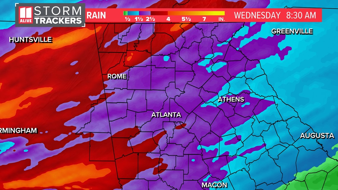
Rain totals on average will be between 1-3 inches. Some localized totals could be even 3-4 inches of rain.

MORE FROM THE 11ALIVE STORMTRACKERS
DOWNLOAD THE 11ALIVE APP:
Set up weather notifications by clicking the Gear icon in the upper right corner of the app. Select Notification -> Notification Settings -> Severe Weather Alerts -> Toggle the Severe Weather Alerts button to the right to turn alerts on.
Send photos and videos through the app by selecting the Near Me feature on the bottom right task bar of the app and entering your information.
TEXT YOUR WEATHER PHOTOS TO US: 404-885-7600
JOIN THE 11ALIVE STORMTRACKERS FACEBOOK GROUP: Nearly 10,000 metro Atlanta and north Georgia weather enthusiasts share their weather photos every day. Click here to join the group!