
ATLANTA — Showers and thunderstorms are moving into north Georgia with a developing strong area of low pressure - which means a chance for severe weather.
As neighboring states experience potentially tornadic activity Saturday, 11Alive StormTrackers are keeping an eye on the line of storms as they move into north Georgia. Though the risk levels for metro Atlanta counties are low - they are not zero. Northwest Georgia has a chance of stronger storms.
People could be waking up to a rainy and gloomy Sunday. You can always check live radar for weather in your area.
Follow for live updates:
8:40 a.m.:
The tornado watch has been cancelled for the last counties. Our severe weather threat is over, but showers will continue. Falling temperatures bring back a winter chill by later today.
7:49 a.m.:
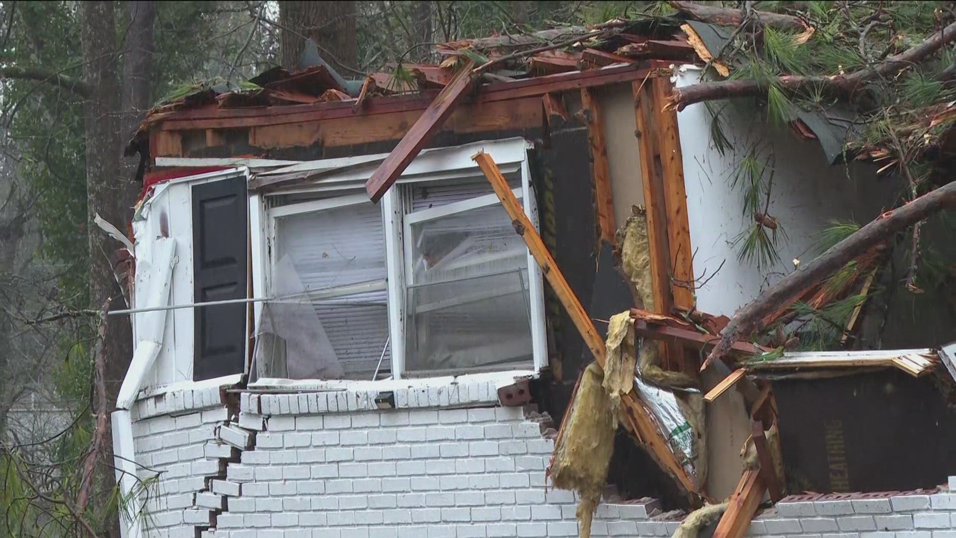
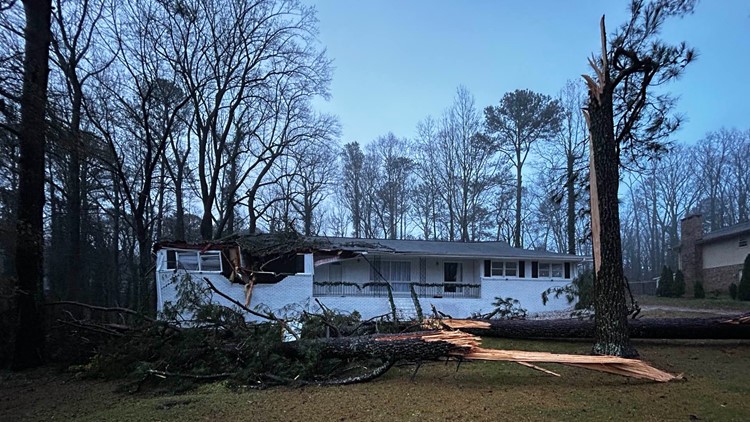
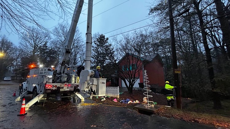
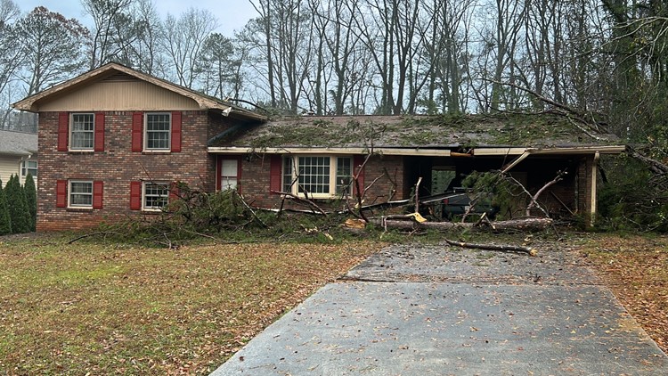
In Marietta, multiple trees fell on powerlines and homes on Renae Lane and Brownmoore Drive.
Storm damage Dec. 10 in Marietta


6:35 a.m.:
The tornado watch was canceled for Meriwether, Pike and Lamar counties. It remains in effect until 9 a.m. for Lamar county.
The first wave of storms have exited Atlanta. The focus in the next hour will be across our far southern counties closer to Macon and Columbus. Showers continue elsewhere.
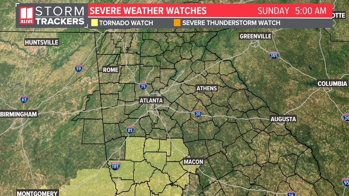
5:15 a.m.:
More counties were canceled from the tornado watch. It still includes Meriwether, Pike, Lamar, and Upson counties until 9 a.m.

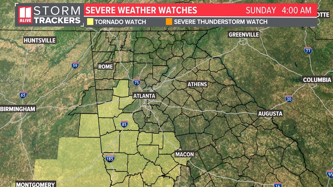
4:15 a.m.:
A few counties have been canceled from the tornado watch early. This includes Bartow, Floyd, Gordon, Haralson, and Polk counties. A tornado Watch remains in effect until 5 a.m. for Douglas and Paulding counties.
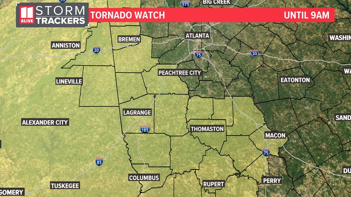
Another tornado watch is in effect south of I-20 for areas south and west of Atlanta until 9am. This includes Carroll, Coweta, Heard, Lamar, Meriwether, Pike, Troup and Upson counties.

3:00 a.m.:
Some counties in NW Georgia are no longer in the tornado watch that was supposed to expire at 3am. The NWS extended the watch until 5am for Floyd, Gordon, Haralson, Polk, Bartow, Douglas and Paulding counties.
Another tornado watch is in effect south of I-20 for areas south and west of Atlanta until 9am. This includes Carroll, Coweta, Heard, Lamar, Meriwether, Pike, Troup and Upson counties.
2:10AM: A new tornado watch is issued for areas south of I-20 south and west of Atlanta until 9am. The counties included are Carroll, Coweta, Heart, Lamar, Meriwether, Pike, Troup and Upson counties.

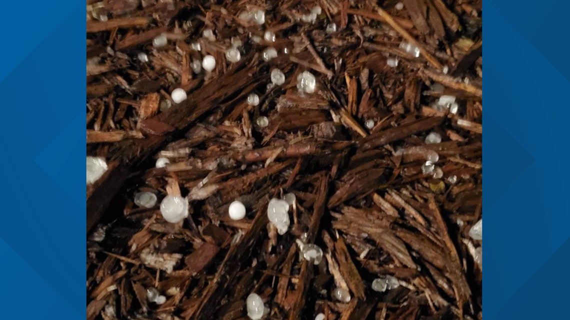
12:27 a.m. | Hail was spotted by 11Alive Stormtracker Maureen Falls Dwyer in Senoia. Have weather photos to share? Join our 11Alive Stormtrackers Facebook group.

12:17 a.m. | Overnight storms could cause power outages and spin up debris. The National Weather Service wants of strong gusts and small hail with the potential for isolated tornadoes.
12:05 a.m. | A severe thunderstorm warning has been issued for Fayette, Meriwether Coweta, Spalding counties until 12:30 a.m.
11:15 p.m. | The tornado watch has been expanded to include Polk and Haralson counties. The watch is scheduled to expire at 3 a.m.
9:30 p.m. | The National Weather Service issued a statement warning of fog in counties Fannin, Gilmer, Union, Towns, Dawson, Lumpkin, White, Forsyth, Hall, Banks, Jackson, Madison, Gwinnett, Barrow, Clarke, Oconee, Oglethorpe, Wilkes and
Walton.
Some patchy dense fog will restrict visibility between one-quarter and one-half of a mile into the early morning hours. Visibility will start to improve as a cold front moves towards sunrise, according to NWS.
For those who plan on driving Sunday morning, slow down, use low-beam headlights and leave extra distance between you and the vehicle in front of you, the NWS advises.
9:10 p.m. | Chief Meteorologist Chris Holcomb hosts an update on the storm system.
9 p.m.: A tornado watch is in effect for northwest Georgia until 3 a.m. The counties included are Fannin, Gilmer, Catoosa, Chattooga, Dade, Floyd, Gordon, Murray, Walker and Whitfield.
MORE FROM THE 11ALIVE STORMTRACKERS
DOWNLOAD THE 11ALIVE APP:
- Download the app on your Apple or Android device.
- Set up weather notifications by clicking the Gear icon in the upper right corner of the app. Select Notification -> Notification Settings -> Severe Weather Alerts -> Toggle the Severe Weather Alerts button to the right to turn alerts on.
- Send photos and videos through the app by selecting the Near Me feature on the bottom right taskbar of the app and entering your information.
TEXT YOUR WEATHER PHOTOS TO US: 404-885-7600
JOIN THE 11ALIVE STORMTRACKERS FACEBOOK GROUP: Nearly 10,000 metro Atlanta and north Georgia weather enthusiasts share their weather photos every day. Click here to join the group!
Download our 11Alive News app for all the latest breaking updates, and sign up for our Speed Feed newsletter to get a rundown of the latest headlines across north Georgia.