ATLANTA — As storm clean up and damage surveying continues from the April 12-13 severe weather outbreak we prepare for more chances of damaging weather.


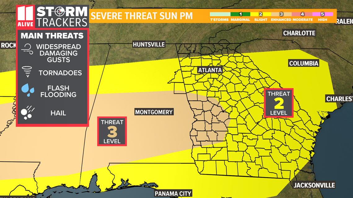
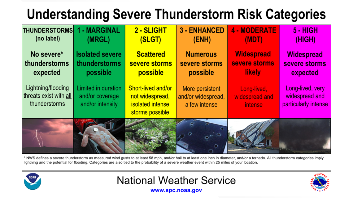
Nearly all of Georgia is under a level 2 of 5 threat for severe thunderstorms Sunday into Monday morning.
West-central Georgia is under a level 3 of 5 threat.


All hazard types are once again possible:
- Widespread damaging wind gusts(biggest threat)
- Tornadoes
- Hail
- Flash flooding
Our main threat for severe weather looks to come from a large complex of storms arriving sometime late Sunday afternoon into Monday morning.
It is not out of the question that a strong storm develops in the late morning or afternoon Sunday.
Within that storm complex, tornadoes may develop. Heavy rainfall may lead to flash flooding as well in central Georgia.
This does not look to be as potent as April 12-13 in terms of the tornado threat, but widespread damage will still be possible from wind gusts alone.
More bad weather coming
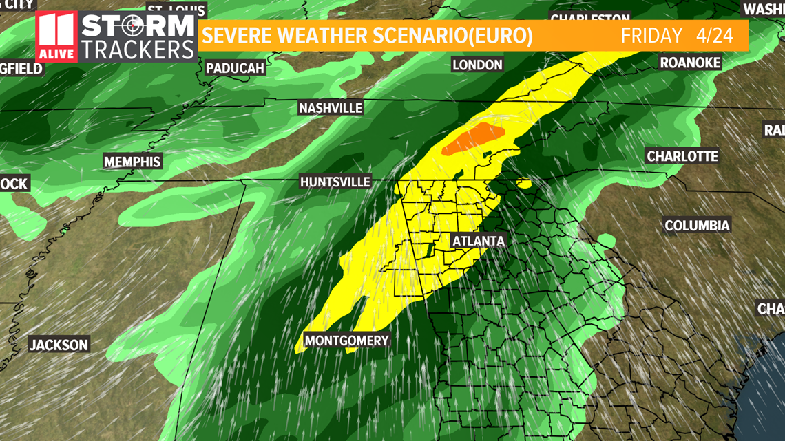
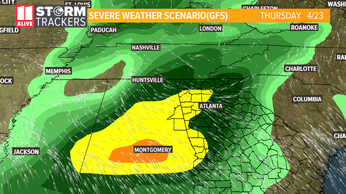
Another round of severe weather arrives mid to late next week. At this point, it looks like Thursday, but it's possible storms arrive as early as Wednesday or as late as Friday.


We'll keep you updated on both severe weather threats.
Please continue to check for forecast updates regularly on 11Alive and 11alive.com.
SEVERE WEATHER PREPARATIONS |

