
ATLANTA — Sunday afternoon brings with it the chance of pop-up storms in metro Atlanta and north Georgia. Some storms may also hang around before midnight with skies becoming partly cloudy in general.
11Alive is keeping track of any severe weather that may move into the area as the storms move in. We'll provide any updates we receive on such weather as it becomes available and also any major impacts reported to our newsroom such as power outages and hazards on major roads.
Check back frequently for updates as they become available.
SUNDAY, JUNE 14, 2020
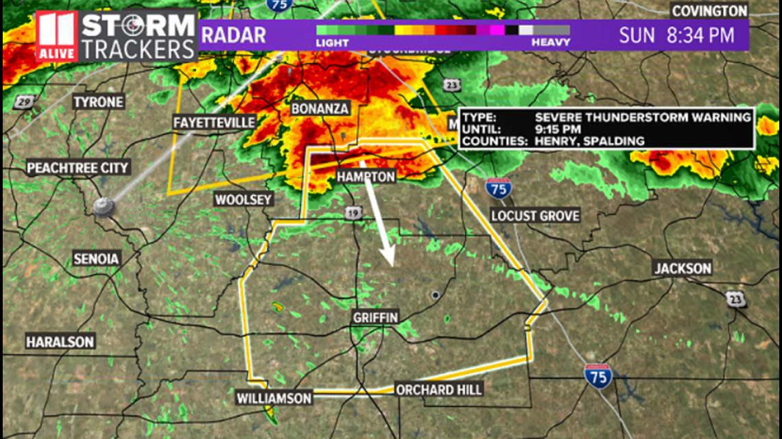
8:33 p.m. | A Severe Thunderstorm Warning has been issued for Henry and Spalding counties until 9:15 p.m.

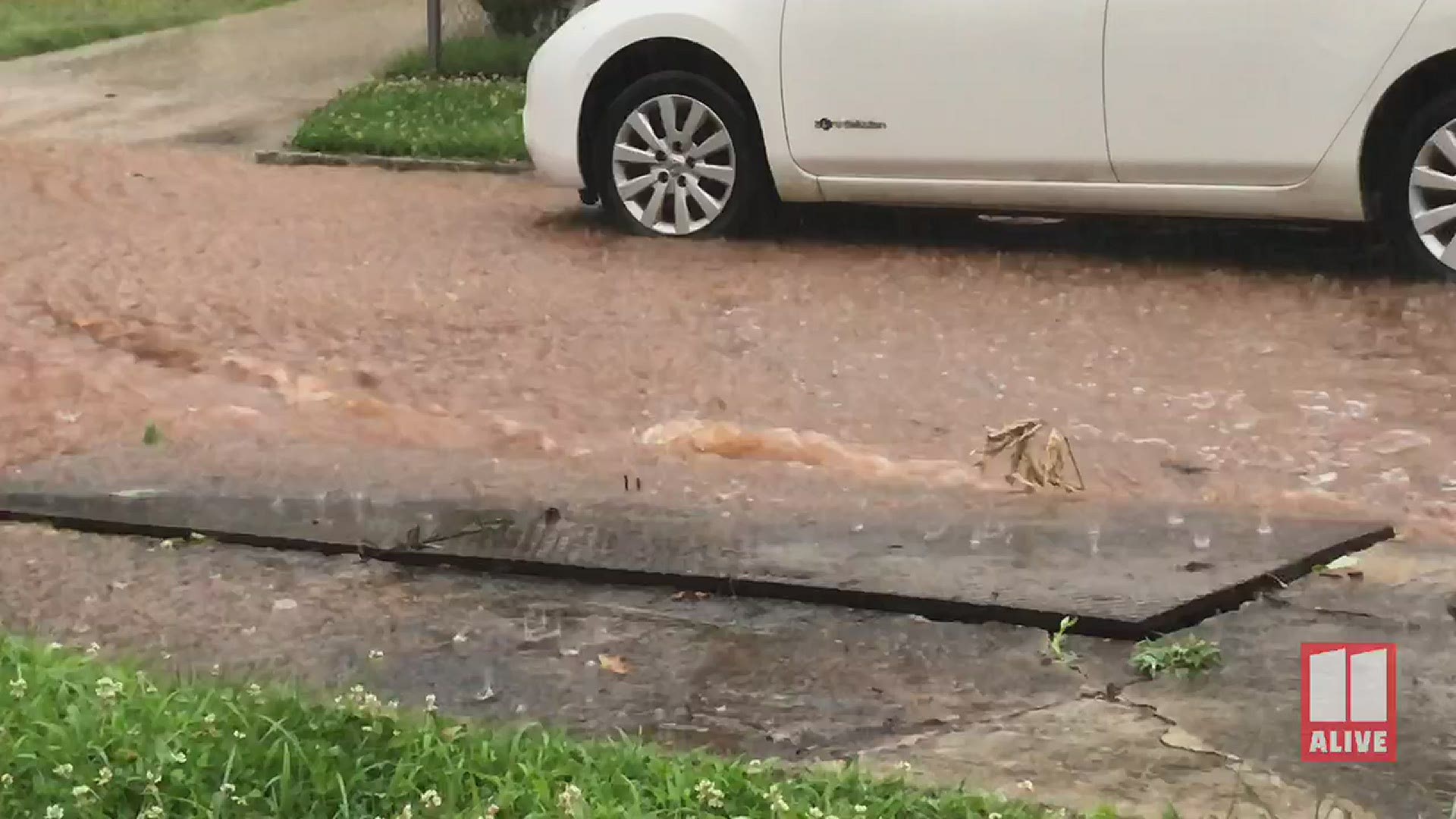
8:19 p.m. | Video from South Atlanta shows heavy rain creating rivers in area streets as a line of storms moves through the area.
8:06 p.m. | A Severe Thunderstorm Warning has been issued for Clayton, Fayette and Henry counties until 8:45 p.m.
7:18 p.m. | A Severe Thunderstorm Warning has been issued for Cobb and Paulding counties until 8 p.m. with the chance of 60 mph winds and hail of up to an inch.
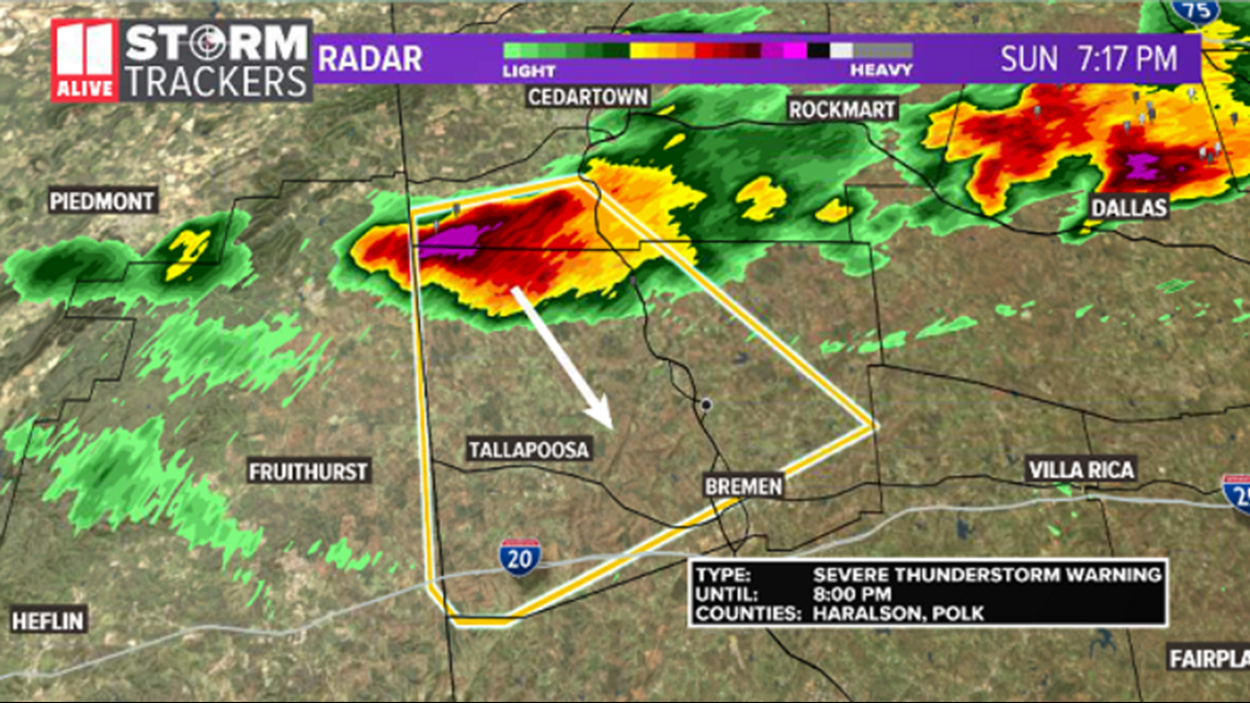
7:15 p.m. | A Severe Thunderstorm Warning has been issued for Haralson and Polk counties until 8 p.m. The storm is capable of winds of 60 mph and hail of up to an inch.

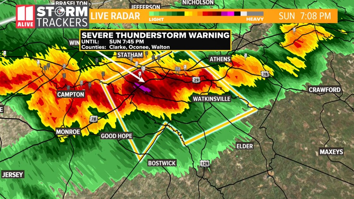
7:05 p.m. | A Severe Thunderstorm Warning has been issued for Clarke, Oconee and Walton counties until 7:45 p.m.

6:13 p.m. | The National Weather Service is looking at the possibility of continued storms in north Georgia. The current risk in many counties is for gusty winds from a couple of stronger storms with minor tree damage locally. Some hail may also occur with one or two strong updrafts.
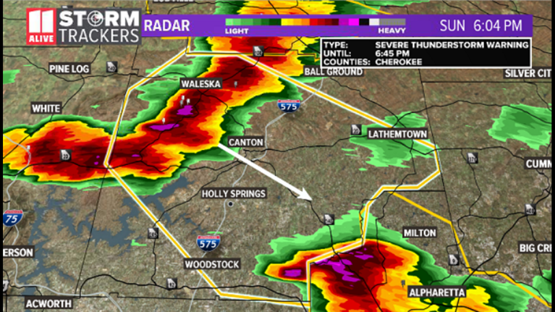
This comes as a band of showers and thunderstorms continues to move over the central and southern Appalachians. Across the north Georgia area, stronger storms have already evolved in a small area. The stronger of these storms occurring in the Cherokee County area.
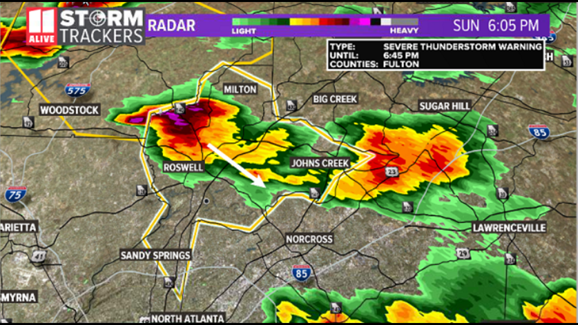
6:02 p.m. | A Severe Thunderstorm Warning has been issued for Fulton and Cherokee counties until 6:45 p.m. These storms are capable of 60 mph winds and quarter-sized hail.


6:00 p.m. | A trained spotter in the Talmadge area of Pickens County reports hail of up to an inch.
5:40 p.m. | The FFC has updated the Severe Thunderstorm Warning, canceling it for Gilmer County. However, the warning continues for Pickens County until 6:15 p.m.
5:30 p.m. | A Severe Thunderstorm Warning has been issued for Gilmer and Pickens counties until 6:15 p.m. The National Weather Service reports the storms could have peak winds of 60 mph and hail of up to an inch in diameter.
4:19 p.m.| A Severe Thunderstorm Warning has been issued for Walker and Whitfield counties until 5 p.m.
► POWER OUTAGES CHECK | Georgia Power customers, check here. Georgia EMC customers check here.
► Have a news tip? Email news@11alive.com, visit our Facebook page or Twitter feed.
RELATED STORIES |