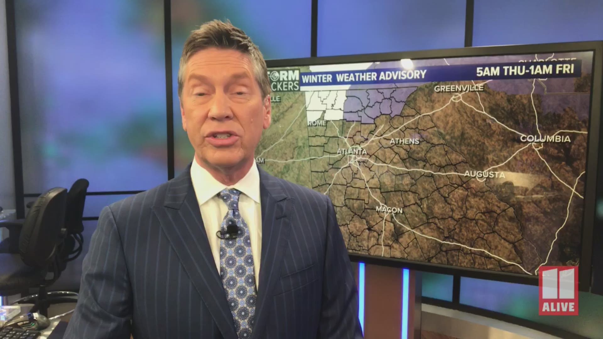
ATLANTA — The 11Alive StormTrackers continue to track the risk for snow for parts of north Georgia Thursday. This blog will break down the timing, risks and potential accumulations.
As you know, forecasting snow in Atlanta or north Georgia is often tough to do.
We have been tracking this system since late last week. At that point, the models kept flip-flopping back and forth between rain and a winter mix. Now that we are getting closer, we are starting to get more confidence in what we are seeing in the model data.
We use multiple models for guidance when we are preparing our forecasts. Just because a model shows snow, that doesn't mean it is necessarily going to happen. We have to watch for trends and consistency from model run to model run as we make our forecast here in the StormTracker Center.
We want to go a little more in-depth with this discussion to give you an idea of what we are seeing.
Winter Weather Advisory:
A Winter Weather Advisory is in effect for 10 counties in NE Georgia. Those counties are Fannin, Gilmer, Pickens, Towns, Union, Rabun, Dawson, Lumpkin, White and Habersham. These counties will see rain to start Thursday, then changing over to freezing rain briefly, then snow. 1-2 inches of snow are possible in these areas. The 2 inch totals would be in the higher elevations. Counties in NW Georgia are not in an advisory, however, Dade, Walker, Chatooga, Catoosa, Whitfield, Murray and Gordon counties could see light accumulations around a half inch.

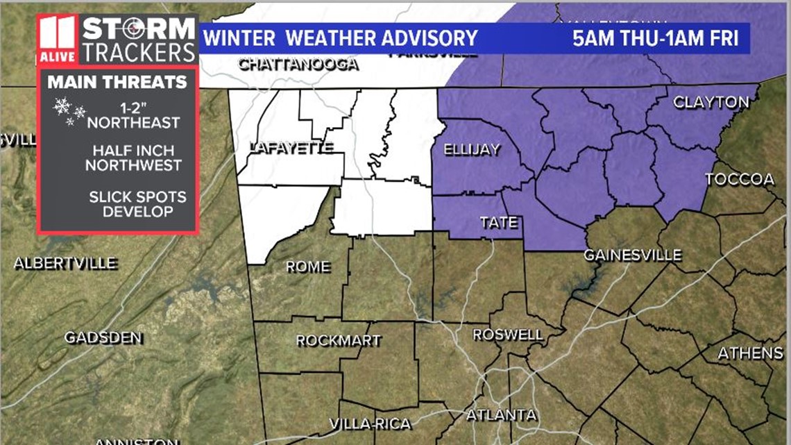
TIMING:
Thursday will start off wet. We will wake up to mainly rain in our area. Most of north Georgia will be seeing rain early Thursday morning. As we move through the morning hours and into the afternoon, colder air will begin to move into north Georgia before the rain moves out.
In far north Georgia, the air will be cold enough to support some snow coming down.
For a few hours, from about 9 am through the afternoon, parts of far north Georgia could see some snow.

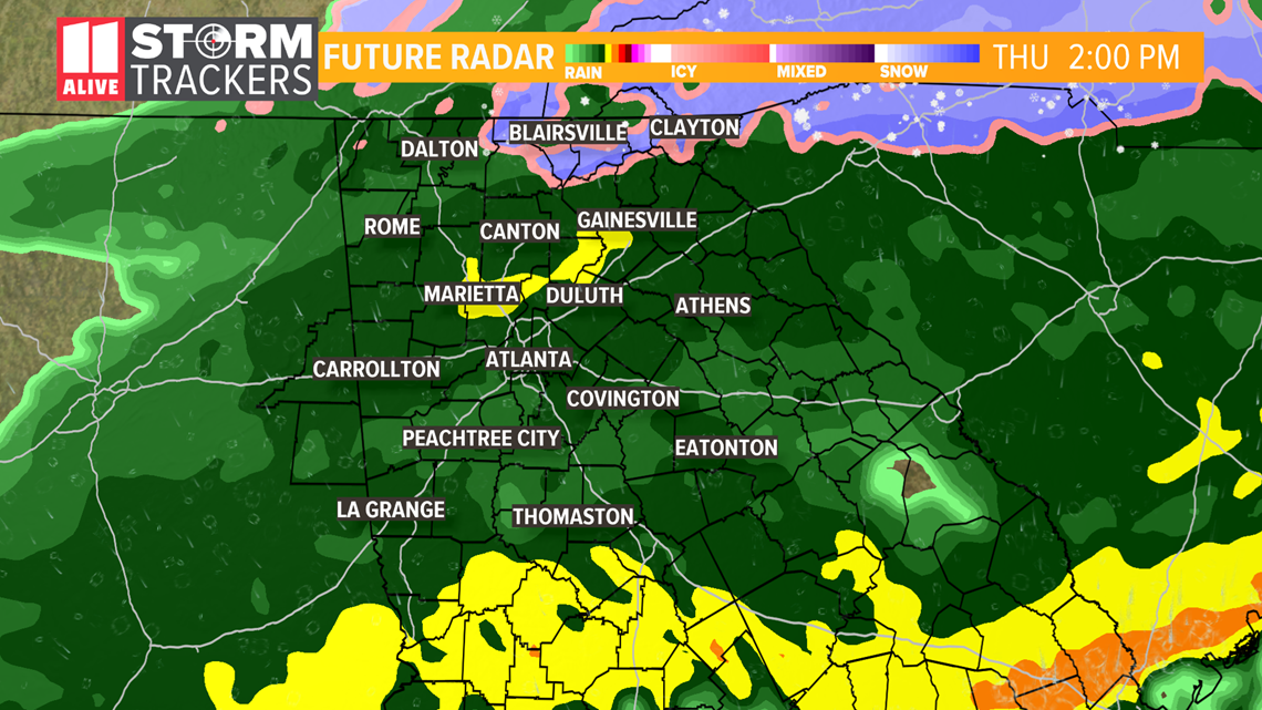
From the late afternoon into the evening, the moisture will move out and the drying out process will begin as temperatures continue to drop. It is possible that slick spots could develop in north Georgia as temperatures fall below freezing Friday morning.
ACCUMULATIONS:
The models continue to show different accumulation totals. Here's a look at the different model scenarios. The European model traditionally handles snow forecasts better than the other models.
This is the model, the European, that we think is most representative of what to expect. It shows the accumulations mainly over far north Georgia in the highrst elevations. It also shows some areas picking up 1 to 2 inches.

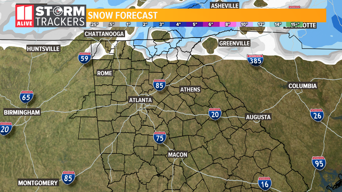
Here is a look at the American model or GFS. It also shows the better chances for accumulating snow over north Georgia. It tries to extend some of those accumulations a little closer to the northern metro areas. It also shows accumulations in north Georgia that could be a little higher potentially 2 to 3 inches in some spots.

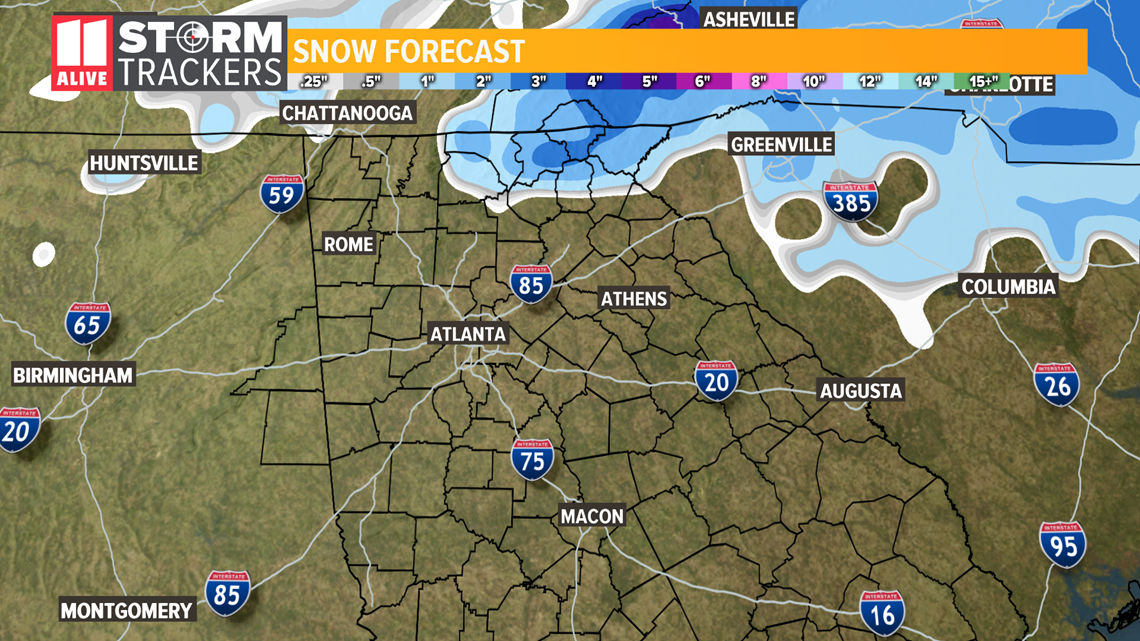
The latest RPM model is the one that is more bullish on snow. It shows a much smaller area of north Georgia that would get some accumulating snow above 2000 feet in the mountains.

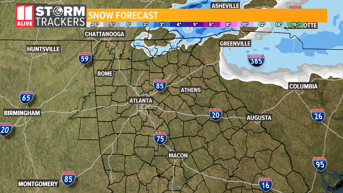
To sum up the accumulations forecast, we think it would be closer to what the EURO model is predicting.
METRO ATLANTA IMPACTS:
At this point, we think metro Atlanta will see mainly rain. It is possible that some north metro counties could see a few flurries mixing in, but at this point, we don't think there would be any accumulations.
We will need to watch the rate of drying for Thursday night into Friday morning.
We will see temperatures drop to near freezing in some parts early Friday morning. Any water that doesn't evaporate Friday morning could develop some black ice. We don't think this would be widespread. It would mainly be some patches of slick spots.
Some flurries or light snow is also possible Friday morning but accumulations appear unlikely.
We will continue to monitor any changes with the moisture track and temperatures. Any changes in this could change the impacts in the area. The 11Alive StormTrackers will keep you updated as new model data comes in.
POWER OUTAGES CHECK | Georgia Power customers, check here. Georgia EMC customers check here.
RELATED STORIES |

