ATLANTA — 11Alive meteorologist Wes Peery says we may be looking at another severe weather event later this week similar to the one that brought rare January tornadoes to north Georgia last month.
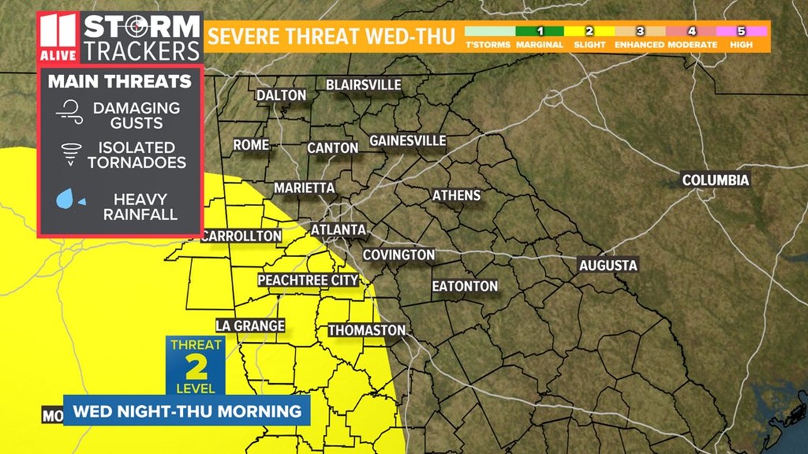
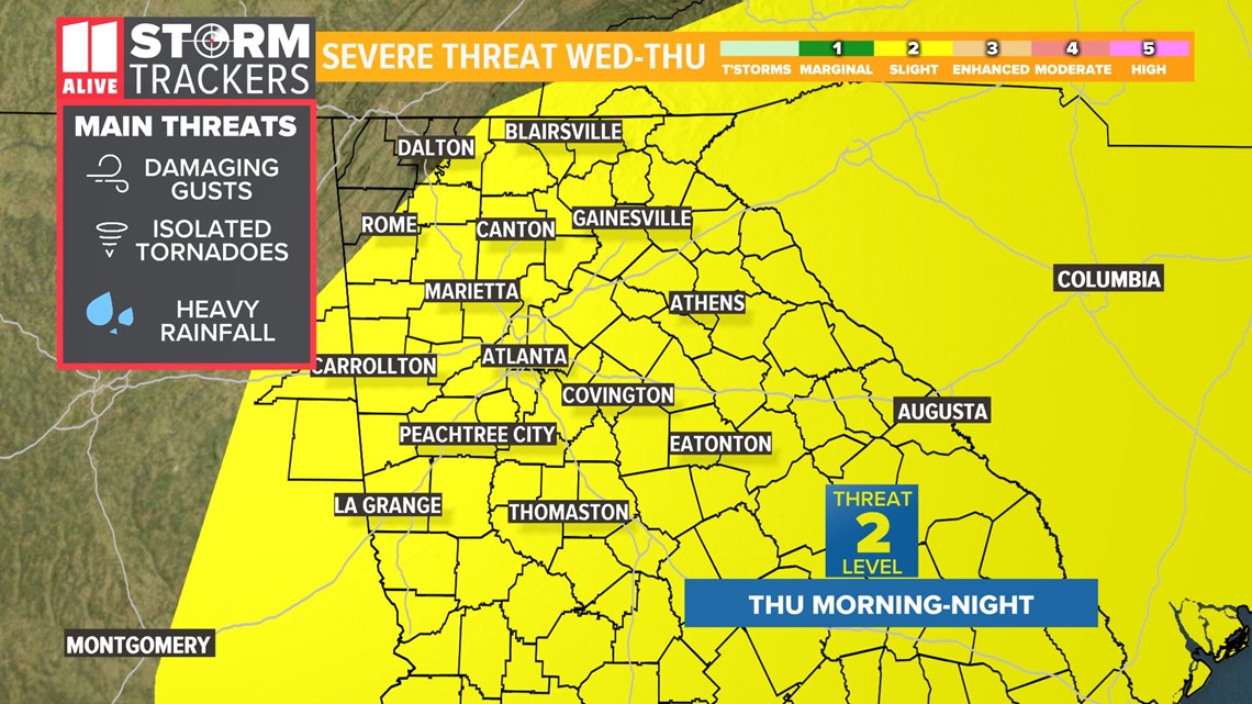
While there are still a lot of questions that are yet to be answered this far ahead of the potential event, strong to severe thunderstorms are possible, beginning late Wednesday and extending into Thursday.
Warmer weather has started to return to the region with highs around 60 for Sunday, and in the mid-to-upper 60s predicted for Monday, under sunny skies.
By Tuesday, some clouds may begin to move toward Georgia, while strong to severe weather is expected over parts of Louisiana, Arkansas and Mississippi.
The strong to severe weather is expected to move eastward with some possibly moving into Georgia as soon as late Wednesday. A greater chance of severe weather is anticipated to move into the state on Thursday.


The largest threat from any severe weather that makes it to Georgia would include heavy rainfall, strong, gusty winds and the possibility for the development of tornadoes.
As it stands now, portions of the state would fall under a Level 2 out of 5 threat for severe weather on both Wednesday and Thursday, according to Wes.
With the situation developing well ahead of the event, both the timing and intensity of the storms is very fluid and subject to change.


Stay with the 11Alive StormTrackers for the latest information as this storm system develops so that you remain weather aware.
POWER OUTAGES CHECK | Georgia Power customers, check here. Georgia EMC customers check here.
RELATED STORIES |

