ATLANTA — The 11Alive StormTrackers are watching a line of storms to our west that will likely bring strong to severe weather into the region as we move into the late afternoon and early evening hours.
The storms are part of a complex weather system moving through the Southeast.
11Alive Meteorologist Wes Peery says the greatest threat of severe storms is primarily in the western portion of the region, mostly near the Georgia-Alabama border, for the strongest storms, with weaker storms to the east.
The main threats from these storms include strong thunderstorm winds, torrential rainfall amounts, and possible hail.
Refresh this story for updates:
6:13 p.m. | Across the state, Georgia Power reports 501 outages impacting 46,846 customers. The majority of these are in metro Atlanta and northeast Georgia. Georgia EMC is also reporting outages impacting 22,812 customers in metro Atlanta, 576 in north Georgia and 141 in west Georgia. South Georgia also has roughly 1,200 customers without power according to local EMCs.
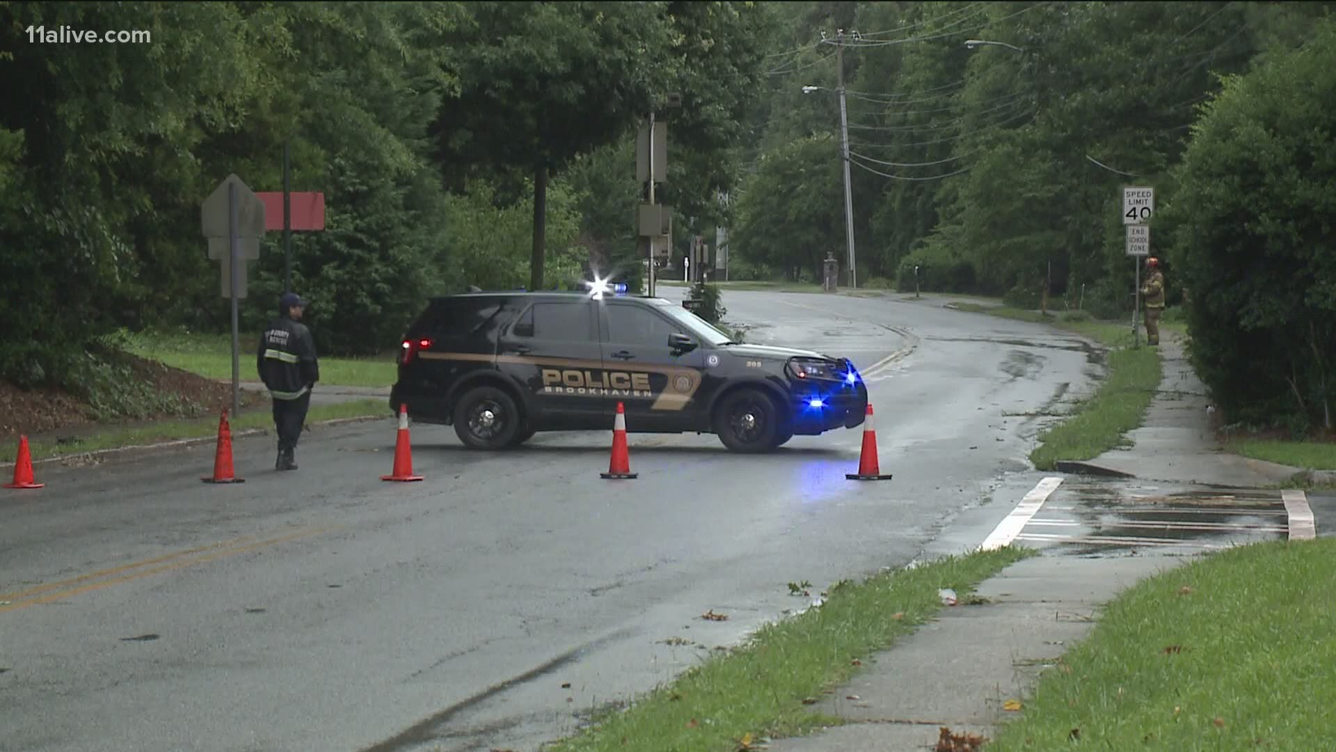
6:11 p.m. | Trees blocking roads in the area of Highway 124 in Snellville. These include 124 at Henry Clower, 124 at Presidential Commons and 124 at Janmar.
6:02 p.m. | A Severe Thunderstorm Warning has been issued for Oglethorpe and Wilkes counties until 6:30 p.m. The storm is capable of winds up to 60 mph and hail of up to three-quarters of an inch in diameter.
5:25 p.m. | A Severe Thunderstorm Warning has been issued for Banks, Clarke, Greene, Jackson, Madison, Morgan, Oconee, Oglethorpe, and Walton counties until 6 p.m.
5:17 p.m. | Milton Police report a tree down on Freemanville Road at Laconia Lane.
5:16 p.m. | Cherokee County reporting trees and powerlines down throughout the county and roughly 3,600 customers without power.
5:01 p.m. | A Severe Thunderstorm Warning has been issued for Banks, Barrow, Clarke, Gwinnett, Hall, Jackson, Madison, Oconee and Walton counties until 5:30 p.m.
4:56 p.m. | Norcross Police report that their phone lines are down. They are instructing residents to call 770-513-5700 for emergency assistance or 911 for emergency assistance until further notice.
4:48 p.m. | There are public reports of thunderstorm damage in the Snellville area - specifically a tree down on Maple Street.
3:35 p.m. | A Severe Thunderstorm Warning has been issued for parts of Bartow, Paulding and Cobb counties until 4 pm.
At 3:33 pm, a severe thunderstorm was located over Euharlee, or near Cartersville, moving east at 10 mph.
Locations impacted included Cartersville, Acworth, Euharlee, Emerson, Kingston, Taylorsville and Red Top Mountain State Park.
Stay with the 11Alive StormTrackers for updates as they become available.
► POWER OUTAGES CHECK | Georgia Power customers, check here. Georgia EMC customers check here.
► Have a news tip? Email news@11alive.com, visit our Facebook page or Twitter feed.
RELATED: Be prepared | Tornado safety tips
RELATED: How to prepare for severe weather