ATLANTA — Fred made landfall Monday afternoon at Cape San Blas, Florida as a tropical storm. It will play an impact on North Georgia's weather.
Here's what you need to know:
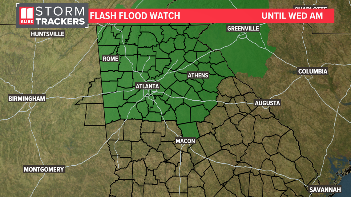
- Fred will bring heavy rain to North Georgia and Atlanta with widespread rain expected at times on Tuesday. There is a Flash Flood Watch for North Georgia
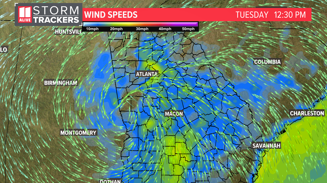
- Gusty conditions are likely early Tuesday. There could be some gusts around 30 miles per hour for areas south of Atlanta. With saturated grounds, this could be enough to cause isolated trees to down.
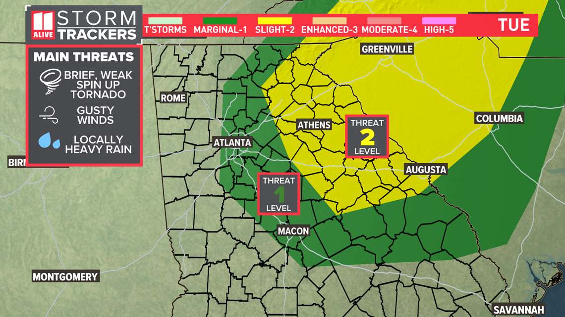
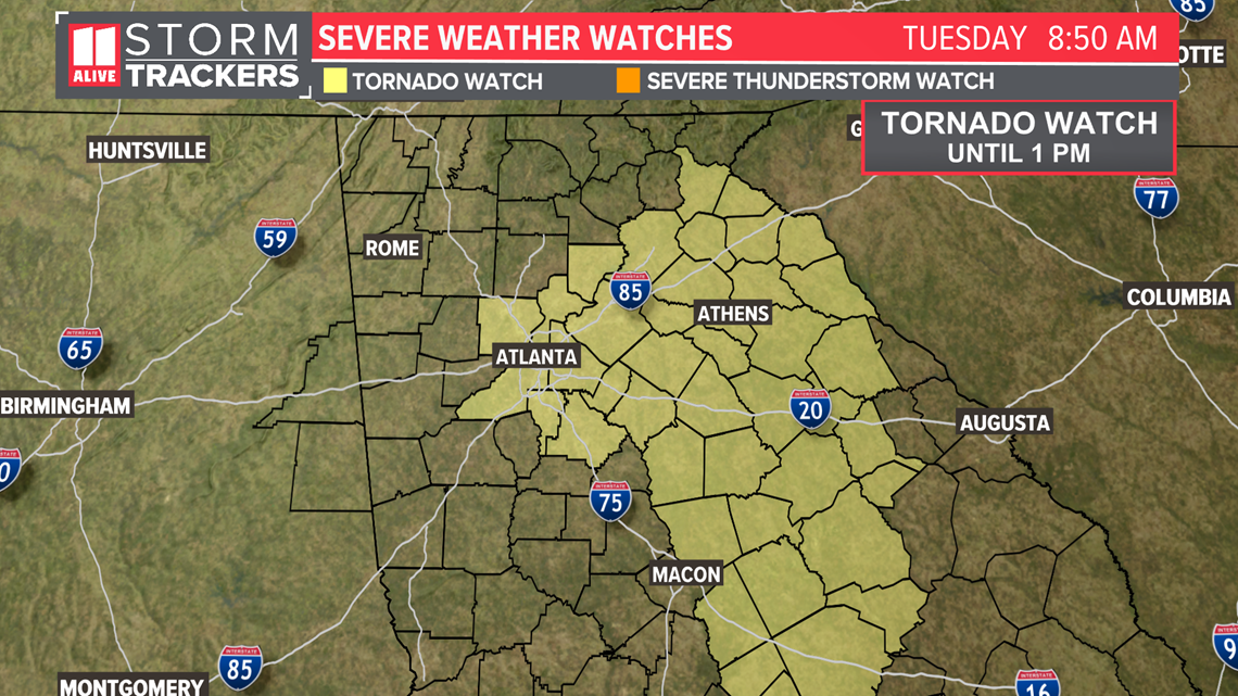
- There could also be isolated severe storms or a brief spin-up tornado, but the extent of this threat is lower than our heavy rain threat. There is a Tornado Watch until 1 p.m. for areas in and east of Atlanta.
Timeline: Impacts From Fred
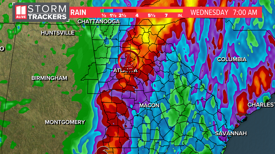
Critical timing for the most significant impacts will be now to 6 p.m. Heavy rain could lead to flash flooding. Rain totals locally 2 - 5+ inches are possible especially northwest of Atlanta. West of Atlanta there could be some gusts above 35 miles per hour closest to the center of Fred. Isolated spin up tornadoes are possible.
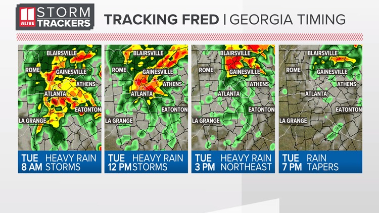
Tuesday Morning - Increasing rain coverage mid-morning as the remnants of Fred work through our southwestern counties. Rain will turn heavy and isolated flash flooding is possible. Roads will be wet, and in some cases there will be ponding/standing water. In some of the rain bands we'll be monitoring for an isolated spin up and brief tornado. There could be some gusts above 35 miles per hour in areas southwest of Atlanta

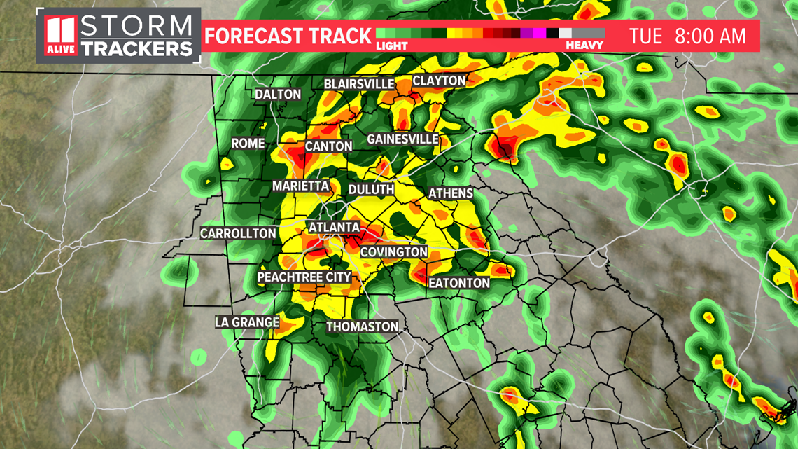
Tuesday Afternoon - The remnants of Fred are working through our western suburbs from Carrollton to Rome. Rain continues to be heavy at times, especially near and northwest of Atlanta. Roads could have ponding/standing water and isolated flash flooding is possible. In some of the rain bands we'll be monitoring for an isolated spin up and brief tornado. There could be some gusts above 35 miles per hour for Atlanta and points west and northwest.

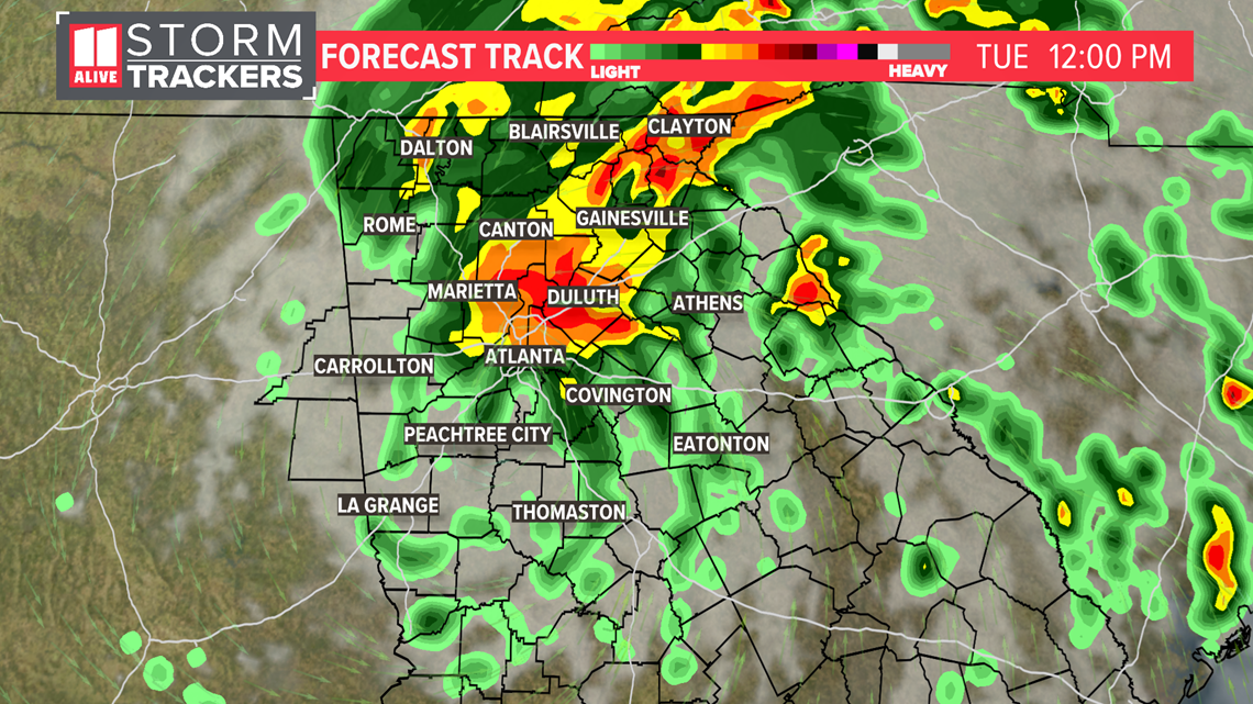
Tuesday Evening - The remnants of Fred are working through northeastern Georgia. The heavy, widespread rain will at this point be in far north and northeast Georgia. The potential for a spin up also is mainly in eastern and northeastern Georgia in the rain bands. Roads where it's raining heavily could have standing/ponding water. Rain will begin to taper off around the Atlanta metro area from southwest to Northeast.

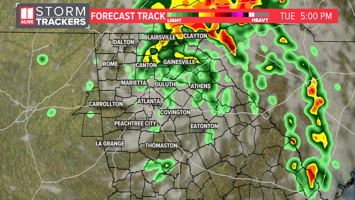
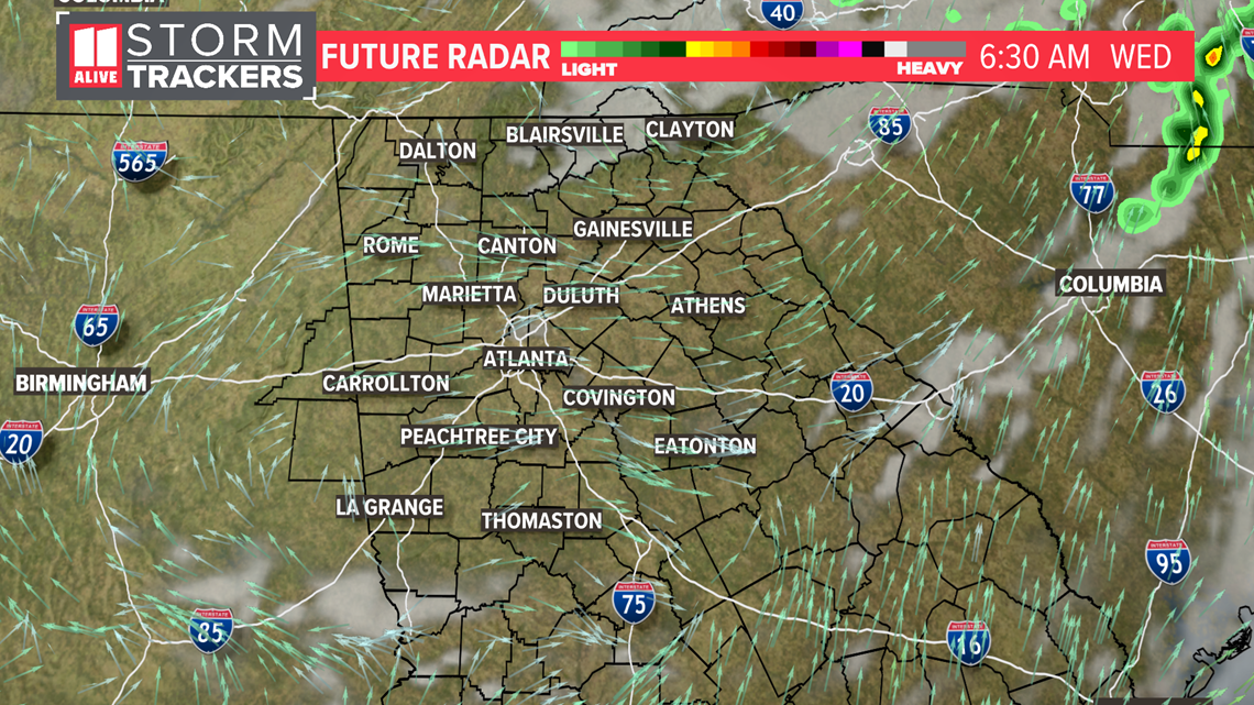
Much of the rain and wind will be gone by late Tuesday night.

Recapping Impacts: Heavy rain will be most widespread felt
Rain totals through Wednesday could be 2 to 5 inches with locally higher amounts.

Here is the Flash Flood Watch that is in effect for the metro:

Being on the eastern side of the storm, we'd normally also be concerned about severe weather and isolated tornadoes.
Our tornado watch continues until 1pm

In addition, it will be breezy with gusts around 30 mph possible in some areas.

Here is our Severe Weather Outlook for Tuesday. It includes a level 2 risk east of Atlanta.

