
ATLANTA — After a 5-day dry stretch, our longest streak in three weeks, showers and storms will move back into the Atlanta area and north Georgia during the day Friday.
Heavy rain is sometimes likely, and a few storms could turn strong to severe.
Three Things To Know about Friday's Rain Chance
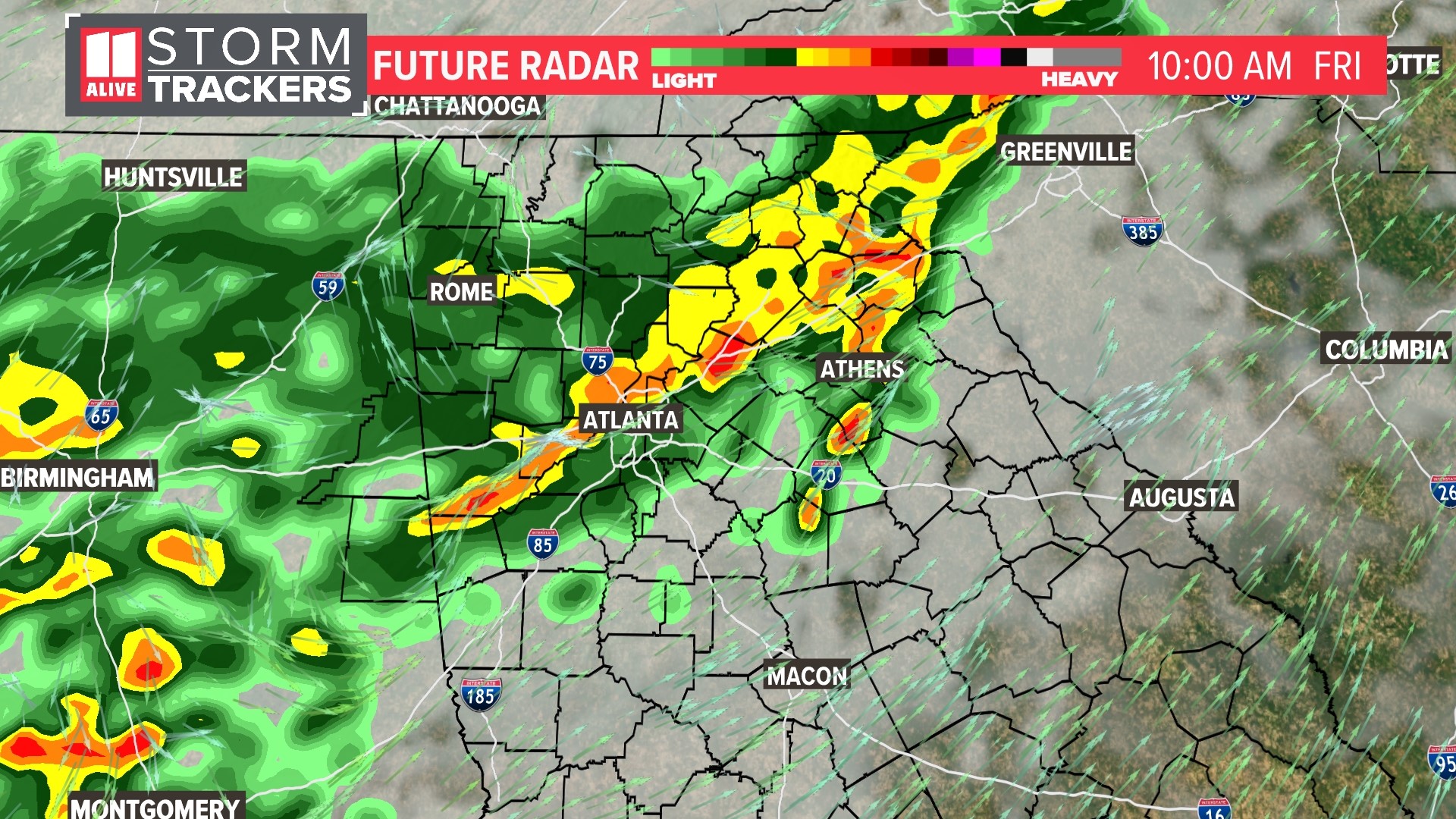
1) Showers and storms will begin moving into north Georgia in the morning as the commute gets underway
2) In the metro area, shower and storm activity will be most likely between 9 a.m. and 2 p.m., although storms could occur before or after that time as well. The timing could still change.
3) Isolated strong to severe storms are possible, with damaging winds being the main impact.
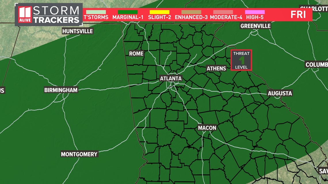
Severe Outlook
All of north Georgia is in a Level 1 threat of Severe Weather. The main severe threat is damaging winds. Storms will likely come in clusters, which can produce some stronger wind gusts. At this time, we do not expect much of a hail threat or tornado threat.

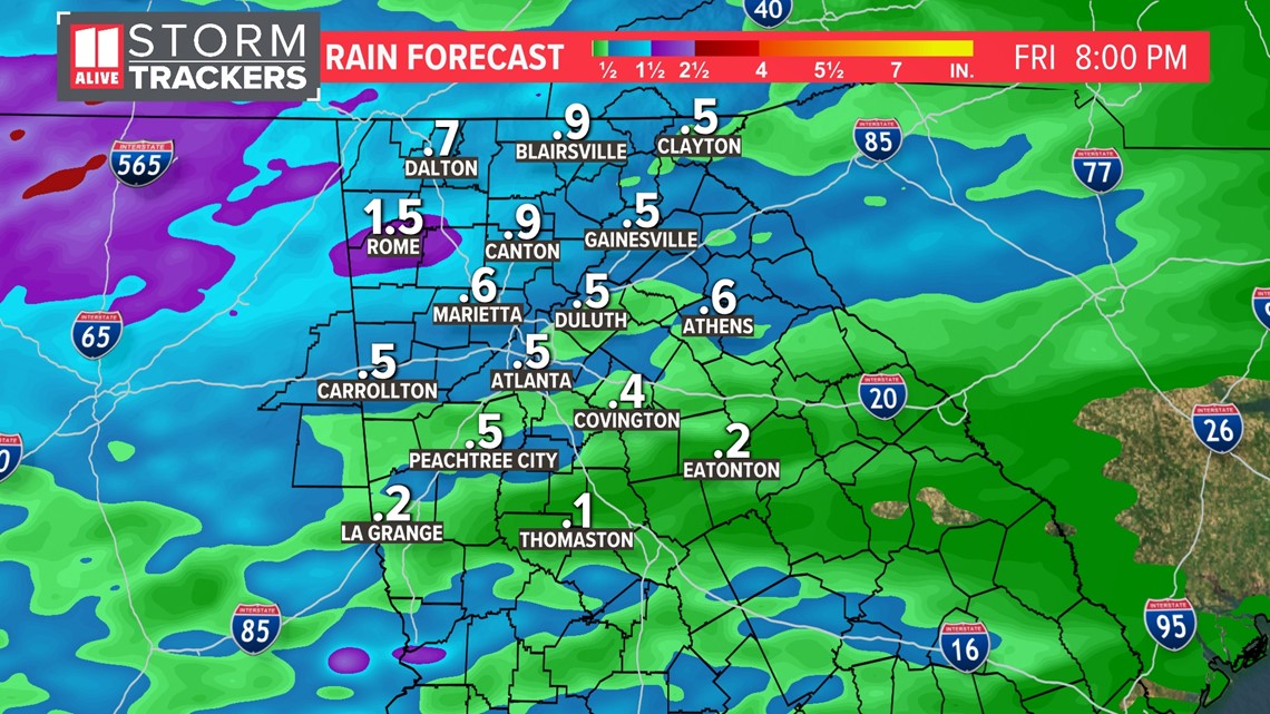
Rain Amounts
As the rain and storms initially move in, some locally heavy rain is possible. Rain totals will be, on average, around 1/2 an inch for the metro area. In far north Georgia, higher amounts are possible, around 1 inch total. Rain amounts could be much lower in central Georgia, with only around 1/4 of an inch.

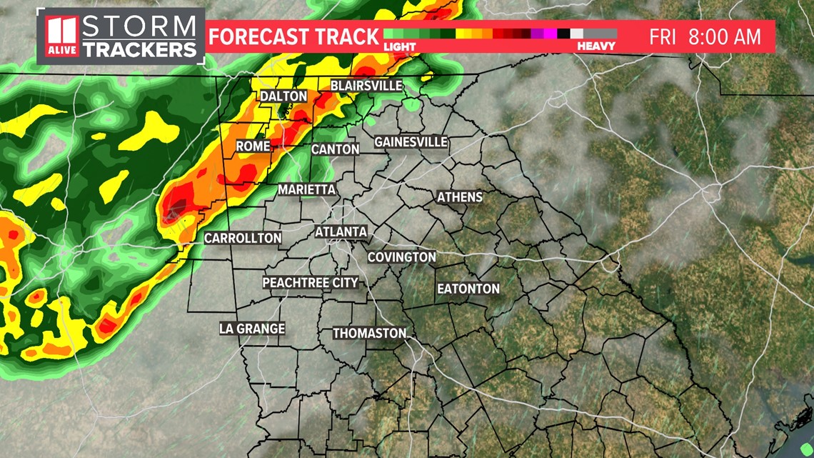
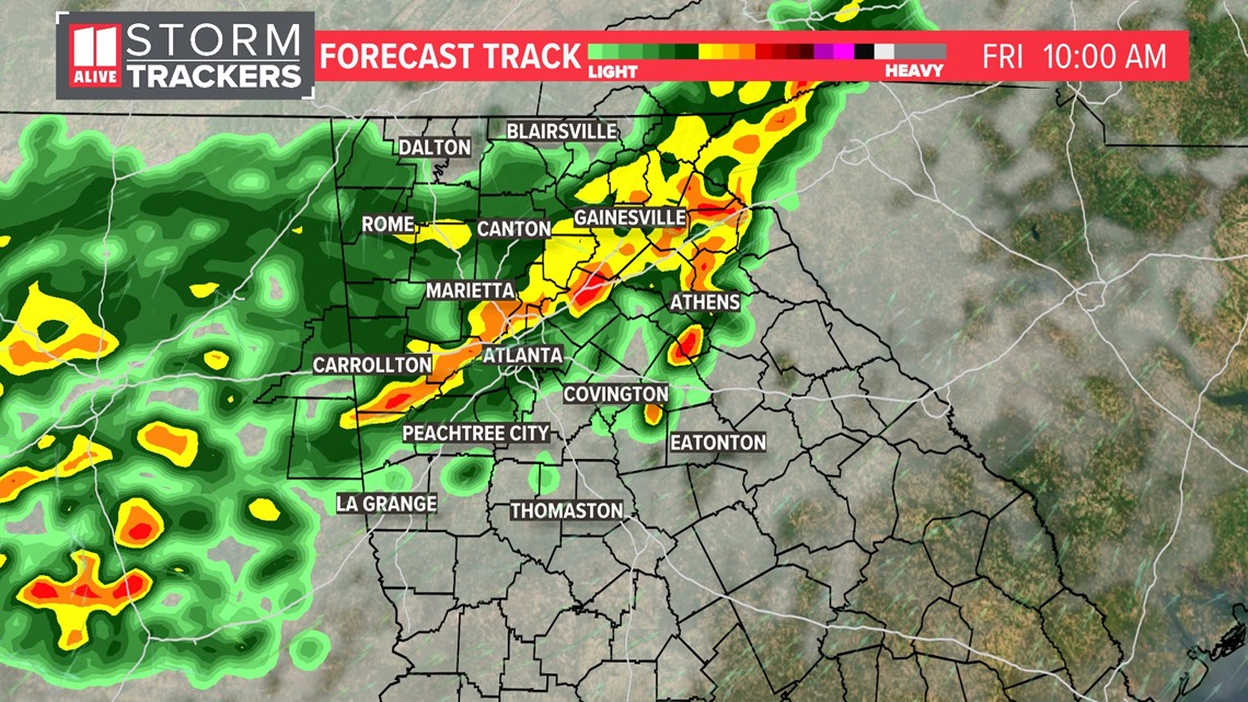
Timeline
Friday morning, storms begin to enter northwest Georgia around 6 a.m.

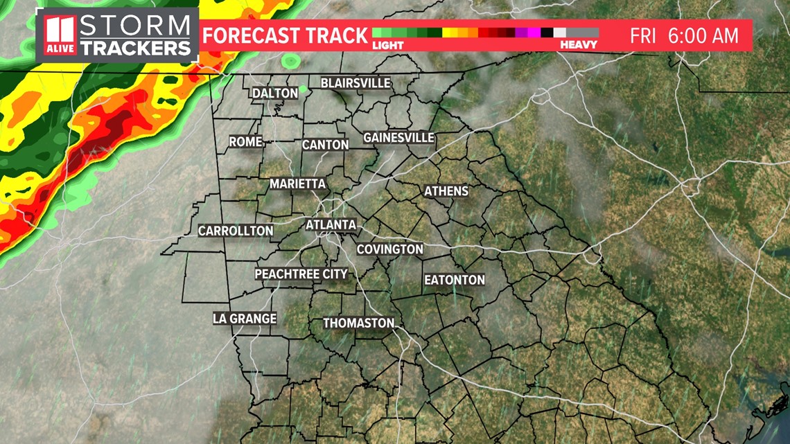
By the height of the morning commute, the storms begin to enter the northwest metro area.

As we get to mid-morning, the storms enter Atlanta

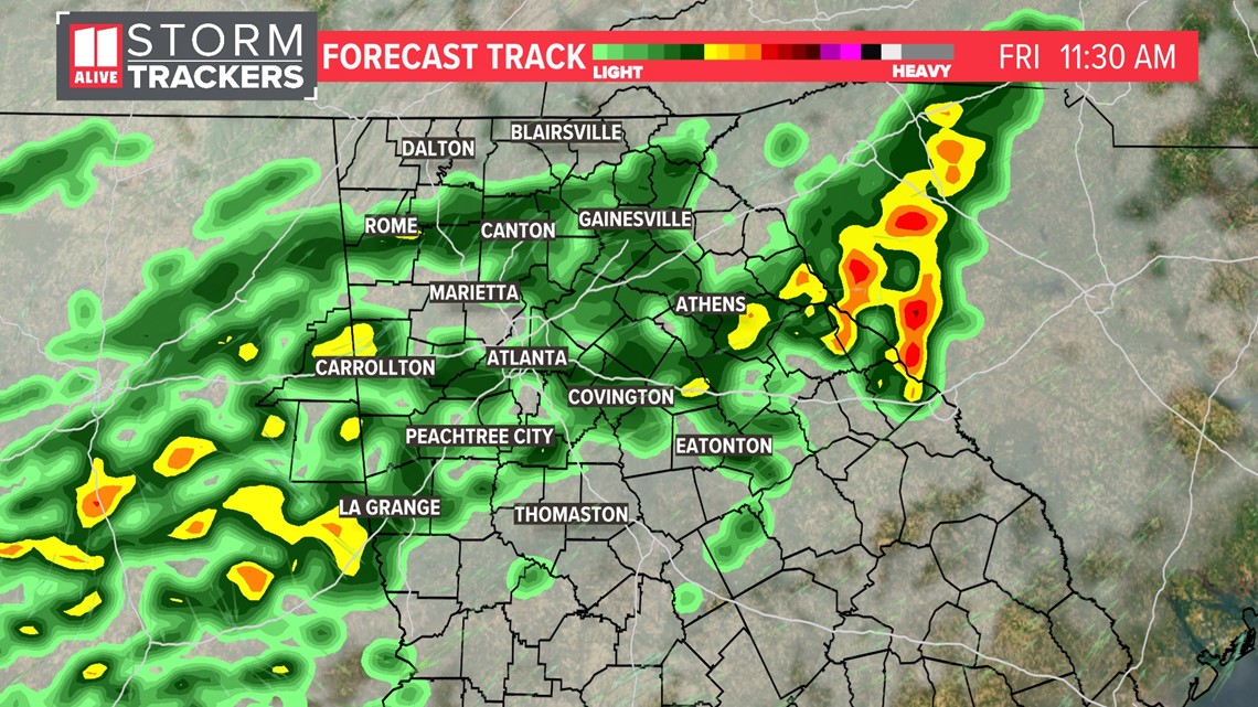
The initial wave of stronger storms should weaken as they move in. Some scattered showers will remain around midday and into the early afternoon.

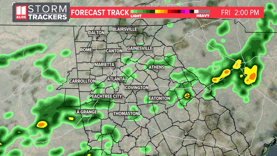
This model shows that fewer showers impact the mid to late afternoon.

Uncertainties With Timing
The timing of this Friday's storms is still not quite a 'lock.' If this morning wave were to weaken and die out earlier, we could see the redevelopment of some storms in the afternoon in the metro area.