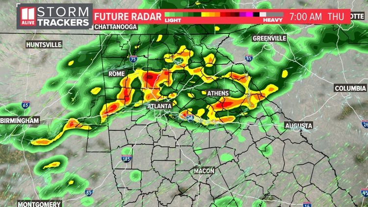
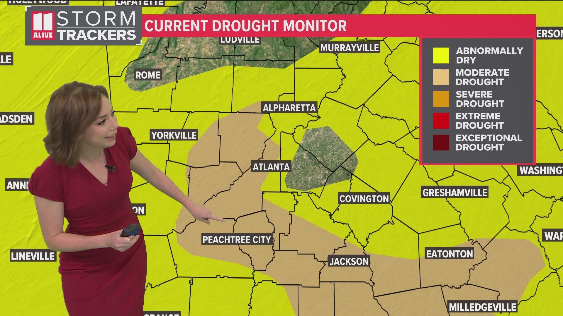
ATLANTA — Multiple waves of showers and storms are likely across north Georgia and the Atlanta area between Wednesday night and Friday morning.
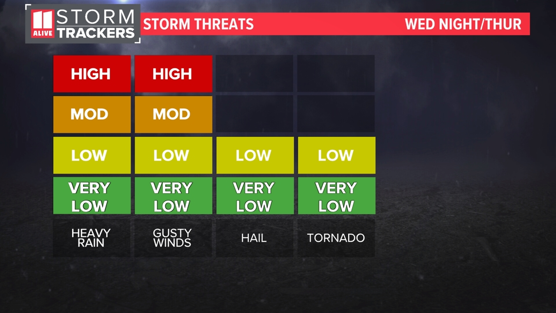
Strong to severe storms are possible in each round, with all modes of severe weather possible. Damaging winds will be our main threat for severe weather. There is also a lower chance of hail and an isolated tornado.
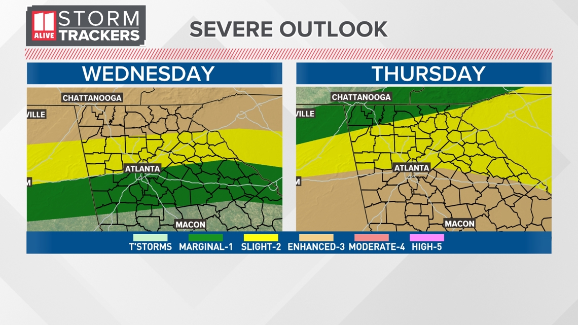
The Storm Prediction Center has highlighted part of our area as a Level 3 threat of severe weather Wednesday for far north Georgia, a Level 2 threat for the north side of the Atlanta metro, and a Level 1 threat for severe weather on the south side.
Then for Thursday, again we have part of our area in a Level 3 threat of severe weather. This time, along and south of I-20.

Stronger storms will be possible with each wave of thunderstorms. Damaging winds will be the main threat. There is also a lower risk of hail and tornadoes.

Timeline
Wednesday Evening
Isolated discrete showers and storms may develop by Wednesday evening but the widespread activity holds off until the overnight.

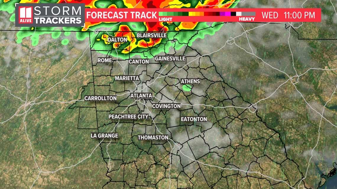
Wednesday Night
Here's a big picture of the storms pushing in overnight. The timeline will be after 11 p.m. to the north, and push further south in the overnight.

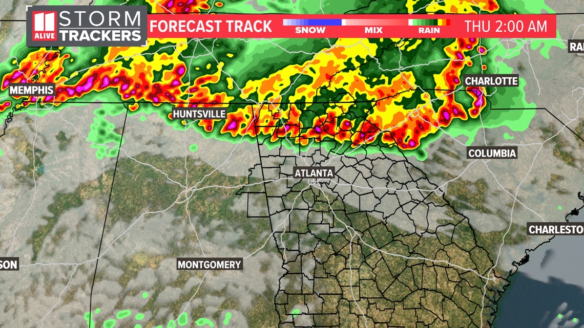
Thursday Morning
Storms will still be around Thursday morning for the commute with heavy rain, lightning and gusty winds.

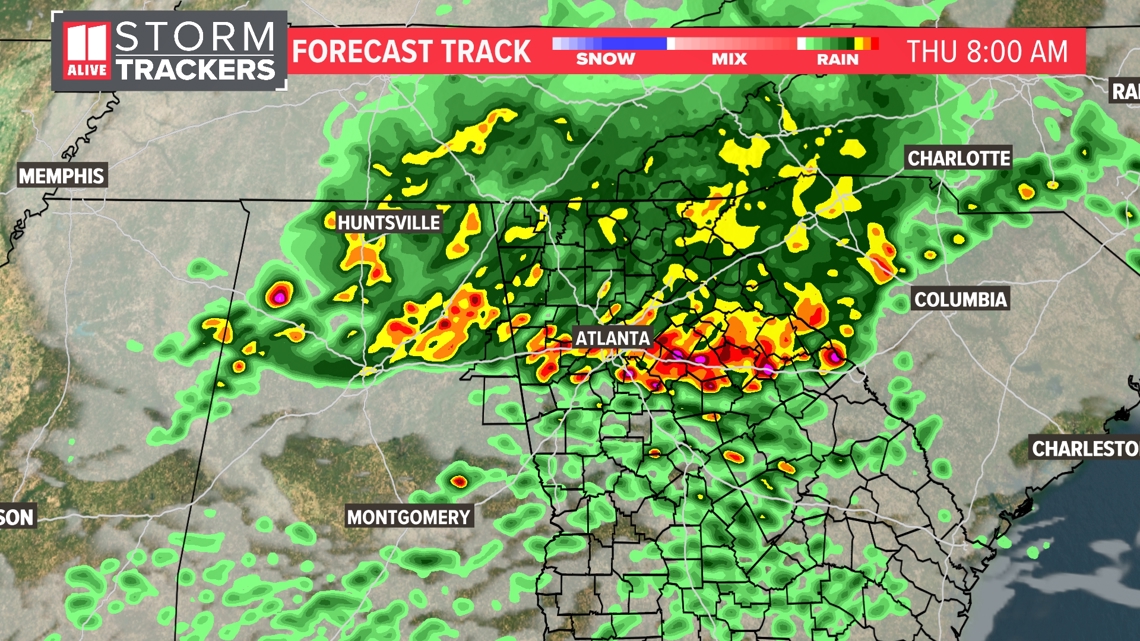
Thursday Afternoon
We may see some afternoon breaks Thursday with temps rebounding into the mid 80s.

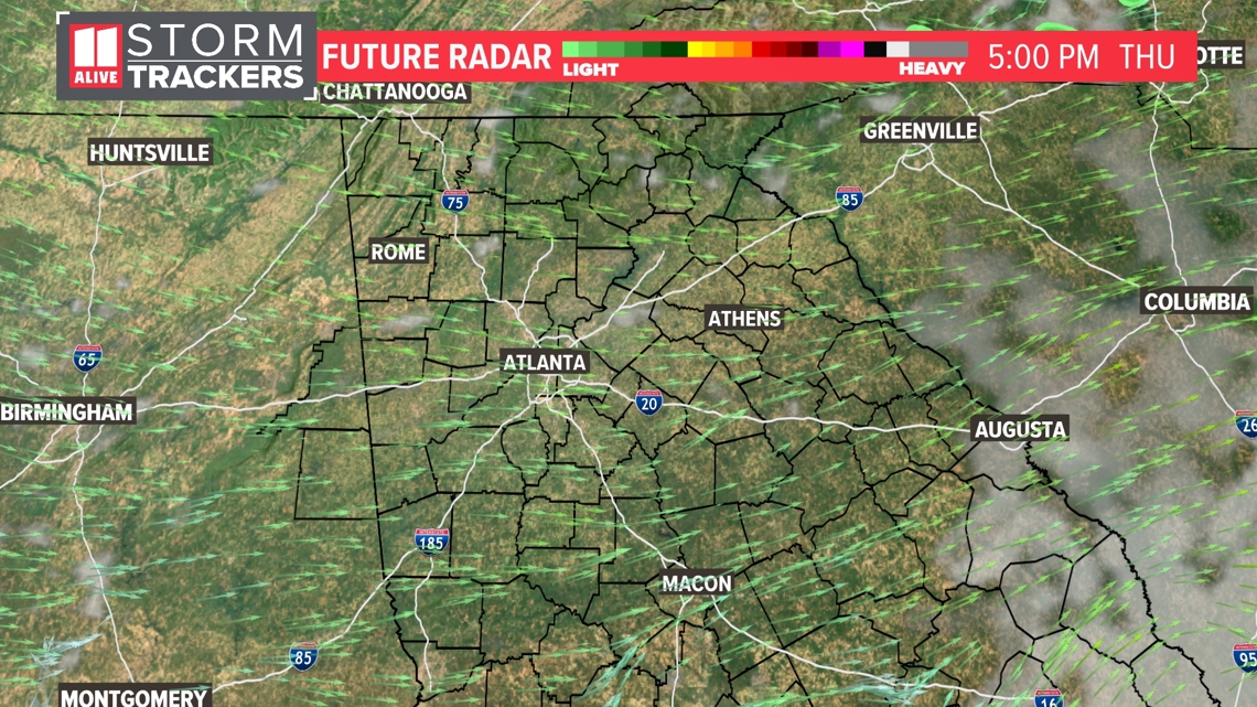
Thursday Night
Another round will move back in Thursday late evening/overnight through early Friday. That round may stay south of I-20 and target more of central Georgia. But the model below shows a more northerly track, targeting the Atlanta metro.

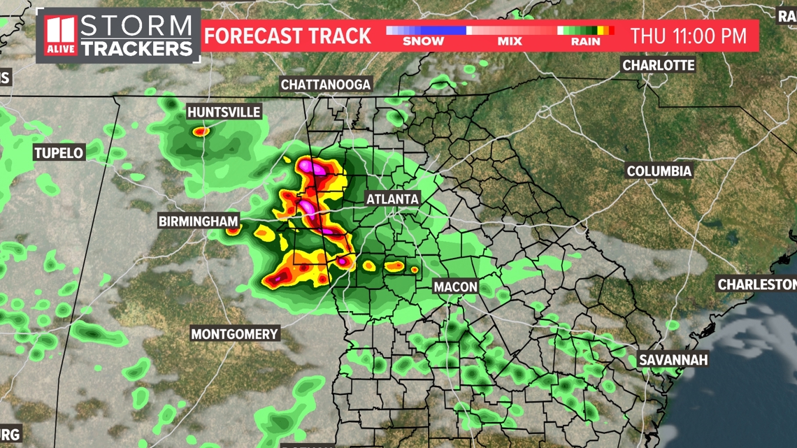
Dry weather moves back in for Mother's Day weekend, along with a drop in humidity and temps!


