Severe weather updates below:
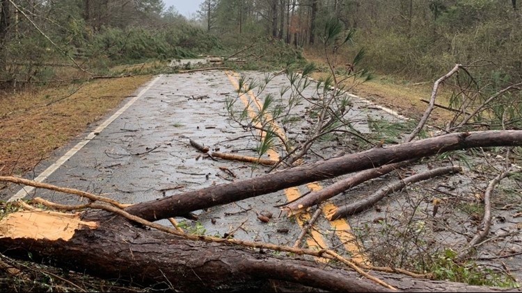
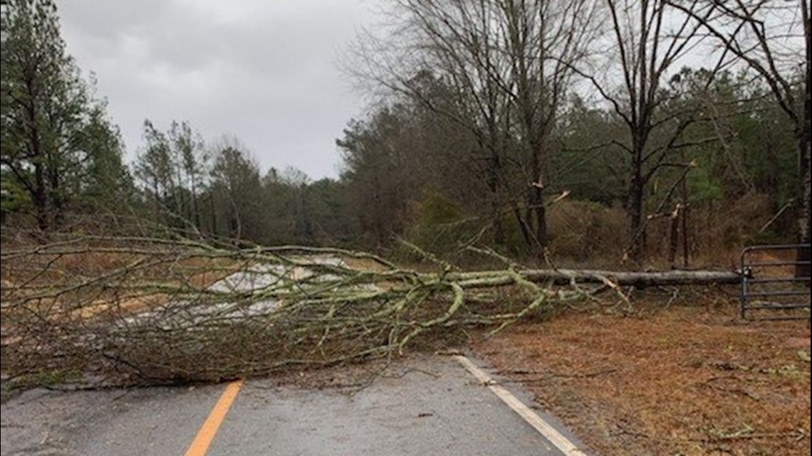
7 p.m.: Emergency management officials forwarded photos of downed trees along a roadway following a severe storm that passed through Crawford County.
No injuries were reported there.


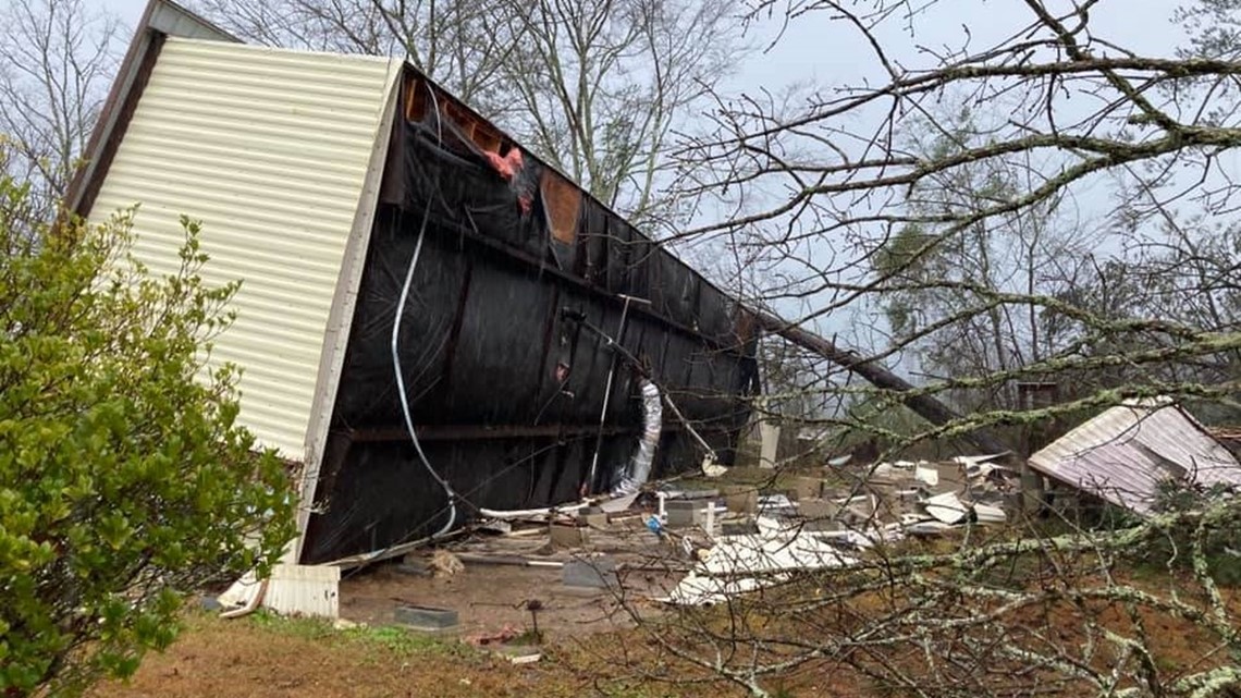
4:30 pm: No injuries were reported after a mobile home was overturned on Dames Ferry Road in Monroe County.
According to the Monroe County Sheriff's Office, a female was entrapped, but rescued without any injuries.


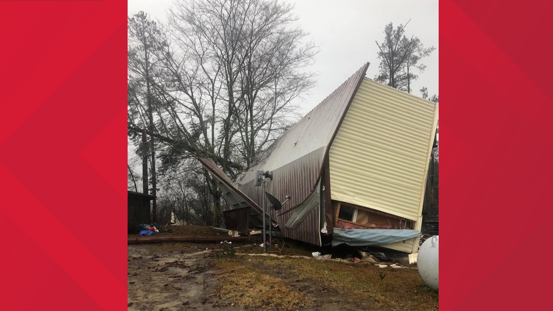
Deputies reported trees and power lines knocked over in parts of Monroe County. Additional downed trees were reported in parts of Putnam and Baldwin counties.
4 pm: The tornado warning for Baldwin, Hancock and Putnam counties has been canceled.
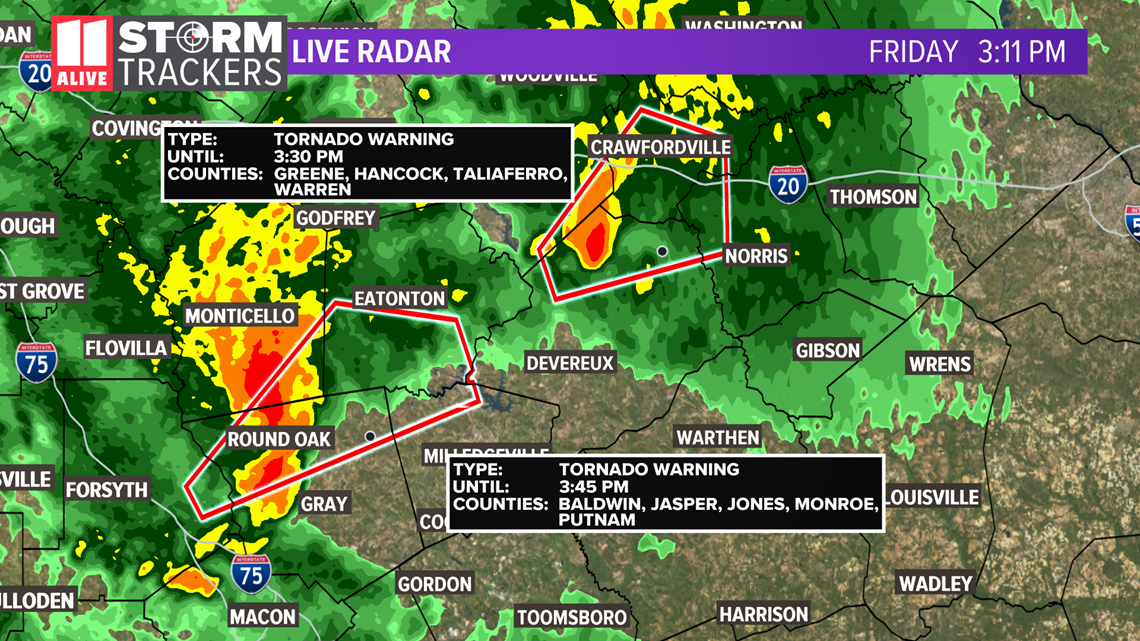
3:39 pm: A tornado warning has been issued for portions of Baldwin, Hancock and Putnam counties until 4:15 pm.
3:37 pm: A tornado warning has been issued for parts of Greene, Hancock, and Putnam counties until 4 pm.
3:30 pm: A small tornado watch area for parts of Georgia to the southeast and east of metro Atlanta has been issued through 8 p.m.
No counties in metro Atlanta are included in the watch area.
3:20 pm: The tornado warning for Baldwin, Jasper, Jones, Monroe and Putnam counties has been canceled.
3:05 pm: A tornado warning has been issued for portions of Warren, Hancock, Greene and Taliferro counties until 3:30 pm.
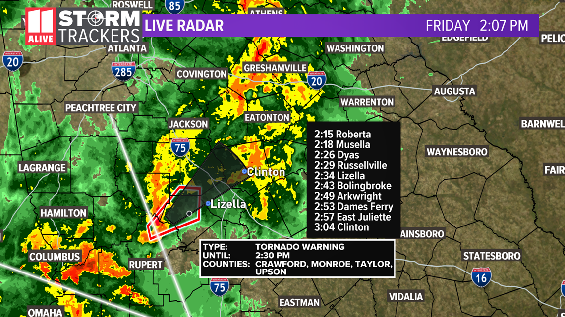
At 3:04 pm, a severe thunderstorm was located near Shoulderbone, or 9 miles northwest of Sparta, moving northeast at 45 mph.

2:58 pm: A tornado warning has been issued for portions of Baldwin, Jasper, Jones, Monroe and Putnam counties until 3:45 pm.
At 2:57 pm, authorities said a tornado-producing storm was located over Jarrell Plantation, or 11 miles east of Forsyth, moving northeast at 40 mph.
2:36 p.m.: A tornado warning has been issued for parts of Jones and Monroe counties, down toward Macon, until 3 pm.
2:14 p.m.: The tornado warning has been canceled for Upson County, but continues for Crawford and Monroe counties until 2:30 pm.
2 p.m.: A tornado warning has been issued for parts of Crawford, Monroe, Taylor and Upson counties until 2:30 pm.

12:00 p.m.: The tornado warning from Meriwether and Troup counties expired.
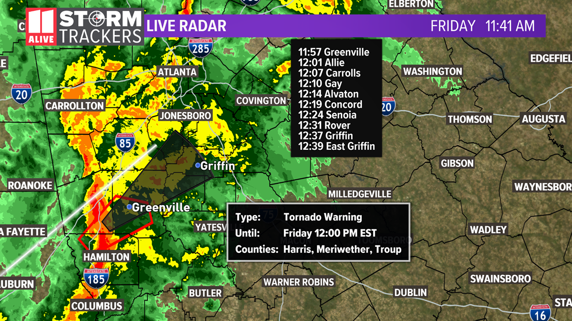
11:45 a.m.: Harris County was removed from the tornado warning.
11:42 a.m.: A tornado warning has been issued for Troup, Harris and Meriwether counties until noon.
The severe thunderstorm capable of producing a tornado is moving NE at 45 mph. Take cover in these communities.

Forecast story below:
The new year will start stormy and wet across north Georgia. The 11Alive Stormtrackers are forecasting numerous showers and thunderstorms Friday, and the potential for a few of these storms to be strong to severe. New Year's Day is only a 4 out of 11 on the Wizometer.
Here's what you need to know:
- Showers and storms are likely New Year's Day
- Critical timing for strong storms: 10 a.m. to 6 p.m.
- Isolated strong to severe storms are possible
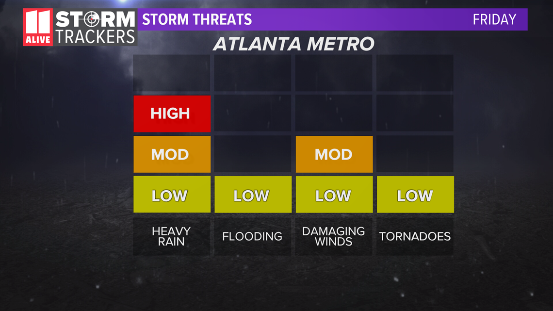
- Main threats: locally heavy rain, lightning, damaging winds, an isolated tornado
- The timing and extent of our storm threats could still change before Friday
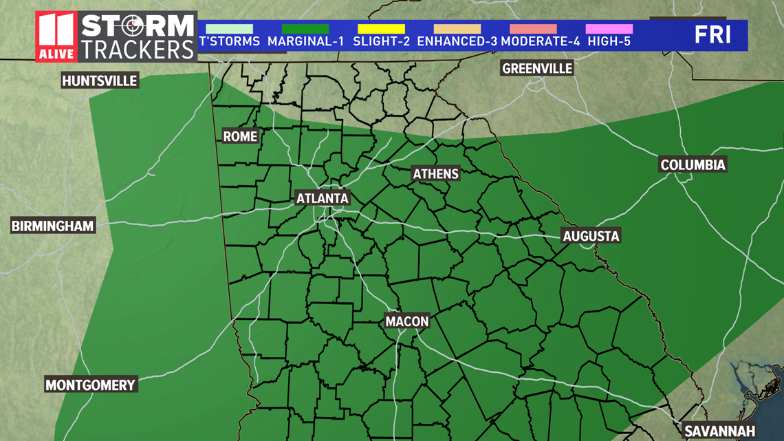
The Severe Weather Outlook from the Storm Prediction Center currently shows the area in a 'Marginal' risk of severe weather. This means that isolated severe thunderstorms are possible, but it does not mean that everyone will see a severe storm. The limiting factor for our severe potential is the stubborn cloud deck which likely won't clear before our storms move in tomorrow, as well as earlier morning showers.

Our threats include a higher threat for heavy rainfall, which could lead to some street flooding on roads with poor drainage or city streets. Our threats for isolated severe storms includes damaging winds and the chance for a brief spin-up tornado.

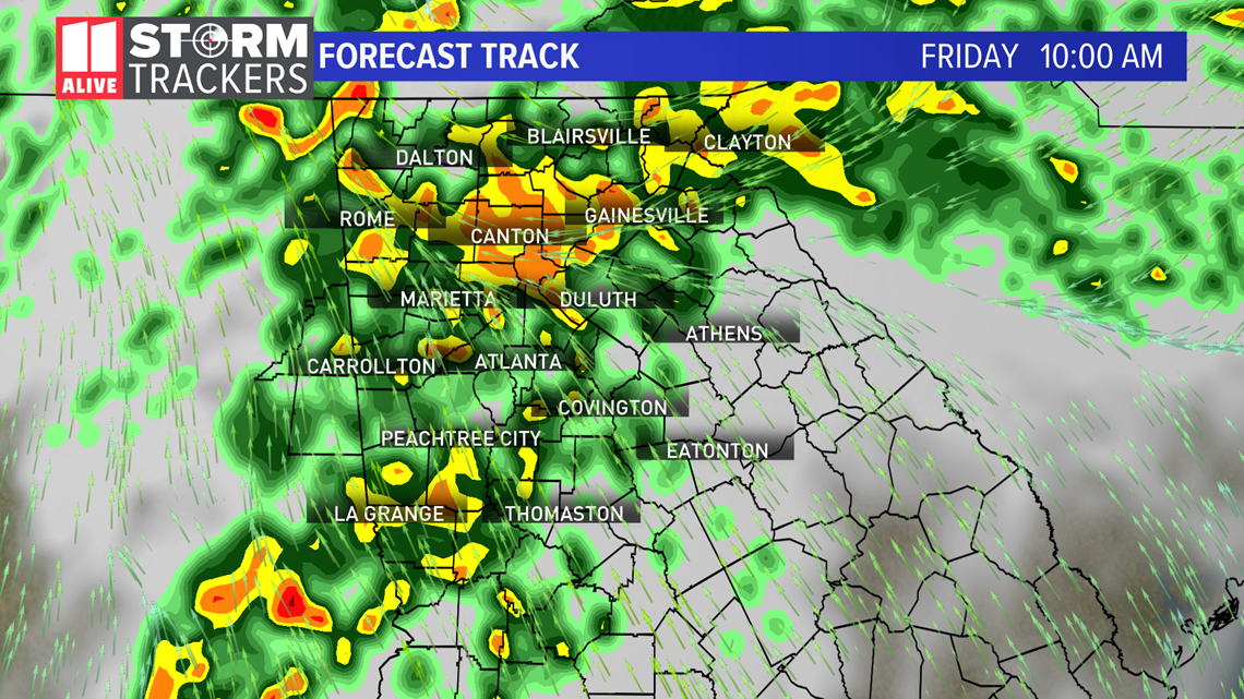
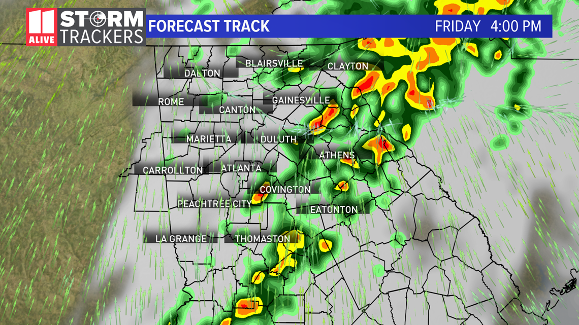
The Forecast Track shows the general timing for storms below. There will be numerous showers and a few rumbles of thunder possible earlier on Friday in the morning. This earlier morning rain factor, in addition to a limited opportunity for any thin spots in the clouds will help to keep our severe risk overall low, but still non-zero. The severe potential may be slightly higher south of Atlanta.
The storm threat winds down in the evening.


Rain totals for north Georgia through Friday will be 1 to 2 inches, with locally higher amounts possible over northeastern Georgia.
Stay up to date with the latest by downloading the 11Alive App.