ATLANTA — A wintry mix is possible late Saturday into early Sunday in parts of north Georgia. Even if it does snow, getting that snow to stick will be a challenge around the metro. Our temperatures will be marginal and the ground will be very warm -- limiting any snow from sticking.
Below you can see who could see snow, the timing of the snow chance, and how much snow to expect.
Here's what we know right now:
- Rain may mix with and/or change to wet snow in parts of north Georgia early Sunday morning.
- Above-freezing temps and the wet, warm ground will help melt snow that falls.
- Light accumulations are most possible in the north Georgia mountains.
- Around the metro, it is too warm to support many areas seeing any flakes mixing in.
Snow chance setup: What we are tracking
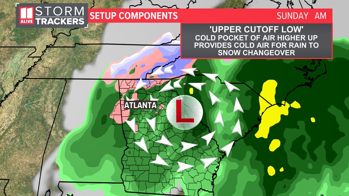
We're tracking an area of surface low pressure developing and cutting across southern Georgia this weekend. This surface low will not directly pass over north Georgia, but rather work its way up the coast.
Meanwhile higher up in the atmosphere will be a cutoff low that can provide enough cold air for a changeover from rain to snow.

Who could see snow
We feel that far north Georgia will likely see some sort of changeover to snow late Saturday night into parts of Sunday morning in the higher elevations. It will be wet snow, and temperatures will likely be above freezing when the snow falls.
With that being said, some minor accumulations are possible in higher elevations above 1500 feet.
Around the metro, we feel some mixing with flakes is possible if we can tap into that cold air aloft with the upper low. The bulk of this will melt upon reaching the surface with temps being above freezing and the warm ground. Anything that sticks would be on grassy, elevated surfaces only and likely melt shortly after thanks to the warm, wet ground.
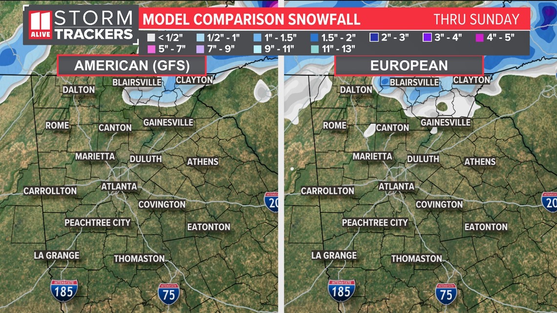
What do models show? Well, models show how much snow they think may fall, but they do not show how much will actually stick and accumulate.
Here is one of our in-house models, showing where snow may fall. The bulk of this will melt thanks to above-freezing temps (we'll be in the mid and upper 30s as the snow falls) and a warm, wet ground (we pick up 1"+ rain before the snow).
Elevations above 1500 feet could see a coating to 1/2". Elevations above 2000 feet could get up to 1".

Timeline - When to expect snow chance
The changeover from rain to a wintry mix or wet snow will happen early Sunday morning. The precipitation exits the area between 9 a.m. and 1 p.m.
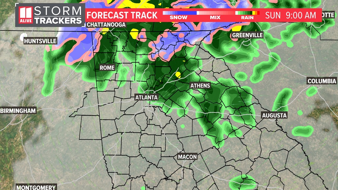
Below are forecast track (future radar) images that show an idea of the timing. This is not exactly how the radar will end up, areas that see a change from rain to snow could change and vary as the event unfolds.
Sunday Morning - The rain/snow mix will be ongoing in the north Georgia mountains. In the metro, temps will be too warm to support much mixing. As quickly as the snow chance starts, it ends. Rates of rain and snow will start to get lighter after 6 a.m. and the coverage of it tapers off.

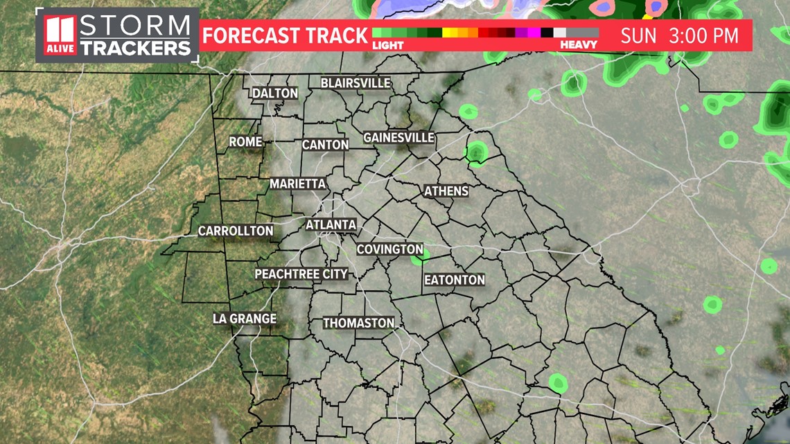
Sunday Afternoon - Northwest gusty winds drive in drier air. This clears some of the clouds out late in the day. It'll be a chilly, breezy, but brighter afternoon. Temps stay in the 40s.

Recap: What to expect
- Rain may mix with and/or change to wet snow in parts of north Georgia late Saturday night into early Sunday morning.
- Above-freezing temps and the wet, warm ground will help melt snow that falls.
- Light accumulations are most possible in the north Georgia mountains.
- This is not a high-impact winter event.
What is important to stress is that this forecast is ever-changing and ever-evolving. It is complicated. What you read today won't be the same that you may see tomorrow but it's better to be prepared.
MORE FROM THE 11ALIVE STORMTRACKERS
DOWNLOAD THE 11ALIVE APP:
Set up weather notifications by clicking the Gear icon in the upper right corner of the app. Select Notification -> Notification Settings -> Severe Weather Alerts -> Toggle the Severe Weather Alerts button to the right to turn alerts on.
Send photos and videos through the app by selecting the Near Me feature on the bottom right task bar of the app and entering your information.
TEXT YOUR WEATHER PHOTOS TO US: 404-885-7600
JOIN THE 11ALIVE STORMTRACKERS FACEBOOK GROUP: Nearly 10,000 metro Atlanta and north Georgia weather enthusiasts share their weather photos every day. Click here to join the group!


