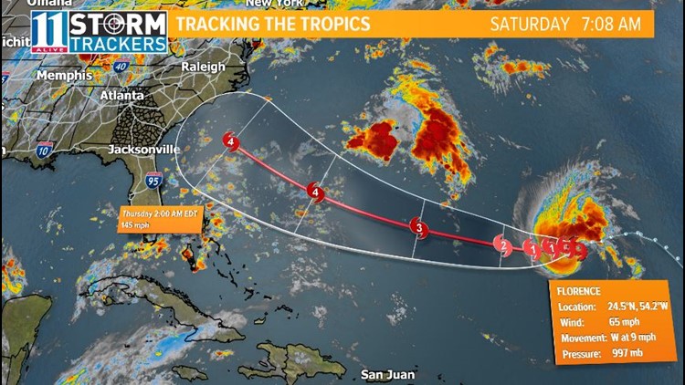
Florence is still spinning in the middle of the Atlantic Ocean about 1,200 miles away from the U.S. and is poised to leave the current inhospitable environment in the next 24 hours.
The storm remains a tropical storm Saturday morning with maximum sustained winds of 65 mph.
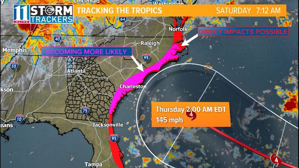
The storm will continue to strengthen as it treks further west into the east coast. Right now, the storm is forecast to be a category 4 storm by Thursday morning.


Given the warm waters near the coastal Carolinas and Georgia, the storm has the potential to strengthen even further as it approaches land.
A large amount of uncertainty still exists as areas from Florida up to Virginia may be directly impacted. Right now, it appears the greatest threat for direct impacts spreads from North Carolina to coastal Georgia.


We should have a much better handle on timing, possible landfall location, and intensity on Sunday night.
If you live in the coastal areas of North Carolina, South Carolina, or Georgia, now is the time to be thinking of a plan in case you ride out the storm or have to evacuate.
This is not hype, this is the reality of the situation.
For more information on how to prepare for a hurricane, click here.


