ATLANTA — The risk of severe weather is back in the forecast across north Georgia Sunday into Sunday night. We'll track scattered showers and thunderstorms for a good portion of the day, but then a more substantial risk of severe weather overnight as a cold front tracks into the area.
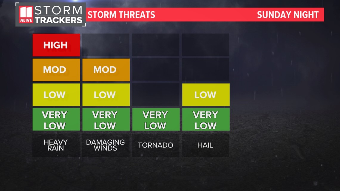
There is a Level 3 out of 5 threat of severe weather for northwest Georgia. There is also a Level 2 out of 5 threat of severe weather for points southeast of Atlanta.

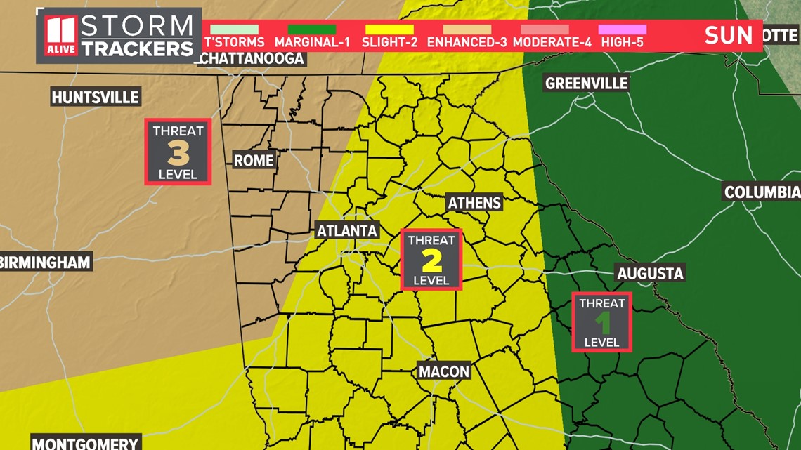
Damaging winds will be our primary severe weather player. Heavy rain will be likely. Some hail is also possible. The tornado threat is very, very low.

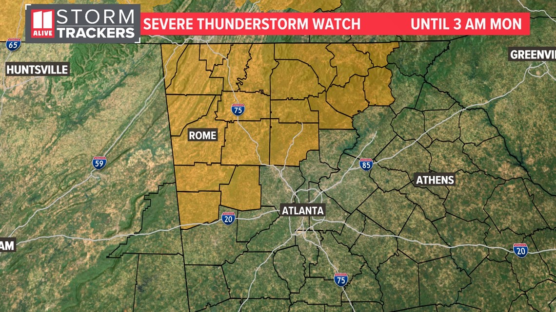
A Severe Thunderstorm Watch is in effect until 3 AM for northwest Georgia where the severe threat is the highest.

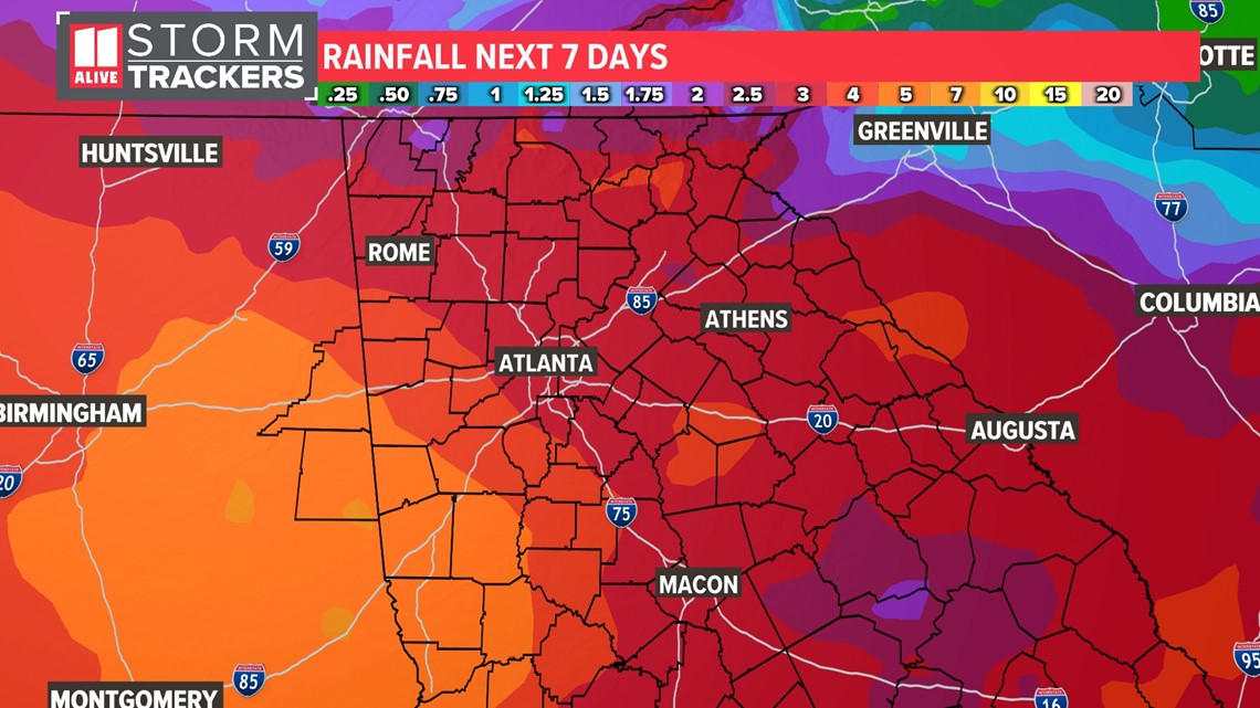
The rain incoming is much-needed! We have a rain deficit of over an inch for the year. May itself was much drier than normal. In the upcoming week, we could pick up three to five inches of rain.
Timeline
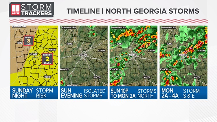
Sunday Overnight
A line of storms is moving into far NW GA. These will bring the greatest severe weather potential, but they have been weakening. They are producing heavy rain and frequent lightning, so you may be awoken to thunder tonight.

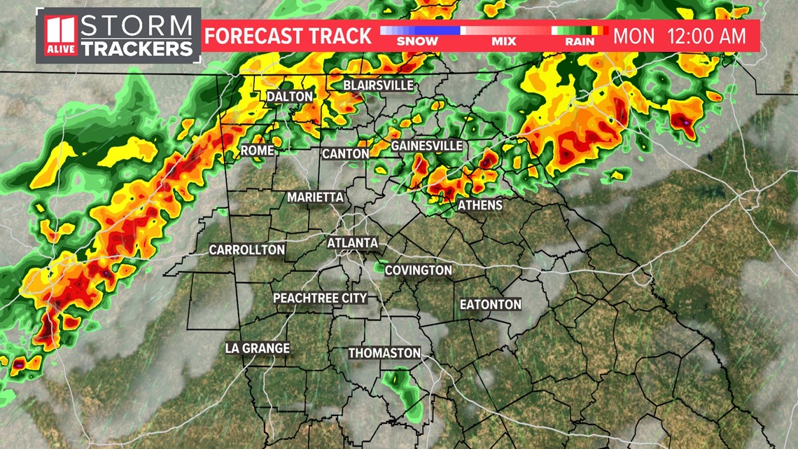
For the Atlanta metro, storms will arrive between midnight and 2 AM.

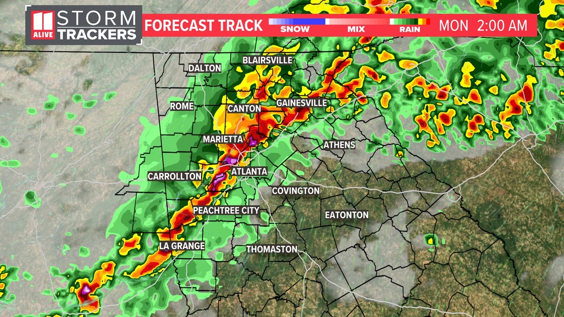
They'll continue racing east of Atlanta after 2 a.m. and should show a gradual weakening trend.

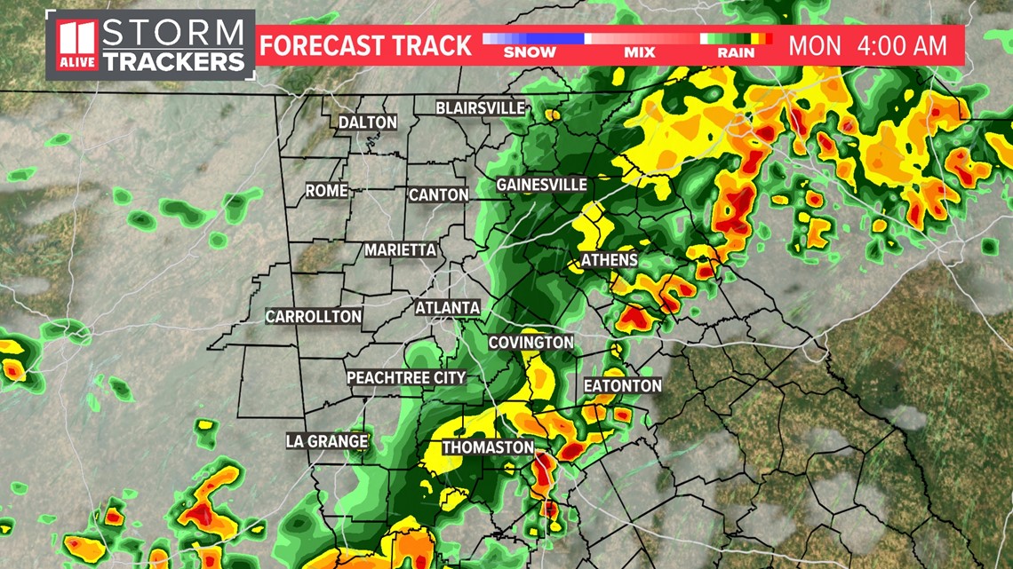
Monday
By Monday morning, the bulk of these showers and storms will be out of here.

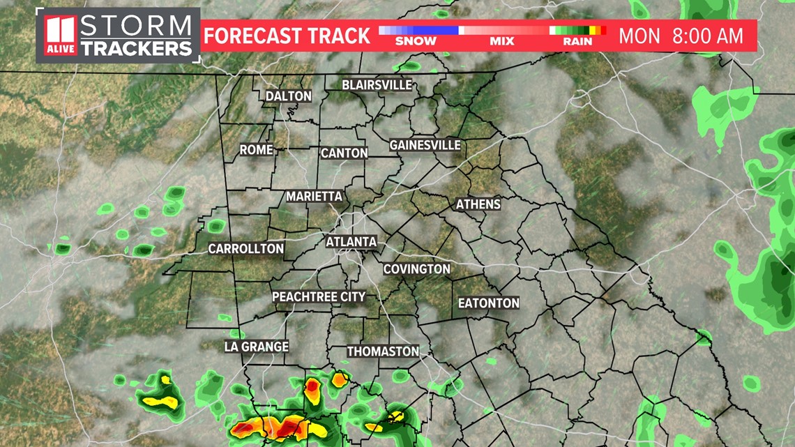
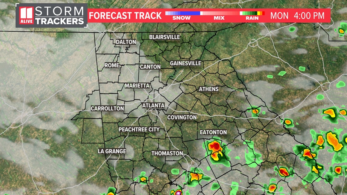
Some sunshine returns by the afternoon. Storms will redevelop south of the front, but this should stay in central and southern Georgia.

Tracking More Storms This Week
After our Sunday round of storms, we aren't done with the rain this week. We've got a fairly unsettled and active pattern ahead as a front stalls near our area late in the work week. The next 'best' chance will move in for Wednesday.

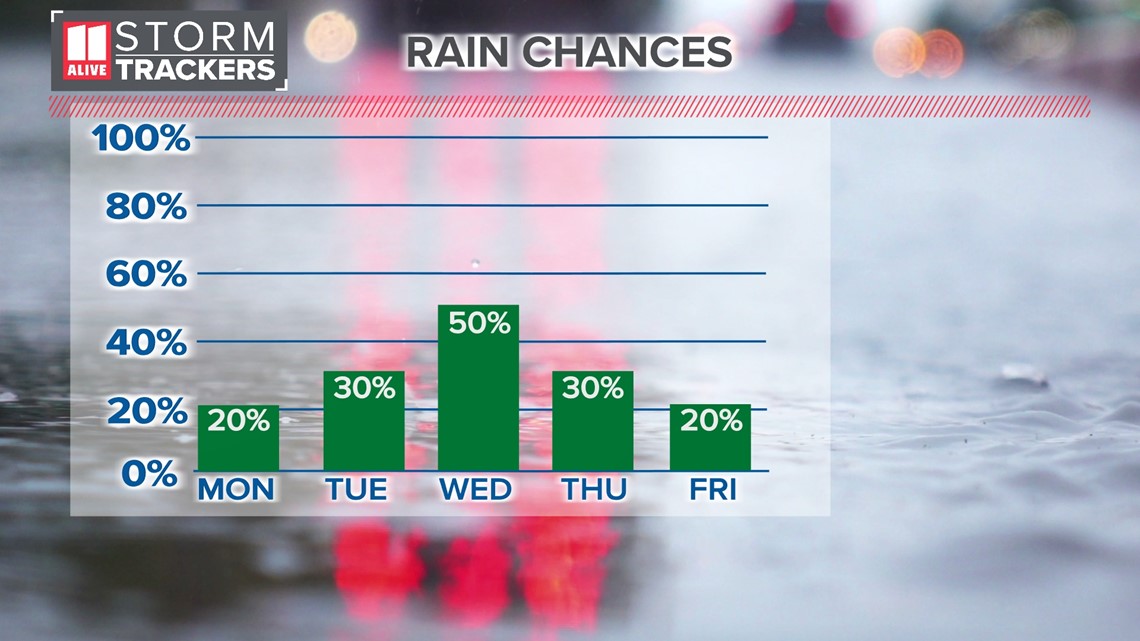
In total, we could see two to five inches of rain over the next 7 days.

