ATLANTA — The calendar may no longer say 2021, but our weather forecast to start the new year looks eerily similar to how the year ended. The 11Alive StormTrackers are tracking another round of strong and severe thunderstorms for the Atlanta metro and North Georgia.
Here are three things to know:
- Severe storms are most likely from Saturday evening through Sunday morning
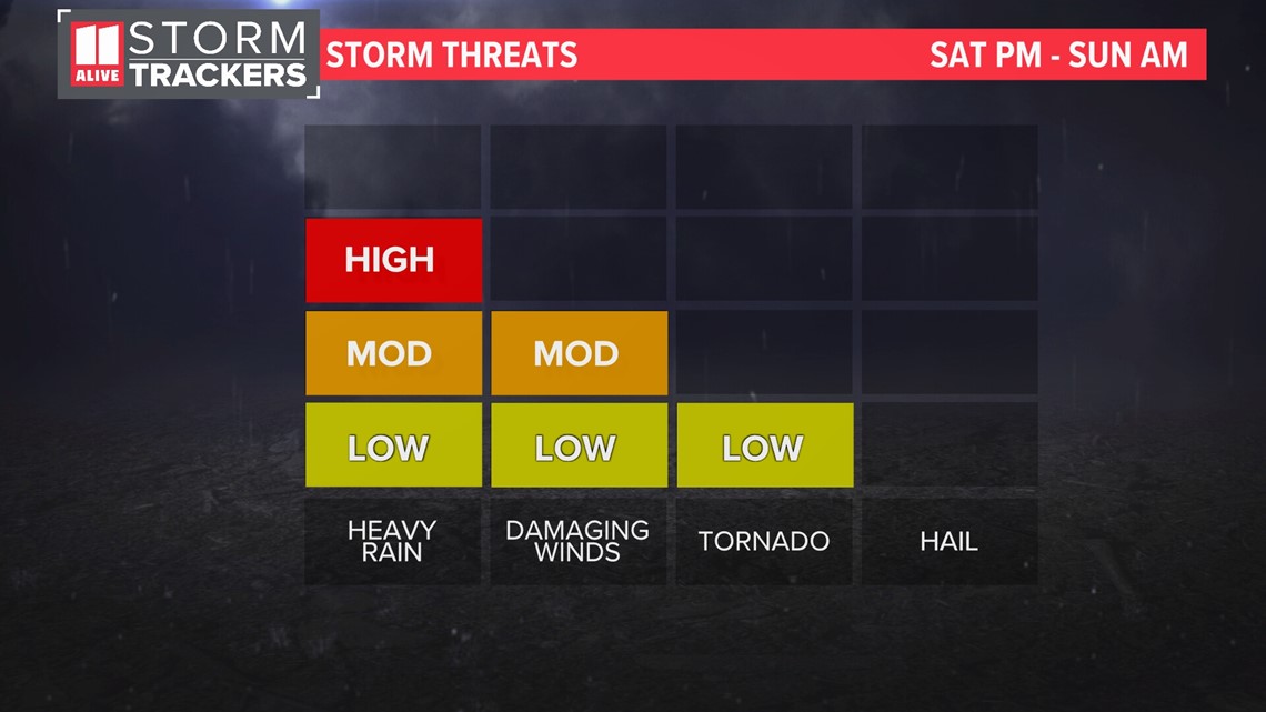
- Damaging winds, heavy rain, lightning, and an isolated spin up tornado will be possible
- Have a way to get warnings while you're asleep. Enable wireless emergency alerts on your phone or use a NOAA Weather Radio. You can also download the 11 Alive App
Severe Storm Threats:
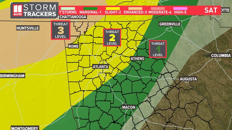
We have a Level 3 threat of severe weather in far Northwest Georgia, a Level 2 threat for the Atlanta area, and a Level 1 threat for areas southeast of the metro.
Damaging winds will be our primary severe weather threat. An isolated tornado is possible. Hail is a very low threat as well and heavy rain is likely. Falling on saturated ground, additional heavy rain could lead to flooding.

Storm Timing:
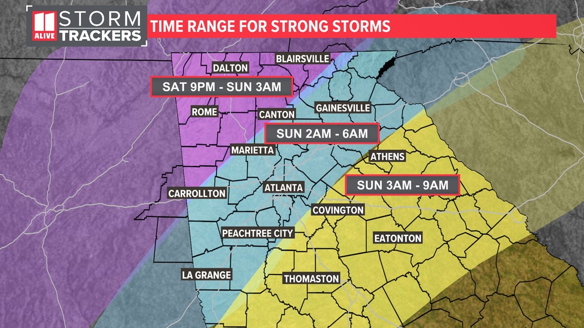
The graphic below shows the window for when storms are most likely in each part of North Georgia. Strong storms can happen outside this time as well. But, this is when they'll be most likely to occur.
For Northwest Georgia, strong storms are most likely between Saturday 9 p.m. and Sunday 3 a.m. For the Atlanta area, strong storms are most likely between Sunday 2 a.m. and 6 a.m. For areas southeast of the immediate metro, the storms will arrive latest. Your severe weather window is between 3 a.m. and 9 a.m. Sunday

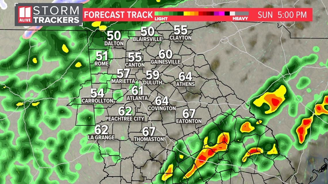
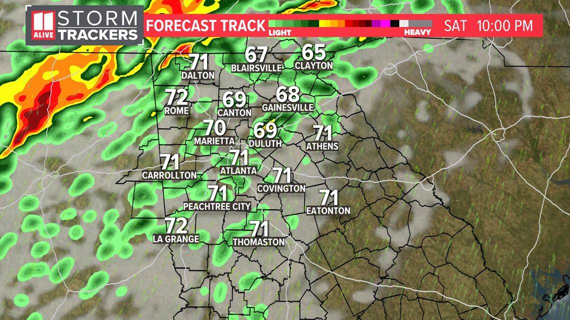
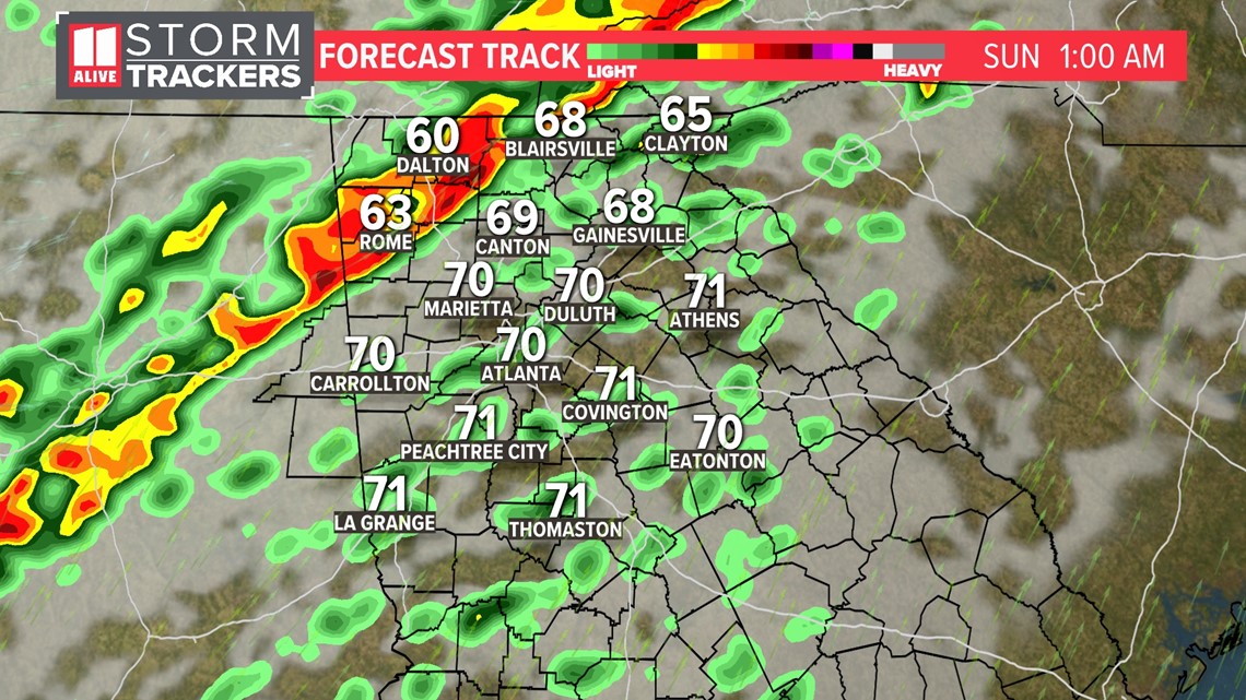
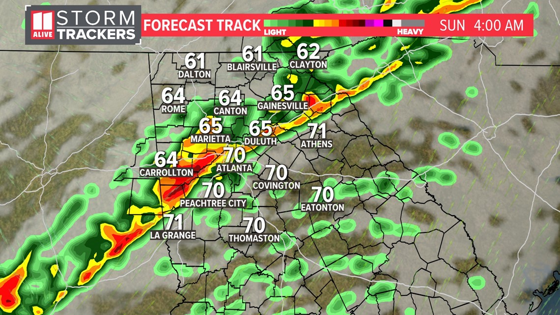
The forecast track shows the progression of storms into the area.
- Saturday evening - storms begin arriving far north & west

- Storms increase in coverage far northwest around midnight

- Strong storms continue in the overnight hours, passing through the Atlanta metro

- And by Sunday late morning, the last of the strong storms exit

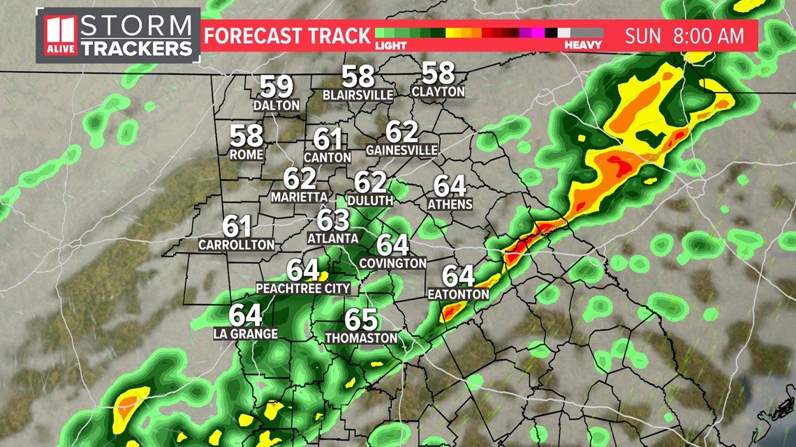
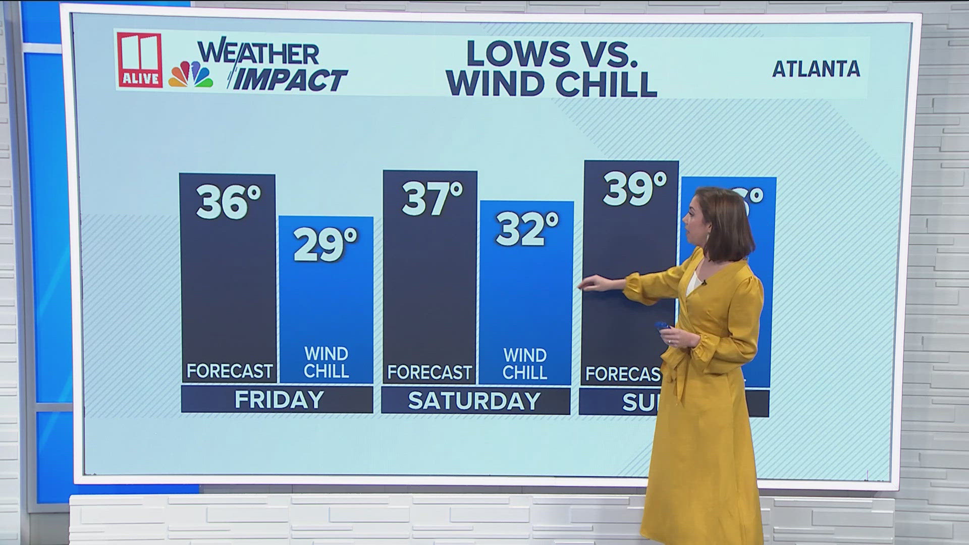
- Although more showers build in Sunday afternoon, the severe weather threat will be over. It stays gusty with falling temps.

