ATLANTA — A significant risk of strong to severe thunderstorms is possible over parts of north Georgia late Saturday and into the overnight hours going into early Sunday is possible.
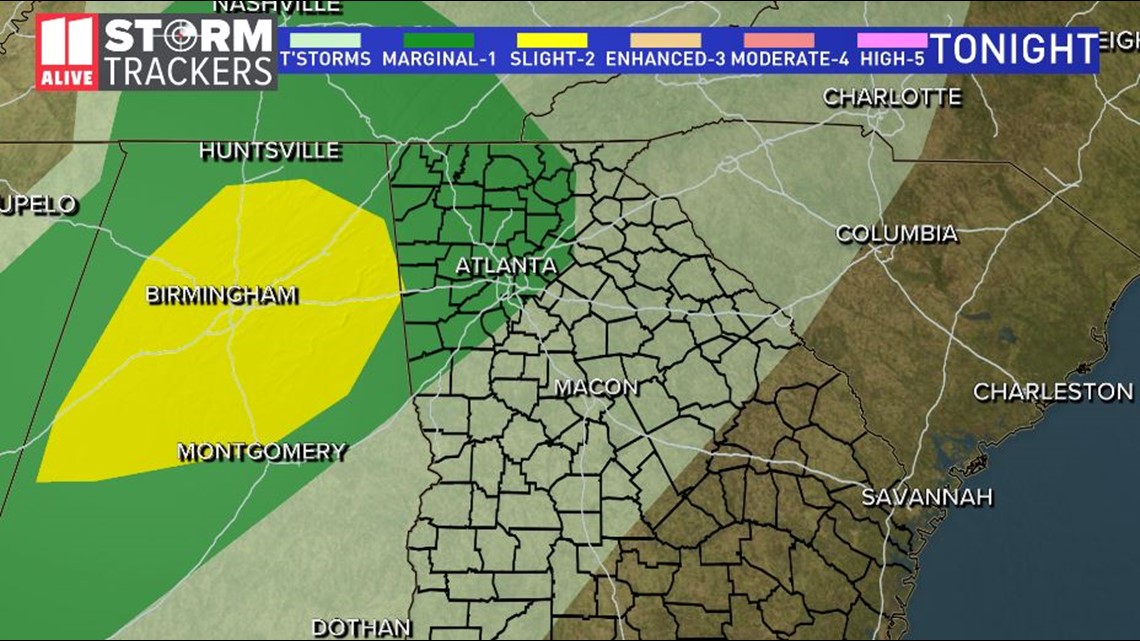
The National Weather Service Storm Prediction Center has placed parts of north Georgia and metro Atlanta under a Marginal Risk category for severe weather.
According to 11Alive Meteorologist Samantha Mohr, a strong springtime weather system is moving across the southern states in a classic February pattern that brought severe weather to parts of Mississippi, Tennessee and Alabama through the first half of of the weekend


That storm system is moving eastward into the evening and overnight hours, bringing the strong and severe storms toward Georgia.
The storms are expected to contiue to weaken however still will bring heavy rainfall and winds gusting 30 to 40 mph at time. A Wind Advisory is in effect and the possibility of falling trees is a very real possibility in and across parts of north Georgia.
In addition, a Flood Watch remains in effect through Sunday morning for parts of far north Georgia, including the following counties: Bartow, Catoosa, Chattooga, Cherokee, Dade, Dawson, Fannin, Floyd, Forsyth, Gilmer, Gordon, Hall, Lumpkin, Murray, Pickens, Polk, Towns, Union, Walker, White and Whitefield.
RISKS FOR NORTH GEORGIA
The primary risks for north Georgia include even more heavy rainfall, flooding, damaging wind gusts, and the possibility of brief spin-up tornadoes.
With the saturated ground, any type of wind gusts have the possibility of bringing trees down, which increases the risk of significant power outages across the region.
Here's when you should expect to see the severe weather move across north Georgia.
1AM TO 2 AM
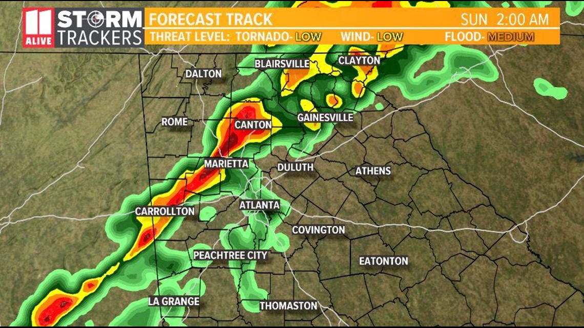
The strongest storms will be entering in the far northwestern portion of the state during the early morning hours.The storms should slide across the state at an angle from Alabama, which means that the line will be stretching back to the southwest.
2AM TO 4 AM
2AM TO 4 AM
By about 2 a.m., the main part of the line is anticipated to be close to Cobb and Fulton counties, and may be affecting the city of Atlanta itself.


4:30 AM TO 7 AM
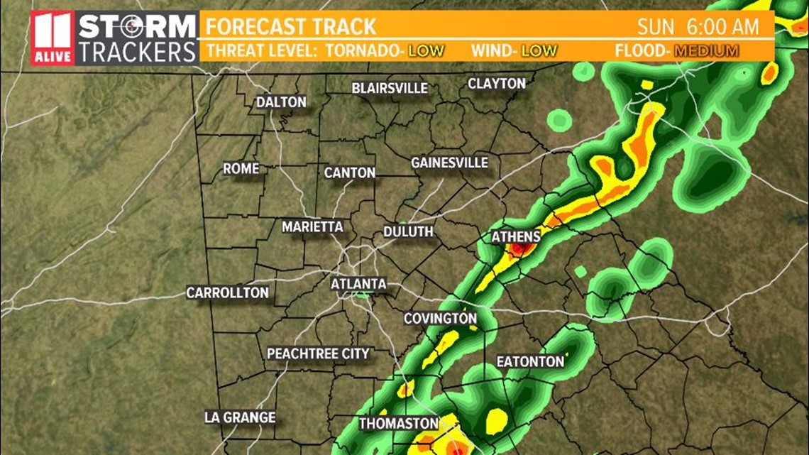
By about 4:30 a.m., the line should be east of the city and affecting areas toward Athens, while the southern end may still be affecting portions of Henry County and trailing down toward the Atlanta Motor Speedway, where many people have been camping out for this weekend's NASCAR activities.


By about 7 a.m., the storms should be clear of metro Atlanta.
CALL TO ACTION
Night time is one of the most dangerous times for severe weather, primarily because people are not able to hear weather warnings when they occur and are not able to take action. Here's what you can do to prepare ahead of time.
- Make sure you can hear weather warnings.
- Get the 11Alive News App for your phone or tablet in the iTunes store or on Google Play and have weather alerts enabled.
- Make sure you have a NOAA Weather Radio for your home with battery backup.
- Know where the safe place is in your home in the event of a tornado or severe weather in your area.
Stay with the 11Alive Storm Trackers throughout the day for any updates and any weather advisories or warnings.
► Download the FREE 11Alive News app now in the iTunes store or on Google Play.
► POWER OUTAGES CHECK | Georgia Power customers, check here. Georgia EMC customers check here.
► Have a news tip? Email news@11alive.com, visit our Facebook page or Twitter feed.

