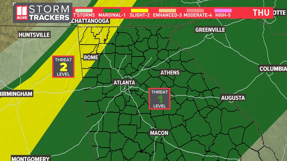
ATLANTA — A cold front Thursday night will bring in our next chance for heavy rain and strong storms. There is a level 1 out of 5 risk for severe weather late Thursday into early Friday for the metro and a level 2 out of 5 risk for far northwest Georgia. A few storms could be strong to severe with damaging winds in addition to heavy rain and lightning.

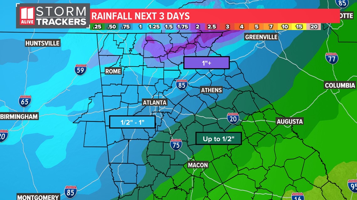
It has been almost two weeks since we've picked up any measurable rainfall in the Atlanta area, and this storm system could leave us with 1" - 2" for parts of North Georgia. The highest rain totals will be in the North Georgia mountains.

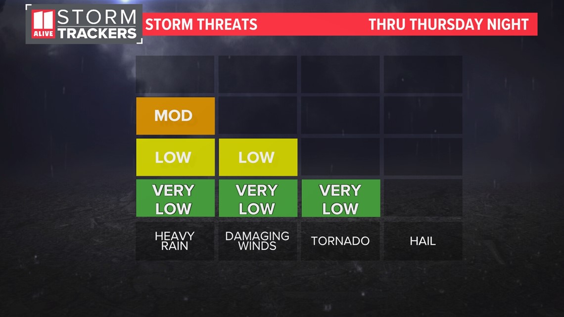
Here are 3 things to know about the storm potential:
- This will be mainly an overnight event. Storms are most likely late Thursday and early Friday.
- Our severe threat is low. A higher threat exists to our northwest through Alabama, Tennessee, Mississippi, Kentucky, and Arkansas.
- Storms could be capable of producing damaging winds. Strong winds will be our primary risk, but an isolated spin-up tornado will also be possible.

Timeline
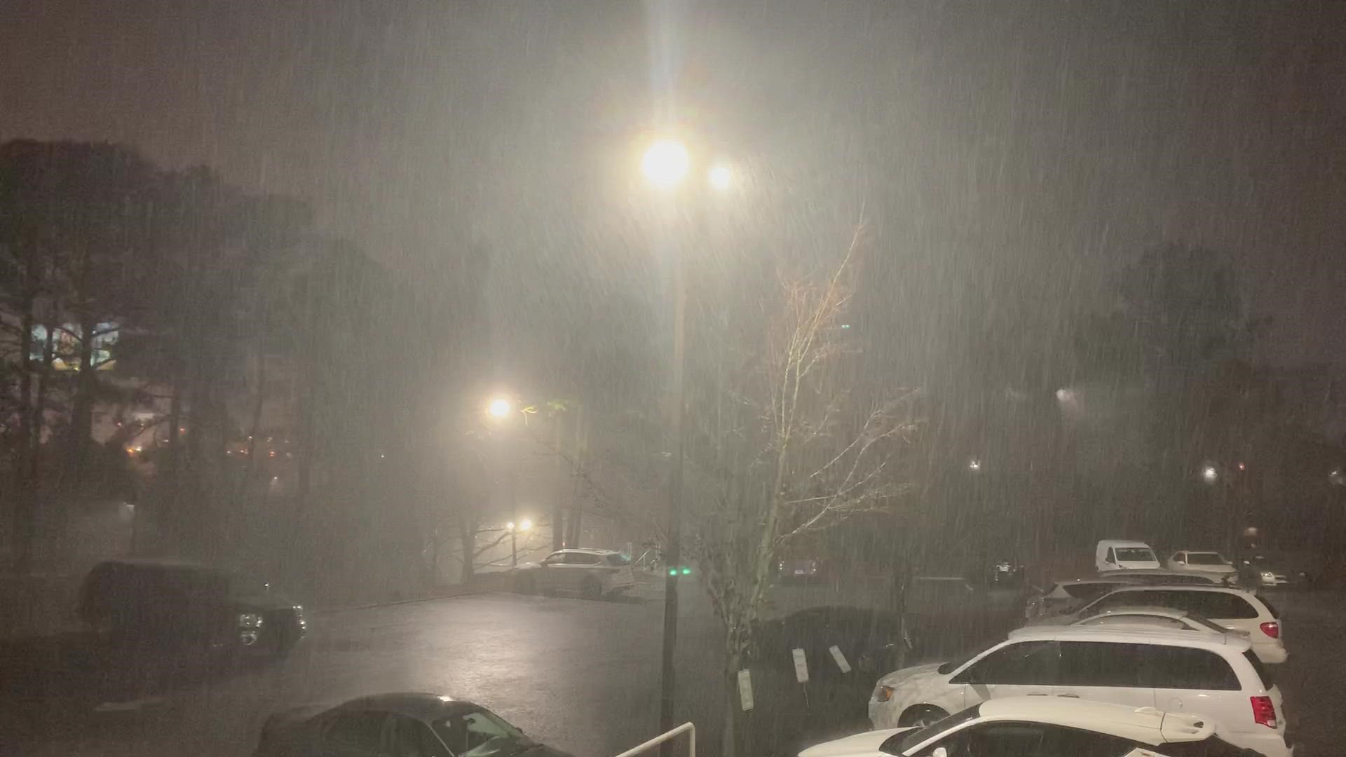
Storms continue to push southeast after sunset. Although rain in Atlanta is possible beforehand, the line of storms will make its way through the Atlanta metro 9:00 PM through 1:00 AM . Isolated strong to severe storms with gusty winds are possible across the metro area in addition to heavy rain and lightning. The heavy rain could lead to minor ponding/standing water on roadways.

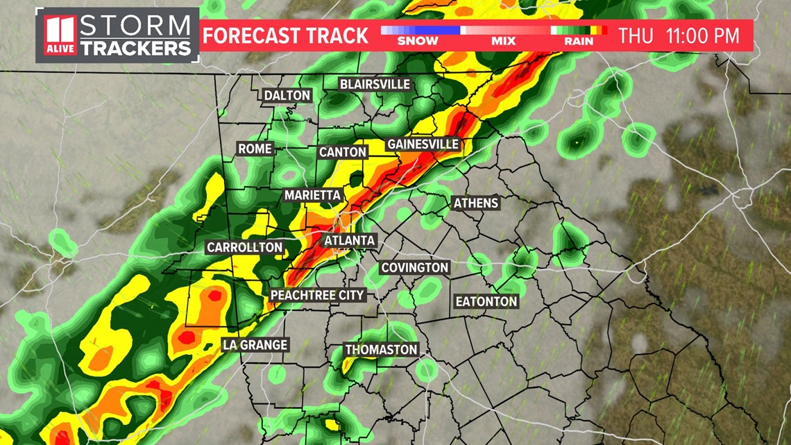
Storms will be long over by the time the sun rises on Friday. Following the storms, you may still need to be on the lookout for small debris in the road for your morning commute.

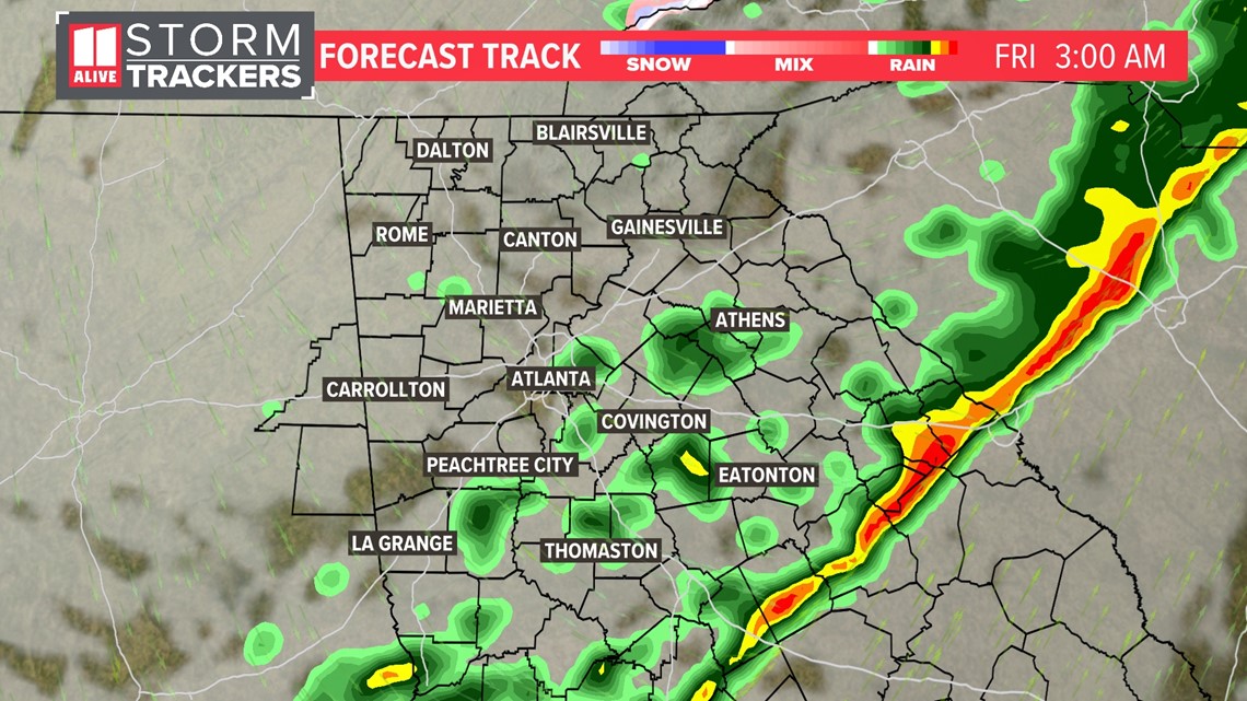
Clouds will clear out during the day on Friday. We'll be soaking up sunshine once again by Friday afternoon!
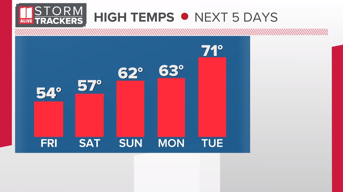
Temperatures will plummet behind Thursday night's cold front. Highs will fall from the low 70s Thursday to the mid 50s on Friday. Overnight lows will be near freezing both Saturday and Sunday mornings.

Download the FREE app now in the iTunes store or on Google Play.
POWER OUTAGES CHECK | Georgia Power customers, check here. Georgia EMC customers check here.

