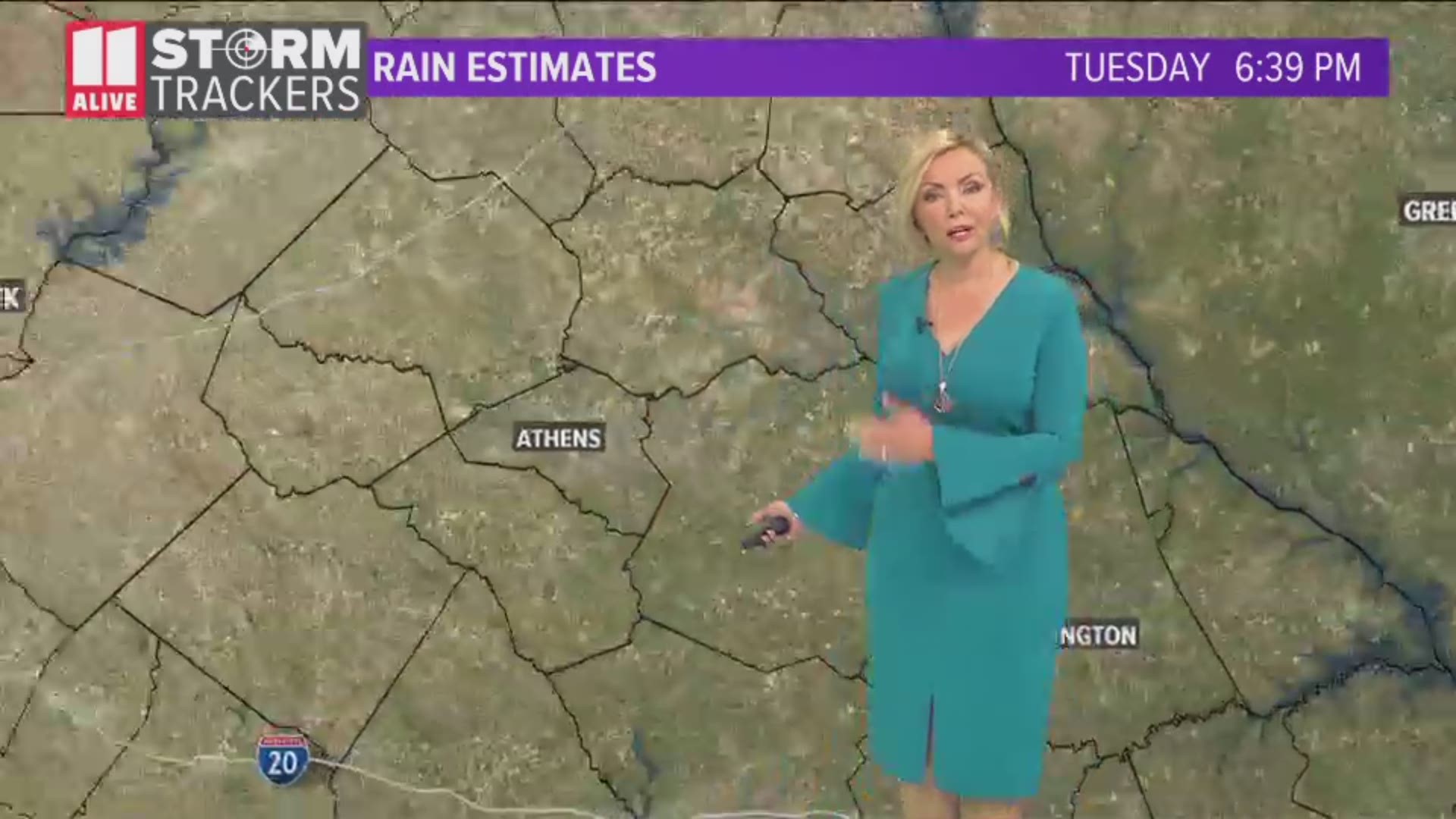
ATLANTA — Strong to severe storms are possible across much of the region on Tuesday, thanks to a widespread area of instability moving across the southeastern states, according to 11Alive meteorologist Chesley McNeil.
As a result, the National Weather Service Storm Prediction Center has placed all of north and central Georgia under a Marginal Risk category for severe weather for Tuesday afternoon and evening.
Energy from the storm system has already produced strong storms in parts of Mississippi and Louisiana Tuesday morning, ahead of what we may experience later in the day.

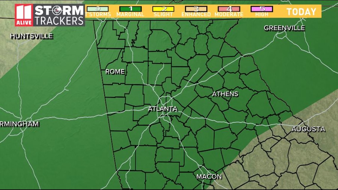
Widespread storms are expected to increase through the afternoon and into the evening hours across much of the north Georgia area.
Chesley says the region should experience showers and storms through the remainder of the week.
Primary weather threat
The primary threat from any showers and storms that develop include damaging wind gusts in excess of 65 mph, torrential rainfall amounts and vivid lightning.
Flash flooding in the area of individual storm cells cannot be ruled out, although those events will not be widespread across the region.
Tuesday afternoon

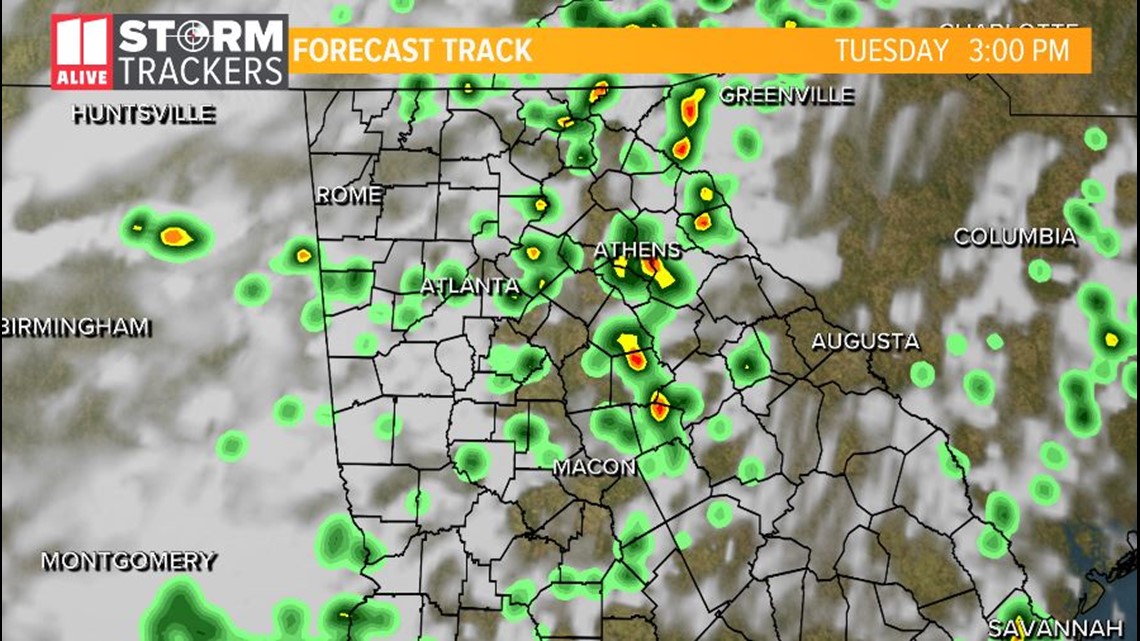
By 3 p.m., scattered showers and thunderstorms will be developing and increasing in coverage across the region. Some storms may reach severe limits.

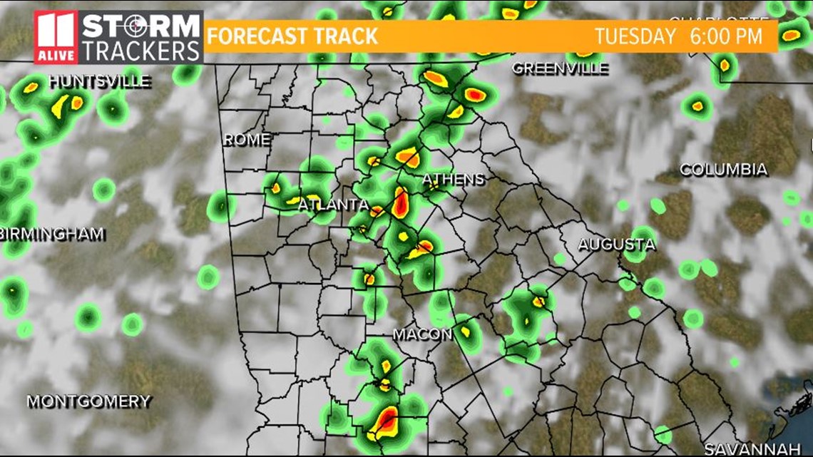
By 6 p.m., scattered storms will increase in coverage across north and central Georgia.
Tuesday evening

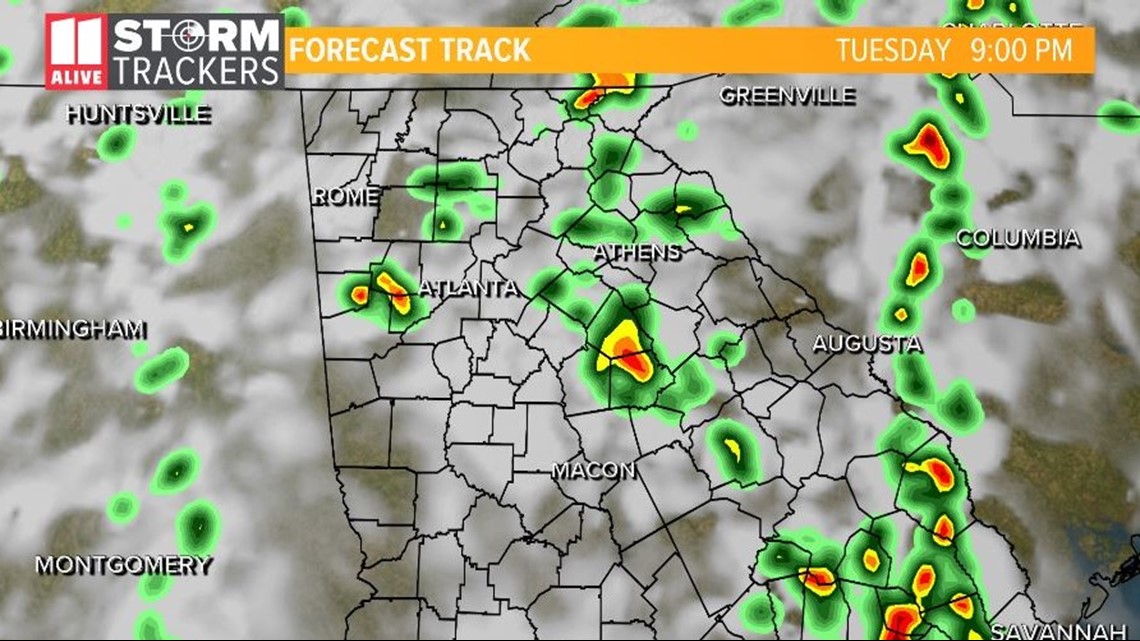
By 9 p.m., many of the showers and thunderstorms will begin to die out as the heading of the day recedes. Additional showers and thunderstorms can be expected on Wednesday and Thursday.
Stay with the 11Alive Storm Trackers throughout the day for any additional updated weather advisories or any weather warnings.
POWER OUTAGES CHECK | Georgia Power customers, check here. Georgia EMC customers check here.
Have a news tip? Email news@11alive.com, visit our Facebook page or Twitter feed.

