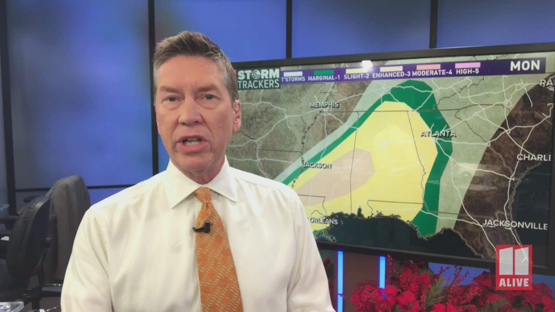
ATLANTA — We are tracking strong storms that will move into Georgia late Monday night and into the early morning hours of Tuesday.
Parts of Georgia have been placed under a Level 1 (marginal) of 5 risk area for severe weather late tonight and early Tuesday. Some areas are under an increased Level 2 (slight) risk.

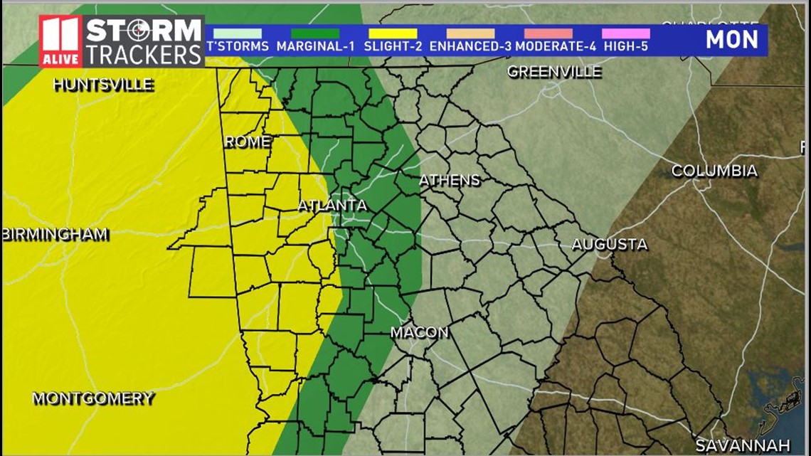
The primary threat for Georgia includes strong to damaging and heavy rainfall. The possibility of a spin-up tornado cannot be ruled out with this storm system.
Viewers are strongly advised to make certain that their mobile devices are charged and that they have a means of receiving weather warning alerts during the overnight hours and early Tuesday morning.
Overnight storms are among the most dangerous, as they can strike with little or no warning -- usually while residents are asleep. A weather radio or weather app with an audible warning can provide the minutes needed to rouse sleeping residents, giving them time enough to get into a safe location.
Here's the timeline on when we expect the strong to severe weather to move through north Georgia:
Late tonight
Strong to severe storms are expected to enter far northwest Georgia starting between 11 p.m. and Midnight.

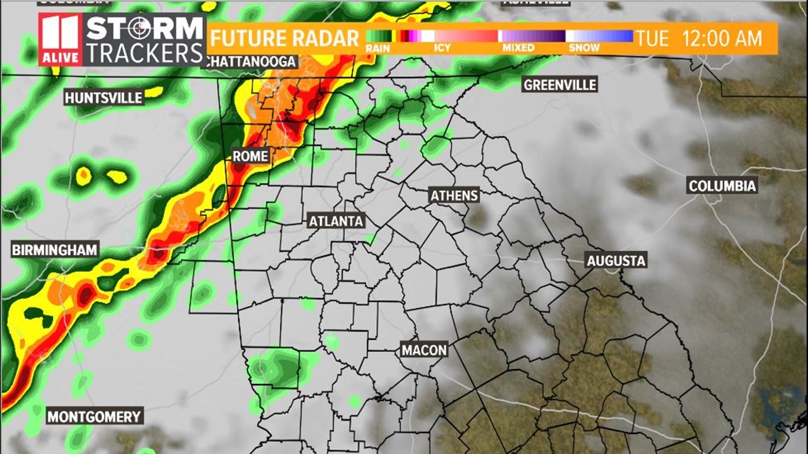
These storms are likely to have strong, gusty winds, heavy rainfall amounts and frequent lightning. The possibility of a spin-up tornado is not out the question.
Make sure you have a way to get warnings if they are issued -- whether through a weather radio or an app like the 11Alive News app, available from the Apple App Store or the Google Play Store.
Early Tuesday Morning

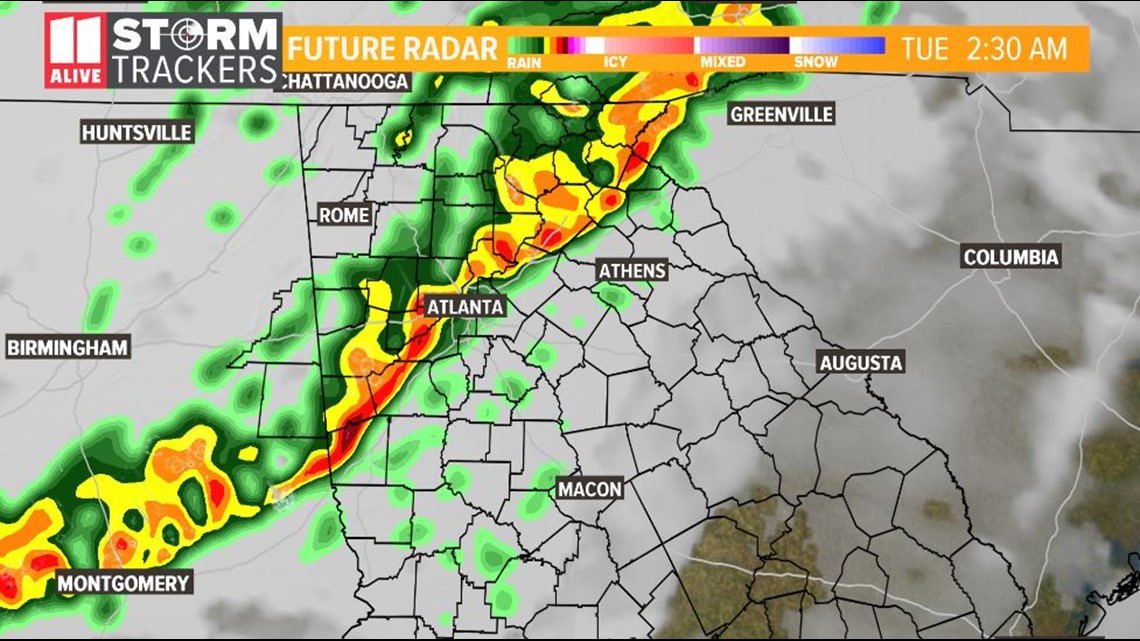
The storms are expected to continue to move across the state, making their way into the far northwestern suburbs between 1 and 3 a.m.
Between 2 and 3am., the strong storms are expected to move into metro Atlanta, with a cold front itself moving across the region by about 6 a.m.

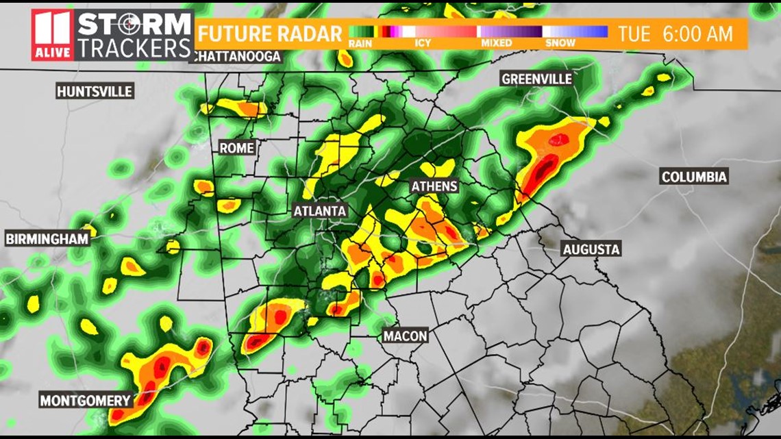
Tuesday Afternoon
After the front moves past, the strong to severe storms will move well east of our area, and drier air will begin to work in.

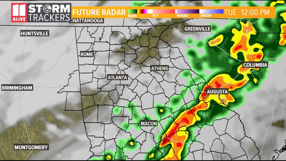
Northwesterly winds are expected to pick up, with wind gusts up to 15 mph with higher gust, as temperatures begin to fall through the day.
By Tuesday night the low is expected to bottom out in the low-to-mid 30s.
Wednesday
Sunny skies should return on Wednesday with a high in the mid-to-upper 40s.
Stay with the 11Alive StormTrackers as this storm system moves through the region for any weather-related watches, warnings or advisories.
► POWER OUTAGES CHECK | Georgia Power customers, check here. Georgia EMC customers check here.
► Have a news tip? Email news@11alive.com, visit our Facebook page or Twitter feed.
RELATED HEADLINES |

