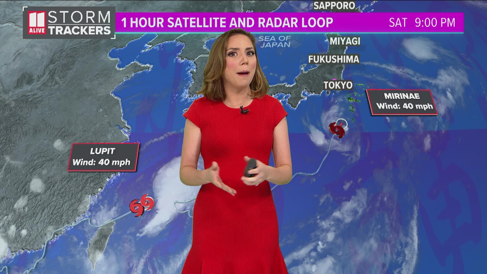
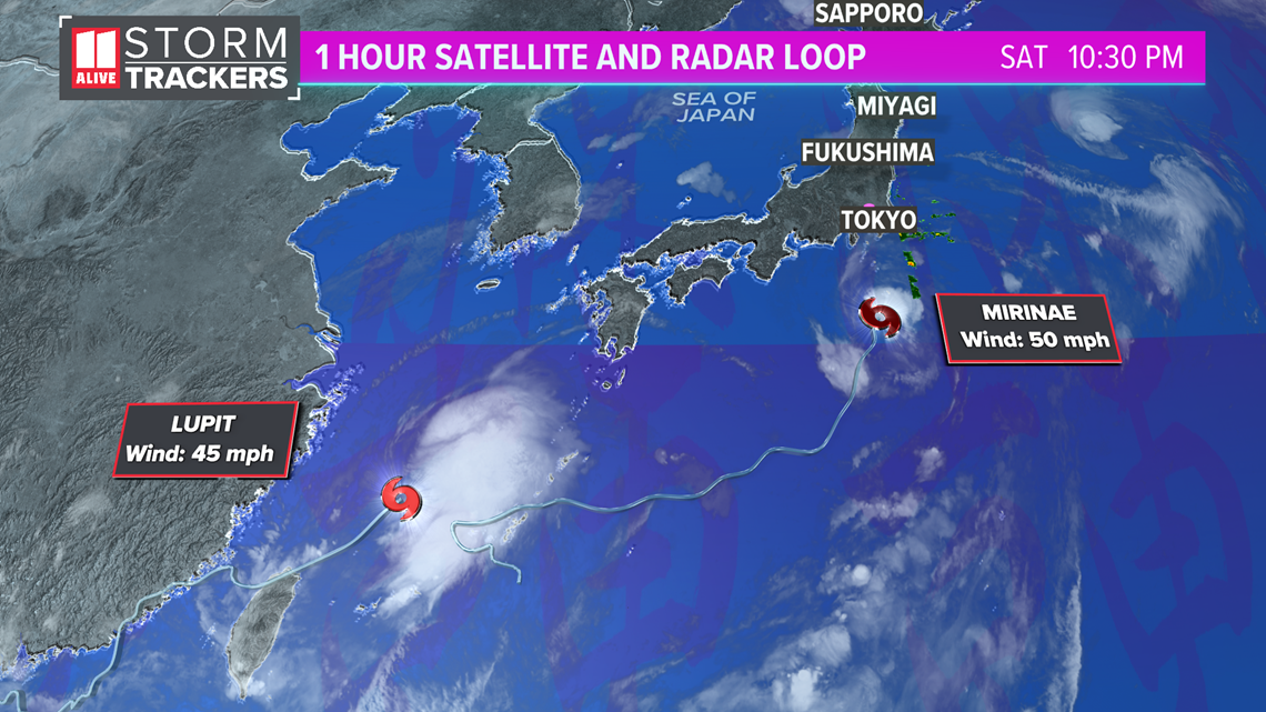
As the final days of the Olympics come to a close, we are tracking two tropical systems that could bring a combination of rain and gusty winds to Tokyo.
The first of which, Tropical Storm Mirinae, will track just east of Tokyo through early Sunday. The second, Tropical Storm Lupit, will track west of Tokyo on Monday.

The forecast track from the Japanese Meteorology Agency, the official weather forecast agency for the Olympics, has the center of the storm remaining several hundred kilometers offshore as it passes by Tokyo on Sunday.

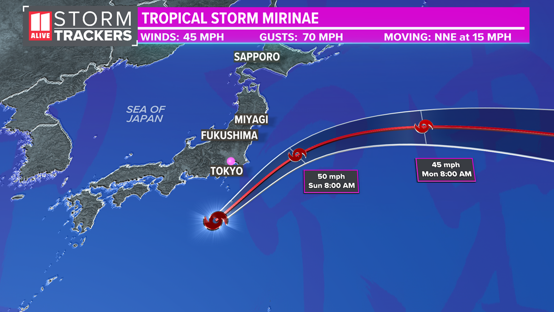
Gusty showers and heavy downpours are possible through Sunday mid-day local time, with them tapering off later in the day. The forecast max sustained winds for the storm are 50 miles per hour, which would remain offshore closer to the center. Max wind gusts in Tokyo likely won't top more than 35 miles per hour.
Here's the European Model showing the storm passing by to the east early Sunday.

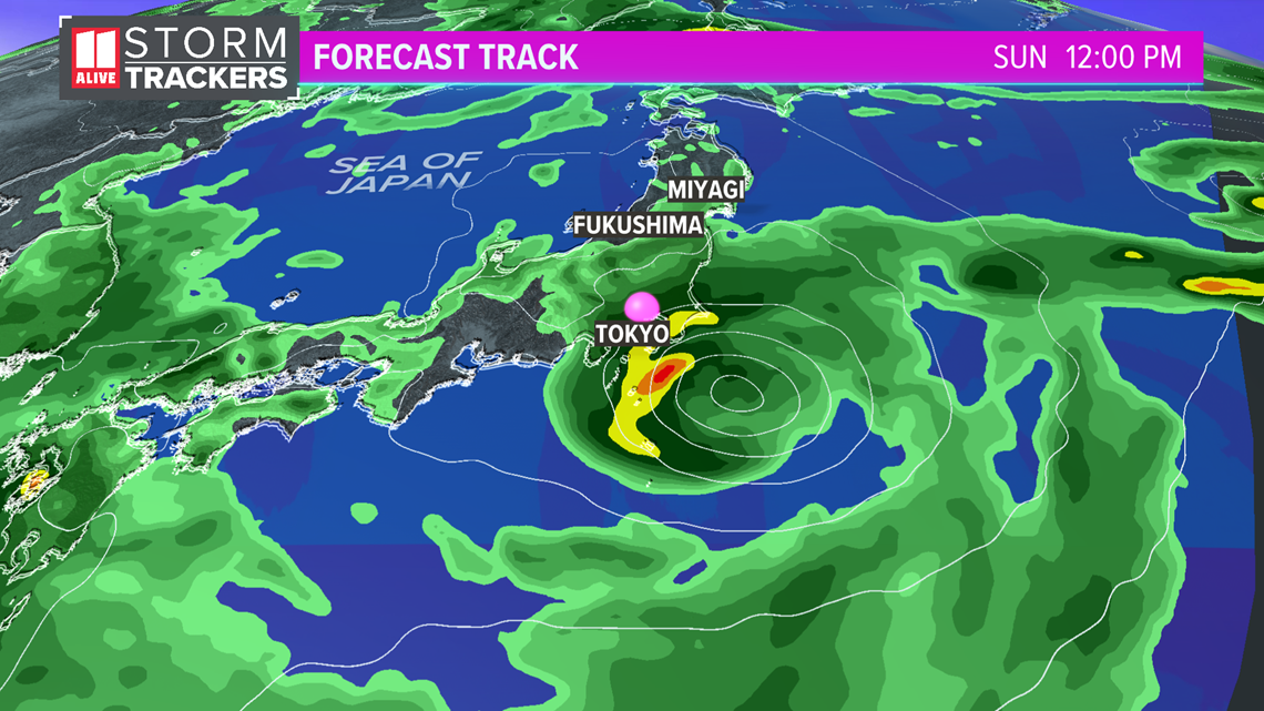
This could play an impact to what you see live on tv Saturday night in the U.S., which is Sunday morning Tokyo time.
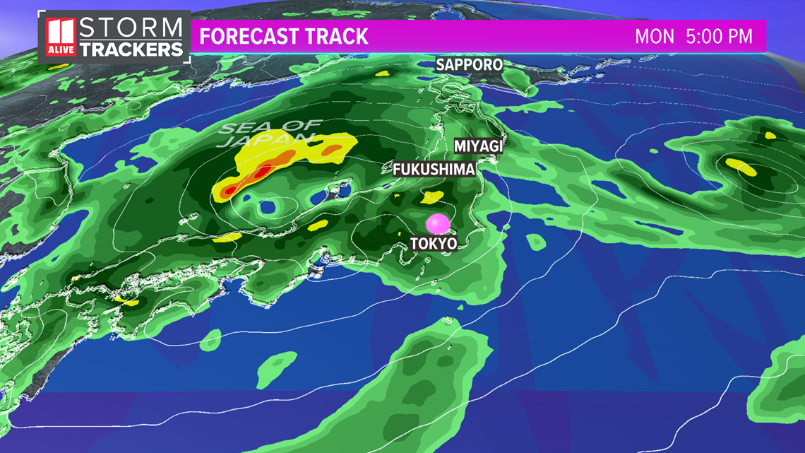
The next storm, Tropical Storm Lupit, is forecast to track over the western side of the island and the Sea of Japan on Monday. Although the closing ceremony will already be complete, periods of heavy rain and gusty winds may be a factor Monday. The gusty winds remain through Tuesday behind the departing storm.

Japan is no stranger to tropical systems. Just like we have hurricanes in the Atlantic, in the western Pacific northern Hemisphere the tropical cyclones are called Typhoons when they reach the same wind threshold.
Earlier in the Tokyo Olympic games, Tropical Storm Nepartak brought gusty, rainy conditions to Japan's main island as well.

