So long, Emily. We hardly knew you.
But really: Emily quickly developed from a mess of showers and thunderstorms to a more organized tropical cyclone in a matter of hours Monday, July 31, and a day later, it's gone.
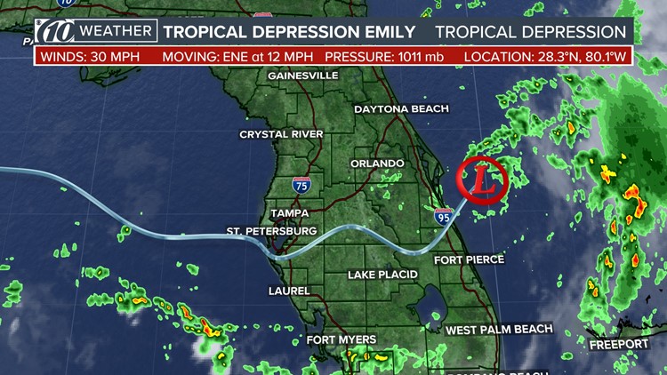
Tropical Depression Emily is moving away from Florida's east coast, according to the 11 a.m. Tuesday, Aug. 1, advisory from the National Hurricane Center. The storm is located about 120 miles east-northeast of Cape Canaveral and is moving northeast at 14 mph.
Maximum sustained wind speeds are down to 30 mph, and the minimum central pressure has risen from the early-morning advisory -- meaning it has weakened -- at 1011 mb.
There are no tropical-related watches nor warnings in effect.
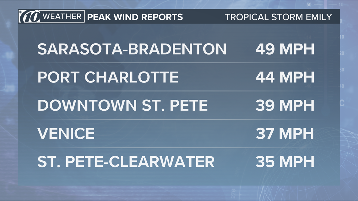
Emily made landfall at 10:45 a.m. Monday on Anna Maria Island. While there was some reported wind damage, wind speeds were contained under 50 mph.


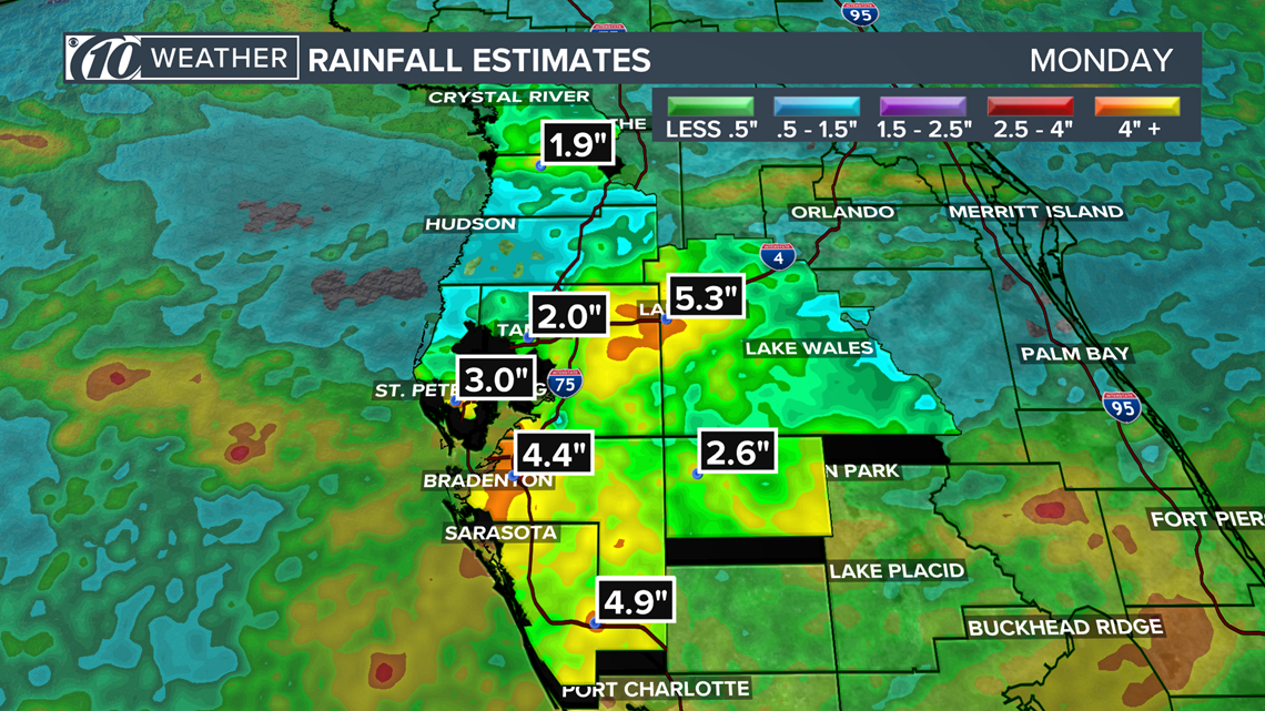
The storm's biggest punch, however, came in the form of heavy rain.
Here's a rundown of the area's highest rainfall totals from Emily, compiled by the National Weather Service in Ruskin:
-Valrico: 8.19 inches
-Plant City: 6.4
-St. Petersburg: 5:88
-Treasure Island: 4.82
-Gulfport: 4.5
-Zephyrhills: 3.85
-South Sarasota: 3.25
-Pinellas Park: 2.85
-Tampa: 2.56
-Clearwater: 2.32
-Citrus Park: 1.57
-Largo: 1.07


Drier and calmer conditions are in store Tuesday across Tampa Bay in Emily's wake. The typical summertime pattern of on-and-off showers and thunderstorms again will develop, with an increase in precipitation chances later in the evening and Wednesday.
►Make it easy to keep up-to-date with more stories like this. Download the 10 News app now.
Have a news tip? Email desk@wtsp.com,visit our Facebook page or Twitter feed.


