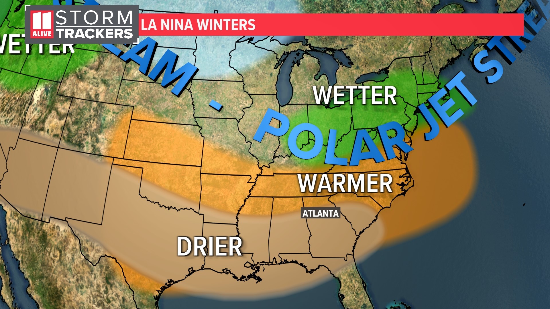
ATLANTA — We've had back-to-back years of La Niña weather patterns in the winter, which is expected to drive drier and warmer conditions in north Georgia this year.
The National Oceanic and Atmospheric Administration (NOAA) released its winter outlook for the 2022-2023 season on Thursday morning.
This forecast is bad news if you are someone who loves cold weather and snow. Here’s what this upcoming winter may hold for Atlanta and North Georgia:
El Niño-Southern Oscillation (ENSO): The Driver of the Winter Outlook
This winter's outlook is based on the forecast of a La Niña. La Niña, which translates from Spanish as “little girl,” it is not a storm. It's part of a climate pattern called the El Niño-Southern Oscillation, or ENSO for short. It occurs with the changes of currents in the equatorial Pacific Ocean and drives seasonal weather trends around the globe. ENSO not only impacts trends for the winter months but also plays a role in hurricane season in the Atlantic Basin.
When the ocean surface water temperatures are below normal, we call it a “La Niña." On the flip side, when water in that region is above normal temperatures, it is referred to as an "El Niño." The neutral phase of this back-and-forth seesaw is called a "La Nada."
La Niña is forecast to continue this fall and is predicted to last at least into the beginning of the winter months. We had a La Niña the last two winters, so this one is called a “triple-dip” La Nina.

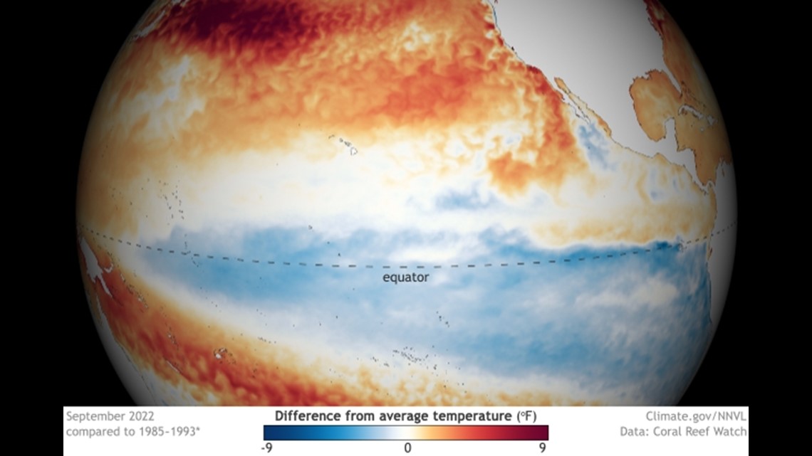
This is the third winter in a row we are having a La Niña, and this has only happened twice before. It occurred once in the early to mid-1970s, from the winter of 1973-1974 to the winter of 1975-1976. It happened again from 1998-1999 to 2000-2001 winter.
NOAA forecasters said one of these triple-dip scenarios finished with a much stronger La Niña while another finished with a much weaker La Niña. The rarity of this happening makes it hard to draw conclusions on if a third La Niña in a row could mean anything significant.
Why does the phase of ENSO matter? The ocean surface temperatures can affect the position of the jet stream, storm tracks and areas of high and low pressure. In essence: it can influence who has a wet versus dry and mild versus cold winter.

ENSO isn't the only player in weather trends; it's just the clearest basis for what an upcoming winter may hold. Other atmospheric patterns can contribute to cold air intrusions, but they aren't something we can look at several months out. These other patterns may only allow us to look weeks out.
What Does It Mean: Temps and Snowfall
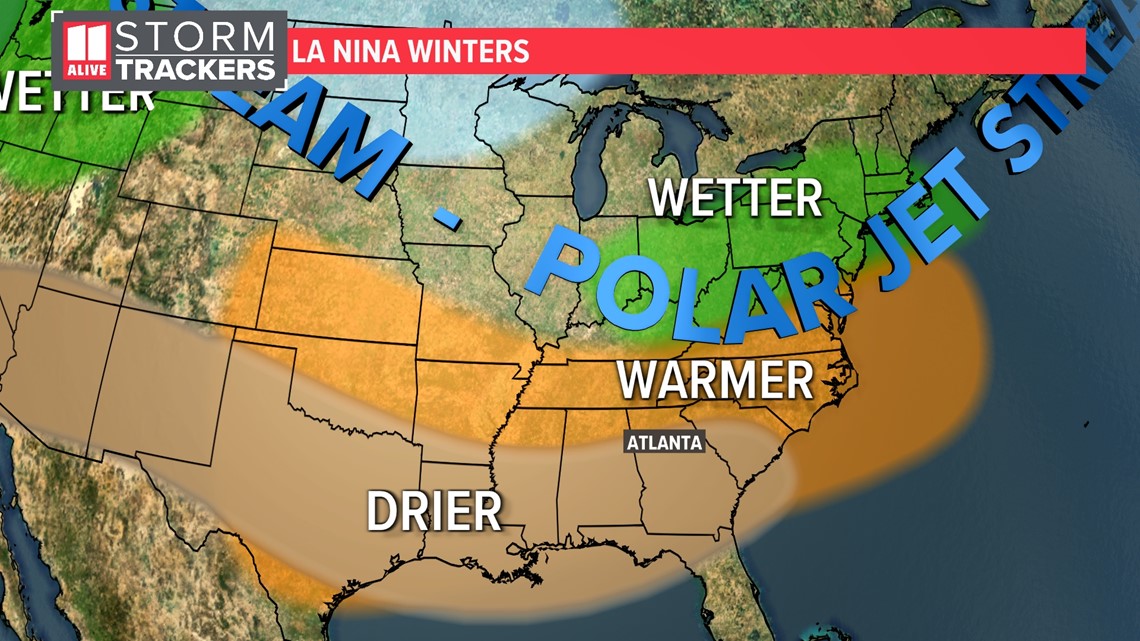
In La Niña winters, the jet stream is farther north. This keeps the active storm tracks also north of our area.
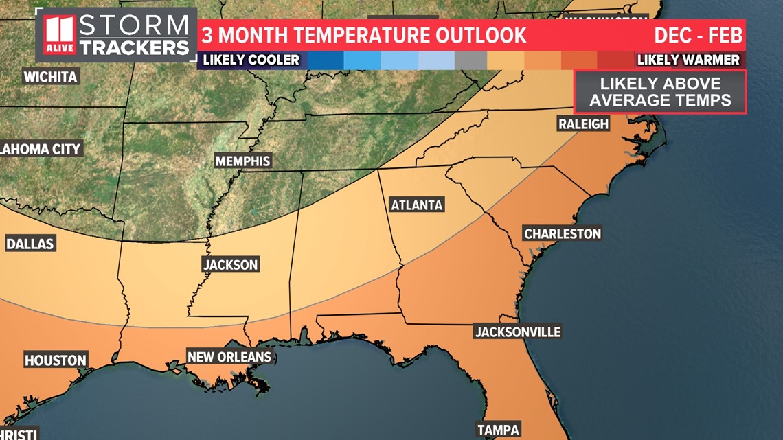
For Georgia, this means we typically see above-average temperatures. The 3-month outlook for December, January and February reflect this. NOAA predicts slightly better than average chances of a warmer-than-normal winter.

For precipitation, we often end up near or below average. This year, NOAA's outlook shows that precipitation may end up below normal.
With this setup, they add that the drought could expand or worsen over the winter months.

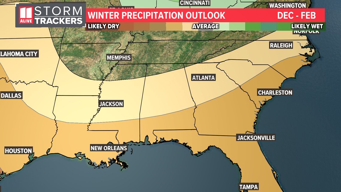
Does this mean we will not see any snow? Not necessarily, but the odds overall are not in our favor.
Digging through the top 10 winters of snowfall for the Atlanta area, only one of them since 1950 was during a La Niña winter. That just so happens to be the year of the January 2011 "Snowmaggedon."
La Niña in 2020 resulted in just a trace of snow. A snow drought persisted for three years but was broken last this past season when we finally recorded measurable snow in January 2022. Atlanta averages 2.2 inches of snow yearly, but we haven't had that much since 2018.
Two main storm setups can give us a winter mess in the capital of the Peach State. Often, the struggle is that we're too warm.
Many of our biggest winter storms, like the Blizzard of '93 or Storm of the Century, originate in the northeastern Gulf of Mexico. The deep moisture plume tracks into Georgia as cold air meets up from the north with an Arctic front. If we get a 'Goldilocks and the Three Bears' situation, Atlanta can get hit with some decent snow.
Our ice storm set-ups originate from cold air damming or the wedge. Cold and dry air is nestled up against the mountains and into northeast Georgia at the surface, and moisture overruns it. This leads to ice rather than snow.
In a La Niña winter, we can also get an early start to severe weather season. This is because of the higher-positioned storm tracks place Atlanta in the warm and unstable air. During last year's La Niña, we had severe weather and tornadoes in late December. During the 2020 La Niña winter, we had severe weather and tornadoes on New Year’s Day.
MORE FROM THE 11ALIVE STORMTRACKERS
DOWNLOAD THE 11ALIVE APP:
- Download the app on your Apple or Android device.
- Set up weather notifications by clicking the Gear icon in the upper right corner of the app. Select Notification -> Notification Settings -> Severe Weather Alerts -> Toggle the Severe Weather Alerts button to the right to turn alerts on.
- Send photos and videos through the app by selecting the Near Me feature on the bottom right taskbar of the app and entering your information.
TEXT YOUR WEATHER PHOTOS TO US: 404-885-7600
JOIN THE 11ALIVE STORMTRACKERS FACEBOOK GROUP: Nearly 10,000 metro Atlanta and north Georgia weather enthusiasts share their weather photos daily. Click here to join the group!

