Many folks ask the difference between some of the precipitation types we talk about on the air. The most common types that folks sometimes confuse are sleet, freezing rain and hail. Here's a look at the specifics of each precip type.
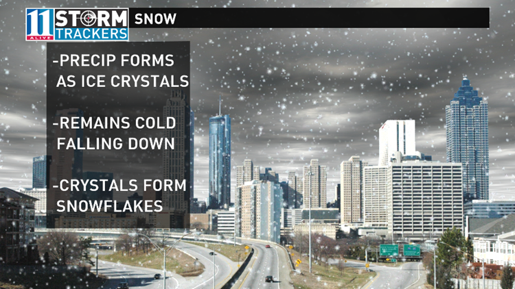
Snow -- Snow is the easy one. It is precip that forms in the upper levels in the form of ice crystals. One the way down to the ground, the column of air remains cold. Those ice crystals collide and become snowflakes. That precip falls as snow all the way down to the ground.
Sleet -- Sleet begins as ice crystals in cold air aloft. On the way down, it hits warmer air. Those ice crystals melt and become a raindrop. As that raindrop continues to fall, it hits another cold layer of air well above the surface. It forms into an ice pellet or sleet in the air while it's falling. Sleet usually bounces when it hits the ground or the hood of your car or your windshield. Mainly people confuse sleet with hail. Hail forms in a thunderstorm. That's when a rain drop gets caught up in an updraft in a storm. It moves up into the cold cloud tops and freezes. It may go up and down numerous times in that up and downdraft forming a larger chunk of ice. That eventually makes it to the ground as a hail stone.
Freezing rain -- Freezing rain is just that...rain that freezes. It starts as ice crystals in the upper atmosphere, hits a warm layer and becomes a raindrop. It continues falling through the air as a liquid. That raindrop doesn't freeze until it hits a surface that is at or below freezing. It doesn't freeze until it hits something. It forms a glaze or layer of ice on roads, tree branches, decks or powerlines.
Feel free to share this with your friends if you think it would help them answer any questions about precip types!


