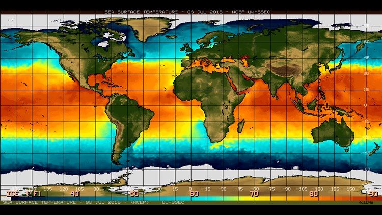
The Climate Prediction Center has confirmed this week that El Nino is continuing to strengthen. El Nino occurs when the sea surface temperatures warm above average in the equatorial Pacific.
The increased heat and humidity of the Pacific Ocean resulting from El Niño events cause worldwide disruptions in weather and climate patterns. This global pattern change often results in active subtropical jet stream which can mean a wetter pattern for our winter and spring. Should these wet episodes coincide with a plunge in the polar jet stream and cold air is imported into our state we could see an increase in winter weather episodes. The latest Climate Prediction Center report this week is giving us an 95% chance that El Nino could effect our weather through the winter months and will likely decrease in intensity through spring of 2016. This years El Nino is looking very similar to record breaking 1997 pattern. That winter we received almost 20" of precipitation in just three months.
It is also important to note that following spring of '98 was an incredibly active severe weather season is North Georgia with many destructive severe weather outbreaks. We are going to monitor this pattern carefully and bring you regular updates on El Nino's on North Georgia and the Atlanta area so stay tuned!
HISTORICAL PHOTOS | El Niño damage
Timeline: El Nino expected in 2015