ATLANTA — North Georgia has experienced a damp pattern over the past few weeks, and that trend is expected to continue into Tuesday afternoon as another round of storms moves through.
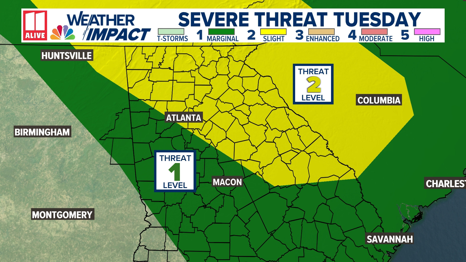
Some storms this afternoon could be strong to severe, with a level two or Slight Risk issued for much of our region, including Atlanta. Those not under a slight risk in north Georgia have a Marginal risk or level one out of five. This means we may have a few storms this afternoon that could produce damaging wind, but the impacts are not expected to be widespread.


Be sure to stay weather aware this afternoon and into this evening from the storm potential, as heavy rain, strong wind and frequent lightning will all be possible.

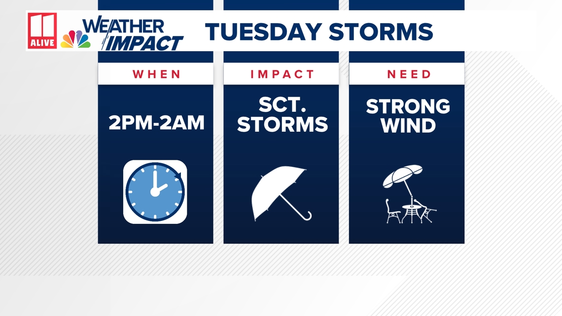
The main threat for storms will not be until late this afternoon and into the evening, but a few pop-up storms could still occur from 2 p.m. to 5 p.m.


The main round of stronger storms will be off to our north at 6:30 p.m. and diving down to our region.


These stronger storms move into far north Georgia around 8:30 p.m. and will continue to move south.


By 10 p.m., these storms will be moving into northern portions of the Atlanta metro like Cherokee, Forsyth, Hall and Gwinnett counties. These storms could have strong wind and heavy rainfall.


Storms will still be fairly strong as they arrive in Atlanta with heavy rain possible around 11:30 p.m. Be sure to have your phones charged as we may end up with isolated power outages due to these storms.


Storms end up south of the city and will be weakening around 1 a.m., but still could have strong wind and heavy rain with them.


We will quiet down with just a few lingering showers by 2:30 a.m. and get to start off Wednesday's rush hour with quieter conditions.


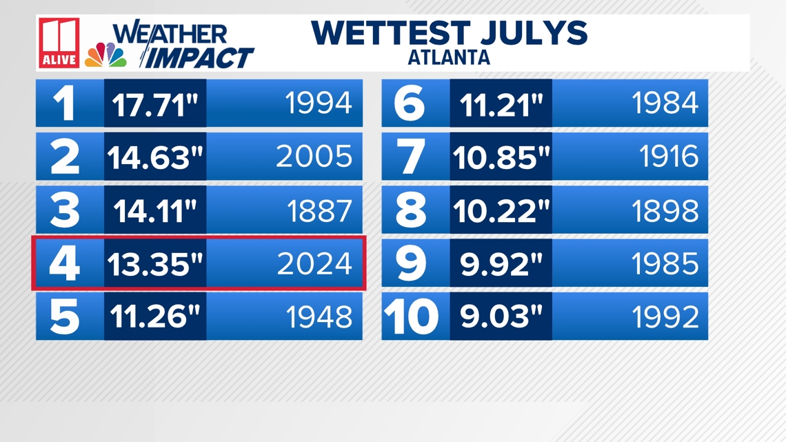
This heavy rain will just continue to add to our rain totals for what has been a very damp July. We are currently at the fourth wettest July on record in Atlanta.

