ATLANTA — The unofficial finish to summer will feel nothing like fall in north Georgia and the metro Atlanta area!
The 11 Alive Weather Impact team is tracking more heat and humidity, along with a daily chance of showers and thunderstorms.
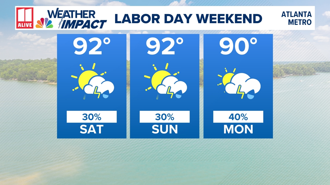
After reaching record temperatures midweek, high temperatures will be a couple of degrees cooler this weekend. But low 90s are still in the forecast through Monday. Heat index values will climb into the mid-90s each day.
The high humidity will fuel a daily chance for pop-up showers and thunderstorms across north Georgia. These will most likely develop after the lunch hour each day and increase in coverage as each afternoon wears on. Around sunset, a shower or storm may still be lingering. But the later each evening we go, the showers and storms should start to wane.
For outdoor activities, the 'big picture' rain chance is not high enough to cancel plans altogether, but you will want to consider the daily storm chance.

Planning for our Labor Day Weekend Weather Impacts:
- Take breaks to hydrate and cool off in the shade or air conditioning
- When spending long days outside, know where to go if you see lightning or hear thunder
- Storms shouldn't last for hours straight at a given location but have a place of shelter you can go to for an hour or so while storms pass by.
Rain chances by day
The coverage of showers and storms through Sunday should remain pretty isolated, with just a 30% chance of rain. That doesn't mean you won't see rain!
As a front approaches by Monday, the coverage of showers and storms may increase slightly. We have a rain chance of 40%. The coverage of Labor Day's showers and storms will be widely scattered.
Strong Storm Potential
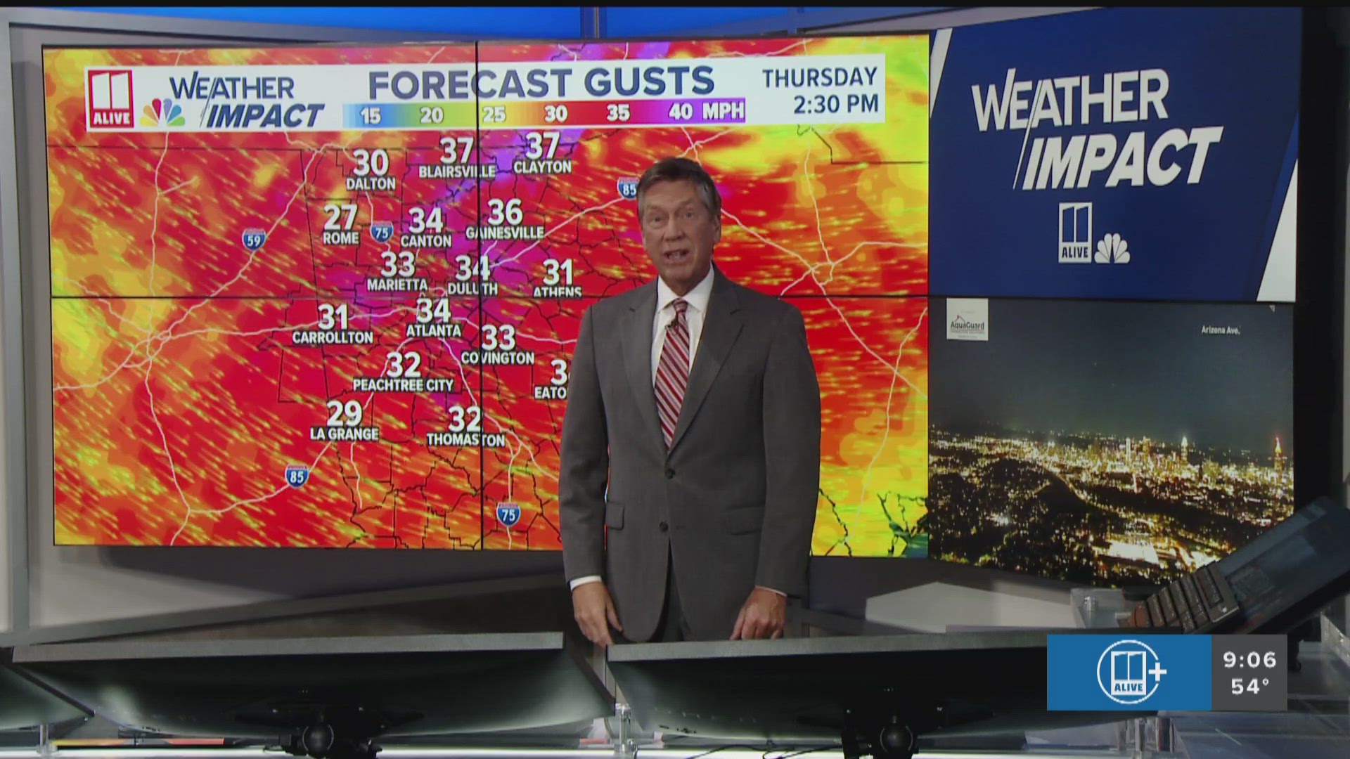
Though an organized widespread severe weather threat isn't in the cards for us, storms will still have the potential to turn strong to severe.
On Friday, northeast Georgia is included in a Level 1 out of 5 threat for severe weather. At a later date, we could also see other days feature low-end severe risks.
Intense thunderstorms could cause locally heavy rain, cloud-to-ground lightning and damaging winds. The hail threat is low but could also become a factor in the strongest of storms like we saw Thursday evening.