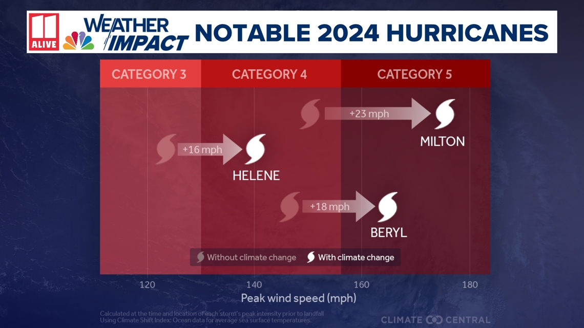
ATLANTA — Climate change increased wind speeds for every 2024 Atlantic Hurricane, according to findings from a new report released Wednesday by the non-profit organization Climate Central.
For the first time, scientists are able to quantify how the human contribution of greenhouse gases can impact the strength of recent hurricanes.
Climate scientist and paper author Dr. Daniel Guilford explains, "For the first time ever, we can put a number on the extent to which human beings are increasing the intensity of hurricanes because of human-caused ocean warming. We know that the warming temperatures are out there in the Gulf are affecting these hurricanes, and now we can say with strong confidence that we are responsible for increasing the intensity of storms that are affecting our communities."
In the 2024 analysis, the hurricane wind speeds, on average, were 18 miles per hour higher than if the storms had happened 100 years ago. Every storm had a wind speed increase, but the intensity varied between 9 and 28 miles per hour due to the warming sea surface temperatures -- also called SSTs.
Hurricane Helene's maximum winds were 16 miles per hour higher than if the storm had happened before the Industrial Revolution. Other storms were much higher.
"Hurricane Rafael, while it was a Category 3 storm, would have actually been a Category 1 storm without human-caused climate change influencing the sea surface temperatures that it experienced," added Dr. Guilford.
Milton also had an impressive wind speed difference with versus without the presence of warmer SSTs. The estimated wind increase was 23 miles per hour - meaning without the presence of climate change, this would have been a Category 4 storm, not a Category 5.
This new report is based on an October paper that looks at Atlantic Hurricanes between 2019 and 2023. It also showed a similar pattern, where storms are about one category higher than they would have been if the storm had occurred a century ago.


What is the science?
Climate scientists have examined the aspects of sea surface temperatures. Tropical cyclones get their energy from the latent heat as water vapor evaporates and then condenses into liquid in the storm clouds.
"We want to use multiple lines of evidence to either agree or disagree that climate change is influencing these storms. So, in order to have those multiple lines of evidence, we've used both observations and models. With observations, we can look at what temperatures were like about 100 years ago and see before the influences of humans on climate change, from climate change on the temperature. How much colder were they?" added Guilford.
They then used climate models with and without greenhouse gas contributions to examine what sea surface temperatures would have been without carbon dioxide emissions.
"When we put these two independent lines of evidence together, we showed that both of in a world without climate change would have been quite a bit colder, sometimes up to 3° F colder because we have emitted greenhouse gasses; we now have that extra 3° F that we're dealing with," Guilford explained. "And when these hurricanes roll over and along, say, the Gulf of Mexico, they see that extra heat and that allows them to bump up in their intensity."
Climate change made elevated sea surface temperatures in the tracks of the 2024 hurricanes up to 800 times more likely, according to the report.
Warmer temperatures can contribute to stronger storm and hurricane intensification. Tropical systems get their energy from warm ocean waters. They act like a steam engine, gaining energy and strength from latent heat.
SSTs around 80 degrees are warm enough to support tropical development. SSTs above 85 become much more favorable for strengthening. More frequently, we are seeing tropical systems pass over even warmer waters, like a bathtub. This adds more fuel to the fire and more potential energy for the storm.
A stronger storm = more damage potential
Stronger storms cause more damage. Although this study doesn't look at wind shear, the presence of dry versus moist air, and the speed of the storms - scientists have made a direct link between wind speeds and damage.
"A while ago, there was a study that looked at how the damages of a storm relate to how intense a storm is, and we find that the sort of rate of damage increases with storm intensity. So a more intense storm, like a Category 5 storm, is generally going to have more intense impacts than Category 4 or Category 3 storms," he stated. "Even along the coastlines in terms of things like storm surge, but also in terms of straight line wind damage or even rotational wind damage in the form of, say, tornadoes."
The study he was referring to showed that every 10% increase in the maximum winds of a landfalling system can increase the damage by 50%.
And this year, the damage from these tropical cyclones has been catastrophic.
Earlier this week, President Biden requested an additional $100 Billion for FEMA to help with long-term support for affected communities.
This Climate Central report and backing research look at water temperatures and don't peer into other factors that influence hurricane intensification, such as wind shear and the influence of dry versus moist air.
Georgia's impacts from recent storms
No climate research has yet delved into where storms will hit more frequently. However, the last decade has come with a high frequency of landfalling tropical system impacts for Georgia.
Will Lanxton, a meteorologist with Georgia's Emergency Management Association (GEMA), acts as a liaison for emergency managers and the state's government as they make critical decisions before and after storms. Lanxton explained how Georgia has been lucky in many ways because the state hasn't had a major coastal strike that would have brought catastrophic surge impact.
"But for South Georgia, they have been very unfortunate for the last several years because these storms that have impacted us have been coming out of the Gulf," Lanxton added. "They've been making landfall in Florida along the panhandle and in the Big Bend area and have been moving up through some of the same areas."
One of those storms, Helene, was possibly the most impactful natural disaster the state has experienced in a very long time.
"We were expecting a statewide impact. What the Governor was saying, and we were really telling our partners that this isn't gonna be one specific area of Georgia. This has the potential to impact all 159 counties," he recalled.
In the days leading up to the storm, they worked tirelessly to make sure every corner of the state was prepared.
"We knew a large area of South Georgia was gonna get a heavy impact, and that happened. But also, the track shifted a bit to the east in the final 24 hours or so. So what we were expecting in metro Atlanta ended up happening closer to Augusta, and they just got devastated."
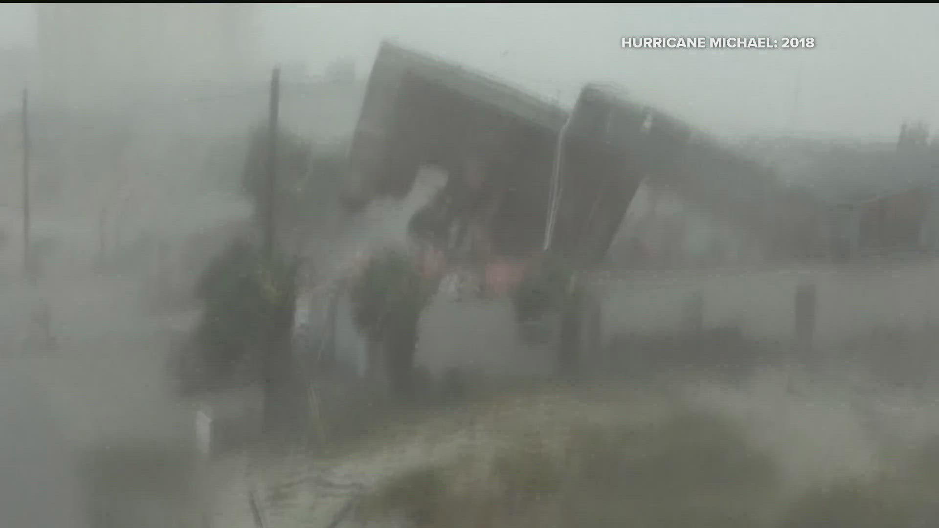
GEMA received over 2,400 resource requests from local counterparts during Helene. The previous record was just over 1,000 for Hurricane Michael in 2018.
GEMA has 161 emergency management agencies in the state of Georgia.
"I think that just goes to show that the impact was so widespread," added Lanxton. "Friday, as soon as the sun was up, as soon as the winds were low enough to where we could safely get people down there, we sent all the resources we could to the Augusta area to South Georgia to try and get the response and recovery started as soon as possible."
Helene was just one of several storms that impacted the state this year. Other storms dropped over a foot of rain in south Georgia also.
"Rafael recently also dropped upwards of 1 ft of rain in Valdosta and some parts that were even impacted by Debbie as well. It was quite an active year for us, obviously high impact, but also with multiple storms, people are still recovering," added Lanxton.
This year's storms came on the heels of some other big, impactful systems for South Georgia in recent years.
"They got impacted very heavily by Michael in 2018 and Idalia last year hit Valdosta very hard. Both of those storms were big agricultural impacts. And then this year we have Helene moving through the same areas bringing hurricane-force winds, widespread agricultural devastation and economic impacts with that," Lanxton said.
Although 2024 was a blockbuster year for GEMA, the agency tirelessly provided resources across the state.
"A lot of folks were tired, but they really did their best. They did great work. I have no doubt that a lot of lives were saved even though we lost a few dozen lives. So just hats off to those agencies," Lanxton said.
Bottom Line: We need to be prepared every hurricane season
Are more storms the new norm for Georgia? Lanxton feels 2024 may be an anomaly or much higher than the norm. However, the trend of more Gulf landfall impacts may not go away for the state.
"I think these Gulf strikes have become a bit more frequent recently, and I think that's probably going to continue just because of how warm the Gulf of Mexico has been in these above-average seasons," Lanxton said. "My advice would just be, no matter where you are in the state, even if you live outside of the coast, have a hurricane plan. What are you going to do if the power is out for a week or two weeks?"
If you are in an evacuation zone along the coast, pay attention to evacuation orders, but even if you are in other parts of the state, listen to your local officials. If they're giving you advice or encouraging you to do something, there's a reason for that. They don't do that lightly. And so you should heed the advice of your local officials.

