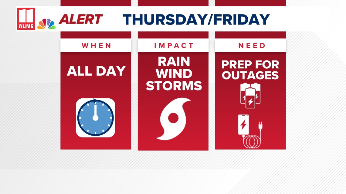
ATLANTA — WHEN: We are issuing a Weather Impact Alert in north Georgia through Friday.
Hurricane Helene will spread heavy rain and strong winds across the state.
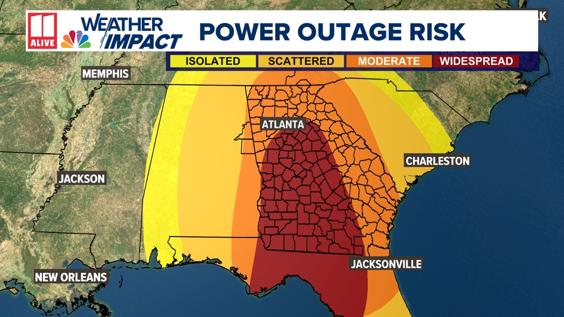
IMPACT: In north Georgia, you need to prepare for significant rainfall. Many spots picked up 2"+ already, and another 3" - 6" is expected. The storm-total rain totals (Wed - Fri) could be over 12 inches in some locations. Dangerous strong winds will lead to downed trees and power lines. Power outages could be widespread, and last for days. A few stronger storms are also possible.
NEED TO DO: In advance of Helene, there are things you can be doing to prepare you home for heavy rain and gusty winds, plus potential power outages. Make sure the water has a path to go: clear leaves and debris away from storm drains, downspouts and gutters. Tie down any loose and light-weight objects that could be picked up by strong winds or bring them inside. Have your phone charged and extra batteries for flashlights, just in case there are power outages.

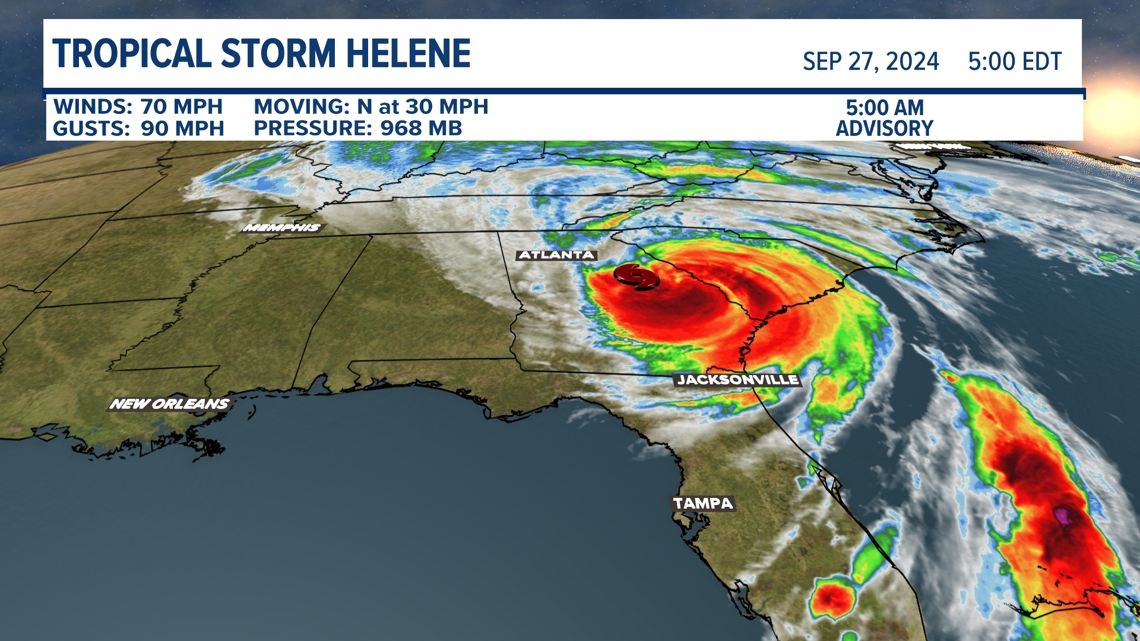
Helene made landfall Thursday at 11:10 p.m. as a Category 4 hurricane in the Florida Big Bend region just east of the mouth of the Aucilla River. It was about 10 miles west-southwest of Perry, Florida. Maxiumum winds at landfall were 140 miles per hour with a minimum pressure of 938 mb.
The storm was downgraded to a tropical storm at 5 a.m. and was located near Macon with max sustained winds of 70 mph.

We expect multi-faceted impacts for north Georgia into Thursday/Friday (Helene). This includes:
- An additional 3 to 6 inches of rain, that could lead to flash flooding
-Increasing wind gusts. Peak gusts in the metro will be 50 to 70 mph. For areas in the hurricane warning, peak gusts could be up to 80 mph.

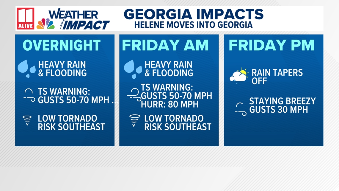
Power outages could be extensive and widespread, especially east of Atlanta.

Rain:
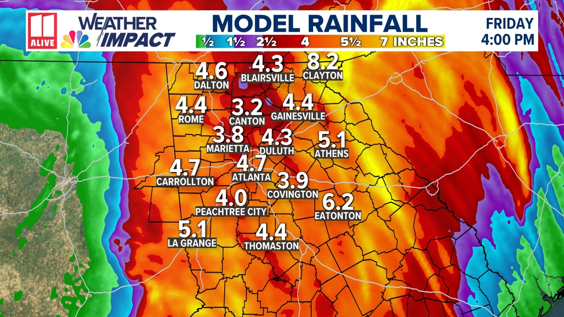
Heavy rain has already fallen across north Georgia ahead of Helene. Many spots picked up 1" - 3" Wednesday (some higher). An additional 3" - 6" will fall in the next 24 hours as Hurricane Helene spreads tropical rain.
Localized higher totals are possible, but pinpointing where the heaviest rain will be is impossible. Be prepared for rounds of heavy, tropical downpours through Friday morning.

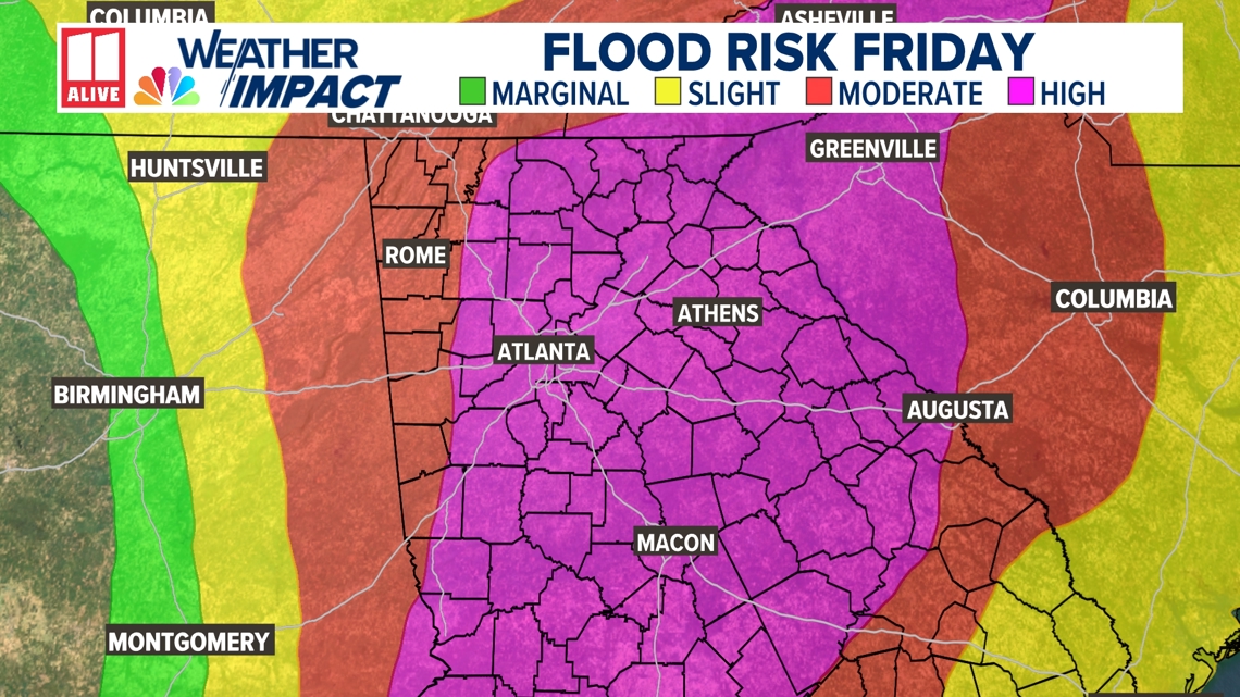
An extremely rare 'High' risk of excessive rainfall and flooding was issued by the Weather Prediction Center for the entire metro area through tonight.

Wind:
We also expect strong wind gusts. Helene may maintain tropical storm or even hurricane strength as it approaches Friday.
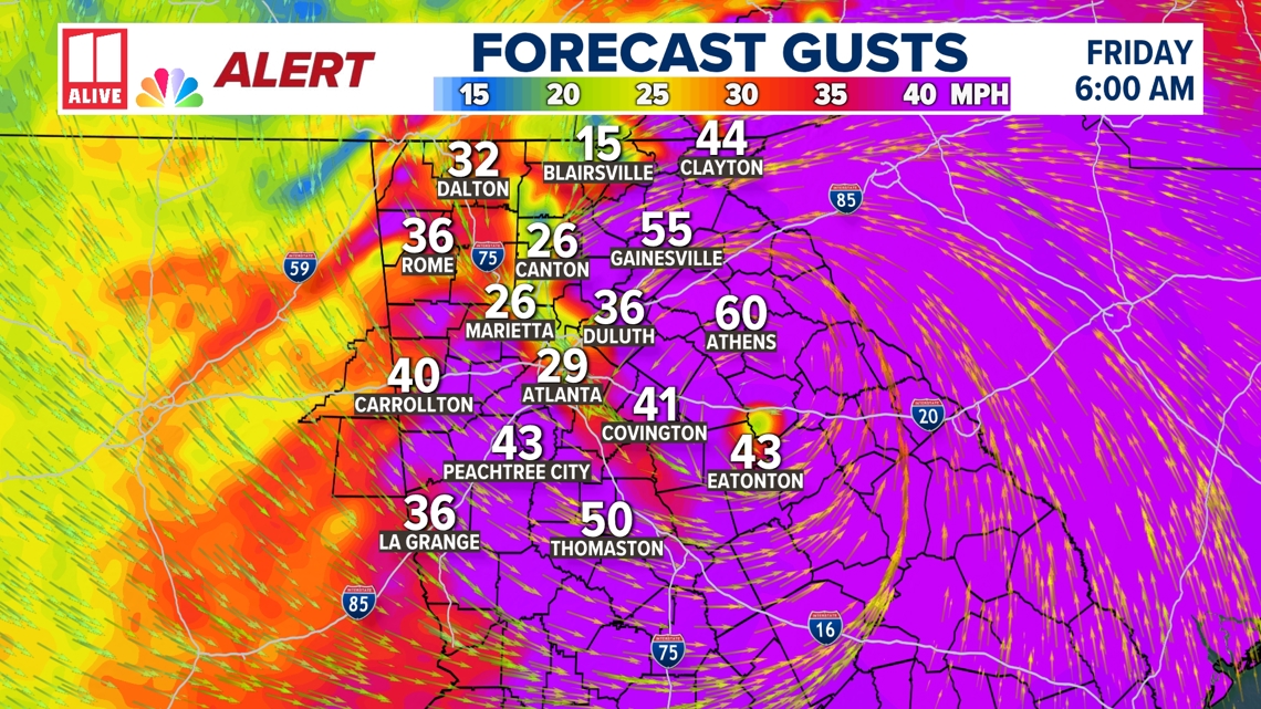
Gusts in the metro could be 50 to 70 mph. Some higher gusts of 80 mph are likely on the east side of the center of circulation. Areas in the Hurricane Warning will see those higher gusts.
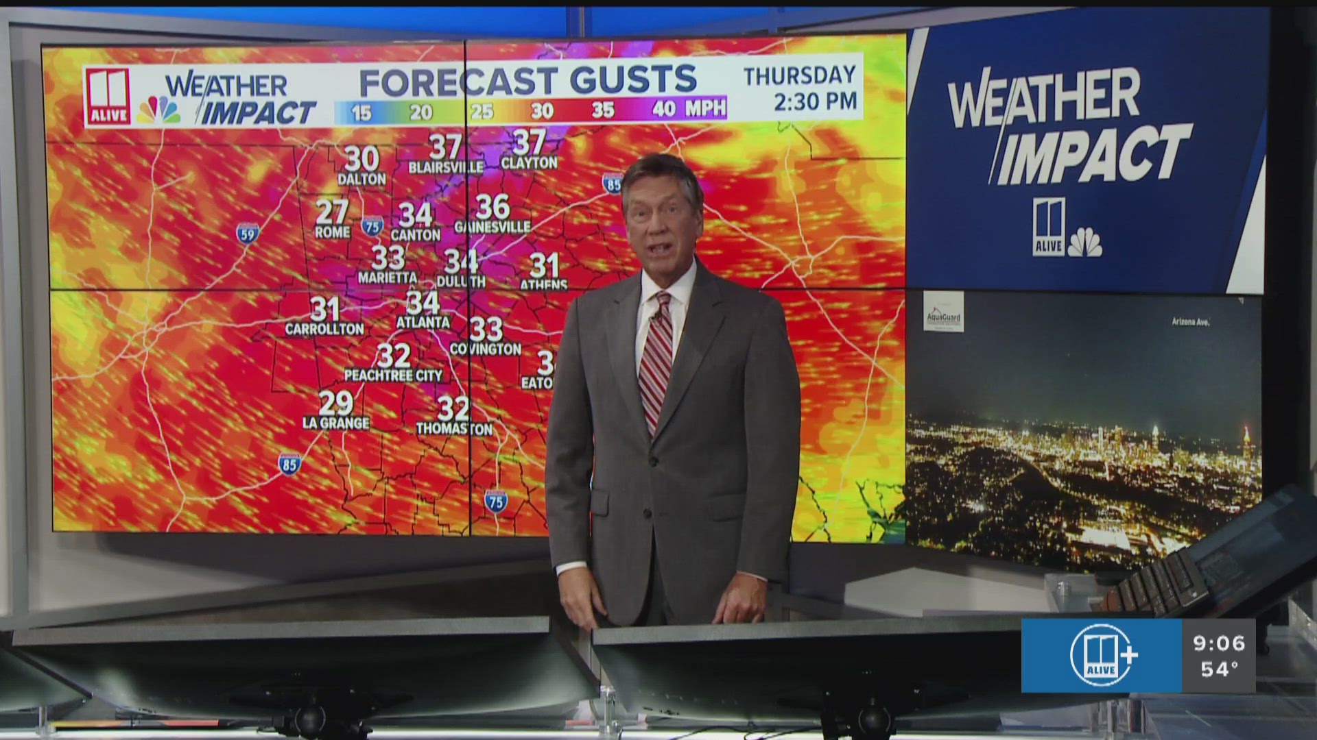
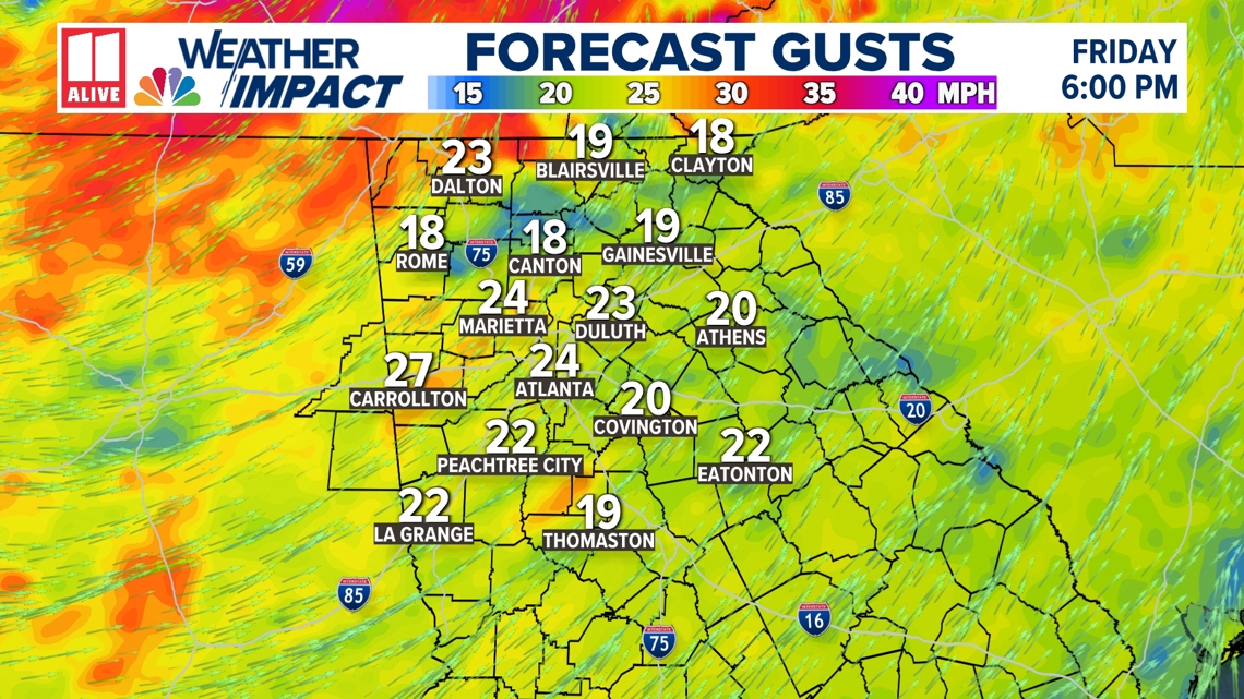
Do not take verbatim what this model below shows. ALL of north Georgia could see gusts around 60 mph for several hours, with isolated gusts around 80 mph. The strongest winds will occur between 3 a.m. and 9 a.m. Friday.

Winds will calm through the day Friday, but they'll remain breezy even after the rain clears.

Severe storms:
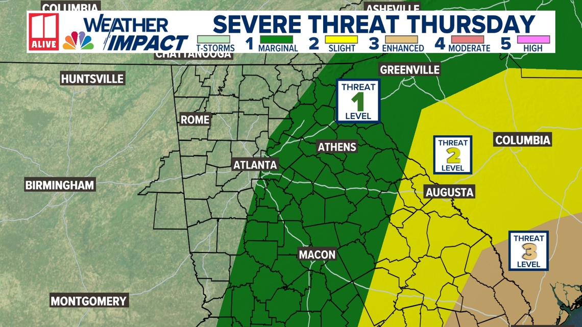
The severe threat overnight remains highest across eastern Georgia. Severe weather and a tornado risk are more prominent east of the center of circulation. Atlanta and points east remain in a Level 1 threat for severe weather.

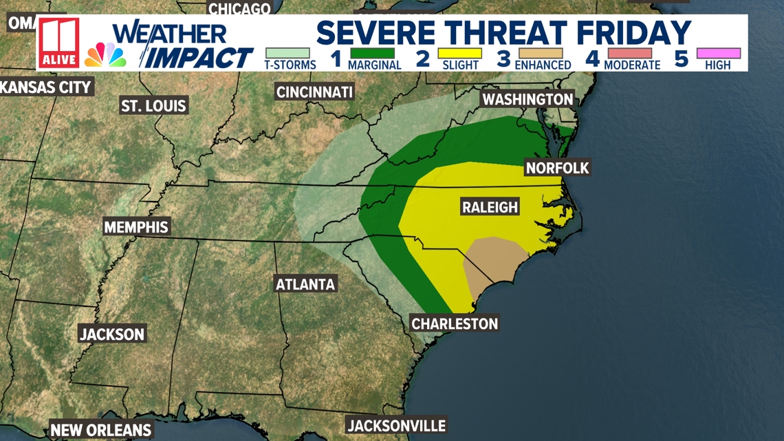
The threat for Friday shifts east into the Carolinas.

Stay with the 11Alive Weather Impact Team for the latest updates on our area.


