ATLANTA — Temperatures this past week have been spring-like and just like what we get in the spring for North Georgia, severe storms will be possible for Wednesday night into Thursday
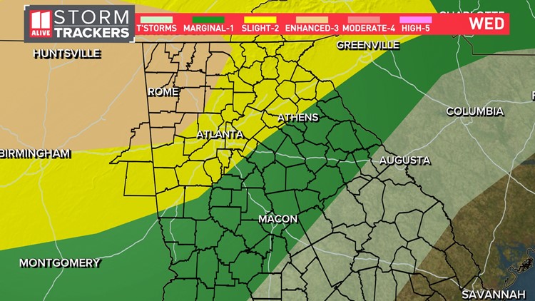
There is a level 3 of 5 risk for severe storms tonight in NW Georgia. The Storm Prediction Center has placed the Atlanta area in a Level 2 out of 5 threat for severe storms.
We are not expecting widespread severe weather, but isolated strong to severe storms are possible.
Here are 3 things to know about our midweek storms:
- Showers and storms will track through North Georgia on Wednesday and Thursday
- Strong to severe storms are most possible between Wednesday evening and early Thursday morning, but a few strong storms could happen outside that window.
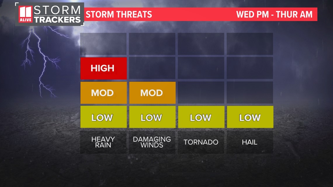
- Storms will bring heavy rain, lightning and gusty winds. An isolated brief spin up tornado is possible, mainly northwest of the Atlanta area. There is a low chance of hail northwest of Atlanta.
Timeline:
Wednesday Overnight
Storms continue pushing through North Georgia. Isolated strong to severe storms will be possible. Storms will generally weaken some as they get further south later in the overnight.
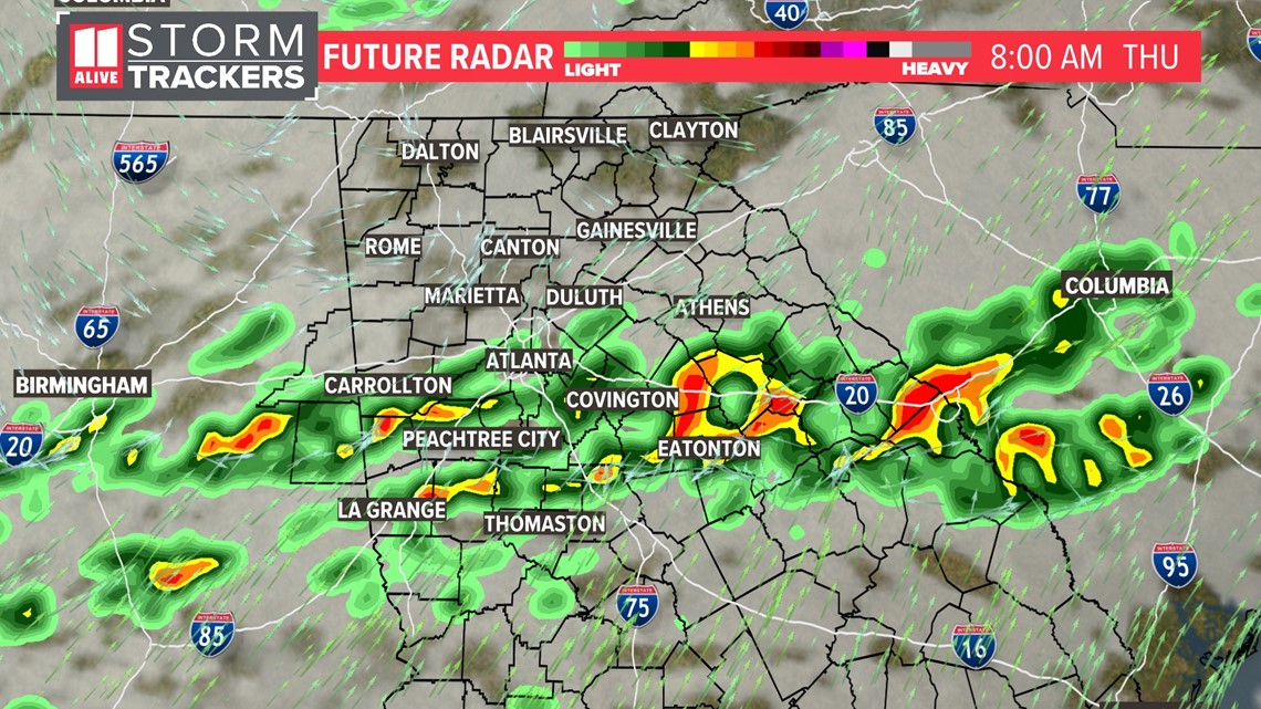
Thursday Morning
It will be a wet start with storms across the area. They'll push further south later in the morning. An isolated strong storms is possible

Thursday Afternoon
The last storms will track into central Georgia for the afternoon where an isolated strong storm is possible.

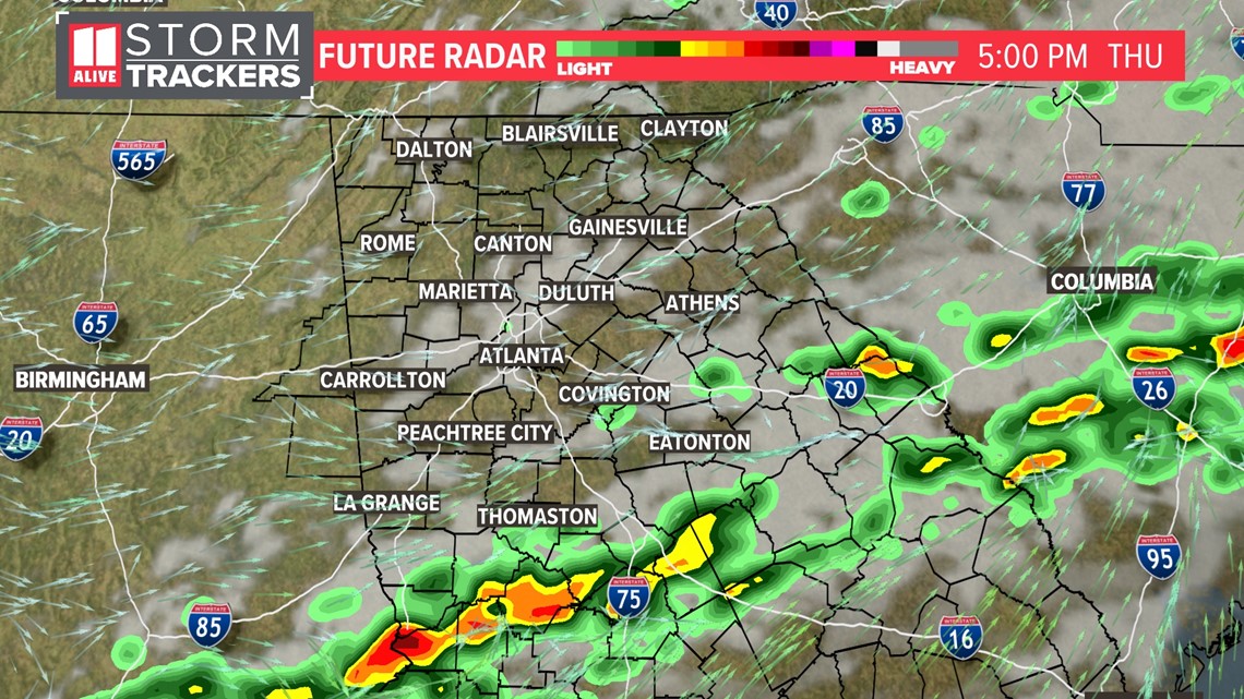
Severe Weather Outlooks
On Thursday the level 1 area includes Atlanta and areas to the south.

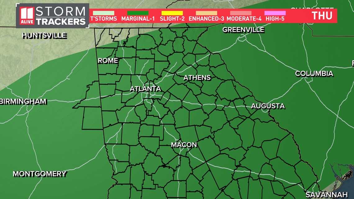
Here are our Storm Threats:
RELATED: Be prepared | Tornado safety tips

